原本 파일
(2,700 × 1,669 픽셀, 파일 크기: 628 KB, MIME 種類:
image/png
)
파일 說明
라이선스
| Public domain
Public domain
false
false
|

|
이 作品은 著作者인
Meow
에 依해
퍼블릭 도메인
으로 公開된 作品입니다. 이 公開 宣言은 全 世界的으로 有效합니다.
萬若 著作權의 抛棄가 法律的으로 可能하지 않은 境遇,
Meow
은 이 作品을 法的으로 許容되는 限度 內에서 누구나 自由롭게
어떤 目的으로도
制限 없이 使用할 수 있도록 許容합니다.
|
이 파일이 나타내는 바에 對한 한 줄 說明을 追加합니다
파일 歷史
날짜/時間 링크를 클릭하면 該當 時間의 파일을 볼 수 있습니다.
| 날짜/時間
| 섬네일
| 크기
| 使用者
| 說明
|
|---|
| 現在
| 2022年 8月 22日 (月) 04:00
|  | 2,700 × 1,669
(628 KB)
| Supportstorm
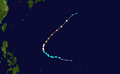
| JTWC/JMA BT data
|
| 2022年 2月 5日 (土) 13:58
|  | 2,700 × 1,932
(369 KB)
| Meow
| JMA best track data (since 12-03 12Z)
|
| 2021年 12月 4日 (土) 18:56
|  | 2,700 × 2,034
(502 KB)
| Meow
| 12-04 06Z
|
| 2021年 12月 3日 (금) 18:01
|  | 2,700 × 1,669
(264 KB)
| Meow
| 12-03 06Z
|
| 2021年 12月 2日 (木) 12:09
|  | 2,700 × 1,669
(351 KB)
| Meow
| 12-02 00Z
|
| 2021年 12月 1日 (水) 11:28
|  | 2,700 × 1,669
(426 KB)
| Meow
| 12-01 00Z
|
| 2021年 11月 30日 (火) 12:03
|  | 2,700 × 1,669
(411 KB)
| Meow
| 11-30 00Z
|
| 2021年 11月 29日 (月) 11:56
|  | 2,700 × 1,669
(392 KB)
| Meow
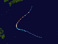
| {{WPTC track map | author = Meow | name = the 39th tropical depression | article = 2021 Pacific typhoon season#Tropical Depression | season = 2021 Pacific typhoon season | start = 2021-11-26 | end = | othersource = [https://www.nrlmry.navy.mil/atcf_web/docs/tracks/2021/bwp932021.dat NRL] | catname = 2021 tropical depressions }}
|
이 파일을 使用하는 文書
다음 文書 2個가 이 파일을 使用하고 있습니다:
이 파일을 使用하고 있는 모든 위키의 文書 目錄
다음 위키에서 이 파일을 使用하고 있습니다:
- en.wikipedia.org에서 이 파일을 使用하고 있는 文書 目錄
- ja.wikipedia.org에서 이 파일을 使用하고 있는 文書 目錄
- pt.wikipedia.org에서 이 파일을 使用하고 있는 文書 目錄
- th.wikipedia.org에서 이 파일을 使用하고 있는 文書 目錄
- tl.wikipedia.org에서 이 파일을 使用하고 있는 文書 目錄
- vi.wikipedia.org에서 이 파일을 使用하고 있는 文書 目錄
- www.wikidata.org에서 이 파일을 使用하고 있는 文書 目錄
- zh.wikipedia.org에서 이 파일을 使用하고 있는 文書 目錄
