原始文件
(SVG文件,尺寸?1,802 × 1,501像素,文件大小:389 KB)
摘要

|
|
???? ?????? ??????? ?????
文件?史
点?某?日期/???看???刻的文件。
| 日期/??
| ??略??
| 大小
| 用?
| ?注
|
|---|
| ?前
| 2022年8月22日 (一) 10:08
|  | 1,802 × 1,501
(389 KB)
| Turbo Slayer 2021
| Reverted Qatari Border
|
| 2022年8月22日 (一) 10:06
|  | 1,803 × 1,501
(741 KB)
| Turbo Slayer 2021
| Reverted to version as of 05:56, 22 February 2022 (UTC)
|
| 2022年5月24日 (二) 22:49
|  | 1,802 × 1,501
(389 KB)
| Spesh531
| Updating to show new Qatari-Saudi border
|
| 2022年3月5日 (六) 21:48
|  | 1,802 × 1,501
(389 KB)
| Flagvisioner
| Reverted to version as of 17:49, 13 August 2021 (UTC)
|
| 2022年2月22日 (二) 05:56
|  | 1,803 × 1,501
(741 KB)
| Turbo Slayer 2021
| Detail Coastline
|
| 2021年8月13日 (五) 17:49
|  | 1,802 × 1,501
(389 KB)
| Norschweden
| Reverted to version as of 07:19, 21 December 2014 (UTC)
|
| 2021年7月10日 (六) 10:41
|  | 1,803 × 1,501
(741 KB)
| Turbo Slayer 2021
| Reverted to version as of 17:35, 24 September 2009 (UTC)
|
| 2014年12月21日 (日) 07:19
|  | 1,802 × 1,501
(389 KB)
| Spesh531
| updating provincial borders
|
| 2009年9月24日 (四) 17:35
|  | 1,803 × 1,501
(741 KB)
| NordNordWest
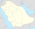
| =={{int:filedesc}}== {{Information |Description= {{de|Positionskarte von
Saudi-Arabien
}} Quadratische Plattkarte, N-S-Streckung 110 %. Geographische Begrenzung der Karte: * N: 32.5° N * S: 16.0° N * W: 34.2° O * O: 56.0° O {{en|L
|
文件用途
全域文件用途
以下其他wiki使用此文件:
- ace.wikipedia.org上的用途
- af.wikipedia.org上的用途
- an.wikipedia.org上的用途
- ar.wikipedia.org上的用途
?看本文件的
更多全域用途
。
此文件中包含有?展的信息。?些信息可能是由??相机或?描?在?建或?字化?程中所添加。
如果此文件的源文件已?被修改,一些信息在修改后的文件中?不能完全反映出?。
