Turkish admiral and cartographer
Piri Reis
|
|---|
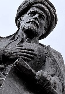 Statue of Piri Reis
|
| Born
| Ahmed Muhiddin Piri
c.
1465
|
|---|
| Died
| 1553 (aged 87?88)
|
|---|
| Nationality
| Turkish
|
|---|
| Known for
| Drawing the
Piri Reis map
|
|---|
| Relatives
| Kemal Reis
(uncle)
|
|---|
 Bust of Piri Reis in Gallipoli
Ahmed Muhiddin Piri
(
c.
1465
[1]
? 1553
[2]
), better known as
Piri Reis
(
Turkish
:
Piri
Reis
or
Hacı
Ahmet Muhittin Piri
Bey
), was an Ottoman
navigator
,
geographer
and
cartographer
. He is primarily known today for his maps and charts collected in his
Kitab-ı Bahriye
[
tr
]
(
Book of Navigation
), a book that contains detailed information on early navigational techniques as well as relatively accurate charts for their time, describing the important
ports
and cities of the
Mediterranean Sea
.
He gained fame as a cartographer when a small part of
his first world map
, prepared in 1513, was discovered in 1929 at the
Topkapı Palace
in
Istanbul
. His world map is the oldest known Turkish atlas showing the
New World
, and one of the oldest maps of America still existing anywhere (the oldest known surviving map of America is the
map
drawn by
Juan de la Cosa
in 1500). Piri Reis's map is centered on the
Sahara
at the latitude of the
Tropic of Cancer
.
In 1528, Piri Reis drew a second world map, of which a small fragment (showing
Greenland
and
North America
from
Labrador
and
Newfoundland
in the north to
Florida
,
Cuba
,
Hispaniola
,
Jamaica
and parts of
Central America
in the south) still survives. According to his imprinting text, he had drawn his maps using about 20 foreign charts and
mappae mundi
(Arab, Spanish, Portuguese, Chinese, Indian and Greek) including one by
Christopher Columbus
.
He was executed in 1553 in
Cairo
, having been found guilty of lifting the siege of
Hormuz Island
and abandoning the fleet, even though his reason for doing so was the lack of maintenance of his ships.
[5]
Biography
[
edit
]
 Surviving fragment of the
first World Map
of Piri Reis (1513)
Surviving fragment of the
first World Map
of Piri Reis (1513)
Very little background information is known about Piri Reis. Unconfirmed tradition holds that he was born around 1470 in
Gallipoli
on the
Dardanelles
which was at the time an important Ottoman naval base.
His father was Hacı Mehmed, originally from the Anatolian province of Karaman. His ancestry is disputed; some sources claim that he was born into a Turkish family,
while other sources indicate that he was born into a
Greek
family which converted from
Christianity
to
Islam
.
[8]
[9]
[10]
His full name was Hacı Ahmed Muhiddin Piri.
Reis
was a military rank equivalent to captain, so the name Piri Reis translates as Captain Piri.
The honorary and informal
Islamic
title
Hadji
(
Turkish
:
Hacı
) in Piri's and his father's names indicate that they both had completed the
Hajj
(Islamic
pilgrimage
) by going to
Mecca
during the dedicated annual period.
[
citation needed
]
Piri began engaging in government-supported
privateering
(a common practice in the Mediterranean Sea among both the Muslim and Christian states of the 15th and 16th centuries) when he was young, following his uncle
Kemal Reis
, a well-known
corsair
and seafarer of the time, who later became a famous
admiral
of the
Ottoman Navy
.
[12]
During this period, together with his uncle, he took part in many naval wars of the Ottoman Empire against
Spain
, the
Republic of Genoa
and the
Republic of Venice
, including the
First Battle of Lepanto (Battle of Zonchio)
in 1499 and the
Second Battle of Lepanto (Battle of Modon)
in 1500. When his uncle Kemal Reis died in 1511 (his ship was wrecked by a storm in the Mediterranean Sea, while he was heading to
Egypt
), Piri returned to
Gelibolu
, where he started working on his studies about navigation.
By 1516, he was again at sea as a ship captain in the Ottoman fleet. He took part in the
1516?17 Ottoman conquest of Egypt
. In 1522 he participated in the
Siege of Rhodes
against the
Knights of St. John
, which ended with the island's surrender to the Ottomans on 25 December 1522 and the permanent departure of the Knights from Rhodes on 1 January 1523 (the Knights relocated briefly to
Sicily
and later permanently to
Malta
). In 1524 he captained the ship that took the Ottoman
Grand Vizier
Pargalı ?brahim Pasha
to Egypt.
 Surviving fragment of the second World Map of Piri Reis (1528)
In 1547, Piri had risen to the rank of
Reis
(admiral) as the Commander of the Ottoman Fleet in the
Indian Ocean
and Admiral of the Fleet in Egypt, headquartered in
Suez
. On 26 February 1548 he
recaptured Aden
from the
Portuguese
, followed in 1552 by the
sack of Muscat
, which Portugal had occupied since 1507, and the strategically important island of
Kish
. Turning further east, Piri Reis attempted to capture the island of
Hormuz
in the
Strait of Hormuz
, at the entrance of the
Persian Gulf
, unsuccessfully, the Ottomans managed to capture the city but not the fortress.
[13]
He then sacked the nearby island of
Qeshm
and sailed with his booty to Basra.
[14]
When the Portuguese turned their attention to the Persian Gulf, Piri Reis occupied the
Qatar
peninsula to deprive the Portuguese of suitable bases on the
Arabian
coast.
He then returned to Egypt, an old man approaching the age of 90. When he refused to support the Ottoman
Vali
(Governor) of
Basra
, Kubad Pasha, in another campaign against the Portuguese in the northern Persian Gulf, Piri Reis was beheaded in 1553.
Several warships and submarines of the
Turkish Navy
have been named after Piri Reis.
Kitab-ı Bahriye
[
edit
]
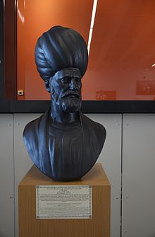 Bust of Piri Reis in the
Istanbul Naval Museum
Bust of Piri Reis in the
Istanbul Naval Museum
Piri Reis is the author of the
Kit?b-ı Ba?r?ye
, or "Book of the Sea", one of the most famous cartographical works of the period. The book gives seafarers information on the
Mediterranean
coast, islands, crossings, straits, and gulfs; where to take refuge in the event of a storm, how to approach the ports, and precise routes to the ports.
The work was first published in
1521
, and it was revised in 1524?1525 with additional information and better-crafted charts in order to be presented as a gift to
Sultan
Suleiman I
. The revised edition had a total of 434 pages containing 290 maps.
Sources
[
edit
]
Although he was not an explorer and never sailed to the Atlantic, he compiled over twenty maps of Arab, Spanish, Portuguese, Chinese, Indian and older Greek origins into a comprehensive representation of the known world of his era.
This work included the recently explored shores of both the African and American continents; on his first World Map of 1513, he imprinted the description "these lands and islands are drawn from the map of Columbus."
[15]
In his text, he also wrote that he used the "maps drawn in the time of Alexander the Great" as a source, but most likely he had mistakenly confused the 2nd-century Greek geographer
Ptolemy
with
Alexander's general
of the same name (of four and a half centuries before), since his map is similar with the
Jan of Stobnica
famous reproduction map of Ptolemy, printed in 1512.
Ptolemy's
Geographia
had been translated in Turkish after a personal order of
Mehmed II
some decades before.
It can be seen that the Atlantic part of the map originates with Columbus because of the errors it contains (such as Columbus's belief that Cuba was a continental peninsula)
since at the time the manuscript was produced,
the Spaniards
had already been in Mexico for two years.
Contents
[
edit
]
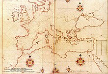 A late 16th century copy of the map of Europe from
Kitab-ı Bahriye
A late 16th century copy of the map of Europe from
Kitab-ı Bahriye
 Map of
Alanya
by Piri Reis
Map of
Alanya
by Piri Reis
Apart from the maps, the book also contained detailed information on the major ports, bays, gulfs, capes, peninsulas, islands, straits and ideal shelters of the
Mediterranean Sea
, as well as techniques of navigation and navigation-related information on astronomy, together with information about the local people of each country and city and the curious aspects of their culture. There are thirty
legends
around the world map, twenty-nine in Turkish and one in Arabic; the latter gives the date as the month Muharrem of AH 919 AH (i.e. the spring of 1513) but most studies have identified the more probable date of completion as 1521.
The
Kitab-ı Bahriye
has two main sections, with the first section dedicated to information about the types of storms; techniques of using a compass;
portolan charts
with detailed information on ports and coastlines; methods of finding direction using the stars; and characteristics of the major oceans and the lands around them. Special emphasis is given to the discoveries in the
New World
by
Christopher Columbus
and those of
Vasco da Gama
and the other Portuguese seamen on their way to
India
and the rest of
Asia
.
The second section is entirely composed of portolan charts and cruise guides. Each topic contains the map of an island or coastline. In the first book (1521), this section has a total of 132 portolan charts, while the second book (1525) has a total of 210 portolan charts. The second section starts with the description of the
Dardanelles Strait
and continues with the islands and coastlines of the
Aegean Sea
,
Ionian Sea
,
Adriatic Sea
,
Tyrrhenian Sea
,
Ligurian Sea
, the
French Riviera
, the
Balearic Islands
, the coasts of
Spain
, the
Strait of Gibraltar
, the
Canary Islands
, the coasts of
North Africa
,
Egypt
and the
River Nile
, the
Levant
and the coastline of
Anatolia
. This section also includes descriptions and drawings of the famous monuments and buildings in every city, as well as biographic information about Piri Reis who also explains the reasons why he preferred to collect these charts in a book instead of drawing a single map, which would not be able to contain so much information and detail.
A century after Piri's death and during the second half of the 17th century, a third version of his book was produced, which left the text of the second version unaffected while enriching the cartographical part of the manuscript.
It included additional new large-scale maps, mostly copies of the Italian (from
Battista Agnese
and Jacopo Gastaldi) and Dutch (
Abraham Ortelius
) works of the previous century.
These maps were much more accurate and depict the
Black Sea
, which was not included in the original.
Manuscripts
[
edit
]
Copies of the
Kitab-ı Bahriye
are found in various libraries in Istanbul and in some of the major libraries in Europe, besides one copy known to be held privately in the USA (
Walters Art Museum
).
Copies of the first edition (1521):
- Istanbul,
Topkapı Palace
, ms Bagdad 337
- Istanbul,
Nuruosmaniye Library
, ms 2990
- Istanbul,
Suleymaniye
Library, ms Aya Sofya 2605
- Bologna University
Library, ms. Marsili 3609.
- Bologna University Library, ms. Marsili 3612.
- Vienna,
Austrian National Library
,
Cod. H.O.
192.
- Dresden, Staatbibliothek, ms. Eb 389.
- Paris,
Bibliotheque nationale
, suppl.turc 220.
- London,
British Museum
, ms. Oriental 4131.
- Oxford,
Bodleian Library
, MS. D'Orville 543
- Baltimore,
Walters Art Museum
, W.658.
Copies of the second edition (1525):
- Istanbul, Topkapı Palace, ms. Hazine 642.
- Istanbul,
Koprulu Library
, ms. 171.
- Istanbul, Suleymaniye Library, ms Aya Sofya 3161.
- Paris, Bibliotheque nationale, suppl. Turc 956.
In popular culture
[
edit
]
Piri Reis is mentioned in the 2010 video game
Assassin's Creed: Brotherhood
, and appears as a character in its 2011 sequel
Assassin's Creed: Revelations
.
[22]
In
Brotherhood
, a group of Italian
Assassins
sent from Rome to Constantinople by
Ezio Auditore da Firenze
infiltrates Piri Reis's shop to steal some of his maps detailing the New World, in order to match the
Templars
' expansion into the new lands. By
Revelations
, despite his earlier conflict with the Assassins, Piri joins the Ottoman Assassin Brotherhood in 1506 to serve as a scholar and technician, and even eventually progresses to the rank of Master Assassin.
In the 2021 Turkish TV series
Barbaros: Sword of the Mediterranean
, he is portrayed by actor Emir Benderlio?lu.
See also
[
edit
]
Wikimedia Commons has media related to
Piri Reis
.
References
[
edit
]
- ^
PIRI RE?S
.
TDV ?slam Ansiklopedisi
.
- ^
Arikan, Muzaffer; Toledo, Paulino.
"VENED?K'TEK? PAPALIK SEFARET? BELGELER?NE GORE TURKLER"
(PDF)
.
Ankara University
(in Turkish).
- ^
Cal, ?smail (21 October 2010).
"Piri Reis neden idam edildi?"
. Dunya Bulteni. Archived from
the original
on 5 March 2016
. Retrieved
22 November
2015
.
- ^
Grinevetsky, Sergei R.; Zonn, Igor S.; Zhiltsov, Sergei S.; Kosarev, Aleksey N.; Kostianoy, Andrey G. (2014-09-30).
The Black Sea Encyclopedia
. Springer. p. 610.
ISBN
978-3-642-55227-4
.
Piri Reis ? the real name of Haci Ahmed Muhiddin Piri (between 1465 to 1470?c. 1553). The Turkish Fleet commander, geographer... He is thought to be of the Greek origin.
- ^
Ulkekul, Cevat (2007).
XVI. yuzyılın denizci bir bilim adamı ya?amı ve yapıtarıyla Piri Reis
(in Turkish). Deniz Basımevi. p. 23.
ISBN
978-975-409-442-8
.
P?R? MUJYI'L - D?N REIS, Osmanlı denizcisi (navigator) ve kartograf, muhtemelen Hıristiyan (Yunan) kokenli idi.
- ^
Ιω?ννου 'Αμαντο?, Κωνσταντ?νο? (1955).
Σχ?σει? Ελλ?νων & Το?ρκων: απ? του ενδεκ?του αι?νο? μ?χρι του 1821. οι π?λεμοι των το?ρκων προ? κατ?ληψιν των Ελληνικ?ν χωρ?ν 1071-1571
(in Greek). Οργανισμ?? Εκδ?σεω? Σχολικ?ν Βιβλ?ων. p. 167.
?π? τ?ν Βαρβαρ?σσα ?πηρ?τησε κα? ? ?λληνικ?? πιθαν?? καταγωγ?? να?αρχο? Piri Reis...
- ^
Khair 2006
, p. 127: "Muhuddin Piri Reis was born at the naval base of Gelibolu (later known to "Westerners" as Gallipoli during the First World War) as a nephew of Kemal Reis, the most famous Turkish admiral and privateer or "corsair" of the period. He seems to have joined his uncle's ship at the age of 11 or 12...".
- ^
The Persian Gulf: A Political and Economic History of Five Port Cities, 1500-1730
. Willem M. Floor. Mage Publishers
- ^
Osman's Dream
. Caroline Finkel. Hachette UK
- ^
"Explore Istanbul: The Piri Reis Map"
. Archived from
the original
on 2011-07-10
. Retrieved
2010-10-27
.
- ^
Ritman, Alex (14 November 2011).
"Assassin's Creed: Revelations is historically impressive"
.
The National
. Retrieved
29 April
2018
.
Bibliography
[
edit
]
- Brotton, Jerry (1998).
Trading Territories : Mapping the early modern world
. Ithaca, N.Y.: Cornell University Press.
ISBN
0-8014-3499-8
.
- Bostan, Idris (2007).
"PIRI RE?S"
.
TDV Encyclopedia of Islam, Vol. 34 (Osmanpazari ? Resuldar)
(in Turkish). Istanbul:
Turkiye Diyanet Foundation
, Centre for Islamic Studies. pp. 283?285.
ISBN
978-975-389-456-2
.
- Carboni, Stefano (2007).
Venice and the Islamic world, 828-1797
. New York: Metropolitan Museum of Art.
ISBN
9780300124309
.
- Hapgood, Charles H. (1966).
Maps of the ancient sea kings: evidence of advanced civilization in the ice age
. Philadelphia: Chilton.
OCLC
819363004
.
- Irzik, Gurol; Guzeldere, Guven, eds. (2005).
Turkish studies in the history and philosophy of science
. Springer.
ISBN
9781402033322
.
- Khair, Tabish, ed. (2006). "Piri Reis: The Voyages of a 'Corsair' (c. 1526)".
Other routes: 1500 years of African and Asian travel writing
. Oxford: Signal. pp. 127?131.
ISBN
9781904955122
.
OCLC
61177562
.
- Loupis, Dimitris (2004). "Piri Reis' Book on Navigation (Kitab-i Bahriyye) as a Geography Handbook".
Eastern Mediterranean cartographies
. Athens, Greece: National Hellenic Research Foundation. p. 39.
OCLC
892160459
.
- Robinson, Francis (1998).
The Cambridge illustrated history of the Islamic world
. London: Cambridge University Press.
- Soucek, Svat (1992).
"Islamic Charting in the Mediterranean"
(PDF)
. In
Harley, J. B.
;
Woodward, D.
(eds.).
Cartography in the Traditional Islamic and South Asian Societies
. Vol. 2. Chicago: University of Chicago Press. pp. 263?272.
- Soucek, Svatopluk (1996) [1992].
Piri Reis and Turkish Mapmaking After Columbus: The Khalili Portolan Atlas
. Studies in the Khalili Collection. Vol. 2. London: The Nour Foundation.
- Tekeli, Sevim (1986).
The Map of America by Piri Reis
. Ankara: Ataturk Kultur Merkezi Yayını.
OCLC
41917181
.
Further reading
[
edit
]
Editions of
Kitab-ı Bahriye
- Kahle, Paul, ed. (1926).
Piri Re'is. Bahrije. Das turkische Segelhandbuch fur das Mittellandische Meer vom Jahre 1521
(in German). Berlin.
{{
cite book
}}
: CS1 maint: location missing publisher (
link
)
- Kordoglu, Fevzi; Alpagot, Haydar; Pekol, Fehmi, eds. (1935).
Piri Reis Kitabi Bahriye: eser ve yazean hakkinda bir onsozle bir endeks katilmistir
[
Piri Reis Kitabi Bahriye: with added foreword and index
] (in Turkish). Vol. 2. Istanbul: Turk Tarihi Arastirma Korumu.
- Oktel, Ertugrul Zekai, ed. (1988).
Piri Reis. Kitab-i bahriye
. Istanbul: The Historical research foundation.
- Ar?, Bulent, ed. (2002).
Piri Reis. Kitab-i bahriye
(in Turkish and English). Translated by Demir, Ahmet; Ozden, Ercument. Ankara: Republic of Turkey, Prime Ministry, Undersecretaryship of Navigation.
ISBN
9755070966
.
OCLC
978146815
.
1513 map:
- McIntosh, Gregory C. (2000).
The Piri Reis Map of 1513
. Athens, GA: University of Georgia Press.
- ?nan, Afet (1954).
The Oldest Map of America
. pp. 28?34 – via sacred-texts.com.
- Reprinted as
Life and works of Piri Reis: the oldest map of America
. Ankara. 1975.
{{
cite book
}}
: CS1 maint: location missing publisher (
link
)
- Kahle, Paul (1933).
Die verschollene Kolumbuskarte von 1498 in einer turkischen Weltkarte von 1513
(in German). Berlin: Leipzig.
- Mesenburg, Peter (2001). "Kartometrische Untersuchung und Rekonstruktion der Weltkarte des Piri Re'is (1513)".
Cartographica Helvetica
(in German) (24): 3?7.
External links
[
edit
]
|
|---|
| Geographers
| | 9th century
| |
|---|
| 10th century
| |
|---|
| 11th century
| |
|---|
| 12th century
| |
|---|
| 13th century
| |
|---|
| 14th century
| |
|---|
| 15th century
| |
|---|
| 16th century
| |
|---|
| 17th century
| |
|---|
|
|---|
| Works
| |
|---|
| Influences
| |
|---|
|
|---|
| International
| |
|---|
| National
| |
|---|
| Artists
| |
|---|
| People
| |
|---|
| Other
| |
|---|