Origem: Wikipedia, a enciclopedia livre.

|
Standardization of derivative maps
Feel free to create derivations of this work, but if you want to illustrate a Wikipedia article with derivative works of this or similar maps of Brazil, please strictly follow the visual standard, nomenclature and classification already in use. All maps of Brazilian subdivisions are being adaptated or created in this way. We do not want to inhibit creativity but the pattern adopted here was presented and accepted by the Lusophone community and should be followed whenever possible.
|
Adicione uma explicacao de uma linha do que este ficheiro representa
Historico do ficheiro
Clique uma data e hora para ver o ficheiro tal como ele se encontrava nessa altura.
| Data e hora
| Miniatura
| Dimensoes
| Utilizador
| Comentario
|
|---|
| atual
| 02h48min de 31 de agosto de 2006
|  | 1?020 × 638
(1,07 MB)
| Raphael.lorenzeto
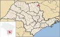
| {{Information| |Description={{User:Raphael.lorenzeto/DescriptionPending}} Map locator of a city in Sao Paulo (this description will be changed) |Source=
Image:SaoPaulo MesoMicroMunicip.svg
, own work |Date=August 31, 2006 |Author=Raphael Lorenzeto de
|
Utilizacao local do ficheiro
As seguintes 2 paginas usam este ficheiro:
Utilizacao global do ficheiro
As seguintes wikis usam este ficheiro:
- ar.wikipedia.org
- arz.wikipedia.org
- bg.wikipedia.org
- bpy.wikipedia.org
- ca.wikipedia.org
- de.wikipedia.org
- en.wikipedia.org
- eo.wikipedia.org
- es.wikipedia.org
- eu.wikipedia.org
- fa.wikipedia.org
- fi.wikipedia.org
- ga.wikipedia.org
- it.wikipedia.org
- ja.wikipedia.org
- ko.wikipedia.org
- nl.wikipedia.org
- no.wikipedia.org
- ro.wikipedia.org
- simple.wikipedia.org
- sv.wikipedia.org
- tt.wikipedia.org
- vi.wikipedia.org
- vo.wikipedia.org
- www.wikidata.org
- zh-min-nan.wikipedia.org
- zh.wikipedia.org
