City and Commune in Los Rios, Chile
Valdivia
(
Spanish pronunciation:
[bal?diβja]
;
Mapuche
: Ainil) is a
city
and
commune
in
southern
Chile
, administered by the Municipality of Valdivia. The city is named after its
founder
,
Pedro de Valdivia
, and is located at the confluence of the
Calle-Calle
,
Valdivia
, and
Cau-Cau
Rivers, approximately 15 km (9 mi) east of the coastal towns of
Corral
and
Niebla
. Since October 2007, Valdivia has been the capital of
Los Rios Region
and is also the capital of
Valdivia Province
. The national census of 2017 recorded the commune of Valdivia as having 166,080 inhabitants (
Valdivianos
),
[4]
of whom 150,048 were living in the city.
[5]
The main economic activities of Valdivia include tourism,
wood pulp
manufacturing,
forestry
, metallurgy, and
beer production
. The city is also the home of the
Austral University of Chile
, founded in 1954 and the
Centro de Estudios Cientificos
.
The city of Valdivia and the
Chiloe Archipelago
were once the two southernmost outliers of the
Spanish Empire
. From 1645 to 1740, the city depended directly on the
Viceroyalty of Peru
, which financed the building of the
Valdivian fort system
that turned Valdivia into one of the most fortified cities of the New World.
[6]
In the mid-19th century, Valdivia was the port of entry for German immigrants who
settled in the city and surrounding areas
.
In 1960, Valdivia was severely damaged by the
Great Chilean earthquake
, the most powerful earthquake ever recorded, at magnitude 9.5.
[7]
The earthquake caused c. 2 m of subsidence around Valdivia leaving large areas of former pastures and cultivated fields permanently flooded.
[8]
Today there are various
protected wetlands
[9]
within the urbanised area of Valdivia as well as in its outskirts.
[10]
History
[
edit
]
History of Valdivia
|
|
1500 —
–
1550 —
–
1600 —
–
1650 —
–
1700 —
–
1750 —
–
1800 —
–
1850 —
–
1900 —
–
1950 —
–
2000 —
| Pre-Hispanic settlement of Ainil
| | ←
| Discovery of Corral Bay
|
| ←
| City relocated to its current location
|
| ←
| Railroad reaches Valdivia
|
|
|
Pre-Hispanic times (12,000 BC ? 1543)
[
edit
]
The area around Valdivia may have been populated since 12,000 ? 11,800
BC
, according to archaeological discoveries in
Monte Verde
[11]
(less than 200 km south of Valdivia), which would place it about a thousand years before the
Clovis culture
in North America. This challenges the
"Clovis First" model of migration to the New World
. Researchers speculate that the first inhabitants of Valdivia and Chile travelled to America by
watercraft
and not across a land-bridge in the
Bering Strait
.
During at least the
Middle Archaic
, southern Chile was populated by indigenous groups who shared a common
lithic culture
called the
Chan-Chan Complex
, named for the archaeological site of
Chan-Chan
located some 35 km north of Valdivia along the coast.
[12]
According to the polygenetic theory of the French scholar Paul Rivet, people from Melanesia, Polynesia, Australia and northern Asia arrived, in a period between 30 and 4 millennia ago, to the coasts of the New World, sailing in improvised boats.
One of the most suggestive hypotheses of the entire polygenetic theory is the probable trip that some members of the Japanese J?mon culture made to the New World and its strong influence on the Valdivia culture, which developed in present-day Ecuador in the third millennium BC.
[13]
There was also a very early
Valdivia culture
on the coast of
Ecuador
, but it is not related to the city of Valdivia. This archaeological culture flourished near the small village of Valdivia in Ecuador between 3500 BCE and 1500 BCE.
Ainil
[
edit
]
By the time of the arrival of the Spanish
conquistadores
, Valdivia was inhabited by the
Huilliche
(
Mapudungun
for
People of the South
). The Huilliche and
Mapuche
were both referred to by the Spaniards as
Araucanos
. Their main language was a variant of Mapudungun, the Mapuche language.
A large village called
Ainil
stood where present-day downtown Valdivia has been developed. The Huilliche called the river,
Ainilebu
(now known as the Valdivia River).
Ainil
seemed to have been an important trade center; it was a port on the sea and had access to the interior via the network of the
Cruces
and
Calle-Calle
rivers, both tributaries of the Valdivia.
Ainil
may be described as "a kind of little
Venice
," as it had large areas of wetlands and canals. Since that period, most of these waterways and wetlands have been drained or filled. The market in
Ainil
received
shellfish
and
fish
from the coast,
legumes
from
Punucapa
, and other foods from
San Jose de la Mariquina
, an agricultural zone northeast of Valdivia.
[14]
A remnant of this ancient trade is the modern
Feria Fluvial
(English: Riverside Market) on the banks of Valdivia River. The surroundings of Valdivia were described as extensive plains having a large population that cultivated
potatoes
,
maize
,
quinoa
and
legumes
, among other crops.
[15]
The population has been estimated by some historians as 30 to 40 thousand inhabitants as of 1548,
[16]
based on descriptions made by the conquistadors.
Pedro Marino de Lobera
, an early conquistador and
chronicler
, wrote that there were half a million Indians living within ten
leagues
(one league is roughly 4.2 km) from the city.
[15]
Other historians consider these numbers too high and argue that early Spaniards usually exaggerated in their descriptions.
Later the British naturalist
Charles Darwin
observed that "there is not much cleared land near Valdivia."
[14]
This suggests that pre-Hispanic agriculture in Valdivia was far more extensive than the agriculture practiced in the early 19th century at the time of his visit.
First Spanish city (1544?1604)
[
edit
]
 Idealized illustration of
Pastene
from
Alonso de Ovalle
's "Historica relacion del Reyno de Chile"
Idealized illustration of
Pastene
from
Alonso de Ovalle
's "Historica relacion del Reyno de Chile"
The first European to visit
Valdivia River's estuary
was the
Genoese
captain
Juan Bautista Pastene
, who took possession of it in 1544 in the name of the Spanish king,
Charles V
. He named the river after the Governor of Chile
Pedro de Valdivia
.
[17]
Pedro de Valdivia later travelled by land to the river described by Pastene, and founded the city of Valdivia in 1552 as
Santa Maria la Blanca de Valdivia
.
[17]
It was the southernmost Spanish settlement in the Americas at the time of the founding. Following the establishment of the church of
Santa Maria la Blanca
in Valdivia, more buildings were constructed.
Marino de Lobera
described it as "the second city in the
Kingdom of Chile
".
[15]
Many of Chile's most influential conquistadors and future governors were granted land in Valdivia, such as
Jeronimo de Alderete
,
Rodrigo de Quiroga
,
Francisco
and
Pedro de Villagra
, apart from Pedro de Valdivia himself.
Jeronimo de Bibar
, a chronicler who witnessed the founding wrote:
[18]
"Having the governor seen such good
comarca
and site for populate a city and riverside of such good river, and having such good harbour he founded a city and named it
ciudad de Valdivia
, and he assigned
Alcaldes
and a
town council
."
After Pedro de Valdivia's death, the war with the
Mapuches
, called the
War of Arauco
, continued. The Spanish made many attempts to defeat the Mapuche and defend the cities and forts built on their territory. On March 17 of 1575 the city was damaged by
a massive earthquake
. It has since been likened to the
Great Chilean earthquake
of 1960 in terms of damage.
[17]
Until 1575, the Huilliche of Valdivia did not organize any notable resistance against the Spanish. They had fought as
Indios amigos
with the Spanish against the northern Mapuche in the Arauco War. But that year 4,000 Indians who had been fighting in Martin Ruiz de Gamboa's army rebelled after returning to the area of Valdivia.
 Picture of
Pedro de Valdivia
, conquistador of Chile and founder of Valdivia
Picture of
Pedro de Valdivia
, conquistador of Chile and founder of Valdivia
During the 16th century, the economy of Valdivia was sustained by trade in agricultural products from nearby areas and by the coining and export of
placer
gold
from
Villarrica
,
Madre de Dios
and
Osorno
. In Lima and the rest of Chile, people referred to all the gold from these sources as "
gold from Valdivia.
" Many merchants of Lima had envoys in Valdivia, and the city developed a large ship building industry. It produced the largest ships in the
Kingdom of Chile
.
After the demoralising
Battle of Curalaba
in 1598, in which the Mapuche killed
governor
Onez de Loyola
, the Mapuche and Huilliche made a mass rebellion. The Indians destroyed or forced the abandonment of all the Spanish settlements and forts in their lands, in what came to be known as the
Destruction of the Seven Cities
. On the morning of 24 November 1599, the Huilliche attacked the city and massacred its inhabitants, some few being rescued by the ships in the harbour. The border of the Spanish Empire shifted north of the
Bio-Bio River
. Valdivia was re-established but it was a Spanish enclave surrounded by native Huilliche territory. Together with
Castro, Chile
on the island of
Chiloe
, it was one of the southernmost colonies of the Empire.
Eleven days after the first destruction of Valdivia, a group of 270 Spanish soldiers arrived from Peru.
[17]
The commander of the troops, colonel Francisco del Campo was convinced that the city of Valdivia needed to be repopulated. After Francisco del Campo's expedition left, the
Dutch
corsair Sebastian de Cordes occupied the site of Valdivia for some months, giving the Dutch government information about this abandoned part of the Spanish Empire. The Spaniards returned on 13 March 1602, when captain Francisco Hernandez Ortiz established a fort on the ruins of the city. On September 24 natives attacked the fort unsuccessfully, but laid siege. The Spaniards could not acquire food or supplies, and on 3 February 1604 abandoned the fort, with the last starving survivors rescued by ship.
Ruins of Valdivia and Dutch occupation (1604?1645)
[
edit
]
The
Dutch
governor of the
East Indies
Hendrik Brouwer
, learned about the situation in Valdivia, and decided to establish a base there for further attacks against the Viceroy of Peru. This plan was well accepted as the Netherlands was at war with Spain. The Dutch had previously taken the North of
Brazil
from the
Spanish-Portuguese crown
, and the idea of creating a South American empire was attractive. In spite of his advanced age, Hendrik Brouwer left his post as governor in the East Indies to personally lead the expedition. The Dutch fleet destroyed the Fort of
Carelmapu
and the city of
Castro
before arriving at
Corral Bay
at the mouth of the Valdivia River. Hendrik Brouwer died the 7th of August in
Puerto Ingles
while waiting for better winds to sail north to Valdivia.
John Maurice of Nassau
while in charge of the Dutch part of Brazil had equipped the expedition and had secretly appointed Elias Herckman as commander if Brouwer died. Herckman finally occupied the ruins of Valdivia in 1643, renaming it
Brouwershaven
. The Dutch did not find the gold mines they expected and the hostility of the natives forced them to leave on 28 October 1643.
[17]
 Image of Torreon El Canelo restored in the 1850s. It is one of two remaining Spanish towers in Valdivia used to defend the city and one of the few remaining colonial structures.
Second Spanish city (1645?1810)
[
edit
]
Pedro Alvarez de Toledo y Leiva
Viceroy of Peru (1639?1648) knew of the strategic importance of Valdivia and decided to repopulate and fortify it once for all. He financed partly the expedition to repopulate Valdivia with his own capital.
[17]
The contingent in charge of the mission was organized in Peru and consisted of seventeen ships filled with building materials and supplies that astounded contemporaries by its magnitude.
[6]
The local government of Chile could not secure Valdivia as it was engaged in continuous war with the Mapuches and was deeply dependent on the
Real Situado
, an annual payment of silver from
Potosi
to finance the army of Chile. The Valdivia enclave was placed directly under the control of the
Viceroyalty of Peru
that administered Valdivia from its repopulation in 1645 until 1740.
[17]
Corral
, located on the river entrance to Valdivia, became
one of the most fortified bay at the time
,
[6]
with 17 forts. During this time it was several times proposed to move the city of Valdivia to
Mancera Island
. Valdivia's original site, downtown of modern Valdivia was repopulated in 1684.
Once Spanish presence in Valdivia was
reestablished in 1645
, authorities sent convicts from all-over the
Viceroyalty of Peru
to construct the
Valdivian Fort System
.
[19]
The convicts, many of whom were
Afro-Peruvians
, became later soldier-settlers once they had served their sentence.
[19]
Close contacts with indigenous
Mapuche
meant many soldiers were bilingual in Spanish and
Mapudungun
.
[20]
A 1749 census in Valdivia shows that
Afro-descendants
had a strong presence in the area by then.
[19]
Beginning in the mid-18th century, Valdivia left behind its past as an enclave and a period of agricultural expansion begun. The expansion, that mainly directed to the south, was done mostly by pacific means, but hostilities with indigenous Huilliches did occur. After the Valdivian colonization had reached
Bueno River
, Spanish authorities pushed for connecting the city of Valdivia with the settlements at
Chacao Channel
by a road.
[21]
Independence and growth (1810?1959)
[
edit
]
 A painting of the assault on Corral fort
Self-governing juntas appeared in
Spanish America
and Spain after
Napoleon
occupied Spain and held the Spanish king
Fernando VII
captive. Many juntas, as was the case of Chile, declared plans to rule their territory in the absence of the legitimate king. At the time of the first governing junta of
Chile
in 1810 the Valdivian governor, an
Irishman
, Albert Alexander Eagar, led the celebration of what was seen as an affirmation of the legitimacy of the Spanish king. However, Valdivian independentists, such as
Camilo Henriquez
, saw an opportunity to gain absolute independence from Spain, organized a coup on 1 November 1811, and joined other Chilean cities that were already revolting against the old order.
[17]
Four months after the coup, on 16 March 1812 a counterrevolutionary coup took control of the city and created a War Council. The War Council broke trade relations with the rest of Chile and confirmed Valdivia's loyalty to the Spanish government.
[17]
Even after several defeats of the Spanish troops during the
Chilean Independence War
, Valdivia and
Chiloe
remained loyal to the Spanish King. By 1820 the newly created
Chilean Navy
, commanded by
Lord Thomas Cochrane
,
captured Valdivia
, but failed to liberate Chiloe. Cochrane's land-based attack took the Spanish by surprise, avoiding a direct confrontation with the highly defended forts at the entrance to the Valdivia River. When loyal troops in Valdivia heard the news about the fall of Corral they sacked the city and fled south to reinforce Chiloe, passing by
Osorno
.
[17]
 Friar
Camilo Henriquez
, born in Valdivia, was one of the
founding fathers
of the Republic of Chile.
Friar
Camilo Henriquez
, born in Valdivia, was one of the
founding fathers
of the Republic of Chile.
Chilean Supreme Director, and
Libertador
,
Bernardo O'Higgins
founded the city of
La Union
south of Valdivia in 1821, to secure the way to Osorno, a city that had been repopulated in 1796 by his father
Ambrosio O'Higgins
. Valdivia had been a province of the
General Captaincy of Chile
and was in 1826 incorporated as one of the eight provinces of Chile.
[17]
On February 20, 1835, Valdivia was affected by the worst earthquake in the area in several decades, an event witnessed by
Charles Darwin
.
[14]
He also stated that
"there is not much cleared land near Valdivia"
[14]
which contrasted with the description made by early Spaniards of large fields and extensive croplands.
The expansion and economic development of the city were limited in the early 19th century. To jump-start economic development, the Chilean government initiated a highly focussed immigration program under
Bernhard Eunom Philippi
and later
Vicente Perez Rosales
as government agents. Through this program, thousands of
Germans
settled in the area, incorporating then-modern technology and know-how to develop agriculture and industry. While immigrants that arrived to the
Llanquihue
area were often poor farmers, Valdivia received more educated immigrants, including political exiles and merchants. Some of the immigrants that arrived in Valdivia established workshops and built new industries. One of the most famous immigrants was
Carlos Anwandter
, an exile from
Luckenwalde
who arrived in Valdivia in 1850 and in 1858 founded Chile's first German school. Other Germans left the city and became settlers, drawn by the promise of free land. They were often given forested land, which they cleared to turn into farms.
[22]
Native
Mapuche
and
Huilliche
either sold their land or were pushed into
reservations
. The Osorno department of Valdivia Province was moved to
Llanquihue Province
(created in 1853) as consequence of German immigration to the Llaquihue area.
We shall be honest and laborious Chileans as the best of them, we shall defend our adopted country joining in the ranks of our new countrymen, against any foreign oppression and with the decision and firmness of the man that defends his country, his family and his interests. Never will have the country that adopts us as its children, reason to repent of such illustrated, human and generous proceeding,...
Valdivia prospered with industries, including shipyards, the Hoffmann
gristmill
, the Rudloff shoe factory, the Anwandter beer company and many more. The
steel mills
of
Corral
were the largest recorded private investment in Chile at the time, and were the first steel mills in
South America
. In 1891 Valdivia became a
commune
according to a law that created such subdivisions. After the
Malleco Viaduct
was built in 1890 the railroads advanced further south, reaching Valdivia in 1895. The first passenger train arrived in 1899. In 1909 a fire destroyed 18
city blocks
in downtown Valdivia,
[17]
which were rebuilt with modern concrete buildings. By 1911 lumber production, from clearing of native forests, became the most important industry. Cattle-raising was a growing industry, and wheat was grown on the cleared lands. Lumber, cattle, leather, flour and beer were exported. In 1895 the city's population was 8,062 inhabitants and was estimated at 9,704 in 1902.
Valdivia, situated at some distance from the coast, on the Calle-calle river, is a German town. Everywhere you meet German faces, German signboards and placards alongside the Spanish. There is a large German school, a church and various
Vereine
, large shoe-factories, and, of course, breweries...
The economic prosperity of Valdivia continued throughout the first half of the 20th century. In 1917 the first "Valdivian Week" (Spanish:
Semana Valdiviana
) was celebrated. Chile's oldest beauty contest, "Queen of The Rivers" (Spanish:
Reina de Los Rios
) began the same year. The city evolved as an early tourist center in Chile, while popular songs that named Valdivia and the
Calle-Calle River
made it better known in Chilean popular culture. The
Pedro de Valdivia Bridge
crossing the Valdivia River was built in 1954. Valdivia came to be one of the most important industrial centers in Chile together with the capital
Santiago
and the main port city,
Valparaiso
.
The commercial and human flux Valdivia suffered two setbacks in the early 20th century, first the connection of
Osorno
by railroad to central Chile which meant that Valdivia lost the quality of being the port that connected Osorno to
Central Chile
.
[23]
Later on 1911 the opening of the
Panama Canal
meant a decrease in ship traffic all over Chile since ships travelling from the north Atlantic to north Pacific no longer had to pass through the
Straits of Magellan
or visit any Chilean port.
Great Chilean earthquake and Los Lagos Region (1960?2006)
[
edit
]
 A street in Valdivia after the
earthquake
of 22 May 1960
A street in Valdivia after the
earthquake
of 22 May 1960
On May 22, 1960, Chile suffered the most powerful earthquake ever recorded, rating 9.5
[7]
on the
moment magnitude scale
, with Valdivia being the most affected city. The earthquake generated devastating
tsunamis
that affected Japan and
Hawaii
. Spanish-colonial
forts around Valdivia
were severely damaged, while soil subsidence destroyed buildings, deepened local rivers, and created wetlands of the
Rio Cruces y Chorocomayo
? a new aquatic park north of the city.
Large sections of the city flooded after the earthquake, and a landslide near the
Tralcan
Mount
dammed the Rinihue Lake
. Water levels in Lake Rinihue rose more than 20 meters (66 feet), raising the danger of a catastrophic break and of destroying everything downriver. Government authorities drew plans for evacuating the city, but many people left on their own. Danger to the city was reduced after a large team of workers opened a drainage channel in the landslide; water levels of the lake slowly returned to normal levels. There is evidence that a similar landslide and earthquake happened in 1575.
[17]
After the Great Chilean earthquake Valdivia's economy and political status declined. Much of the city was destroyed and many inhabitants left.
The
1973 Chilean coup d'etat
and the military's actions that followed brought dozens of detainees to Valdivia and saw the imposing of a nationwide
curfew
. In October a group of 12 young men, among them
Jose Gregorio Liendo
, were brought from the
Complejo Forestal y Maderero Panguipulli
in the Andes to be executed in Valdivia by
firing squad
due to alleged participation in the
assault on Neltume police station
and "guerrilla activities".
By 1974, the military junta reorganized the political divisions of Chile and declared Valdivia a province of the
Los Lagos Region
with
Puerto Montt
as the regional capital. Many Valdivians resented the decision, and felt theirs should have been the legitimate regional capital?while Valdivia was founded in 1552, and had resisted
pirate attacks
,
hostile natives
and several earthquakes, Puerto Montt was a relatively new city founded only in 1853 (three hundred and one years later).
Since the liberalization of the economy in Chile in the 1980s the forestry sector in Valdivia boomed, first by exporting wood chips to Japan from
Corral
and then by producing
woodpulp
in Mariquina (50 km northeast of Valdivia). This led to deforestation and substitution of native
Valdivian temperate rainforests
to plant pines and
eucalyptus
, but also created new jobs for people with limited education. Valdivia also benefitted from the development of
salmon
aquaculture
in the 1990s, but to a much lesser extent than places such as
Puerto Montt
and Chiloe.
Culture
[
edit
]
 Picture of
Michelle Bachelet
's visit to Valdivia in 2007, in which she confirmed the creation of
Los Rios Region
Picture of
Michelle Bachelet
's visit to Valdivia in 2007, in which she confirmed the creation of
Los Rios Region
Valdivia is often promoted for its unique characteristics, that make it different from other cities in Chile: Valdivia has an early Spanish colonial past, plus a later history of
German colonization
. Both eras left visible landmarks such as the
forts of Corral Bay
and the German-style wood houses. The governments of Spain and Germany currently maintain honorary
consulates
in Valdivia. The city is commonly seen as a tourist magnet in Chile, and sometimes described as
La Perla del Sur
(
The Pearl of the South
) and as
La ciudad mas linda de Chile
(
Chile's most beautiful city
).
Every year during the summer months of January and February the municipality organizes many free cultural events along the river site, such as concerts, sporting events, and other entertainment. To mark and celebrate the end of the touristic summer months, halfway through February all entertainment reaches its climax with the celebration of
noche Valdiviana
(Valdivian night). During this night many local groups and communities present themselves on boats during a night parade over the river. Every boat has its own theme related with one theme of that year. At the end a jury picks the winners in different categories. The parade is by tradition started by a boat which presents
la reina de los rios
. In recent years Valdivians have showed an increasing interest in nature and
ecotourism
. An example of this was the formation of
Accion por los Cisnes
an ecologist group formed to protect black-necked swans and the natural environment that surrounds the city, particularly wetlands created or expanded by the
Great Chilean earthquake
. With the founding of
Universidad Austral
in 1954 and the arrival of the
CECS
research center, Valdivia is now considered a major research center in Chile, particularly in areas related to nature such a
glaciology
and
ecology
. The
Great Chilean earthquake
and the national government's creation of the
Los Lagos Region
were difficult for Valdivian society. Valdivians resented to be punished first by a major earthquake and then by being placed under the administration of what they perceived to be a less-deserving city,
Puerto Montt
. The recent creation of a new, smaller, but more independent region (Los Rios), with Valdivia as its capital, reduced the previous stigma.
Valdivia's varied influences are reflected by its multicultural
toponyms
that include placenames of
Mapuche
, Spanish,
Quechua
and German origin.
[24]
Spanish colonial influences
[
edit
]
During much of the colonial period, Valdivia was essentially a military camp, a walled city surrounded by hostile natives. The coastal defenses and their garrisons made up a large part of the population. After several fires and earthquakes, nearly all buildings from this period were destroyed, with the exception of the military defenses. Valdivia's best known historical landmarks are now the two towers which were part of a former city wall, built by the Spaniards to defend the city, known as
Torreones
:
Torreon Los Canelos
and
Torreon del Barro
.
German influences
[
edit
]
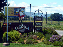 Kunstmann
Brewery, Valdivia, Chile
Kunstmann
Brewery, Valdivia, Chile
Since the first
Germans
migrated to Valdivia in the mid-1840s, German cultural influence has been visible in the city. Germans in Valdivia settled mostly in the
Isla Teja
and
Collico
suburban areas. Until the building of
Pedro de Valdivia Bridge
, inhabitants of
Isla Teja
lived isolated from the city, where it was common that children first learned to speak
German
before Spanish. Nowadays, the
German language
is preserved by the
Instituto Aleman Carlos Anwandter
one of
Latin America
's oldest German schools. German descendants also form Valdivia's oldest fire station
Germania,
located in Isla Teja.
German immigrants and their descendants formed their social club
Club Aleman,
which after
World War II
changed names to
Club la Union
. German workers once had their own club simply called
El Aleman
(The German).
Valdivia also hosts
Bierfest Valdivia
, a celebration that could be described as a small, regional
Oktoberfest
, despite being celebrated in late January or February of every year (during the local summer, when there is the largest influx of tourists). The main sponsor and organizer is
Kunstmann
, a local
beer
company, founded by German nationals, but since bought out by the largest beer and beverages company in Chile (CCU).
Literature
[
edit
]
The Valdivia Book Fair is organized annually by the Municipal Cultural Corporation in Parque Saval.
[25]
Likewise, the Society of Writers of Chile, through its subsidiary Valdivia and with the collaboration of the
Austral University of Chile
, regularly holds literary gatherings, a space in which books are presented and local letters are shared with the student community.
[26]
Several authors born in the
Los Rios Region
also stand out in the city, such as
Maha Vial
,
[27]
Ivan Espinoza Riesco,
[28]
Jose Baroja
,
[29]
Aldo Astete Cuadra,
[30]
Efrain Miranda Cardenas, among others.
Demographics
[
edit
]
According to the 2002
census
of the
National Statistics Institute
, the commune of Valdivia spans an area of 1,015.6 km
2
(392 sq mi) and has 140,559 inhabitants (68,510 men and 72,049 women). Of these, 129,952 (92.5%) lived in
urban areas
and 10,607 (7.5%) in
rural areas
. Between the 1992 and 2002 censuses, the population grew by 15.1% (18,391 persons).
[3]
The city of Valdivia spans 42.39 km
2
(16 sq mi) had a population of 127,750 and 35,217 homes, giving it a population density of 3,013.7/km
2
(7,805/sq mi). The commune is divided into 19 census districts with one recognized
town
, Niebla, with an area of 1.55 square kilometers (0.60 sq mi), population of 2,202 (in 1,169 homes) and population density of 1,420.6/km
2
(3,679/sq mi).
[3]
Within the population, the presence of descendants of migrants of German origin and of Spanish origin also stands out, colonies that are grouped into different social, educational, sports and cultural institutions.
Arts and Scientific research
[
edit
]
The Southern University of Chile (
Universidad Austral de Chile
, UACh), one of the original eight Chilean state universities, has its main campus in Valdivia. In the last decade Valdivia gained prestige as an important cultural and scientific venue: the
Valdivia Film Festival
became the most important in Chile, and the
Centro de Estudios Cientificos
(CECS) is now housed in the recently modernized, German-style hotel Schuster located by the Valdivia River.
Claudio Bunster
, a physicist and winner of Chile's National Prize in Exact Sciences, is the Director of CECS. Some research areas where CECS and UACH have gained widespread recognition include:
The city is surrounded by many nature reserves and large areas of forest plantations, wetlands and
Valdivian temperate rainforest
that, together with the numerous rivers that circle the city, have heightened the residents' awareness of living close to nature.
Trivia
[
edit
]
In addition to being known as
the City of Rivers
, Valdivia has also been called
The pearl of the South,
The key of the South seas
,
Gibraltar of the Pacific
, and
Chile's most beautiful city
. The nickname
Valdilluvia
is a mix of the Spanish word for rain ?
lluvia
and Valdivia referring to the rainy climate of the city.
Geography
[
edit
]
 Map of Valdivia and its surroundings
As part of the
Chilean
Patagonia
, the geography of the Valdivia area consists of wetlands and alluvial terraces. Several rivers, such as
Cau-Cau
,
Calle-Calle
and
Cruces
, join near the city forming the larger
Valdivia River
. Valdivia River in turn empties to
Corral Bay
in the
Pacific Ocean
just some 15 km west of Valdivia. This river network made Valdivia a trade center even since
Pre-Hispanic
times. The city itself was built on a riverine terrace but expanded later over adjacent wetlands. Nowadays the city is virtually surrounded by hills by all sides except north where Valdivia's lowlands connect to the flatlands of San Jose de la Mariquina. Some hilly areas around Valdivia are covered with exotic forest species such as
Douglas-fir
,
Pinus radiata
and
Eucalyptus globulus
. Other places are used for recreational purposes or conservation of native ecosystems. Additional Northern Hemisphere exotic trees such as
birch
,
horsechestnut
and
poplar
are common in residential areas.
Palms
are occasional.
Parts of city is built on poor soils made up of former wetlands or artificial fills that are prone to suffer during earthquakes as demonstrated in 1960 and
2010
.
[31]
Geology
[
edit
]
Within the context of
plate tectonics
, the city lies at a
convergent margin
where
Nazca Plate
, in the Pacific, is
subducted
beneath the
South American Plate
. Topographically Valdivia lies in a depression amidst the
Chilean Coast Range
. The
basement rocks
that crops out in the hills around the city are of
metamorphic type
. The city itself is chiefly built upon terraces made up of hardened
volcanic
sand
. This volcanic sandstone is known as "cancagua" and deposited during the late
Pleistocene epoch
.
[32]
As terraces took shape during the
interglacial
preceding the
Llanquihue glaciation
?the
last glacial period
? this interglacial is known in Chile as the
Valdivia interglacial
.
[33]
 View of Valdivia from west
A
tectonically
and
eustatically
stable period during the
Oligocene
and Early
Miocene
allowed erosion to create deep valleys in the Coast Range and peat swamps at what is now the
estuary
of the Valdivia basin.
[34]
About 23.5 million years ago this stable period was interrupted by a major
volcanic eruption
and 23 mya ago an increase in convergence rate at the
Peru?Chile Trench
caused an uplift of the landscape and renewed erosion.
[34]
However basin
subsidence
and a marine
transgression
formed deep embayments,
tidal flats
, bayhead deltas and beaches.
[34]
Climate
[
edit
]
Valdivia has an
oceanic climate
with
Mediterranean
influences.
[35]
The natural vegetation of the region is the
Valdivian temperate rainforest
.
During the summer months (December, January and February) the average temperature is about 17 °C (63 °F), while in winter the temperature descends to 8.5 °C (47.3 °F). The annual average temperature for
Los Rios Region
is 11 °C (52 °F), while the mean temperature amplitude is 8.8 °C (47.8 °F) and the daily is 11 °C (51.8 °F).
[35]
Average annual
precipitation
is 1,750 millimeters (70 in), distributed through the year, but primarily between March and October. Hail occurs with some frequency during winter, but snow falls rarely. The last times it snowed in Valdivia were in August 2020, July 2007, and in August 1995 during the so-called
Terremoto Blanco
(
Spanish
for White Earthquake). The
Seven Lakes
in the interior help to keep an average relative humidity of 80% for the region as whole and there are no months with less than 75% average humidity.
[35]
The precipitation is generated by
frontal systems
that cross the zone, which produce cloudiness and few clear days.
[35]
The
leeward
effect of the
Valdivian Coast Range
is minimal due to its low height (715 m at
Cerro Oncol
) and the gap in the range at
Valdivia River
's outflow to the
Pacific Ocean
.
Decreasing precipitation
has caused the city's water supply in
Calle-Calle River
to be contaminated with saline water from the coast.
[36]
The effects of saline water entering the water supply of Valdivia were particularly noticeable in March 2015 when there was a surge in complains about the taste of the water.
[36]
[37]
The saltwater in the rivers near Valdivia during autumn is expected to increase in the future.
[37]
Estimations indicate that whenever the sum of the water discharge of Cruces and Calle-Calle rivers falls below 74 m
3
/s (2,600 cu ft/s) saltwater reaches the supply site at Cuesta Soto.
[37]
| Climate data for Valdivia, Chile (
Pichoy Airport
) 1991?2020, extremes 1966?present
|
| Month
|
Jan
|
Feb
|
Mar
|
Apr
|
May
|
Jun
|
Jul
|
Aug
|
Sep
|
Oct
|
Nov
|
Dec
|
Year
|
| Record high °C (°F)
|
35.2
(95.4)
|
38.5
(101.3)
|
32.0
(89.6)
|
27.5
(81.5)
|
21.2
(70.2)
|
18.2
(64.8)
|
19.2
(66.6)
|
20.0
(68.0)
|
25.9
(78.6)
|
29.2
(84.6)
|
31.2
(88.2)
|
33.2
(91.8)
|
38.5
(101.3)
|
| Mean daily maximum °C (°F)
|
24.0
(75.2)
|
24.1
(75.4)
|
21.5
(70.7)
|
17.0
(62.6)
|
13.5
(56.3)
|
11.0
(51.8)
|
10.8
(51.4)
|
12.4
(54.3)
|
14.8
(58.6)
|
16.9
(62.4)
|
19.2
(66.6)
|
21.8
(71.2)
|
17.3
(63.1)
|
| Daily mean °C (°F)
|
16.4
(61.5)
|
16.3
(61.3)
|
14.5
(58.1)
|
11.7
(53.1)
|
9.8
(49.6)
|
8.0
(46.4)
|
7.4
(45.3)
|
8.3
(46.9)
|
9.4
(48.9)
|
11.1
(52.0)
|
13.0
(55.4)
|
15.0
(59.0)
|
11.7
(53.1)
|
| Mean daily minimum °C (°F)
|
8.8
(47.8)
|
8.5
(47.3)
|
7.5
(45.5)
|
6.3
(43.3)
|
6.0
(42.8)
|
5.0
(41.0)
|
4.0
(39.2)
|
4.2
(39.6)
|
4.1
(39.4)
|
5.3
(41.5)
|
6.8
(44.2)
|
8.2
(46.8)
|
6.2
(43.2)
|
| Record low °C (°F)
|
?0.7
(30.7)
|
?0.2
(31.6)
|
?1.9
(28.6)
|
?3.8
(25.2)
|
?6.0
(21.2)
|
?6.8
(19.8)
|
?7.2
(19.0)
|
?5.2
(22.6)
|
?5.0
(23.0)
|
?3.0
(26.6)
|
?1.4
(29.5)
|
0.0
(32.0)
|
?7.2
(19.0)
|
| Average
precipitation
mm (inches)
|
40.5
(1.59)
|
39.1
(1.54)
|
68.0
(2.68)
|
125.0
(4.92)
|
231.5
(9.11)
|
329.3
(12.96)
|
265.0
(10.43)
|
241.8
(9.52)
|
123.4
(4.86)
|
107.3
(4.22)
|
84.7
(3.33)
|
66.8
(2.63)
|
1,722.4
(67.81)
|
| Average precipitation days
(≥ 1.0 mm)
|
4.7
|
4.7
|
7.1
|
10.5
|
14.7
|
18.8
|
17.0
|
16.8
|
12.0
|
11.9
|
8.7
|
7.1
|
134.1
|
| Average
relative humidity
(%)
|
63
|
64
|
72
|
80
|
87
|
89
|
87
|
83
|
76
|
72
|
68
|
65
|
76
|
| Mean monthly
sunshine hours
|
295.8
|
259.7
|
211.2
|
127.9
|
71.6
|
46.8
|
70.6
|
100.3
|
151.0
|
194.6
|
219.3
|
262.7
|
2,011.5
|
| Source 1: Direccion Meteorologica de Chile (humidity 1970?2000)
[38]
[39]
[40]
|
| Source 2:
NOAA
(precipitation days 1991?2020)
[41]
|
Government and politics
[
edit
]
The commune of Valdivia is a third-level
administrative division of Chile
governed by a directly elected
mayor
(
alcalde
) and a
municipal council
(
consejales
). The city's current mayor is
Carla Andrea Amtmann Fecci
of the
Democratic Revolution
party. The prior mayor was Omar Sabat Guzman of the
Independiente UDI
.
Within the
electoral divisions of Chile
, Valdivia is represented in the
Chamber of Deputies
by Alfonso De Urresti (
PS
) and Roberto Delmastro (RN) as part of the 53rd electoral district, together with
Lanco
,
Mariquina
,
Mafil
and
Corral
. The commune is represented in the
Senate
during the 2014?2022 period by
Alfonso de Urresti
(
PS
) and
Ena von Baer
(
UDI
) as part of the 16th senatorial constituency (Los Rios Region).
The creation of
Los Rios Region
and
environmental
issues have dominated the political scene of Valdivia in recent years. The communist lawyer Wladimir Riesco headed the legal actions against pulp mill enterprise
CELCO
after the deaths of
black-necked swans
in
Carlos Anwandter Nature Sanctuary
in 2004.
Ecological action
[
edit
]
In response to the alleged contamination of Cruces River by the
Celco
cellulose pulp mill, a group of citizens formed the
Accion por los Cisnes
(
Action for the Swans
) ecology group. Action for the Swans attracted the attention of the national newspapers and succeeded in temporarily closing down
Valdivia Pulp Mill
through a court order.
[42]
Economy and tourism
[
edit
]
The city and commune of Valdivia rely heavily on
silviculture
, the
pulp and paper industry
and other forestry-related activities (the harvesting and processing of wood from nearby plantations of
eucalyptus
and
Douglas firs
). Large businesses such as
CELCO
,
Bomasil
and
Louisiana-Pacific
have established wood processing factories near Valdivia.
Metallurgy
,
naval construction
and repairs are also important industries, with the companies of
Asenav
and Alwoplast based in the area.
[43]
Agroforestry
/
agriculture
,
livestock
,
aquaculture
and
food processing
are lesser but also important industries that contribute to the region's economy. The
chocolate
company (
Entrelagos
) contributes to the image of the region, as does the
brewing
industry, a symbol of the area and another important part of the local economy, with
Kunstmann
the most famous brewery in Valdivia.
Beer
, along with
cold cut
meat and
sausages
, is part of the city's German heritage and is preserved as part of the local heritage.
[44]
Trade, restaurants and hotels link to the tourism industry which represent an important part in Valdivia's growing economy.
[45]
Tourism
[
edit
]
Valdivia is a historic tourist destination in Chile, valued for the beauty of the city and surrounding areas, the area's culture and its history. It is an all season city, but during the summer months in particular (December, January, February) tourism is a major source of income for Valdivia's economy. "Valdivian Week" (Spanish:
Semana Valdiviana
), as it has been known since 1917, is a long-held tradition that dates back to the foundation of the city. Starting February 9 each year,
[46]
it commemorates the city's anniversary and also gives Valdivia the chance to promote itself as a tourism center. "Semana Valdiviana" features an allegorical parade of ships ? a tradition that began in the seventeenth century as a protest against the Spaniard authorities ? and also includes a big artisan market, fairground rides, and the election of the "queen" of
Los Rios
. The week ends with
fireworks
and theatre performances on the closing night, known as "Noche Valdiviana" (Valdivian Night).
The center of the city has a rich architectural heritage. One of its most visited buildings is the "Mercado Municipal" ("municipal market"),
[47]
a local produce market that is also now a gastronomic and cultural attraction. Also popular are the "Convento San Francisco" (Saint Francis Convent) and the European-style buildings dating back to the beginning of the 20th century, used today by the city's universities, cultural centers and government.
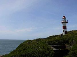 Picture of
Niebla lighthouse
situated just above the Niebla fort
Picture of
Niebla lighthouse
situated just above the Niebla fort
Education
[
edit
]
Universities and colleges
[
edit
]
Valdivia is home to several public and private
schools
and
universities
. The largest and oldest university is the
Universidad Austral de Chile
(UACh) that was founded by decree in 1954 as one of Chile's seven original
Chilean Traditional Universities
. Its main campus is located in
Isla Teja
but it has other minor campus and properties spread through the city and
southern Chile
. Since the liberalization of higher education in Chile in the 1980s other universities have established campuses in Valdivia, including
Universidad Arturo Prat
,
Universidad San Sebastian
,
Universidad Santo Tomas
and
Universidad de Los Lagos
.
Schools
[
edit
]
Like in the rest of Chile, most of Valdivia's best schools are private.
Instituto Aleman Carlos Anwandter
(Deutsche Schule Valdivia) founded in 1858 is Chile's second oldest German school after the Instituto Aleman de Osorno (1854). Other notable private schools are
Windsor School
and Colegio San Luis de Alba. Among public schools
Instituto Salesiano de Valdivia
,
Liceo Rector Armando Robles Rivera
and
Liceo Comercial
have reached good results.
Sports
[
edit
]
Facilities for playing
football
,
tennis
,
rowing
,
rugby
,
golf
, indoor
swimming
, indoor and outdoor
basketball
and some other sports are available throughout the area. Rowing is practiced in Valdivia in three clubs: Club Deportivo Phoenix Valdivia, Club Centenario de Remeros and Club Arturo Prat. Valdivian rowers
Cristian Yantani
and
Miguel Cerda
won the first place in Men's Lightweight Coxless Pair-Oared Shells at the world championship in
Seville
, 2002.
[48]
Club Deportivo Valdivia
is Valdivia's main basketball team and plays in Chiles first division,
DIMAYOR
where it won the 2001 season. In 1977 and 2001 Valdivia hosted South Americas Men's Basketball Championship.
[49]
The football club
Club Deportivo Deportes Valdivia
, founded in 2003, plays currently in the
Chilean third division
and as of 2013
[update]
, will play in the Primera B (or Second Division)
Transport
[
edit
]
Roads and bridges
[
edit
]
 Pedro de Valdivia Bridge
and the city's
sea lion
colony
Pedro de Valdivia Bridge
and the city's
sea lion
colony
Most of Valdivia lies on the southern side of the
Valdivia
and
Calle-Calle Rivers
but other areas of the city, such as
Isla Teja
and
Las Animas
, are connected to it by bridges. The main access points to the city are
Calle-Calle Bridge
from the north and a southern route. Both connect the city with the
Pan-American Highway
and run through forested areas and wetlands.
Route 207
runs from Valdivia southeast connecting the city with the town of
Paillaco
at the
Route 5
.
[50]
Calle-Calle Bridge, the first bridge built in the city, connects Valdivia with Las Animas and forms the northern highway access to the city.
Pedro de Valdivia Bridge
was built in 1954 and connects the city with
Isla Teja
, where many German immigrants once lived. During the Great
1960 Valdivia earthquake
only the minor
Caucau Bridge
(connecting Las Animas with Isla Teja) was destroyed,
[
dubious
–
discuss
]
while all other bridges were repaired and are still in use. In 1987
Augusto Pinochet
opened
Rio Cruces Bridge
, making the coastal town of
Niebla
as well as
Torobayo
and
Punucapa
accessible by road. Calle-Calle Bridge, the main access to the city, was enlarged in the 1990s.
 The New Cau Cau bridge in Valdivia has been restored and fixed.
The new Caucau bridge was intended to provide a faster route from the city centre to the Pichoy airport via Isla Teja, but the faulty construction made it unusable.
Waterways
[
edit
]
Until highway bridges were built, Valdivia's economy and citizens depended on boat traffic on the surrounding rivers, but with a contraction of bridges and highways, the river has lost its importance. Today, the rivers are used by the commercial ships built or repaired in
Asenav
, one of Chile's most important shipyard companies, and by tourist boats. Some of the locations that are regularly reached by tourist boats include
Mancera Island
and
Punucapa
.
Fishing boats also travel inland from the coast to the River Market. Today, just one ferry is still in operation, the
Niebla
?
Corral
line, as it is much quicker to reach Corral by
ferry
than by road.
Although in recent years the rivers have not had a major role in Valdivia's public transportation, a new private project is being developed by "Los Solares",
[51]
an environmentally friendly company that operates solar-powered river taxis on
Valdivia River
. The project is called Transporte Fluvial Sustentable (TFS, or "Sustainable Water Transportation" in English). So far, the company has a fleet of three river taxis,
[52]
and a small, sustainable and locally designed floating village that includes a pier, a cafe and the company's offices. The community produces its own electricity, water supply and processes its own wastewater with a bacterial solution.
[53]
Airports
[
edit
]
The city is served mainly by
Pichoy Airport
, lying 32 km northeast of the city via the north entrance road that connects the city with the
Pan American Highway
. The smaller but much closer
Las Marias Airport
is used primarily by small aircraft, with no
airlines
operating there.
Twin towns ? sister cities
[
edit
]
Gallery
[
edit
]
Places adjacent to Valdivia
|
|---|
|
See also
[
edit
]
References
[
edit
]
 This article incorporates text from a publication now in the
public domain
:
Chisholm, Hugh
, ed. (1911). "
Valdivia
".
Encyclopædia Britannica
. Vol. 27 (11th ed.). Cambridge University Press. p. 844.
This article incorporates text from a publication now in the
public domain
:
Chisholm, Hugh
, ed. (1911). "
Valdivia
".
Encyclopædia Britannica
. Vol. 27 (11th ed.). Cambridge University Press. p. 844.
- ^
"Asociacion Chilena de Municipalidades"
(in Spanish). Archived from
the original
on 19 April 2011
. Retrieved
23 February
2011
.
- ^
"Municipality of Valdivia"
(in Spanish). Archived from
the original
on 18 October 2000
. Retrieved
23 February
2011
.
- ^
a
b
c
d
e
"National Statistics Institute"
(in Spanish).
Archived
from the original on 6 January 2019
. Retrieved
7 February
2010
.
- ^
"Censo 2017: Primera entrega de resultados definitivos - Cantidad de personas por sexo y edad"
(in Spanish). National Statistics Institute. 2019.
Archived
from the original on 2 January 2018
. Retrieved
1 November
2020
.
- ^
"Ciudades, pueblos, aldeas y cacerios 2019"
(PDF)
(in Spanish). National Statistics Institute. 2019.
Archived
(PDF)
from the original on 13 July 2019
. Retrieved
1 November
2020
.
- ^
a
b
c
"The Defensive Complex of Valdivia"
.
Entry on the UNESCO Tentative List
.
Archived
from the original on 27 December 2022
. Retrieved
15 August
2007
.
- ^
a
b
U.S. Geological Survey (March 7, 2006).
Historic Earthquakes ? Chile ? 1960 May 22 19:11:14 UTC ? Magnitude 9.5: The Largest Earthquake in the World.
Archived
2009-10-07 at the
Wayback Machine
Retrieved on 2007-01-09
- ^
Ramirez, C., E. Carrasco, S. Mariani & N. Palacios. 2006. La desaparicion del luchecillo (Egeria densa) del Santuario del Rio Cruces (Valdivia, Chile): una hipotesis plausible. Ciencia & Trabajo, 20: 79-86
- ^
"Ley de Humedales Urbanos 21.202 y su Reglamento"
.
Ministerio del Medio Ambiente
(in Spanish).
Government of Chile
.
Archived
from the original on 2 March 2021
. Retrieved
4 April
2021
.
- ^
Vallejos, Gabriel; Salgado, Daniela (10 December 2021).
"Reconocen como humedales urbanos a Angachilla y el sector de Isla Teja en Valdivia]"
.
Radio Bio-Bio
(in Spanish).
Archived
from the original on 2 March 2022
. Retrieved
3 March
2022
.
- ^
Dillehay, Tom
,
Monteverde: A Late Pleistocene Settlement in Chile
(Smithsonian Institution Press, Washington, 1989)
- ^
Pino, Mario
and Navarro, Rayen.
"Geoarqueologia del sitio arcaico Chan-Chan 18"
Archived
2012-09-26 at the
Wayback Machine
(in Spanish)
.
Revista Geologica de Chile
, 2005.
- ^
"Was J?mon the origin of the Valdivia culture? ? Neperos"
.
Neperos.com
.
- ^
a
b
c
d
- ^
a
b
c
Marino de Lobera, Pedro,
Cronica del reino de Chile, Coleccion de historiadores de Chile, Imprenta del Ferrocarril, 1865. Available in www.memoriachilena.cl
- ^
Guarda, Gabriel
.
Nueva historia de Valdivia
(Editorial Universidad Catolica de Chile, Santiago, 2001)
- ^
a
b
c
d
e
f
g
h
i
j
k
l
m
"Breve Historia de Valdivia"
. Editorial Francisco de Aguirre. 1971.
Archived
from the original on 18 February 2007
. Retrieved
17 September
2007
.
- ^
Jeronimo de Vivar
? Cronica y relacion copiosa y verdadera de los reynos de Chile ? Ended in 1558. Transcription of Irving Leonard published by
Fondo Historico y Bibliografico Jose Toribio Medina
, Santiago de Chile, 1966
- ^
a
b
c
"Historia"
.
Museo de Sitio Castillo de Niebla
(in Spanish). Servicio Nacional del Patrimonio Cultural. Archived from
the original
on 4 August 2020
. Retrieved
7 April
2020
.
- ^
Urbina C., Maria Ximena
(2017).
"La expedicion de John Narborough a Chile, 1670: Defensa de Valdivia, rumeros de indios, informaciones de los prisioneros y la creencia en la Ciudad de los Cesares"
[John Narborough expedition to Chile, 1670: Defense of Valdivia, indian rumours, information on prisoners, and the belief in the City of the Cesares].
Magallania
.
45
(2): 11?36.
doi
:
10.4067/S0718-22442017000200011
.
Archived
from the original on 16 May 2020
. Retrieved
27 December
2019
.
- ^
Couyoumdjian, Juan Ricardo (2009).
"Resena de "La frontera de arriba en Chile colonial. Interaccion hispano-indigena en el territorio entre Valdivia y Chiloe e imaginario de sus bordes geograficos, 1600?1800" de MARIA XIMENA URBINA CARRASCO"
(PDF)
.
Historia
.
I
(42): 281?283.
Archived
(PDF)
from the original on 20 December 2016
. Retrieved
30 January
2016
.
- ^
Otero, Luis, La Huella del Fuego: Historia de los bosques y cambios en el paisaje del sur de Chile (Valdivia, Editorial Pehuen)
- ^
Investigacion aplicada sobre Geografia Urbana: Un caso practico en la ciudad de Valdivia
Archived
2014-10-25 at the
Wayback Machine
Victor Figueroa, Jorge Gayoso, Edgardo Oyarzun, Lenia Planas
Gestion Turistica
,
UACh
.
- ^
Bernales Lillo, Mario (1984).
"Aspectos diacronicos en la toponimia de Valdivia"
.
Anales de la Universidad de Chile
(in Spanish).
5
(5): 79?94.
Archived
from the original on 24 February 2017
. Retrieved
23 February
2017
.
- ^
"Todo lo que necesitas saber sobre la 29° Feria del Libro de Valdivia"
.
Diario Futrono
(in Spanish).
Archived
from the original on 3 December 2022
. Retrieved
16 June
2022
.
- ^
"Invitan a nueva tertulia literaria Tren de letras bajo la lluvia"
.
Universidad Austral de Chile
.
Archived
from the original on 18 May 2022
. Retrieved
16 June
2022
.
- ^
Marimon, Guido Macari (27 October 2020).
"Muere la poeta y actriz Maha Vial"
.
La Tercera
.
Archived
from the original on 16 June 2022
. Retrieved
16 June
2022
.
- ^
"Ivan Espinoza Riesco"
.
comunidadcreativalosrios.cultura.gob.cl
.
Archived
from the original on 18 August 2022
. Retrieved
16 June
2022
.
- ^
Fernandez, Antonio Cazas.
"
"La escritura le aporto sentido, coherencia e identidad a mi vida"
"
.
www.elcorreogallego.es
(in European Spanish).
Archived
from the original on 17 May 2022
. Retrieved
16 June
2022
.
- ^
"Aldo Astete Cuadra ? El Ser que acecha entre la Lluvia"
.
comunidadcreativalosrios.cultura.gob.cl
.
Archived
from the original on 16 June 2022
. Retrieved
16 June
2022
.
- ^
Rojas Hoppe, Carlos; Diez Lorente, Silvia (2013).
"El terremoto chileno del 27 de febrero de 2010: Analisis preliminar de las consecuencias en la ciudad de Valdivia"
.
Investigaciones Geograficas
(in Spanish).
60
(60): 139?153.
doi
:
10.14198/INGEO2013.60.08
.
hdl
:
10045/34749
.
- ^
Vega, Rodrgo; Mella, Mauricio; Nielsen, Sven N.;
Pino, Mario
(2018).
"Stratigraphy and sedimentology of a late Pleistocene incised valley fill: a depositional and paleogeographic model for "Cancagua" deposits in north-western Patagonia, Chile"
.
Andean Geology
.
45
(2): 161?185.
doi
:
10.5027/andgeoV45n2-3030
.
Archived
from the original on 7 August 2018
. Retrieved
7 August
2018
.
- ^
Astorga, G. and
Pino, M
. (2011).
"Fossil leaves from the last interglacial in Central-Southern Chile: Inferences regarding the vegetation and paleoclimate"
Archived
2016-12-02 at the
Wayback Machine
.
Geologica Acta
.
9
(1): 45?54.
- ^
a
b
c
le Roux, J.P.; Elgueta, Sara (2000).
"Sedimentologic development of a Late Oligocene?Miocene forearc embayment, Valdivia Basin Complex, southern Chile"
.
Sedimentary Geology
.
130
(1?2): 27?44.
Bibcode
:
2000SedG..130...27L
.
doi
:
10.1016/S0037-0738(99)00096-2
.
Archived
from the original on 8 March 2022
. Retrieved
8 March
2022
.
- ^
a
b
c
d
Direccion Meteorologica de Chile
Archived
2008-02-29 at the
Wayback Machine
(in Spanish)
- ^
a
b
Jara, Yonatan; Stuardo, Manuel (21 September 2020).
"Cientificos proyectan en 80 anos la llegada de mar a toma de agua en Valdivia para buscar soluciones"
.
Radio Bio-Bio
(in Spanish).
Archived
from the original on 8 March 2022
. Retrieved
7 March
2022
.
- ^
a
b
c
Lara, Emilio (16 September 2020).
"El mar se acerca a principal toma de agua dulce en Valdivia y amenaza calidad del recurso"
.
Radio Bio-Bio
(in Spanish).
Archived
from the original on 8 March 2022
. Retrieved
7 March
2022
.
- ^
"Datos Normales y Promedios Historicos Promedios de 30 anos o menos"
(in Spanish). Direccion Meteorologica de Chile. Archived from
the original
on 23 May 2023
. Retrieved
23 May
2023
.
- ^
"Temperatura Historica de la Estacion Pichoy, Valdivia Ad. (390006)"
(in Spanish). Direccion Meteorologica de Chile. Archived from
the original
on 23 May 2023
. Retrieved
23 May
2023
.
- ^
"Estadistica Climatologica Tomo II"
(PDF)
(in Spanish). Direccion General de Aeronautica Civil. March 2001. Archived from
the original
(PDF)
on March 3, 2016
. Retrieved
December 25,
2012
.
- ^
"Pichoy Valdivia Climate Normals 1991?2020"
.
World Meteorological Organization Climatological Standard Normals (1991?2020)
.
National Oceanic and Atmospheric Administration
. Archived from
the original
on 6 August 2023
. Retrieved
6 August
2023
.
- ^
Forbes List of Billionaires 2006
- ^
INSTITUTO NACIONAL DE ESTADISTICAS DIRECCION REGIONAL DE LOS RIOS
Archived
2016-03-04 at the
Wayback Machine
(in Spanish)
INSTITUTO NACIONAL DE ESTADISTICAS DIRECCION REGIONAL DE LOS RIOS. October 2010. Retrieved February 22, 2014.
- ^
"Gobierno de Chile"
. Gobiernodechile.cl.
Archived
from the original on 7 February 2012
. Retrieved
22 May
2012
.
- ^
El Indicador de Actividad Economica Regional (INACER) presento alza de 3,4% respecto a doce meses
Archived
2015-02-09 at the
Wayback Machine
(in Spanish)
. February 18, 2014. Retrieved February 22, 2014.
- ^
CULTURA E IDENTIDAD DE VALDIVIA
Archived
2014-04-25 at the
Wayback Machine
(in Spanish)
. munivaldivia.cl. Retrieved February 18, 2014.
- ^
"Mercado Municipal de Valdivia"
.
Archived
from the original on 25 April 2014
. Retrieved
24 April
2014
.
- ^
"World Rowing Medalists"
. Archived from
the original
on 5 December 2012
. Retrieved
5 December
2012
.
- ^
DIMAYOR
Archived
2011-07-07 at the
Wayback Machine
(in Spanish)
- ^
Burford, Tim (2005).
Chile: The Bradt Travel Guide
. Bradt Travel Guides. p. 475.
ISBN
9781841620763
.
- ^
Rutas de Los Solares Transportes TFS
Archived
2014-04-25 at the
Wayback Machine
Solaresdevaldivia.cl retrieved on February 17, 2014
- ^
Barrio Flotante en Valdivia ya esta en marcha
Archived
2014-04-25 at the
Wayback Machine
elnaveghable.cl January 27, 2013
- ^
Valdivia’s River neighbourhood Short documentary with English subtitles
Archived
2014-04-25 at the
Wayback Machine
www.livingatlaschile.com released on February 18, 2014 retrieved on February 23, 2014
- ^
CSRIO
, AGSO - Marine And Petroleum Division,
South Pacific Continental Report Annual 1998
, p23
Notes
[
edit
]
Sources
[
edit
]
External links
[
edit
]
Wikivoyage has a travel guide for
Valdivia
.
https://www.munivaldivia.cl/web/
Chilean
cities with a population of over 150,000 (2017 census)
|
|---|
|
|
|---|
| International
| |
|---|
| National
| |
|---|
| Geographic
| |
|---|
| Other
| |
|---|