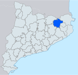
Comarca in Catalonia, Spain
Garrotxa
|
|---|
|
 |
| Country
|  Spain
Spain
|
|---|
| Autonomous community
|  Catalonia
|
|---|
| Region
| Comarques Gironines
|
|---|
| Province
| Girona
|
|---|
| Capital
| Olot
|
|---|
| Municipalities
|
- Argelaguer
,
Besalu
,
Beuda
,
Castellfollit de la Roca
,
Maia de Montcal
,
Mieres
,
Montagut i Oix
,
Olot
,
Les Planes d'Hostoles
,
Les Preses
,
Riudaura
,
Sales de Llierca
,
Sant Aniol de Finestres
,
Sant Feliu de Pallerols
,
Sant Ferriol
,
Sant Jaume de Llierca
,
Sant Joan les Fonts
,
Santa Pau
,
Tortella
,
La Vall d'en Bas
,
La Vall de Bianya
|
|---|
|
| ? Body
| Garrotxa Comarcal Council
|
|---|
| ? President
| Santi Reixach (
Junts
)
|
|---|
|
| ? Total
| 734.5 km
2
(283.6 sq mi)
|
|---|
|
| ? Total
| 55,999
|
|---|
| ? Density
| 76/km
2
(200/sq mi)
|
|---|
| Demonym
|
|
|---|
| Time zone
| UTC+1
(
CET
)
|
|---|
| ? Summer (
DST
)
| UTC+2
(
CEST
)
|
|---|
| Largest municipality
| Olot
|
|---|
Garrotxa
(
Catalan pronunciation:
[???r?t??]
) is a
comarca (county)
in the
Girona region
,
Catalonia
,
Spain
. Its population in 2016 was 55,999, more than half of them in the capital city of
Olot
. It is roughly equivalent to the historical
County of Besalu
.
Geography
[
edit
]
Garrotxa borders the comarques of
Ripolles
,
Osona
,
Selva
,
Girones
,
Pla de l'Estany
,
Alt Emporda
, and
Vallespir
. It includes the upper basin of the River
Fluvia
and the headwaters of the rivers
Muga
,
Amer
and
Llemena
.
From both the human point of view and that of physical geography, the comarca has a clear division into two subcomarques. Extending north from the valley of the Fluvia, is Alta Garrotxa (Upper Garrotxa), while the southern part is sometimes called the comarca of Olot, after the capital city.
The Fluvia flows toward the
Mediterranean
, and has a relatively small flow of water (1.07 m³/s at Olot).
The high humidity of Garrotxa contrasts with that of the neighboring comarques. Annual rainfall is over 1000 mm (about 40 inches). It is said that "Si no plou a Olot, no plou enlloc" ("if it's not raining in Olot, it is not raining anywhere."). Winter temperatures hover around freezing; in August, temperatures average 27.7 °C (about 80 °F). Thermal inversions are relatively common; Alta Garrotxa and Puigsacalm, particularly, have more of a mountain climate, with snowfall figuring more prominently.
Vegetation varies with the climate. Alta Garrotxa and the east part of the comarca have typically Mediterranean climate and vegetation; the rest has a sub-Mediterranean climate, tending toward an Atlantic climate in the most humid areas.
Volcanic zone
[
edit
]
In the western part of the
comarca
, the land around Olot and
Santa Pau
contains some 40 well-preserved
volcanic
cones at
Croscat
, important flows of
basaltic
lava
, and the volcano of
Santa Margarida
. This zone is protected within the 120.07 km²
Parc Natural de la Zona Volcanica de la Garrotxa
.
The populated areas are mostly located on the plain and hillsides of Olot. A field of lava covers most of the plain (some 25 km²), and lava flows continue down the valley of the Fluvia to
Sant Jaume de Llierca
. Another important sector is in the tectonic valley of the
River Ser
, at the foot of the
fault scarp
of the
Corb
and
Finestres
ranges, with the volcanoes of Santa Margarida and Croscat. Lava flowed down the valley, past Sallent de Santa Pau to the
Gibert
mill. A third group of volcanoes lies in the
Llemena
river valley and the stream of Adri.
 Romanesque monastery of Sant Joan les Fonts
The field became active about 700,000 years ago,
[1]
with the last eruption occurring 11,500 years ago.
[2]
[3]
There appear to have been old eruptions around
Olot
, because one can find
basalt
boulders
from the
Pliocene
era in the valley of the Fluvia.
In 1982, the
Generalitat de Catalunya
declared the zone comprising the valleys of the Fluvia and Ser and the upper part of the valleys of
Aiguavella
and
Sant Iscle
to be Natural Places of National Interest. They also declared most of the volcanic cones and the
Fageda d'en Jorda
(
beech
woods rooted in lava) to be Integral Geobotanical Reserves.
Population and economic activity
[
edit
]
9.4% of the population are engaged in agriculture and primary production, 59.4% in industry and energy, and 31.2% in the service sectors. Agricultural land has been shrinking, but Garrotxa remains the leading producer of
maize
. The livestock sector is actually expanding, especially
pigs
and
cattle
.
Industry, centered on Olot,
Sant Joan les Fonts
, and
Besalu
, has been generally on the rise since 1940. The most important industries are textiles, especially knitwear, the processing of locally grown food, and metallurgy. Behind these come papermaking, chemistry, and plastics.
Arts and crafts are traditional also, being the Olot Art School (
Escola d'Art i Superior de Disseny d'Olot
) one of the oldest ones in Catalonia.
Municipalities
[
edit
]
 Municipalities of la Garrotxa
| Municipality
|
Population
(2014)
[4]
|
Area
km
2
[4]
|
| Argelaguer
|
425
|
12.5
|
| Besalu
|
2,400
|
4.9
|
| Beuda
|
200
|
35.9
|
| Castellfollit de la Roca
|
1,013
|
0.7
|
| Maia de Montcal
|
443
|
17.3
|
| Mieres
|
326
|
26.3
|
| Montagut i Oix
|
970
|
93.7
|
| Olot
|
33,913
|
29.0
|
| Les Planes d'Hostoles
|
1,694
|
37.5
|
| Les Preses
|
1,772
|
9.4
|
| Riudaura
|
463
|
23.6
|
| Sales de Llierca
|
133
|
35.8
|
| Sant Aniol de Finestres
|
351
|
47.7
|
| Sant Feliu de Pallerols
|
1,353
|
34.9
|
| Sant Ferriol
|
240
|
42.2
|
| Sant Jaume de Llierca
|
812
|
6.8
|
| Sant Joan les Fonts
|
2,919
|
31.9
|
| Santa Pau
|
1,567
|
49.0
|
| Tortella
|
772
|
11.1
|
| La Vall d'en Bas
|
2,965
|
90.7
|
| La Vall de Bianya
|
1,305
|
93.6
|
| ? Total: 21
|
56,036
|
734.5
|
See also
[
edit
]
References
[
edit
]
- ^
Dades del Parc Natural de la Zona Volcanica de la Garrotxa
, Department of the Environment and Housing, Generalitat de Catalunya, April 2006, archived from
the original
on 2009-04-26
, retrieved
2009-10-11
.
- ^
"Descubren que volcanes Croscat y Santa Margarida los formo la misma erupcion"
[They discover that the Croscat and Santa Margarida volcanoes were formed by the same eruption].
EFE
(in Spanish). abc.es. 27 January 2011
. Retrieved
February 16,
2013
.
- ^
Marti, J.; Planaguma, L.; Geyer, A.; Canal, E.; Pedrazzi, D. (2011). "Complex interaction between Strombolian and phreatomagmatic eruptions in the Quaternary monogenetic volcanism of the Catalan Volcanic Zone (NE of Spain)".
Journal of Volcanology and Geothermal Research
.
201
(1?4): 178?193.
doi
:
10.1016/j.jvolgeores.2010.12.009
.
- ^
a
b
"El municipi en xifres"
. Institut d'Estadistica de Catalunya
. Retrieved
2015-05-25
.
External links
[
edit
]
Places adjacent to Garrotxa
|
|---|
|
42°10′17″N
2°33′17″E
/
42.17139°N 2.55472°E
/
42.17139; 2.55472