Vikipediya, ochiq ensiklopediya
Asl fayl
(4 000 × 2 400 piksel, fayl hajmi: 799 KB, MIME tipi:
image/png
)
Ushbu fayl Vikiomborga yuklangan bo?lib, boshqa loyihalarda ham qo?llanilishi mumkin.
Uning
tavsif sahifasidan
olingan ma?lumot quyida keltirilgan.
Qisqa izoh
Litsenziyalash
Data
Rivers, lakes, and urban areas
| Public domain
Public domain
false
false
|

|
This file uses data that was sourced from
Natural Earth
, a public domain dataset. From the
terms of use
:
All versions of Natural Earth raster + vector map data found on this website are in the public domain. You may use the maps in any manner, including modifying the content and design, electronic dissemination, and offset printing. The primary authors, Tom Patterson and Nathaniel Vaughn Kelso, and all other contributors renounce all financial claim to the maps and invites you to use them for personal, educational, and commercial purposes.
|
Shipwreck locations
The locations of the shipwrecks are facts and are not eligible for copyright protection
| Public domain
Public domain
false
false
|
|
|
This work is
ineligible for
copyright
and therefore in the
public domain
because it consists entirely of information that is
common property and contains no original authorship
.
|
International boundary
The international boundaries are sourced from the
Large Scale International Boundaries
published by the US Department of State
| Public domain
Public domain
false
false
|
|
|
This image is a work of a
United States Department of State
employee, taken or made as part of that person's official duties. As a
work of the U.S. federal government
, the image is in the
public domain
per 17 U.S.C. § 101 and § 105 and the
Department Copyright Information
.
|

|
State boundary
The state boundaries are sourced from
STATE_BOUNDS
the United States Geological Survey
| Public domain
Public domain
false
false
|
Final Map
I, the copyright holder of this work, hereby publish it under the following license:
- Siz erkinsiz:
- ulashishga
? ishlanmani nusxalash, tarqatish va uzatish
- remiks qilishga
? ishni moslashtirishga
- Quyidagi shartlar asosida:
- atribut
? Siz tegishli litsenziyaga havolani taqdim etishingiz va o?zgartirishlar kiritilganligini ko?rsatishingiz kerak. Siz buni har qanday oqilona yo?l bilan qilishingiz mumkin, lekin litsenziar Sizni yoki Sizning foydalanishingizni ma'qullashini taklif qiladigan tarzda emas.
- bir xil ulashish
? Agar Siz materialni remiks qilsangiz, o?zgartirsangiz yoki unga asoslansangiz, o?z hissalaringizni asl nusxadagi kabi
bir xil yoki mos litsenziya
ostida tarqatishingiz kerak.
https://creativecommons.org/licenses/by-sa/4.0
CC BY-SA 4.0
Creative Commons Attribution-Share Alike 4.0
true
true
Add a one-line explanation of what this file represents
Fayl tarixi
Faylning biror paytdagi holatini ko?rish uchun tegishli sana/vaqtga bosingiz.
| Sana/Vaqt
| Miniatura
| O?lchamlari
| Foydalanuvchi
| Izoh
|
|---|
| joriy
| 23:54, 8-Noyabr 2021
|  | 4?000 × 2?400
(799 KB)
| Guerillero
| Remedy copyright issues
|
| 19:07, 27-Fevral 2007
|  | 1?786 × 1?194
(1,05 MB)
| SalomonCeb
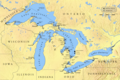
| Shipwrecks during the
en:Great Lakes Storm of 1913
. Reference: ''White Hurricane'', by David G. Brown, 2002. All text and icons were added to the PD blank map located at: http://walrus.wr.usgs.gov/infobank/gazette/jpg/regions/fr_glez.jpg {{PD-s
|
Fayllarga ishoratlar
Bu faylga quyidagi sahifa bog?langan:
Faylning global foydalanilishi
Ushbu fayl quyidagi vikilarda ishlatilyapti:
- ca.wikipedia.org loyihasida foydalanilishi
- de.wikipedia.org loyihasida foydalanilishi
- de.wiktionary.org loyihasida foydalanilishi
- en.wikipedia.org loyihasida foydalanilishi
- fr.wikipedia.org loyihasida foydalanilishi
- nl.wikipedia.org loyihasida foydalanilishi
- ru.wikipedia.org loyihasida foydalanilishi
Bu fayl qo?shimcha ma?lumotlarni o?z ichiga oladi, ehtimol uni tuzish yoxud raqamlashtirish uchun raqamli kamera yoki skanerdan foydalanilgan.
Agar fayl asl holatidan o?zgartirilgan bo?lsa, ba?zi tafsilotlar o?zgartirilgan faylni to?liq aks ettirmasligi mumkin.
