???? ???????
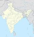
(SVG ????, ??????????? 1,500 × 1,615 ??????????, ???? ???????: 1.23 MB)
???????
???????????

|
? ???? ????? ??????? ????, ?? ????? ? ?????? ???? ?????????????, ???? ??????????? ?????/???? ????????-???????? ?????????????
GFDL
, ???????? ??????? 1.2 ???? ???? ??????
???????? ?????????? ????????
?????????? ? GFDL ???????? ?????? ????? ?????? ???????????; ? ?????? ?????????? ?????? ????, Front-Cover ???? ????, Back-Cover ???? ????. ? ???????? ????? ????? ?????? "
???????? ???? ?????????????? ????????
" ??? ??????????? ???????? ????.
http://www.gnu.org/copyleft/fdl.html
GFDL
GNU Free Documentation License
true
true
|
- ??? ????????? ???? ??????? ????:
- ????????????
? ? ?????? ???? ???????????, ?????? ????????, ???????? ????????
- ???????? ?????????
? ?????? ??????????????
- ??????? ??????? ?????:
- ????????
? ????????? ??????????? ???????, ?????????? ????? ???????, ???????????? ?????? ?????? ?????????. ?????? ????????? ?????? ???????? ?????????????. ???? ???? ?? ??????? ????????? ??????????? ??? ????? ???????????? ?????? ????.
- share alike
? ???? ? ?????? ??????????, ????????, ???? ????????????? ??????? ??????
??? ???????? ???? ?????? ??????????? ????????
?????? ??????? ?????? ??????.
https://creativecommons.org/licenses/by-sa/3.0
CC BY-SA 3.0
Creative Commons Attribution-Share Alike 3.0
true
true
- ??? ????????? ???? ??????? ????:
- ????????????
? ? ?????? ???? ???????????, ?????? ????????, ???????? ????????
- ???????? ?????????
? ?????? ??????????????
- ??????? ??????? ?????:
- ????????
? ????????? ??????????? ???????, ?????????? ????? ???????, ???????????? ?????? ?????? ?????????. ?????? ????????? ?????? ???????? ?????????????. ???? ???? ?? ??????? ????????? ??????????? ??? ????? ???????????? ?????? ????.
- share alike
? ???? ? ?????? ??????????, ????????, ???? ????????????? ??????? ??????
??? ???????? ???? ?????? ??????????? ????????
?????? ??????? ?????? ??????.
https://creativecommons.org/licenses/by-sa/3.0/de/deed.en
CC BY-SA 3.0 de
Creative Commons Attribution-Share Alike 3.0 de
true
true
???????? ???? ?????? ???????????? ???????????.
???? ????????? ??????
Transferred from
de.wikipedia
to Commons by
Uwe Dedering
.
The original description page was
here
. All following user names refer to de.wikipedia.
- 2010-02-21 16:39
Uwe Dedering
1500×1615× (2412750 bytes)
{{Information |Beschreibung = very little borders style changes |Quelle = |Urheber = |Datum = |Genehmigung = |Andere Versionen = |Anmerkungen = }}
- 2010-02-21 14:16
Uwe Dedering
1500×1615× (2411518 bytes)
{{Information |Beschreibung = North now 37.5, changed disputed areas |Quelle = |Urheber = |Datum = |Genehmigung = |Andere Versionen = |Anmerkungen = }}
- 2010-02-20 16:44
Uwe Dedering
1500×1540× (2246850 bytes)
{{Information |Beschreibung = Location map of India. Equirectangular projection. Strechted by 106.0%. Geographic limits of the map: * N: 36.0° N * S: 5.0° N * W: 67.0° E * E: 99.0° E Made with Natural Earth. Free vector and raster map data @ nat
Add a one-line explanation of what this file represents
mappa di localizzazione dell'India
???? ?????
????/???? ?? ?????? ? ????? ???? ??? ?????? ????????.
| ????/????
| ????????
| ??????
| ???????
| ???????
|
|---|
| ????????
| 09:24, 4 ??????? 2021
|  | 1,500 × 1,615
(1.23 MB)
| TKsdik8900
| Fulfilling the edit request (
File talk:India location map.svg#Upload more compact version of India location map
) by
C1MM
|
| 16:50, 14 ???????? 2020
|  | 1,500 × 1,615
(1.64 MB)
| NordNordWest
| correct Telangana/Andhra Pradesh
|
| 23:10, 3 ?????? 2019
|  | 1,500 × 1,615
(1.62 MB)
| RaviC
| slight colour change for consistency
|
| 23:06, 3 ?????? 2019
|  | 1,500 × 1,615
(1.62 MB)
| RaviC
| == {{int:filedesc}} == {{Information |Description={{en|Location map of India. Equirectangular projection. Strechted by 106.0%. Geographic limits of the map: * N: 37.5° N * S: 5.0° N * W: 67.0° E * E: 99.0° E Made with Natural Earth. Free vector and raster map data @ naturalearthdata.com.}} |Source={{own}} |Date=2010-02-20 |Author={{user at project|Uwe Dedering|wikipedia|de}} |Permission= |other_versions={{DerivativeVersions|India location map2.svg|India location map 3.png}} {{Other versions/I...
|
| 21:42, 19 ?????? 2014
|  | 1,500 × 1,615
(1.59 MB)
| M0tty
| Update by Semhur : add the state of Telangana
|
| 11:51, 7 ???? 2011
|  | 1,500 × 1,615
(1.49 MB)
| NordNordWest
| Nagaland corrected
|
| 16:10, 18 ????? 2011
|  | 1,500 × 1,615
(2.36 MB)
| Uwe Dedering
| Reverted to version as of 15:50, 17 January 2011 and again, layer structure destroyed, and first discuss this!
|
| 19:04, 17 ????? 2011
|  | 1,500 × 1,615
(1.52 MB)
| AshwiniKalantri
| The disputed land of Kashmir are shown in a different shade.
|
| 15:50, 17 ????? 2011
|  | 1,500 × 1,615
(2.36 MB)
| Uwe Dedering
| Reverted to version as of 11:34, 22 September 2010 vandalism
|
| 23:30, 16 ????? 2011
|  | 1,500 × 1,615
(2.01 MB)
| AshwiniKalantri
| {{Information |Description=Location Map of India |Source= |Date= |Author= |Permission= |other_versions= }}
|
???????
? ?????? 100 ???? ?????? ?????? ????????????.
? ?????? ??????? ????????? ????? 100 ??????? ? ??????? ?????? ???????????.
?????? ??????
????.
? ?????? ???? ???????
????????
???????
?????????? ???? ?????
? ??????????? ? ??????? ??? ?????? ????????????????:
- ace.wikipedia.org ?? ?????
- af.wikipedia.org ?? ?????
? ????????
????? ?????????? ???????
??????.
? ?????? ????? ??????? ????, ????? ?????? ?????????????? ???? ?????????????????? ????? ??????? ?????? ???? ??????? ? ??????????? ???????????????. ? ?????? ???? ?????? ????? ????????, ? ????? ?????? ?????? ??????? ???????? ??????????????????.