Visayas
|
|---|
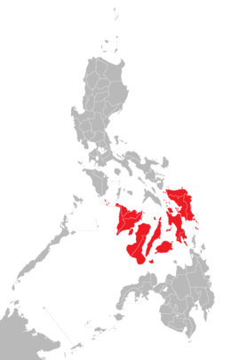 Location of the Visayas within the Philippines
|
 |
|
| Location
| Southeast Asia
|
|---|
| Archipelago
| Philippines
|
|---|
| Major islands
| |
|---|
| Area
| 71,503 km
2
(27,607 sq mi)
|
|---|
| Highest elevation
| 2,465 m (8087 ft)
|
|---|
| Highest point
| Mount Kanlaon
|
|---|
|
|
| Regions
| |
|---|
| Largest settlement
| Cebu City
(pop. 964,169)
|
|---|
|
| Demonym
| - Visayan (natively "
Bisaya
")
|
|---|
| Population
| 21,155,014 (2021)
[1]
|
|---|
| Pop. density
| 292/km
2
(756/sq mi)
|
|---|
| Ethnic groups
| |
|---|
The
Visayas
or
Visayan Islands
(
Cebuano
and
Waray-Waray
:
Kabisay-an
,
Tagalog
:
Kabisayaan
,
Spanich
:
Bisayas
), is one of the three principal geographical divisions of the
Philippines
; the other two divisions are
Mindanao
, to the south, and
Luzon
, to the north.
People living in this islands are called
Visayans
.
The Visayas consists of several islands in central Philippines around the
Visayan Sea
, with the
Philippine Sea
to the east and the
Sulu Sea
to the west.
The main islands (and area) are:
- Bohol
, 3,269 km
2
(1,262 sq mi)
- Cebu
, 4,468 km
2
(1,725 sq mi)
- Leyte
, 7,367.6 km
2
(2,844.6 sq mi)
- Negros
, 13,328.4 km
2
(5,146.1 sq mi)
- Panay
, 12,011 km
2
(4,637 sq mi)
- Samar
, 12,849 km
2
(4,961 sq mi)
 A
map
of the Visayas.
A
map
of the Visayas.
Central Visayas
Eastern Visayas
Western Visayas
The major islands, from west to east, are
Panay
,
Negros
,
Cebu
,
Bohol
,
Leyte
, and
Samar
.
Administratively, the Visayas is divided into 3
regions
:
Western Visayas
,
Central Visayas
and
Eastern Visayas
. Each region is headed by a Regional Director.
The Visayas is composed of 16
provinces
, each headed by a
governor
.
Western Visayas consists of the islands of
Panay
and the western half of
Negros
; it has a population, in 2010, of 7,102,438.
[2]
The regional center is
Iloilo City
. Its provinces are:
Central Visayas includes the islands of
Cebu
and
Bohol
and the eastern half of
Negros
; it has a population, in 2010, of 6,800,180.
[2]
The regional center is
Cebu City
. Its provinces are:
Eastern Visayas consists of the islands of
Leyte
and
Samar
; it has a population, in 2010, of 4,101,322.
[2]
The regional center is
Tacloban
. Its provinces are:
Wikimedia Commons has media related to
Visayas
.
11°00′N
123°30′E
/
11.000°N 123.500°E
/
11.000; 123.500