From Simple English Wikipedia, the free encyclopedia
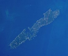 A satellite image of Tsushima Island
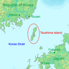 Map showing Tsushima Island west of Kyushu
Tsushima Island
(?馬,
Tsushima
) is a
Japanese
island
in the waters between
South Korea
and Japan.
[1]
Beginning in the early 6th century, the island was a
province of Japan
, It was called
Tsushima Province
. In the
Meiji period
, the island and the province became part of
Nagasaki Prefecture
.
[2]
 Media related to
Tsushima
at Wikimedia Commons
Media related to
Tsushima
at Wikimedia Commons
34°25′N
129°20′E
/
34.417°N 129.333°E
/
34.417; 129.333
