Frae Wikipedia, the free beuk o knawledge
Oreeginal file
(SVG file, nominallie 1,401 × 1,198 pixels, file size: 1.42 MB)
This file is fae Wikimedia Commons n micht be uised bi ither waurks.
The descreeption oan its
file descreeption page
thaur is shawn ablo.
Bosnia
Ootline

|
|
Licensin
I, the copyright holder of this work, hereby publish it under the following license:
- Ye are free:
- tae share
? tae copy, distribute an transmit the wirk
- tae remix
? tae adapt the wirk
- Unner the follaein condeetions:
- attribution
? Ye must attribute the wirk in the manner specified bi the author or licensor (but nae in ony way that suggests that thay endorse ye or yer uise o the wirk).
- share alik
? If ye alter, transform, or big upon this wirk, ye mey distribute the resultin wirk anly unner the same or seemilar license tae this ane.
https://creativecommons.org/licenses/by-sa/3.0
CC BY-SA 3.0
Creative Commons Attribution-Share Alike 3.0
true
true
Add a one-line explanation of what this file represents
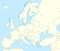
An unlabeled map of Europe
File history
Clap oan ae date/time fer tae see the file aes it kithed at that time.
| Date/Time
| Thummnail
| Dimensions
| Uiser
| Comment
|
|---|
| current
| 03:13, 9 Mairch 2020
|  | 1,401 × 1,198
(1.42 MB)
| Ratherous
| Add more inland water for better accuracy
|
| 10:28, 1 Februar 2020
|  | 1,401 × 1,198
(1.84 MB)
| Thayts
| + disputed crimea, golan heights, and other minor border tweaks
|
| 20:50, 11 Mairch 2010
|  | 1,401 × 1,198
(1.84 MB)
| Alexrk2
| fixing inland water
|
| 19:58, 11 Mairch 2010
|  | 1,401 × 1,198
(1.83 MB)
| Alexrk2
| == Summary == {{Information |Description= {{de|Positionskarte
Europa
; Politisch mit Staatsgrenzen; Flachentreue Azimutalprojektion}} {{en|Location map
Europe
; Political with state boundaries; Lambert azimuthal equal-area pro
|
Eimage airtins
The follaein pages airts tae this image:
Global file uisage
The follaein ither wikis uise this file:
- Uisage on ab.wikipedia.org
- Uisage on af.wikipedia.org
- Uisage on als.wikipedia.org
- Uisage on ar.wikipedia.org
- Uisage on arz.wikipedia.org
- Uisage on ast.wikipedia.org
- Uisage on av.wikipedia.org
- Uisage on azb.wikipedia.org
View
mair global usage
o this file.
This file contains addeetional information, likelie eikit fae the deegital camera or scanner uised tae cræft or deegitise it.
Gif the file haes bin modeefied fae its oreeginal state, some details micht na fullie reflect the modeefied file.
