No higher resolution available.
This file is from Wikimedia Commons and may be used by other projects.
The description on its
file description page
there is shown below.
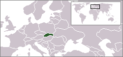
Location map for the
Slovakia
.
Originally created for English Wikipedia by Vardion.
| Public domain
Public domain
false
false
|

|
This work has been released into the
public domain
by its author,
Vardion
, at the
English Wikipedia
project
. This applies worldwide.
In case this is not legally possible:
Vardion
grants anyone the right to use this work
for any purpose
, without any conditions, unless such conditions are required by law.
|
Add a one-line explanation of what this file represents
File history
Click on a date/time to view the file as it appeared at that time.
| Agew/Oras
| Thumbnail
| Dimensions
| Manguusar
| Komento
|
|---|
| kaplesan
| 16:26, 6 Hunyo 2006
|  | 250 × 115
(6 KB)
| Rain74
| Montenegro
|
| 13:41, 8 Disyembre 2004
|  | 250 × 115
(7 KB)
| EugeneZelenko
| Location map for the
Slovakia
.<br/>Originally created for English Wikipedia by Vardion.<br/>{{PD}}<br/>
Category:Country locator maps
|
Saray Gawing
The following page uses this file:
Global file usage
The following other wikis use this file:
- Usage on arc.wikipedia.org
- Usage on av.wikipedia.org
- Usage on awa.wikipedia.org
- Usage on bn.wikibooks.org
- Usage on bpy.wikipedia.org
- Usage on br.wikipedia.org
- Usage on bs.wikiquote.org
- Usage on cv.wikipedia.org
- Usage on de.wiktionary.org
- Usage on dsb.wikipedia.org
- Usage on el.wiktionary.org
- Usage on en.wikipedia.org
- Usage on en.wikibooks.org
- Usage on en.wikivoyage.org
- Usage on en.wiktionary.org
- Usage on eu.wiktionary.org
- Usage on fiu-vro.wikipedia.org
- Usage on fr.wikipedia.org
- Usage on fr.wikinews.org
- Usage on gu.wikipedia.org
- Usage on he.wikivoyage.org
- Usage on hi.wikipedia.org
- Usage on hu.wikinews.org
- Usage on ia.wikipedia.org
- Usage on id.wikibooks.org
- Usage on ilo.wikipedia.org
- Usage on incubator.wikimedia.org
- Usage on it.wikivoyage.org
- Usage on ja.wiktionary.org
- Usage on jv.wikipedia.org
- Usage on ka.wikipedia.org
- Usage on kk.wikipedia.org
- Usage on ko.wikipedia.org
- Usage on ku.wiktionary.org
- Usage on ky.wikipedia.org
- Usage on lij.wikipedia.org
- Usage on li.wikipedia.org
- Usage on lt.wiktionary.org
- Usage on lv.wiktionary.org
- Usage on nds-nl.wikipedia.org
- Usage on nl.wikipedia.org
View
more global usage
of this file.
