Original file
(SVG file, nominally 384 × 420 pixels, file size: 26 KB)
This file is from Wikimedia Commons and may be used by other projects.
The description on its
file description page
there is shown below.
Summary
Baluve
- You are free:
- to share
? to copy, distribute and transmit the work
- to remix
? to adapt the work
- Under the following conditions:
- attribution
? You must give appropriate credit, provide a link to the license, and indicate if changes were made. You may do so in any reasonable manner, but not in any way that suggests the licensor endorses you or your use.
https://creativecommons.org/licenses/by/4.0
CC BY 4.0
Creative Commons Attribution 4.0
true
true
Add a one-line explanation of what this file represents
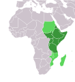
Map of East Africa
File history
Click on a date/time to view the file as it appeared at that time.
| Kilumbu/Ngunga
| Thumbnail
| Dimensions
| Sadi
| Comment
|
|---|
| bubu yayi
| 18:20, 12 ngoida ya kumi na zole 2023
|  | 384 × 420
(26 KB)
| ReneeWrites
| Uploaded a work by
ReneeWrites
from {{derived from|Africa-countries-blank.svg}} with UploadWizard
|
File usage
The following 66 pages use this file:
Global file usage
The following other wikis use this file:
- Usage on am.wikipedia.org
View
more global usage
of this file.
This file contains additional information, probably added from the digital camera or scanner used to create or digitize it.
If the file has been modified from its original state, some details may not fully reflect the modified file.
