Ne existas grandeso plu granda.
Kansai_closeup.jpg
(800 × 600 pixel-i, grandeso dil arkivo: 66 KB, MIME type:
image/jpeg
)
Ca arkivo jacas en Wikimedia Commons, e povas uzesar en altra projeti.
La deskriptado en lua
pagino di deskriptado
montresas adinfre.
Titulo
Licencizo
| Public domain
Public domain
false
false
|

|
La ?i-supra dosiero estas
publika hava?o
, ?ar ?i apartenas al
NASA
. La
kopirajta regularo de NASA
asertas, ke "?iuj dokumentoj de NASA estas publika hava?o, se ne estas donata kontra?a deklaro".
|

|

|
Atentu:
|
en.Wikipedia upload log
The en.Wikipedia description page is/was
here
. All following user names refer to en.Wikipedia.
- 2004-04-05 19:30
Finlay McWalter
800×600 (66 KB)
(nasa image of kansai airport)
Adjuntez 1 lineo explikanta quo reprezentas ca arkivo
Historio dil arkivo
Kliktez sur la dato/horo por vidar arkivo quale ol aparis ye ta tempo.
| Dato/Horo
| Miniaturo
| Dimensioni
| Uzero
| Komento
|
|---|
| aktuala
| 03:46, 13 dec. 2005
|  | 800 × 600
(66 KB)
| Sam916~commonswiki
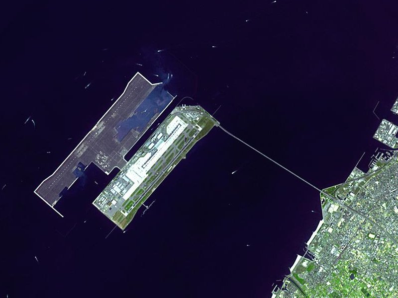
| Satellite image of
Kansai International Airport
in
Osaka Bay
in
Japan
. This is a closeup - for an overview image showing the airport on its artificial island in the bay, see
Image:Wfm kansai overview.jpg
Taken from an uncopyrighted imag
|
Ligilo al imajo
Ca pagini ligas al imajo:
Uzado en altra Wiki
La sequanta Wiki anke uzas ica arkivo:
- Uzado en ar.wikipedia.org
- Uzado en ast.wikipedia.org
- Uzado en bbc.wikipedia.org
- Uzado en bg.wikipedia.org
- Uzado en bh.wikipedia.org
- Uzado en bn.wikipedia.org
- Uzado en de.wikipedia.org
- Uzado en el.wikipedia.org
- Uzado en en.wikipedia.org
- Uzado en en.wikibooks.org
- Uzado en es.wikipedia.org
- Uzado en eu.wikipedia.org
- Uzado en fa.wikipedia.org
- Uzado en fi.wikipedia.org
- Uzado en he.wikipedia.org
- Uzado en hu.wikipedia.org
- Uzado en id.wikipedia.org
- Uzado en it.wikipedia.org
- Uzado en it.wikivoyage.org
- Uzado en ja.wikipedia.org
- Uzado en ko.wikipedia.org
- Uzado en lfn.wikipedia.org
- Uzado en ml.wikipedia.org
- Uzado en mn.wikipedia.org
- Uzado en ms.wikipedia.org
- Uzado en nl.wikipedia.org
- Uzado en pt.wikipedia.org
- Uzado en ro.wikipedia.org
- Uzado en simple.wikipedia.org
- Uzado en sl.wikipedia.org
- Uzado en sr.wikipedia.org
- Uzado en sv.wikipedia.org
- Uzado en ta.wikipedia.org
- Uzado en uk.wikipedia.org
- Uzado en vi.wikipedia.org
- Uzado en www.wikidata.org
- Uzado en zh-yue.wikipedia.org
- Uzado en zh.wikipedia.org
