Dari Wikipedia bahasa Indonesia, ensiklopedia bebas
Staten Island
|
|---|
|
| Richmond County
|
 |
 Letak Staten Island ditandai warna oranye.
|
| Negara
| Amerika Serikat
|
|---|
| Negara Bagian
| New York
|
|---|
| County
| Richmond
|
|---|
| Kota
| New York City
|
|---|
| Dihuni
| 1661
|
|---|
|
| ? Jenis
| Borough (New York City)
|
|---|
| ?
Presiden Borough
| James Molinaro
(R/C)
|
|---|
|
| ? Total
| 102,50 sq mi (26,500 km
2
)
|
|---|
| ? Luas daratan
| 58,48 sq mi (15,150 km
2
)
|
|---|
| ? Luas perairan
| 44,02 sq mi (11,400 km
2
)
|
|---|
|
| ? Total
| 491,730
|
|---|
| ? Kepadatan
| 8.408/sq mi (3,246/km
2
)
|
|---|
|
| Biro Sensus AS
, 2009
|
|---|
| Zona waktu
| UTC-5
(
Waktu Standar Timur (Amerika Utara)
)
|
|---|
| ? Musim panas (
DST
)
| UTC-4
(
Waktu Musim Panas Timur (Amerika Utara)
)
|
|---|
| Kode area telepon
| 718
,
917
&
347
(
tata wilayah
)
|
|---|
| Situs web
| Official Website of the Staten Island Borough President
|
|---|
Staten Island
(
pengucapan:
/?stæt?n?a?l?nd/
) adalah sebuah
borough
di
New York City
,
New York
,
Amerika Serikat
, terletak di daerah barat daya kota. Staten Island terpisah dari
New Jersey
oleh
Arthur Kill
dan
Kill Van Kull
, dan dari seluruh New York oleh
New York Bay
. Dengan jumlah penduduk 491.730 jiwa, Staten Island adalah borough paling jarang penduduknya dari lima borough New York tetapi terbesar ketiga menurut luasnya yang mencakup 59 sq mi (153 km
2
).
Borough of Staten Island berdiri bersama
Richmond County
,
county
paling selatan di negara bagian
New York
. Hingga 1975, borough ini secara resmi bernama Borough of Richmond.
[2]
Staten Island kadang disebut "borough yang terlupakan" oleh penduduk yang merasa diabaikan oleh
pemerintah kota
.
[3]
[4]
Staten Island secara keseluruhan merupakan borough paling pinggir di New York City.
North Shore
? khususnya permukiman
St. George
,
Tompkinsville
,
Clifton
, dan
Stapleton
? merupakan daerah perkotaan di pulau ini; daerah-daerah tersebut berisi distrik resmi St. George Historic District dan St. Paul’s Avenue-Stapleton Heights Historic District, yang memiliki banyak rumah bergaya Victoria. South Shore memiliki permukiman bergaya pinggiran kota dan merupakan tempat bagi
F.D.R. Boardwalk
sepanjang 2,5 mil yang menjadi jembatan pejalan kaki terpanjang keempat di dunia. Secara historis, bagian tengah dan selatan pulau pernah didominasi oleh peternakan sapi dan unggas, hampir semuanya menghilang pada abad ke-20.
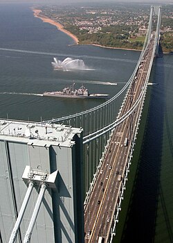
Borough ini memiliki akses ke
Brooklyn
melalui
Jembatan Verrazano-Narrows
dan ke New Jersey melalui
Goethals Bridge
,
Outerbridge Crossing
, dan
Bayonne Bridge
. Staten Island memiliki layanan bus
Metropolitan Transportation Authority
(MTA) dan jalur angkutan cepat MTA,
Staten Island Railway
, yang membentang dari terminal feri di St. George hingga
Tottenville
. Staten Island merupakan satu-satunya borough di New York City yang tidak memiliki angkutan cepat bawah tanah. Layanan gratis
Staten Island Ferry
menghubungkan borough ini dengan
Manhattan
dan menjadi atraksi wisata populer karena menyajikan pemandangan menarik menghadap
Patung Liberty
,
Ellis Island
dan Lower Manhattan.
- ^
"Richmond County QuickFacts from the US Census Bureau"
. September 4, 2009. Diarsipkan dari
versi asli
tanggal 2015-04-24
. Diakses tanggal
May 15,
2009
.
- ^
"Timeline of Staten Island - 1900s - Present"
.
New York Public Library
.
Diarsipkan
dari versi asli tanggal 2006-01-13
. Diakses tanggal
January 16,
2006
.
- ^
Brown, Chip (January 30, 1994).
"Escape From New York - The New York Times"
.
The New York Times
. Diakses tanggal
January 14,
2008
.
Given their status as residents of "the forgotten borough" ? the sorry Cinderella sister in New York's dysfunctional family ? maybe the giddiest aspect of all was the attention.
- ^
Buckley, Cara (October 7, 2007).
"Bohemia by the Bay"
.
The New York Times
. Diakses tanggal
January 14,
2008
.
Even as New York’s hip young things invade and colonize neighborhoods near, far and out of state, Staten Island has stayed stubbornly uncool. It remains the forgotten borough.
- ^
Biro Sensus AS
, Population Division,
Table 5. Annual Estimates of the Resident Population for Minor Civil Divisions in New York, Listed Alphabetically Within County: April 1, 2000 to July 1, 2009 (SUB-EST2009-05-36)
and
Table 1. Annual Estimates of the Resident Population for Incorporated Places Over 100,000, Ranked by July 1, 2009 Population: April 1, 2000 to July 1, 2009 (SUB-EST2009-01)
,
Release Date: June 2010, retrieved on July 31, 2010
- ^
County and City Data Book:2007
(U.S. Census Bureau), Table B-1, Area and Population
, diakses pada 12 Juli 2008. New York County (Manhattan) was the nation's densest-populated county, followed by Kings County (Brooklyn), Bronx County, Queens County and
San Francisco, California
.
- ^
American Fact Finder (U.S. Census Bureau): New York by County - Table GCT-PH1. Population, Housing Units, Area, and Density: 2000 Data Set: Census 2000 Summary File 1 (SF 1) 100-Percent Data
, diakses pada 9 Februari 2009
|
|---|
| County
| | |
|---|
| Kota besar
| |
|---|
Kota
100.000?999.000
| |
|---|
Kota
25.000?99.000
| |
|---|
Kota
10.000?25.000
| |
|---|
| Subwilayah
| |
|---|
