???? ????????, ???????????? ???????
????? ??????
(???? SVG, ????? ??????:
1,651 × 1,334
???????, ???? ?????: 944 ?"?)
 | |
Eric Gaba, Wikimedia Commons user
Sting
, ??? ?????? ??????? ?? ?????? ????, ????? ???? ???? ??? ??????? ???:
?????:
Eric Gaba, Wikimedia Commons user
Sting
- ???? ?????:
- ????
? ??????, ????? ??????? ?? ??????
- ????? ??? ??????
? ?????? ?? ??????
- ??? ?????? ?????:
- ?????
? ?? ??? ????? ????, ??? ????? ???????, ?????? ?? ???? ???????. ???? ????? ?? ?? ??? ???? ?????, ??? ?? ???? ???? ?????? ???? ?????? ??????? ???? ?? ?? ?????? ???.
- ????? ???
? ?? ????? ?????, ????, ?? ???? ?? ?????, ???? ????? ????? ?? ??????? ??? ??? ????
?????? ??? ?? ????
?????.
https://creativecommons.org/licenses/by-sa/3.0
CC BY-SA 3.0
Creative Commons Attribution-Share Alike 3.0
true
true
?? ?????? ???? ?????? ?? ????? ?????
????????? ?????
???? ????? ?? ?????/??? ??? ????? ?? ????? ??? ????? ????? ???.
| ?????/???
| ????? ???????
| ?????
| ?????
| ????
|
|---|
| ??????
| 18:21, 12 ??????? 2015
|  | ?1,334 × 1,651?
(944 ?"?)
| Sting
| Boundaries correction
|
| 19:25, 22 ?????? 2015
|  | ?1,334 × 1,651?
(945 ?"?)
| Sting
| Boundaries correction
|
| 17:03, 21 ?????? 2015
|  | ?1,334 × 1,651?
(943 ?"?)
| Sting
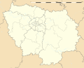
| == {{int:filedesc}} == {{Location|48|40|30|N|02|30|00|E|scale:1000000}} {{Information |Description={{en|Blank administrative map of the region of
Ile-de-France
, France, as in January 2015, for geo-location purpose, with distinct...
|
????? ?????
????? ????? ??????? ????? ???:
????? ?????? ?????
???? ?????? ?????? ????? ??????? ????? ??:
- ????? ???? af.wikipedia.org
- ????? ???? als.wikipedia.org
- ????? ???? ast.wikipedia.org
- ????? ???? azb.wikipedia.org
??? ?
??????? ????? ?? ?????? ???????? ??????
.
???? ?? ???? ???? ????, ?????? ???? ?????? ???????? ?? ????? ???? ????? ???? ?? ??? ????????.
?? ????? ???? ????? ???????, ??? ???????? ???? ?????? ??? ???? ????? ??? ?? ????? ??????.
