??? ?????/??????? ???? ???? ?? ????? ????? ?? ?? ????? ?? ??????.
| ?????/????
| ?????????
| ?????
| ?????
| ?????
|
|---|
| ?????
| ??? ????? ????? ???? ??:??
|  | ????? ?? ?????
(??? ????????)
| NordNordWest
| Reverted to version as of 17:55, 15 April 2013; no reason for change given
|
| ??? ????? ????? ???? ??:??
|  | ????? ?? ?????
(??? ????????)
| Ekivalan
| Reverted to version as of 17:38, 12 April 2013
|
| ??? ????? ????? ???? ??:??
|  | ????? ?? ?????
(??? ????????)
| Ekivalan
| Reverted to version as of 17:38, 12 April 2013
|
| ??? ????? ????? ???? ??:??
|  | ????? ?? ?????
(??? ????????)
| NordNordWest
| according to http://images.persianblog.ir/516041_B0b76ypr.jpg + Tabas -> South Khorasan province
|
| ??? ????? ????? ???? ??:??
|  | ????? ?? ?????
(??? ????????)
| Yamaha5
| Reverted to version as of 20:08, 11 July 2010
|
| ??? ????? ????? ???? ??:??
|  | ????? ?? ?????
(??? ????????)
| Yamaha5
| Reverted to version as of 20:08, 11 July 2010 in all maps khorasan is like past!
|
| ??? ???? ????? ???? ??:??
|  | ????? ?? ?????
(??? ????????)
| NordNordWest
| upd
|
| ??? ?????? ????? ???? ??:??
|  | ????? ?? ?????
(??? ????????)
| Uwe Dedering
| 31. province Alborz
|
| ??? ?????? ????? ???? ??:??
|  | ????? ?? ?????
(??? ????????)
| Uwe Dedering
| Bahrain above water, no disputed countries
|
| ??? ?????? ????? ???? ??:??
|  | ????? ?? ?????
(??? ????????)
| Uwe Dedering
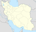
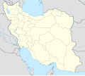
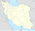
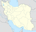
| {{Information |Description={{en|1=Location map of Iran. Equirectangular projection. Strechted by 118.0%. Geographic limits of the map: * N: 40.0° N * S: 24.5° N * W: 43.5° E * E: 64.0° E Made with Natural Earth. Free vector and raster map data @
|