De Wikipedia, la enciclopedia libre

Resumen
Licencia
Usage of this file with
:
explanatory notes:
Legally binding is only the full legalcode. For a
free usage
I recommend to respect the following licence conditions:
1. Provide my name as given above:
NordNordWest
,
2. a copy of, or the URI for, the applicable license:
https://creativecommons.org/licenses/by-sa/3.0/de/legalcode
,
3. the title of the work,
4. in the case of an adaptation, a credit identifying the use of the work in the adaptation.
This license and the rights granted hereunder will terminate automatically upon any breach by you of the terms of this license. Any of the above conditions can be waived if you get permission from the copyright holder.
If you have questions or wish differing conditions, please contact me through
nnwest
t-online.de
or
my discussion page
- Eres libre:
- de compartir
? de copiar, distribuir y transmitir el trabajo
- de remezclar
? de adaptar el trabajo
- Bajo las siguientes condiciones:
- atribucion
? Debes otorgar el credito correspondiente, proporcionar un enlace a la licencia e indicar si realizaste algun cambio. Puedes hacerlo de cualquier manera razonable pero no de manera que sugiera que el licenciante te respalda a ti o al uso que hagas del trabajo.
- compartir igual
? En caso de mezclar, transformar o modificar este trabajo, deberas distribuir el trabajo resultante bajo la
misma licencia o una compatible
como el original.
https://creativecommons.org/licenses/by-sa/3.0/de/deed.en
CC BY-SA 3.0 de
Creative Commons Attribution-Share Alike 3.0 de
true
true
Anade una explicacion corta acerca de lo que representa este archivo
Mapa lokalizacyjna Belgii
Historial del archivo
Haz clic sobre una fecha y hora para ver el
archivo tal como aparecio en ese momento.
| Fecha y hora
| Miniatura
| Dimensiones
| Usuario
| Comentario
|
|---|
| actual
| 21:11 27 dic 2021
|  | 1136 × 988
(142?kB)
| NordNordWest
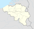
| == {{int:filedesc}} == {{Information |description= {{de|1=Positionskarte von Belgien}} {{en|1=Location map of Belgium}} {{Location map series N |stretching=157,218 |top=51.8 |bottom=49.2 |left=2.2 |right=6.9 }} |source={{Own using}} * United States National Imagery and Mapping Agency data * World Data Base II data |date=2021-12-27 |author={{U|NordNordWest}} |other fields= }} {{Kartenwerkstatt}} == {{int:license-header}} == {{User:NordNordWest/LicenceMap}} [[Category:Location maps of Europe...
|
Usos del archivo
Hay mas de 100 paginas que enlazan con este archivo.
La lista siguiente solo muestra las primeras 100 paginas que enlazan con este archivo. Tambien puedes consultar la
lista completa
.
Ver
mas enlaces
a este archivo.
Uso global del archivo
Las wikis siguientes utilizan este archivo:
- Uso en af.wikipedia.org
- Uso en als.wikipedia.org
- Uso en an.wikipedia.org
- Uso en ar.wikipedia.org
- Uso en arz.wikipedia.org
- Uso en ast.wikipedia.org
Ver
mas uso global
de este archivo.
Este archivo contiene informacion adicional, probablemente anadida por la camara digital o el escaner usado para crearlo o digitalizarlo.
Si el archivo ha sido modificado desde su estado original, pueden haberse perdido algunos detalles.
