County in Ohio, United States
County in Ohio
Warren County
is a
county
located in the southwestern part of the
U.S. state
of
Ohio
. As of the
2020 census
, the population was 242,337.
[2]
Its
county seat
is
Lebanon
and largest city is
Mason
.
[3]
The county is one of Ohio's most affluent, with the highest median income of the state's 88 counties. The county was established on May 1, 1803, from
Hamilton County
; it is named for Dr.
Joseph Warren
, a hero of the
Revolution
who sent
Paul Revere
and the overlooked William Dawes on their famous rides and who died at the
Battle of Bunker Hill
.
[4]
Warren County is part of the
Cincinnati, OH-KY-IN Metropolitan Statistical Area
.
History
[
edit
]
Warren County was established in 1803. The first non-Native American settlers were migrants from
New England
. During the election of 1860
[5]
Abraham Lincoln received 60% of the vote in Warren County, and in 1864 he was reelected with 70% of the vote in the county.
[6]
[7]
[8]
From that time on the county was a stronghold of the Republican party, with
Ulysses S. Grant
going on to carry the county by large margins in both 1868 and 1872.
[9]
[10]
[11]
Geography
[
edit
]
According to the
United States Census Bureau
, the county has a total area of 407 square miles (1,050 km
2
), of which 401 square miles (1,040 km
2
) is land and 6.0 square miles (16 km
2
) (1.5%) is water.
[12]
The county is a rough square with the sides about 20 miles (32 km) long.
Adjacent counties
[
edit
]
Boundaries
[
edit
]
Warren County was created by the first
Ohio General Assembly
in the Act of March 24, 1803, which also created Butler and Montgomery Counties. The act defined Warren County as "all that part of the county of Hamilton included within the following bounds, viz.: Beginning at the northeast corner of the county of Clermont, running thence west with the line of said county to the
Little Miami
; thence up the same with the meanders thereof to the north boundary of the first tier of sections in the second entire range of townships in the
Miami Purchase
; thence west to the northeast corner of Section No. 7 in the third township of the aforesaid range; thence north to the
Great Miami
; thence up the same to the middle of the fifth range of townships; thence east to the County line; thence with same south to the place of beginning." Originally this included land now in
Clinton County
as far east as
Wilmington
.
Clinton County proved a continuing headache to the legislature. The Ohio Constitution requires that every county have an area of at least four hundred square miles (1,036 km
2
). Clinton County's boundaries were several times adjusted in an effort to comply with that clause of the constitution. One of them, the Act of January 30, 1815, detached a strip of land from the eastern side to give to Clinton. That would have left Warren under four hundred square miles (1,036 km
2
), so a portion of Butler County (the part of
Franklin Township
where
Carlisle
is now located) was attached to Warren in compensation. The 1815 act was as follows:
- Section 1?That all that part of the county of Butler lying and being within the first and second fractional townships in the fifth range, and adjoining the south line of Montgomery County, shall be and the same is hereby attached to and made part of the county of Warren.
- Section 2?That eleven square miles 28 km
2
of the territory of the county of Warren and extending parallel to the said eastern boundary of Warren County, along the whole length of such eastern boundary from north to south, shall be and the same is hereby attached to and made a part of the county of Clinton."
Except for the sections formed by the Great and Little Miamis, the sides are all straight lines.
Lakes and rivers
[
edit
]
The major rivers of the county are the
Great Miami River
, which flows through the northwest corner of the county in
Franklin Township
, and the
Little Miami River
which zig-zags across the county from north to south. There is one sizable lake, the
Caesars Creek Reservoir
, created by a
U.S. Army Corps of Engineers
dam on Caesars Creek in the northeast part of the county in
Massie Township
.
Demographics
[
edit
]
Historical population
| Census
| Pop.
| Note
| %±
|
|---|
| 1810
| 9,925
| | ?
|
|---|
| 1820
| 17,837
| | 79.7%
|
|---|
| 1830
| 21,468
| | 20.4%
|
|---|
| 1840
| 23,141
| | 7.8%
|
|---|
| 1850
| 25,560
| | 10.5%
|
|---|
| 1860
| 26,902
| | 5.3%
|
|---|
| 1870
| 26,689
| | ?0.8%
|
|---|
| 1880
| 28,392
| | 6.4%
|
|---|
| 1890
| 25,468
| | ?10.3%
|
|---|
| 1900
| 25,584
| | 0.5%
|
|---|
| 1910
| 24,497
| | ?4.2%
|
|---|
| 1920
| 25,716
| | 5.0%
|
|---|
| 1930
| 27,348
| | 6.3%
|
|---|
| 1940
| 29,894
| | 9.3%
|
|---|
| 1950
| 38,505
| | 28.8%
|
|---|
| 1960
| 65,711
| | 70.7%
|
|---|
| 1970
| 84,925
| | 29.2%
|
|---|
| 1980
| 99,276
| | 16.9%
|
|---|
| 1990
| 113,909
| | 14.7%
|
|---|
| 2000
| 158,383
| | 39.0%
|
|---|
| 2010
| 212,693
| | 34.3%
|
|---|
| 2020
| 242,337
| | 13.9%
|
|---|
| 2021 (est.)
| 246,553
| [13]
| 1.7%
|
|---|
|
2000 census
[
edit
]
As of the
census
[18]
of 2000, there were 158,383 people, 55,966 households, and 43,261 families residing in the county. The population density was 396 inhabitants per square mile (153/km
2
). There were 58,692 housing units at an average density of 147 per square mile (57/km
2
). The racial makeup of the county was 94.66%
White
, 2.73%
Black
or
African American
, 0.18%
Native American
, 1.26%
Asian
, 0.03%
Pacific Islander
, 0.31% from
other races
, and 0.84% from two or more races.
Hispanic
or
Latino
of any race were 1.03% of the population.
There were 55,966 households, out of which 39.70% had children under the age of 18 living with them, 66.20% were
married couples
living together, 8.00% had a female householder with no husband present, and 22.70% were non-families. 18.90% of all households were made up of individuals, and 6.40% had someone living alone who was 65 years of age or older. The average household size was 2.72 and the average family size was 3.12.
In the county, the population was spread out, with 27.70% under the age of 18, 7.10% from 18 to 24, 34.00% from 25 to 44, 21.80% from 45 to 64, and 9.40% who were 65 years of age or older. The median age was 35 years. For every 100 females there were 102.60 males. For every 100 females age 18 and over, there were 102.40 males.
The median income for a household in the county was $57,952, and the median income for a family was $64,692. Males had a median income of $47,027 versus $30,862 for females. The
per capita income
for the county was $25,517. About 3.00% of families and 4.20% of the population were below the
poverty line
, including 4.40% of those under age 18 and 4.70% of those age 65 or over.
2010 census
[
edit
]
As of the
2010 United States Census
, there were 212,693 people, 76,424 households, and 57,621 families residing in the county.
[19]
The population density was 530.0 inhabitants per square mile (204.6/km
2
). There were 80,750 housing units at an average density of 201.2 per square mile (77.7/km
2
).
[20]
The racial makeup of the county was 90.5% white, 3.9% Asian, 3.3% black or African American, 0.2% American Indian, 0.7% from other races, and 1.5% from two or more races. Those of Hispanic or Latino origin made up 2.2% of the population.
[19]
In terms of ancestry, 28.7% were
German
, 14.1% were
Irish
, 12.0% were
English
, 11.6% were
American
, and 5.0% were
Italian
.
[21]
Of the 76,424 households, 40.1% had children under the age of 18 living with them, 62.6% were married couples living together, 8.8% had a female householder with no husband present, 24.6% were non-families, and 20.4% of all households were made up of individuals. The average household size was 2.70 and the average family size was 3.14. The median age was 37.8 years.
[19]
The median income for a household in the county was $71,274 and the median income for a family was $82,090. Males had a median income of $61,091 versus $41,331 for females. The per capita income for the county was $31,935. About 4.7% of families and 6.0% of the population were below the
poverty line
, including 7.6% of those under age 18 and 5.2% of those age 65 or over.
[22]
Economy
[
edit
]
Warren County is home to the Mason Business Center, a 2-million-square-foot (0.19 km
2
) research and development facility for
Procter and Gamble
(P&G), whose global headquarters are located in downtown
Cincinnati
.
[23]
Originally built in 1995 after three years of construction, P&G recently completed expansion of a new 500,000-square-foot (46,000 m
2
) Beauty and Innovation Center in 2019, adding an additional 1,000 jobs for a total of 2,800 employees at the site.
[24]
[25]
Mason is also home to the corporate headquarters of
LensCrafters
.
Top employers
[
edit
]
According to the county's 2019 Comprehensive Annual Financial Report,
[26]
the top employers in the county are:
| #
|
Employer
|
# of employees
|
| 1
|
Procter and Gamble
|
3,036
|
| 2
|
Macy's
Credit and Customer Service
|
2,250
|
| 3
|
LensCrafters
|
1,853
|
| 4
|
Cintas
|
1,512
|
| 5
|
Wellpoint
|
1,300
|
| 6
|
Anthem Blue Cross and Blue Shield
|
1,300
|
| 7
|
Warren County
|
1,276
|
| 8
|
Atrium Medical Center
|
1,200
|
| 9
|
Mason City Schools
|
1,184
|
| 10
|
Huma Care
|
1,000
|
Government and infrastructure
[
edit
]
Warren County has a 3-member
Board of County Commissioners
that administer and oversee the various County departments, similar to all but 2 of the 88 Ohio counties. The original county commissioners in 1804 were
Robert Benham
,
Matthias Corwin
and William James. The elected commissioners now serve four-year terms. Warren County's current elected commissioners are:
- County Commissioners
: Tom Grossmann (R), Shannon Jones (R), and David Young (R).
[27]
Hospitals
[
edit
]
Post offices
[
edit
]
The following post offices, with ZIP codes, serve Warren County:
- Blanchester
, 45107
- Carlisle
, 45005
- Cincinnati
(Sharonville branch), 45241
- Cincinnati
(Symmes branch), 45249
- Clarksville
, 45113
- Dayton
(Centerville/Washington Twp. branch), 45458
- Franklin
, 45005
- Harveysburg
, 45032
- Goshen
, 45122
- Kings Mills
, 45034
- Lebanon
, 45036
- Loveland
, 45140
- Maineville
, 45039
- Mason
, 45040
- Miamisburg
, 45342
- Middletown
, 45044
- Monroe
, 45050
- Morrow
, 45152
- Oregonia
, 45054
- Pleasant Plain
, 45162
- South Lebanon
, 45065
- Springboro
, 45066
- Waynesville
, 45068
Telephone service
[
edit
]
These are the telephone companies serving Warren County:
CenturyLink
(CL);
FairPoint Communications
(FP);
Altafiber
(AF);
AT&T
(AT&T);
TDS Telecom
(TDS); and
Frontier Communications
(F). Warren County is in the 513 and 937 area codes.
The following exchange areas serve Warren County, listed with the area code and
incumbent local exchange carrier
(ILEC) abbreviation from above serving that exchange (list may not be up-to-date):
- Bellbrook (937-AT&T): 310, 661, 848
- Blanchester (937-F): 783
- Butlerville (513-TDS): 877
- Centerville (937-AT&T): 350, 619, 885, 886
- Clarksville (937-F): 289, 501, 574, 577
- Franklin (937-AT&T): 514, 550, 557, 704, 743, 746, 748, 790, 806, 928
- Germantown (937-FP): 855
- Lebanon (513-CL): 228, 282, 331, 695, 696, 836, 850, 932, 933, 934
- Little Miami (513-Cin): 239, 248, 274, 334, 340, 444, 453, 575, 576, 583, 600, 677, 683, 697, 707, 716, 722, 774, 831, 833, 965
- Mason (513-CL): 336, 339, 398, 459, 492, 573, 622, 754, 229, 234, 701, 770
- Miamisburg-West Carrollton (937-AT&T): 247, 353, 384, 388, 530, 560, 847, 859, 865, 866, 914
- Middletown (513-AT&T): 217, 222, 224, 261, 267, 292, 306, 318, 320, 355, 392, 420, 422, 423, 424, 425, 433, 435, 464, 465, 571, 594, 649, 705, 727, 783, 804, 849, 890, 915
- Monroe (513-AT&T): 360, 539
- Morrow (513-CL): 899
- New Burlington (937-F): 488
- South Lebanon (513-CL): 268, 480, 494
- Spring Valley (937-AT&T): 317, 659, 862
- Springboro (937-AT&T): 743, 746, 748, 885, 886 - (513-CL): 902, 915, 956
- Waynesville (513-CL): 897
Politics
[
edit
]
Warren County has long been one of the most
Republican
counties in Ohio, and has been since the party was established in the 1850s. Since the first presidential election after its founding, 1856, Warren County has supported the Republican candidate for president all but once, the exception being 1964 when Warren County voted for
Democrat
Lyndon B. Johnson
over
Barry M. Goldwater
. In 2008, Warren County cast the largest net vote for
John McCain
of any Ohio county. Before the Republican Party was formed, Warren County supported the
Whigs
.
The Republican trend is no less pronounced at the state level. Since 1869, Warren County has almost always supported the Republican candidate for
Governor of Ohio
, the exceptions being in 1924 when it supported
Vic Donahey
, 1932 (
George White
), 1952 (
Frank Lausche
), and 1958 (
Michael V. DiSalle
). However, other than DiSalle, each of these four Democrats, who were all victorious statewide, were conservative Democrats.
In local races, Warren County occasionally elected Democrats for much of the 20th century. In 1976, two of the three county commission seats were won by Democrats, and as late as the 1990s, local elections between Democrats and Republicans frequently remained competitive. However, with the massive expansion of Warren County's population in the 1990s, the county swiftly became a Republican stronghold, this being indicated by the fact that Republicans' typically ran unopposed. In elections between 1996 and 2012, in which eight county offices were on the ballot, no Democrat filed to run. In November 1999, the last elected Democrat to hold office in Warren County, a member of the Educational Service Center (county school board), lost her seat to a Republican.
United States presidential election results for Warren County, Ohio
[28]
| Year
|
Republican
|
Democratic
|
Third party
|
| No.
|
%
|
No.
|
%
|
No.
|
%
|
| 2020
|
87,988
|
64.49%
|
46,069
|
33.76%
|
2,384
|
1.75%
|
| 2016
|
77,643
|
65.63%
|
33,730
|
28.51%
|
6,936
|
5.86%
|
| 2012
|
76,564
|
68.85%
|
32,909
|
29.60%
|
1,724
|
1.55%
|
| 2008
|
71,691
|
67.36%
|
33,398
|
31.38%
|
1,337
|
1.26%
|
| 2004
|
68,037
|
72.06%
|
26,044
|
27.58%
|
341
|
0.36%
|
| 2000
|
48,318
|
69.95%
|
19,142
|
27.71%
|
1,618
|
2.34%
|
| 1996
|
33,210
|
59.94%
|
17,089
|
30.84%
|
5,110
|
9.22%
|
| 1992
|
27,998
|
53.02%
|
13,542
|
25.65%
|
11,262
|
21.33%
|
| 1988
|
31,419
|
73.38%
|
11,145
|
26.03%
|
254
|
0.59%
|
| 1984
|
29,848
|
76.40%
|
9,031
|
23.11%
|
191
|
0.49%
|
| 1980
|
22,430
|
63.14%
|
11,306
|
31.83%
|
1,786
|
5.03%
|
| 1976
|
16,115
|
53.83%
|
13,349
|
44.59%
|
471
|
1.57%
|
| 1972
|
20,210
|
72.45%
|
6,941
|
24.88%
|
746
|
2.67%
|
| 1968
|
12,663
|
48.68%
|
6,756
|
25.97%
|
6,595
|
25.35%
|
| 1964
|
10,982
|
46.96%
|
12,406
|
53.04%
|
0
|
0.00%
|
| 1960
|
14,505
|
64.61%
|
7,945
|
35.39%
|
0
|
0.00%
|
| 1956
|
13,673
|
65.53%
|
7,193
|
34.47%
|
0
|
0.00%
|
| 1952
|
11,529
|
62.04%
|
7,054
|
37.96%
|
0
|
0.00%
|
| 1948
|
7,584
|
56.56%
|
5,793
|
43.20%
|
32
|
0.24%
|
| 1944
|
8,598
|
59.86%
|
5,765
|
40.14%
|
0
|
0.00%
|
| 1940
|
8,722
|
55.85%
|
6,895
|
44.15%
|
0
|
0.00%
|
| 1936
|
7,359
|
50.04%
|
7,209
|
49.02%
|
139
|
0.95%
|
| 1932
|
7,421
|
56.37%
|
5,547
|
42.13%
|
197
|
1.50%
|
| 1928
|
8,708
|
77.62%
|
2,455
|
21.88%
|
56
|
0.50%
|
| 1924
|
6,729
|
69.02%
|
2,406
|
24.68%
|
614
|
6.30%
|
| 1920
|
7,464
|
64.96%
|
3,956
|
34.43%
|
71
|
0.62%
|
| 1916
|
3,610
|
54.35%
|
2,937
|
44.22%
|
95
|
1.43%
|
| 1912
|
2,788
|
44.49%
|
2,101
|
33.52%
|
1,378
|
21.99%
|
| 1908
|
4,233
|
60.51%
|
2,656
|
37.96%
|
107
|
1.53%
|
| 1904
|
4,381
|
67.11%
|
2,012
|
30.82%
|
135
|
2.07%
|
| 1900
|
4,311
|
60.59%
|
2,675
|
37.60%
|
129
|
1.81%
|
| 1896
|
4,379
|
60.53%
|
2,794
|
38.62%
|
61
|
0.84%
|
| 1892
|
3,807
|
59.00%
|
2,400
|
37.19%
|
246
|
3.81%
|
| 1888
|
4,173
|
59.78%
|
2,598
|
37.22%
|
210
|
3.01%
|
| 1884
|
4,318
|
62.73%
|
2,481
|
36.05%
|
84
|
1.22%
|
| 1880
|
4,565
|
63.86%
|
2,564
|
35.87%
|
19
|
0.27%
|
| 1876
|
4,146
|
61.79%
|
2,559
|
38.14%
|
5
|
0.07%
|
| 1872
|
3,763
|
63.38%
|
2,168
|
36.52%
|
6
|
0.10%
|
| 1868
|
3,917
|
67.63%
|
1,875
|
32.37%
|
0
|
0.00%
|
| 1864
|
3,911
|
70.84%
|
1,610
|
29.16%
|
0
|
0.00%
|
| 1860
|
3,316
|
60.62%
|
2,011
|
36.76%
|
143
|
2.61%
|
| 1856
|
2,688
|
55.91%
|
1,776
|
36.94%
|
344
|
7.15%
|
Education
[
edit
]
Public school districts
[
edit
]
Private schools
[
edit
]
Virtual schools
[
edit
]
Vocational schools
[
edit
]
Colleges and universities
[
edit
]
Warren County has no native colleges or universities, but was the original site selected for
Miami University
which instead located in
Oxford, Ohio
in 1809.
National Normal University
, a teachers college, was in Lebanon from 1855 until 1917 when it closed. Several colleges offer classes in Warren County at various locations, including
Sinclair Community College
of Dayton, the
University of Cincinnati
, and
Wilmington College
. Sinclair opened a branch in the Mason area in 2007. The University of Cincinnati owns 398 acres (1.61 km
2
) of land
[29]
at the intersections of I-71 and Wilmington road, but no plans for development on the site have been announced.
Libraries
[
edit
]
The county has six public libraries:
[30]
- Franklin Public Library - Franklin
- Lebanon Public Library - Lebanon
- Mary L. Cook Public Library ? Waynesville
- Mason Public Library - Mason
- Salem Township Public Library - Morrow
- Springboro Public Library - Springboro
Transportation
[
edit
]
Highways
[
edit
]
Airports
[
edit
]
Warren County has one public airport, designated as
Lebanon-Warren County Airport
(I68). The runway is a 4502' x 65' paved and lighted north?south runway (01/19), and parallel taxiway. Navigation and communications equipment includes
PAPI
,
AWOS
,
Pilot Controlled Lighting
, and
UNICOM
. The airport runway, taxiway, and navigation equipment is owned by the county. The county leases a public terminal, but other facilities are privately owned and operated under contract by a
Fixed-base operator
. The airport serves general and business aviation, but has no commercial airlines.
There are also two privately owned operating airports in the county; Waynesville airport, also known as Red Stewart Field (40I), and Caesar Creek Gliderport (2OH9), both with grass runways. Operations have ceased at two former private paved runway airports, Brownie's Lebanon Airport (19I), and Lebanon San Mar Gale (OH79).
Rail and Bus
[
edit
]
Warren County does not have passenger train service except for a scenic train that runs between Lebanon and Mason. Freight trains still serve Carlisle, and on a limited basis, Monroe, Mason, and Lebanon. Historically, there have been several trains that ran through the county whose stops became cities and villages. These trains include the
Cincinnati, Lebanon and Northern Railway
, the
Middletown and Cincinnati Railroad
, and the
Little Miami Railroad
whose path is now replaced by the
Little Miami Bike Trail
. There have been proposals to run commuter trains from Cincinnati to the Kings Island area, but none have ever found sufficient support or funding.
[31]
There is no public bus transportation based in Warren County, but there is limited service from Cincinnati to Mason and Kings Island. Middletown also runs bus service to eastern portions of Middletown that are in Warren County.
Waterways
[
edit
]
There are no commercially navigable waterways in Warren County, but the
Warren County Canal
did operate in the 19th century as a branch of the
Miami and Erie Canal
, bringing freight to Lebanon by
canal boat
. Recreationally, the Little Miami River can be traveled by canoe or kayak for its length through the county, and motorized boating can be done at Caesar's Creek Lake.
Media
[
edit
]
The Journal-News
circulates in
Franklin
,
Springboro
,
Lebanon
, and
Turtlecreek Township
.
The
Dayton Daily News
, circulates in the northern part of the county.
The
Cincinnati Enquirer
circulates through most of the county while the
Cincinnati Post
abandoned all distribution in the county in 2004.
Among its weekly papers was
The Western Star
, the oldest weekly in the state and the oldest newspaper west of the Appalachians published under its original name. It was closed on January 17, 2013. The
Star,
like the
Pulse-Journal
in Mason and the
Star-Press
in Springboro, was owned by the parent of the
Middletown Journal
and the
Dayton Daily News
,
Cox
Media Group. Other weeklies include the
Franklin Chronicle
.
For a time in the mid-1990s, Lebanon was the home of commercial radio station
WMMA-FM
, begun by Mike and Marilyn McMurray in 1994. The McMurrays sold to what was then known as American Radio Systems License Corp. a
Boston
-based chain of stations which also owned Cincinnati stations
WGRR-FM
and
WKRQ
(both since sold to various other owners). The new owners moved the station to Hamilton County. In 2010, the only radio station in the county at the time was
WLMH
-FM, a student-run station at Little Miami High School in
Hamilton Township
. It went off the air around 2010, and in 2012, the FCC removed WLMH from their database and cancelled their license as a result of no broadcasts for over a year.
Warren County is assigned to the Cincinnati television market, but Dayton television stations treat it as part of their market as well.
Recreation and attractions
[
edit
]
Communities
[
edit
]
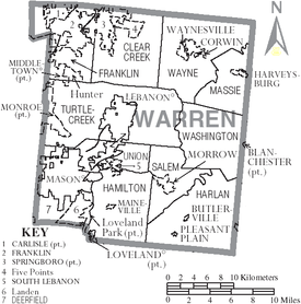 Map of Warren County, Ohio with municipal and township labels
Cities
[
edit
]
Villages
[
edit
]
Townships
[
edit
]
Census-designated places
[
edit
]
Unincorporated communities
[
edit
]
Notable people
[
edit
]
- Neil Armstrong
, Astronaut
- Robert Benham
, Pioneer politician
- Clarence Brown, Jr.
, Congressman
- John Chivington
, Civil War officer
- Thomas Corwin
, Governor
- Brant Daugherty
, Actor
- William H. P. Denny
, Newspaper publisher
- Clifford B. Harmon
, Aviator
- Woody Harrelson
, Actor
- Cordell Hull
, Secretary of State
- Bruce E. Ivins
, Scientist
- Michael Larson
, Game-show contestant
- Donald Lukens
, Congressman
- William C. McClintock
, Newspaper publisher
- John McLean
, U.S. Supreme Court justice
- Jeremiah Morrow
, Governor
- Marcus Mote
, Early Ohio Artist
- Anthony Munoz
,
NFL
player
- Corwin M. Nixon
, Ohio State Representative (1962-1992), Ohio House of Representatives Minority Leader (1979-1992)
- Dan Patrick
, Sports broadcaster
- Marty Roe
, Musician
- Thomas Ross
, Congressman
- Larry Sparks
, Musician
- Wilson E. Terry
, Spanish?American War soldier
- Durbin Ward
, Civil War general
- Mark Whitacre
, FBI informant, Inspiration for the book and movie
The Informant!
- Joseph Whitehill
, Ohio state treasurer
See also
[
edit
]
Historical articles about Warren County
[
edit
]
State facilities in Warren County
[
edit
]
References
[
edit
]
- ^
"Ohio County Profiles: Warren County"
(PDF)
. Ohio Department of Development. Archived from
the original
(PDF)
on May 8, 2007
. Retrieved
April 28,
2007
.
- ^
a
b
"State & County QuickFacts"
. United States Census Bureau
. Retrieved
July 7,
2022
.
- ^
"Find a County"
. National Association of Counties. Archived from
the original
on May 31, 2011
. Retrieved
June 7,
2011
.
- ^
"Warren County data"
.
Ohio State University
Extension Data Center
. Retrieved
April 28,
2007
.
[
dead link
]
- ^
The History of Warren County, Ohio: Containing a History of the County; Its Townships, Towns; General and Local Statistics; Portraits of Early Settlers and Prominent Men; History of the Northwest Territory; History of Ohio, Map of Warren County, Constitution of the United States, Miscellaneous Matters, Etc. by W.H. Beers & Company, 1882
- ^
"Presidential election of 1864 - Map by counties"
.
geoelections.free.fr
. Retrieved
January 19,
2022
.
- ^
"1864 Presidential General Election Results - Ohio"
.
- ^
"1860 Presidential General Election Results - Ohio"
.
- ^
"1872 Presidential General Election Results - Ohio"
.
- ^
"1868 Presidential General Election Results - Ohio"
.
- ^
"Presidential election of 1876 - Map by counties"
.
geoelections.free.fr
. Retrieved
January 27,
2022
.
- ^
"2010 Census Gazetteer Files"
. United States Census Bureau. August 22, 2012. Archived from
the original
on May 4, 2014
. Retrieved
February 11,
2015
.
- ^
"Annual Estimates of the Resident Population for Counties: April 1, 2020 to July 1, 2021"
. Retrieved
July 7,
2022
.
- ^
"U.S. Decennial Census"
. United States Census Bureau
. Retrieved
February 11,
2015
.
- ^
"Historical Census Browser"
. University of Virginia Library
. Retrieved
February 11,
2015
.
- ^
Forstall, Richard L., ed. (March 27, 1995).
"Population of Counties by Decennial Census: 1900 to 1990"
. United States Census Bureau
. Retrieved
February 11,
2015
.
- ^
"Census 2000 PHC-T-4. Ranking Tables for Counties: 1990 and 2000"
(PDF)
. United States Census Bureau. April 2, 2001.
Archived
(PDF)
from the original on March 27, 2010
. Retrieved
February 11,
2015
.
- ^
"U.S. Census website"
.
United States Census Bureau
. Retrieved
January 31,
2008
.
- ^
a
b
c
"DP-1 Profile of General Population and Housing Characteristics: 2010 Demographic Profile Data"
.
United States Census Bureau
. Archived from
the original
on February 13, 2020
. Retrieved
December 27,
2015
.
- ^
"Population, Housing Units, Area, and Density: 2010 - County"
.
United States Census Bureau
. Archived from
the original
on February 13, 2020
. Retrieved
December 27,
2015
.
- ^
"DP02 SELECTED SOCIAL CHARACTERISTICS IN THE UNITED STATES ? 2006-2010 American Community Survey 5-Year Estimates"
.
United States Census Bureau
. Archived from
the original
on February 13, 2020
. Retrieved
December 27,
2015
.
- ^
"DP03 SELECTED ECONOMIC CHARACTERISTICS ? 2006-2010 American Community Survey 5-Year Estimates"
.
United States Census Bureau
. Archived from
the original
on February 13, 2020
. Retrieved
December 27,
2015
.
- ^
"P&G'S MASON BUSINESS CENTER TURNS 20"
.
Procter and Gamble
. Retrieved
June 1,
2021
.
- ^
"P&G unveils its largest R&D center in the world. It's in Mason, Ohio"
.
Cincinnati Enquirer
. Retrieved
June 1,
2021
.
- ^
"Procter & Gamble to expand with new state-of-the-art center in Mason"
.
WLWT
. May 16, 2019
. Retrieved
June 1,
2021
.
- ^
"Warren County, Ohio Comprehensive Annual Financial Report For the Fiscal Year Ended December 31, 2019"
(PDF)
.
Archived
(PDF)
from the original on June 2, 2021
. Retrieved
June 1,
2021
.
- ^
"Ohio Counties"
.
County Commissioners Association of Ohio
. Archived from
the original
on December 30, 2016
. Retrieved
December 29,
2016
.
- ^
Leip, David.
"Dave Leip's Atlas of U.S. Presidential Elections"
.
uselectionatlas.org
. Retrieved
April 6,
2018
.
- ^
http://www.co.warren.oh.us/auditor/property_search/summary.asp?account_nbr=7202334
Archived
September 28, 2007, at the
Wayback Machine
Warren county property record
- ^
"Warren County Ohio"
. Archived from
the original
on April 22, 2017
. Retrieved
April 21,
2017
.
- ^
"Cincinnati's Rail + Bus Plan"
.
www.lightrailnow.org
. Retrieved
April 6,
2018
.
Further reading
[
edit
]
- Elva R. Adams.
Warren County Revisited
. Lebanon, Ohio: Warren County Historical Society, 1989.
- Robert Brenner.
Maineville, Ohio, History: 100 Years as an Incorporated Town, 1850?1950
. Cincinnati: John S. Swift, 1950.
- The Centennial Atlas of Warren County, Ohio
. Lebanon, Ohio: The Centennial Atlas Association, 1903.
- Mabel Eldridge and Dudley Bryant.
Franklin in the Great Miami Valley
. Edited by Harriet E. Foley. Franklin, Ohio: Franklin Area Historical Society, 1982.
- Harriet E. Foley, editor.
Carlisle: The Jersey Settlement in Ohio, 1800?1990
. 2nd ed.
Carlisle, Ohio
: The Editor, 1990.
- Josiah Morrow
.
The History of Warren County, Ohio
. Chicago: W.H. Beers, 1883. (Reprinted several times)
- Ohio Atlas & Gazetteer
. 6th ed.
Yarmouth, Maine
: DeLorme, 2001.
ISBN
0-89933-281-1
- Thomas D. Schiffer.
Peters & King: The Birth & Evolution of the Peters Cartridge Co. & the King Powder Co
. Iola, Wisconsin: Krause Publications, 2002.
ISBN
0-87349-363-X
- William E. Smith.
History of Southwestern Ohio: The Miami Valleys
. New York: Lewis Historical Publishing, 1964. 3 vols.
- Rose Marie Springman.
Around Mason, Ohio: A Story
.
Mason, Ohio
: The Author, 1982.
- Warren County Engineer's Office.
Official Highway Map 2003
. Lebanon, Ohio: The Office, 2003.
External links
[
edit
]
Places adjacent to Warren County, Ohio
|
|---|
|
39°26′N
84°10′W
/
39.43°N 84.17°W
/
39.43; -84.17