District in Brandenburg, Germany
Uckermark
(
German pronunciation
ⓘ
) is a
Kreis
(
district
) in the northeastern part of
Brandenburg
,
Germany
. Neighbouring districts are (clockwise from the south)
Barnim
and
Oberhavel
, the districts
Mecklenburgische Seenplatte
and
Vorpommern-Greifswald
in
Mecklenburg-Vorpommern
, and to the east
Poland
(
Police County
and
Gryfino County
). It is one of the largest districts of Germany areawise. The district is named after the historical region of
Uckermark
.
Geography
[
edit
]
The Uckermark is named after the
Uecker
river. The Oder River, forming the Polish border, bounds the district in the east. The district is characterised by 600 lakes and 2,800 km of rivers. Rare animals still live in the lakeland, such as
ospreys
,
beavers
and
otters
.
The western parts of the
Lower Oder Valley National Park
are located in the district.
History
[
edit
]
The Uckermark was originally divided between the administrative units
Uckerkreis
and
Stolpirischer Kreis
. In 1817 as part of the
Province of Brandenburg
, a third district was created in the area, the district
Angermunde
, and the other two districts were renamed to
Prenzlau
and
Templin
. The current district Uckermark was created in 1993 by merging the previous districts Angermunde, Prenzlau and Templin, as well as the previously district-free city
Schwedt
. The district encompasses a small part of historical
Western Pomerania
, namely the area of
Amt Gartz (Oder)
, while on the other hand, a part of the historical Uckermark around
Locknitz
is currently included in the
Vorpommern-Greifswald
District.
Demography
[
edit
]
Landkreis Uckermark: Population development
within the current boundaries (2017)
[2]
| Year
| Pop.
| ±% p.a.
|
|---|
| 1875
| 129,964
| ?
|
|---|
| 1890
| 128,385
| ?0.08%
|
|---|
| 1910
| 132,931
| +0.17%
|
|---|
| 1925
| 140,942
| +0.39%
|
|---|
| 1933
| 137,444
| ?0.31%
|
|---|
| 1939
| 140,502
| +0.37%
|
|---|
| 1946
| 166,690
| +2.47%
|
|---|
| 1950
| 174,223
| +1.11%
|
|---|
| 1964
| 160,730
| ?0.57%
|
|---|
| 1971
| 172,776
| +1.04%
|
|---|
| 1981
| 175,927
| +0.18%
|
|---|
| 1985
| 173,993
| ?0.28%
|
|---|
| 1989
| 172,982
| ?0.15%
|
|---|
| 1990
| 170,409
| ?1.49%
|
|---|
| 1991
| 165,542
| ?2.86%
|
|---|
| | Year
| Pop.
| ±% p.a.
|
|---|
| 1992
| 165,115
| ?0.26%
|
|---|
| 1993
| 163,719
| ?0.85%
|
|---|
| 1994
| 162,022
| ?1.04%
|
|---|
| 1995
| 160,310
| ?1.06%
|
|---|
| 1996
| 159,029
| ?0.80%
|
|---|
| 1997
| 157,663
| ?0.86%
|
|---|
| 1998
| 155,723
| ?1.23%
|
|---|
| 1999
| 154,086
| ?1.05%
|
|---|
| 2000
| 151,740
| ?1.52%
|
|---|
| 2001
| 148,606
| ?2.07%
|
|---|
| 2002
| 145,715
| ?1.95%
|
|---|
| 2003
| 143,411
| ?1.58%
|
|---|
| 2004
| 141,454
| ?1.36%
|
|---|
| 2005
| 139,326
| ?1.50%
|
|---|
| 2006
| 137,209
| ?1.52%
|
|---|
| | Year
| Pop.
| ±% p.a.
|
|---|
| 2007
| 134,958
| ?1.64%
|
|---|
| 2008
| 132,837
| ?1.57%
|
|---|
| 2009
| 131,115
| ?1.30%
|
|---|
| 2010
| 129,738
| ?1.05%
|
|---|
| 2011
| 123,731
| ?4.63%
|
|---|
| 2012
| 122,484
| ?1.01%
|
|---|
| 2013
| 121,326
| ?0.95%
|
|---|
| 2014
| 120,829
| ?0.41%
|
|---|
| 2015
| 121,014
| +0.15%
|
|---|
| 2016
| 120,878
| ?0.11%
|
|---|
| 2017
| 120,349
| ?0.44%
|
|---|
| 2018
| 119,552
| ?0.66%
|
|---|
| 2019
| 118,947
| ?0.51%
|
|---|
|
Coat of arms
[
edit
]
The main feature of the coat of arms are the brick buildings of the district — the churches of
Prenzlau
and
Angermunde
. The city wall below recalls the many wars of the Middle Ages. The two circular windows in the church tower symbolizes the division into two districts before the reform of 1817, the three
Gothic
windows represent this division. On the city wall are two shields — one with the
griffin
of
Pomerania
, the other with the
red eagle of Brandenburg
. The wavy lines in the upper part represent the main rivers in the district,
Oder
,
Randow
, and
Uecker
. The yellow color of the background represents the agriculture of the district, as the Uckermark was the "
granary
" of Brandenburg. The coat of arms was created by
Hans Benthin
, and was officially granted on November 8, 1995.
Towns and municipalities
[
edit
]
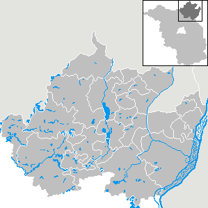 Clickable map of towns and municipalities in the district
References
[
edit
]
External links
[
edit
]
Wikimedia Commons has media related to
Uckermark
.
 Urban and rural districts in the state of
Brandenburg
in Germany
 |
|---|
| Urban districts
| |
|---|
| Rural districts
| |
|---|
|
53°15′N
13°52′E
/
53.250°N 13.867°E
/
53.250; 13.867