Community in Houston, Texas
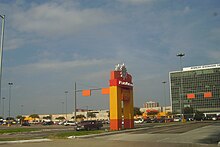
 A sign in a median indicating Sharpstown
 Sharpstown sign from the Greater Sharpstown Management District (now the
Southwest Management District
)
Sharpstown sign from the Greater Sharpstown Management District (now the
Southwest Management District
)
Sharpstown
is a
master-planned community
in the
Southwest Management District
(formerly Greater Sharpstown),
Southwest
Houston, Texas
.
[1]
It was one of the first communities to be built as a
master-planned
,
automobile
centered community and the first in Houston.
Frank Sharp
(1906?1993), the developer of the subdivision, made provisions not only for homes but also for schools, shopping and recreation areas. While this model has been duplicated countless times in the past fifty years, at the time it was quite revolutionary, attracting national media attention. The development was dedicated on March 13, 1955.
Overview
[
edit
]
 PlazAmericas
(formerly Sharpstown Center and Sharpstown Mall)
PlazAmericas
(formerly Sharpstown Center and Sharpstown Mall)
The residential
architecture
in Sharpstown consists of post?
World War II
bungalows
, modern and traditional homes. The materials used in building these homes were of sound quality and have withstood the wear and tear of the
baby boomer
generation as well as the test of time.
 Sharpstown Mall sign
History
[
edit
]
Sharp donated a 300-foot-wide strip of land through the development to the state of Texas for construction of the Southwest Freeway (
Interstate 69
/
U.S. Highway 59
). This routing ensured easy access from
Downtown Houston
to homes in the neighborhood, as well as to
PlazAmericas
(formerly Sharpstown Mall and Sharpstown Center) (1961), Houston's first
air-conditioned
, enclosed
shopping mall
.
From the 1980 U.S. Census to the 1990 Census, many African-Americans left traditional
African-American neighborhoods
and entered parts of
Southwest Houston
such as Sharpstown. The Hispanic population increased by an amount between 1,000 and 3,500 per square mile. Many Asian-Americans also moved into the Sharpstown area, creating one of the largest concentrations of Asian-Americans in Houston. Glenda Kay Joe, an Asian community leader, said in a 1991
Houston Chronicle
article that the Sharpstown Civic Association and the
Southwest Advocate
newspaper opposed Asian-American settlement in Sharpstown. According to Joe, once Sharpstown residents became accustomed with Asian immigrants, the opposition disappeared.
[2]
Sharpstown was affected by the
Sharpstown scandal
. The scandal combined with a set of apartment complexes that became run-down ensured that Sharpstown became a neighborhood surrounded by
crime
by the mid-to-late 1990s.
[
citation needed
]
Crime increased in the 1990s with the deterioration of area apartment complexes.
[3]
A 1992
Houston Chronicle
article described Sharpstown as "a racially mixed neighborhood with a strong
Vietnamese
community."
[4]
With Sharpstown's close-in location, there is renewed interest in revitalizing the neighborhood. In 2005, median home prices in Sharpstown had roughly doubled since 2000.
[
citation needed
]
In a 2007
Houston Press
article journalist John Nova Lomax said "residential Sharpstown never changes" and that "the houses are still decent and the apartments still rotten."
[5]
In 2010,
Mary Ellen Carroll
, a conceptual artist who taught at Rice University's School of Architecture realized Phase I of the work
prototype 180
. The catalytic moment was the 180 degree revolution of the single-family home and its surrounding lot at 6513 Sharpview in Sharpstown Section I. prototype 180 occupies architecture to make it perform, albeit as a work of art. It is a collection of processes that utilize land-use policy or no zoning, and the lack thereof in Houston as a material condition and is an example of 'considered urbanism'. The site functions as a visible museum of post-war planned communities and architectural interventions. prototype 180 raises questions regarding planning and policy in aging first ring developments.
[6]
 The 180 degree revolution of 6513 Sharpview to make the single family home perform as a work of art that is a collection of processes as a public museum in a single family home. www.prototype180.org
In 2017, the structure that had been compromised during
Hurricane Harvey
was 'unbuilt' in a performance on November 11, 2017 in front of an invited, live public audience for Phase II of prototype 180. The unbuilding of the structure was titled
Daringly Unbuilt
and was introduced by the Charles Renfro, a partner in the firm
Diller, Scofidio + Renfro
and the performance artist
Joseph Keckler
sang a requiem accompanied accompanied by the acclaimed violinist
Ruben Rengel
.
Phase III for prototype 180 will be the rebuilding of the structure that will be done with a proprietary process that incorporates a substrate made by reconstituting the salvaged building materials to rebuild the original structure and the creation of an ethno-botanic garden in the land surrounding the structure.
During the same year the
Houston Press
named Sharpstown the 2010 "Best Hidden Neighborhood." The
Houston Press
stated that Sharpstown "is less a "hidden" neighborhood than it is one that's undervalued and underrated."
[7]
In 2013
Houstonia
magazine stated that Sharpstown was one of the "25 Hottest Neighborhoods" in Houston.
[8]
Cityscape
[
edit
]
Sharpstown has a lot of
mid-century
style houses on large lots.
[7]
Government and infrastructure
[
edit
]
 Fire Station 51 Sharpstown
The
Houston Fire Department
operates the Fire Station 51 Sharpstown along
Bellaire Boulevard
, a part of Fire District 68.
[9]
Station 51 opened in 1962. Since then it had two facelifts and a renovation in the financial year of 1999.
[10]
 Fire Station 51, 1976
After the 2012 redristricting process, Sharpstown is split between
Texas's 7th congressional district
and
Texas's 9th congressional district
The neighborhood is served by two
Houston Police Department
patrol divisions. Areas north and west of
Interstate 69
/
U.S. Route 59
are served by the Midwest Patrol Division. Areas south and east of I-69/U.S. 59 are served by the Fondren Patrol Division.
[11]
The portion that is now in the Midwest Patrol Division was formerly in the Westside Patrol Division.
[12]
At one time the police department operated the Sharpstown-area police storefront at
Bellaire Boulevard
at Rogerdale.
[13]
The City of Houston Health Department operates the Sharpstown Health Services clinic.
[14]
Harris Health System
(formerly Harris County Hospital District) designated Valbona Health Center (formerly People's Health Center) in
Greater Sharpstown
for ZIP code 77074. The nearest public hospital is
Ben Taub General Hospital
in the
Texas Medical Center
.
[15]
Political representation
[
edit
]
The City of Houston instituted the current nine city council districts in 1979. Sharpstown has been districted in District F since 1980. District council members elected to the Houston City Council have been past presidents of the Sharpstown Civic Association ? John Goodner (1980?1993), Ray Driscoll (1994?1999), Mark Ellis (2000?2003),
M.J. Khan
(2004?2010), and
Aloysius Hoang
(2010/11 ? prior to the City of Houston redistricting). As of 2011, Sharpstown was redistricted into District J where Mike Laster is the newly elected council member.
Houston City Council
District J now covers Sharpstown.
[16]
District J was created to allow Hispanics to more easily elect representatives who cater to them.
[17]
Robert Jara, a political consultant of the group Campaign Strategies, drew the boundaries of District J in order to ensure that Sharpstown and
Gulfton
were together in one area. That way, the Hispanic residents could lobby for influence with their city council representative, whether he or she is of Hispanic origin or not.
[18]
City Council District F previously covered Sharpstown. As of 2008 M. J. Khan represented the district.
[19]
[20]
[21]
In 1989, during a city council race, many in Sharpstown voted for Jim Westmoreland for an at-large position. In one precinct 68.5 percent of the voting residents voted for him. Westmoreland drew controversy after reports of a joke that was characterized as racist spread. Westmoreland was defeated in that race. In a 1989
Houston Chronicle
article, Nancy Palm, a Republican Party activist from western Houston, said that the residents who voted for Westmoreland had social ties with them and did not see the controversy as significant.
[22]
In the first 1991
Mayor of Houston
election most Sharpstown voters voted for
Bob Lanier
.
[23]
[24]
By December 3, 1991, increases in crime and changes of demographics in southwestern Houston neighborhoods lead to many challengers desiring to fill the city council seat of District F.
[25]
In 2005 Khan promoted an anti-graffiti campaign in Sharpstown and other communities in his district.
[26]
Culture, parks, and recreation
[
edit
]
The city operates Sharpstown Park and the Sharpstown Golf Course along
Bellaire Boulevard
, in Sharpstown Country Club Estates Harbor Town Addition.
[27]
[28]
[29]
In 2003 Wendy Grossman of the
Houston Press
said that the course "looks like a rundown city park with yellow paint chipping off the curb." The course has an on-site pro shop and an on-site restaurant behind the shop. An employee in the on-site pro shop stated that Sharpstown Park Golf Course was the flattest course in the city.
[30]
The golf course first opened in the 1950s as the Sharpstown Country Club Golf Course. At the time it housed fifty sand traps, five lakes, and a special kind of grass. The lakes had
bass
and
perch
. In 1964 the $50,000 Houston Golf Classic was at the golf course. In 1976, the owners of the course had not made a payment on their $5 million mortgage in five years, leading to the course's closure. The City of Houston proceeded to buy about two-thirds of the course two years later; real estate developers bought the rest of the course. The course is the home course of the
Wisdom High School
golf team; the school is about 4 miles (6.4 km) from the course.
[30]
The city operates the Sharpstown Green Park at 6300 Sharpview Drive.
[28]
The city operates the Sharpstown Community Center at 6600 Harbor Town Drive.
[31]
Bonham Park, a city park, is in Sharpstown original Section 3.
[32]
[33]
E. L. Crain Park, another city park, is in Sharpstown Country Club Terrace Section 3.
[32]
[34]
Lansdale Park is in Country Club Terrace Section 2.
[35]
[36]
Sharpstown has a
little league
called Sharpstown Little League that plays at Bayland Park.
In 2007, the group Neighborhood Centers Inc. announced that it would build the
Gulfton
Neighborhood Campus at the intersection of Rookin Street and High Star Drive when it raises $20 million.
[37]
The Baker-Ripley Neighborhood Center opened in 2010 and now offers a wide range of services including after school programs, a medical clinic, financial center, fitness classes, and ESL.
[38]
Sections
[
edit
]
Original sections
[
edit
]
Sharpstown Sections 1, 1A, 2, 3, and 5 form the original sections of Sharpstown.
[39]
Sharpstown Country Club Estates
[
edit
]
Sharpstown Country Club Estates is a set of two sections in Sharpstown.
[39]
It was developed in the late 1950s by the Sharpstown expansion west of the
Southwest Freeway
by
Frank Sharp
. The neighborhood is next to the
Sharpstown Golf Course
and west of
PlazAmericas
(formerly Sharpstown Center and Sharpstown Mall).
Sharpstown Country Club Estates was named after the
Sharpstown
Country Club
(now
Sharpstown Park
and Golf Course) that was east and west of the neighborhood after 1955, Sharpstown CCE surrounded the country club. The neighborhood is known as one of the quietest sections of
Houston
by its residents. The neighborhood is divided into two sections, Sharpstown Country Club Estates East and Sharpstown Country Club Estates West. Sharpstown Country Club Estates attracted middle to upper class citizens who were involved at the Sharpstown Country Club.
The sections are Country Club Estates 2 and Country Club Estates 3.
[39]
Sharpstown Country Club Terrace
[
edit
]
Sharpstown Country Club Terrace includes Country Club Terrace 1, Country Club Terrace 2, and Country Club Terrace 3.
[39]
As of 2016
[update]
the section included mid-century modern houses, bungalows built in the post-
World War II
style, and traditional ranch houses. There were houses worth almost $300,000 which had new appliances and features, while those under $200,000, in the words of Nancy Sarnoff of the
Houston Chronicle
, "generally require some fixing up."
[3]
From 2011 to 2015 the median price per square foot of the houses in Sharpstown Country Club Terrace increased by 54%.
[3]
Education
[
edit
]
Colleges and universities
[
edit
]
Houston Community College System
serves Sharpstown.
Houston Baptist University
, a private university, is located in Sharpstown Section 3A.
[40]
[41]
Primary and secondary education
[
edit
]
Public schools
[
edit
]
 Sharpstown High School
Sharpstown is served by several schools in the
Houston Independent School District
.
[39]
Sutton Elementary school serves original sections 1, 1A, and 2.
[39]
[42]
James Butler Bonham Elementary School, located in original section 3,
[33]
[43]
serves most of original section 3,
[39]
[44]
while McNamara Elementary School, outside of Sharpstown, serves a portion of original section 3.
[39]
[45]
Neff Elementary School serves original section 5, Estates 2, Terrace 1, most of Estates 3, and almost all of Terrace 2.
[39]
[46]
The current Neff campus is in Country Club Estates Section 2,
[47]
[48]
as was its previous one.
[36]
[49]
Ed White Elementary School, in Terrace 3,
[34]
[50]
serves Terrace 3 and a small portion of Terrace 2.
[51]
Ralph Waldo Emerson Elementary School, outside of Sharpstown, serves sections of Estates 3.
[39]
[52]
Sands Point Elementary School, serving as a relief school, was named after Sands Point Drive in Sharpstown Country Club Estates.
[53]
 Sharpstown International School
Jane Long Academy
in Sharpstown (any student zoned to Long may apply to
Pin Oak Middle School
's regular program
[54]
) serves original sections 1, 1A, and 2 for middle school.
[39]
[55]
Sugar Grove Middle School, located in Section 3,
[56]
[57]
serves original section 3, original section 5, all three Terrace sections, Estates 2, and most of Estates 3.
[39]
[58]
In the period 2009 to 2019, the school had "improvement required" ratings from the State of Texas for four of those years. Each year, about 37% of the teachers present in one school year are not in the next. There were five principals in a period circa 2009 to 2019. Circa 2014, 925 students in the Sugar Grove attendance zone attended schools other than Sugar Grove middle. This increased to 1,200 circa 2019.
[59]
Sharpstown High School
serves original sections 1, 1A, 2, and 3, original section 5, all three Terrace sections, Estates 2, and most of Estates 3.
[39]
[60]
A portion of Sharpstown Country Club Estates 3 is zoned to Revere Middle School and
Margaret Long Wisdom High School
(formerly Robert E. Lee High School), with
Lamar High School
and
Westside High Schools
as options.
[39]
[61]
[62]
) serves a small portion of western Sharpstown.
[63]
Sharpstown International School
, a 6?12 district magnet school, is in the community.
Las Americas Newcomer School
, a 6?8 school for new immigrants, is on the property of Jane Long.
KIPP Houston Public Schools
operates several
charter schools
along KIPP Way, west of Sharpstown.
-
Edward H. White Elementary School
-
William S. Sutton Elementary School
-
Pat Neff Elementary School (old campus)
Histories of public schools
[
edit
]
 Jane Long Academy
Long Middle School was built in 1957. Sutton was built in 1958, and McNamara opened in 1958. Bonham was built 1962. Emerson was erected in 1963. Neff opened in 1964. White opened in 1967. Sharpstown Junior-Senior High School opened in 1968; the high school split and moved to its own campus in 1969. In February 1995 Sugar Grove, built in former church property, opened as a relief school. Sands Point opened in 1998 as a relief school for Emerson, Piney Point, and Walnut Bend. Repairs and renovations of Sugar Grove were completed by January 1999.
[53]
In the early 2000s (decade), the areas north of Sands Point Drive were zoned to Sharpstown Middle School; at a later point they were rezoned to Revere.
[64]
Sharpview Elementary School was temporarily established at 7734 Mary Bates in order to relieve some Sharpstown-area elementary schools; Sharpview opened fall 2000 and closed in spring 2004.
[53]
Sugar Grove received a grades 5?6 attendance boundary in 2009.
[65]
In 2011 Sharpstown Middle was consolidated with Sharpstown International High School to form a new 6?12 school,
Sharpstown International School
. The new 6?12 school took attendance boundaries from Lee High School (now
Wisdom High School
) and
Sharpstown High School
, while Sugar Grove Middle School took portions of the boundary from Sharpstown Middle School.
[66]
As of 2012, Sharpstown International School now has no boundary, with Sugar Grove Middle School and Sharpstown High School controlling its former middle and high school boundaries.
[67]
[68]
Liberty High School
, an alternative high school for recent immigrants, was from 2017 on the campus of Sharpstown International.
[69]
In 2022 it moved to the
Houston Community College
(HCC) Gulfton Campus.
[70]
[71]
Private schools
[
edit
]
 Strake Jesuit College Preparatory
Sharpstown also has three private schools.
St. Francis de Sales Catholic School
(grades K-8) is in Sharpstown Country Club Terrace Section 2.
[36]
[72]
Secondary schools include
Strake Jesuit College Preparatory
and
Saint Agnes Academy
.
Public libraries
[
edit
]
 M. E. Walter Neighborhood Library
The area is served by the
Houston Public Library
. M. E. Walter Neighborhood Library, a full service branch, is located at 7660 Clarewood,
[73]
in Sharpstown Section 4.
[74]
HPL Express Southwest is located within the Southwest Multi-Service Center at 6400 High Star in the
Southwest Management District
, east of the Sharpstown subdivisions.
[75]
The
Harris County Hospital District
operates the Vallbona Health Center (formerly the People's Health Center) at 6630 DeMoss Street.
[76]
Memorial Hermann Hospital Southwest
is in Sharpstown Section 3.
[77]
[78]
Media
[
edit
]
The
Bellaire Texan
, which served the Sharpstown community in the mid-20th Century,
[79]
was headquartered in
Bellaire
and published by the Texan Publishing Corporation.
[80]
By 1975 it became known as the
Bellaire & Southwestern Texan
and was published by the Preston Publishing Company. It was then headquartered in Houston.
[81]
See also
[
edit
]
References
[
edit
]
- ^
"
Districts
." Greater Sharpstown Management District. Retrieved on August 15, 2009.
- ^
Rodriguez, Lori. "
Census tracks rapid growth of suburbia
."
Houston Chronicle
. Sunday March 10, 1991. Section A, Page 1. Retrieved on December 13, 2010.
- ^
a
b
c
Sarnoff, Nancy. "
A diverse Sharpstown still on the upswing
."
Houston Chronicle
. July 1, 2016. Retrieved on July 11, 2016.
- ^
Criss, Catherine and Eric Hanson. "
Ultimate divorce: a murdered family
."
Houston Chronicle
. Saturday May 20, 1991. A2. Retrieved on December 13, 2010.
- ^
Lomax, John Nova. "
I am a Pedestrian Report: Bellaire
."
Houston Press
. May 25, 2007.
- ^
Turner, Allan. "
About-face for Sharpstown urban blight
."
Houston Chronicle
. September 23, 2010. Retrieved on October 14, 2010.
- ^
a
b
"
Best Hidden Neighborhood ? 2010 Sharpstown
."
Houston Press
. Retrieved on December 13, 2010.
- ^
Holley, Peter, John Lomax, and Todd Spoth. "
25 Hottest Neighborhoods
" (
Archive
).
Houstonia
. June 1, 2013. Retrieved on November 2, 2015.
- ^
"
Primary Run Area
."
Houston Fire Department Station 68
. Retrieved on December 13, 2008.
- ^
"
Fire Station 51
." City of Houston. Retrieved on May 8, 2010.
- ^
"
Beat Map
."
Houston Police Department
. Retrieved on April 5, 2010.
- ^
"
Crime Statistics for Westside Patrol Division
." City of Houston. Retrieved on April 5, 2010.
- ^
Mangin, Charles de. "
Alief 's first / New police storefront set to open
." (
Archive
)
Houston Chronicle
. Wednesday March 15, 2000. ThisWeek 1. Retrieved on December 30, 2011.
- ^
"Sharpstown Health Services"
. City of Houston
. Retrieved
2021-04-09
.
Sharpstown Health Services 6201 Bonhomme Road South Tower, Third Floor Houston, Texas 77036
- ^
"Clinic/Emergency/Registration Center Directory By ZIP Code"
.
Harris County Hospital District
. 2001-11-19. Archived from
the original
on 2001-11-19
. Retrieved
2021-04-08
.
- See ZIP code 77074.
See this map for relevant ZIP code
.
- ^
City of Houston, Council District Maps, District J
." City of Houston. Retrieved on November 5, 2011.
- ^
Shauk, Zain. "
Hispanic-opportunity district draws three candidates
."
Houston Chronicle
. Friday October 14, 2011. Retrieved on November 4, 2011.
- ^
"
Political challenge: Revised council redistricting plan offers Hispanics a third majority district
." (editorial)
Houston Chronicle
. Wednesday May 18, 2011. Retrieved on November 5, 2011.
- ^
"
COUNCIL DISTRICT MAPS > DISTRICT F
."
City of Houston
.
- ^
"
City Council
."
City of Houston
. Retrieved on May 10, 2008.
- ^
Bernstein, Alan. "
Rookie members to decide city matters for years to come
."
Houston Chronicle
. Sunday September 24, 1995.
- ^
Bernstein, Alan. "
Core of white support failed to halt Westmoreland's defeat
."
Houston Chronicle
. Sunday November 12, 1989. A1.
- ^
Rodriguez, Lori. "
Saying goodbye, with no regrets
."
Houston Chronicle
. Saturday November 9, 1991. A31.
- ^
Bernstein, Alan and Jim Simmon. "
Black vote went solidly for Turner/Whitmire failed to produce split
."
Houston Chronicle
. Thursday November 7, 1991. A21.
- ^
Johnson, Stephen. "
Crime, drugs main issues in Dist. F race
."
Houston Chronicle
. November 3, 1991. Voter's Guide, Page 5.
- ^
De Mangin, Charles. "
Summit to address public safety / Councilman, HPD to give tips, information to cut crime rate
."
Houston Chronicle
. Thursday March 24, 2005. ThisWeek 1.
- ^
"Harbor Town Add'n to Sharpstown Country Club Estates Part 1 of 2" (
JPG
and
PDF
). Harris County Block Book Maps. Volume 114, Page 509. Retrieved on August 9, 2017.
- ^
a
b
"
Our Parks and Greenspaces O-Z
." City of Houston. Retrieved on August 9, 2017. "Sharpstown Green Park 6300 Sharpview, 77074" and "Sharpstown Park & Golf Course 6600 Harbor Town, 77036"
- ^
"
Sharpstown Park Golf Course
." City of Houston. Retrieved on February 5, 2011.
- ^
a
b
Grossman, Wendy. "Tee Time."
Houston Press
. November 13, 2003.
3
. Retrieved on February 5, 2011.
- ^
"
Sharpstown Community Center
."
City of Houston
. Retrieved on January 3, 2009.
- ^
a
b
"
Our Parks and Greenspaces A ? F
." City of Houston. Retrieved on August 9, 2017. "Bonham Park 8401 Braes Acres, 77074" and "Crain (E.L.) Park (% Lease) 9051 Triola, 77036"
- ^
a
b
Sharpstown Section 3 Blocks 17?23 (
JPG
,
PDF
). Harris County Block Book Maps. Volume 92, Pages 414?420. Retrieved on August 9, 2017.
- ^
a
b
Sharpstown Country Club Terrace Section 3 Part 2 (Blocks 29?30, 34?36, 39 Reserv. A, 40?42) (
PDF
and
JPG
). Harris County Block Book Maps. Volume 93, Pages 368?440. Retrieved on August 9, 2017.
- ^
"
Our Parks and Greenspaces G-N
." City of Houston. Retrieved on August 9, 2017. "Lansdale Park 8201 Roos, 77036"
- ^
a
b
c
"Sharpstown Country Club Terrace Sec. 2" Blocks 1?3, 9?13, 19?22, 24, and 26 (
JPG
and
PDF
). Harris County Block Book Maps. Volume 93, p. 302-367. Retrieved on August 9, 2017.
- ^
Friedberg, Jennifer. "
Funds sought for Gulfton center
."
Houston Chronicle
. January 30, 2007. Retrieved on December 13, 2008.
- ^
Rogers, Susan. "
[1]
."
Cite
. Rice Design Alliance, (Northern Hemisphere) Fall 2009. 24. Retrieved on March 3, 2010.
- ^
a
b
c
d
e
f
g
h
i
j
k
l
m
n
"
SCA's Sections and Boundaries
." (
Archive
) Sharpstown Civic Association, Inc. Retrieved on August 8, 2011.
- ^
Sharpstown Section 3A Replat & Extension Blocks 1?2 (
JPG
,
PDF
). Harris County Block Book Map. Volume 94, Pages 97?99. Retrieved on August 8, 2017.
- ^
Printable Campus Map
.
Houston Baptist University
. Retrieved on August 8, 2017.
Interactive map
- ^
"
Sutton Elementary Attendance Zone
."
Houston Independent School District
. Retrieved on August 19, 2009.
- ^
Home
. James B. Bonham Elementary School. Retrieved on August 9, 2017. "8302 Braes River Houston, TX 77074-4212"
- ^
"
Bonham Elementary Attendance Zone
."
Houston Independent School District
. Retrieved on August 19, 2009.
- ^
"
McNamara Elementary Attendance Zone
."
Houston Independent School District
. Retrieved on August 19, 2009.
- ^
"
Neff Elementary Attendance Zone
."
Houston Independent School District
. Retrieved on August 19, 2009.
- ^
Home
. Neff Elementary School. Retrieved on August 9, 2017. "8301 Neff Street. Houston, TX 77036"
- ^
Section 2 of Sharpstown Country Club Estates, Blocks 16?18, Res. D, 27?31, 33, Res. E (
JPG
,
PDF
). Harris County Block Book Maps. Volume 93, Pages 302?367. Retrieved on October 9, 2017.
- ^
[web.archive.org/web/20000916172745/
http://es.houstonisd.org/neffes
Home]. Pat Neff Elementary School. September 16, 2000. Retrieved on August 9, 2017. "8200 Carvel Houston, TX 77036"
- ^
Home
. Ed White Elementary School. Retrieved on August 9, 2017. "9001 Triola Houston, TX 77036-6147"
- ^
"
White Elementary Attendance Zone
."
Houston Independent School District
. Retrieved on August 19, 2009.
- ^
"
Emerson Elementary Attendance Zone
."
Houston Independent School District
. Retrieved on August 19, 2009.
- ^
a
b
c
"
School Histories: the Stories Behind the Names
."
Houston Independent School District
. Retrieved on August 19, 2009.
- ^
"
Pin Oak Middle School
." The Southwest District, Houston Independent School District. February 14, 2002. Retrieved on May 24, 2009.
- ^
"
Long Middle Attendance Zone
."
Houston Independent School District
. Retrieved on August 19, 2009.
- ^
Home
. Sugar Grove Middle School. Retrieved on August 9, 2017. "8405 Bonhomme Houston, TX 77074-5502"
- ^
Partial Sharpstown Section 3 Blocks 4?5 (
PDF
,
JPG
). Harris County Block Book Maps. Volume 92, pg. 399?403. Retrieved on August 9, 2017.
- ^
"
Sugar Grove Middle Attendance Zone
."
Houston Independent School District
. Retrieved on August 8, 2011.
- ^
Carpenter, Jacob (2019-08-05).
"Revolving door: Teachers, principals churn through HISD's lowest-performing schools"
.
Houston Chronicle
. Retrieved
2019-08-06
.
- ^
"
Sharpstown High School Attendance Zone
."
Houston Independent School District
. Retrieved on August 19, 2009.
- ^
"
Revere Middle Attendance Zone
."
Houston Independent School District
. Retrieved on August 19, 2009.
- ^
Home Page
. (
Archive
)
Lee High School
. May 9, 2005. Retrieved on May 25, 2009.
- ^
"
Lee High School Attendance Zone
."
Houston Independent School District
. Retrieved on August 19, 2009.
- ^
"
Sharpstown MS Boundary Map
."
Houston Independent School District
. Retrieved on May 6, 2009.
- ^
"
AGENDA REVIEW FOR THE MAY 13, 2009 BOARD MEETING
."
Houston Independent School District
. Retrieved on August 20, 2009.
- ^
"
Board of Education Meeting April 14, 2011
."
Houston Independent School District
. Item D10 and Attachment D10. Retrieved on August 28, 2012.
- ^
"
Sharpstown High School Attendance Zone
."
Houston Independent School District
.
- ^
"
Sugar Grove Middle Attendance Boundary
."
Houston Independent School District
.
- ^
"Contact Information"
. Liberty High School
. Retrieved
2017-11-24
.
OUR NEW LOCATION: Sharpstown International 8330 Triola Houston, TX 77036
- ^
"Home"
. Liberty High School
. Retrieved
2022-06-18
.
Liberty High School has moved to its permanent location: 5407 Gulfton St. Houston, TX 77081
- See the scrolling panels for the address.
- ^
"Gulfton Campus"
.
Houston Community College
. Retrieved
2022-06-18
.
5407 Gulfton Road, Houston, TX 77081
- ^
Home
. St. Francis de Sales Catholic School (Houston). Retrieved on August 9, 2017. "8100 Roos Road, Houston, TX 77036"
- ^
"
Walter Neighborhood Library
."
Houston Public Library
. Retrieved on April 28, 2009.
- ^
"Replat Sharpstown Sec. 4 Plate 3/3" (
PDF
,
JPG
). Harris County Block Book Maps. Volume 93, Pages 151?154. Retrieved on August 8, 2017.
- ^
"
HPL Express Southwest
."
Houston Public Library
. Retrieved on April 28, 2009.
- ^
"
People's Health Center
."
Harris County Hospital District
. Retrieved on April 28, 2009.
- ^
Sharpstown Section 3 Replat
PDF
and
JPG
. Harris County Block Book Map. Volume 92, Page 398. Retrieved on August 8, 2017.
- ^
Home
.
Memorial Hermann Hospital Southwest
. Retrieved on August 8, 2017. "7600 Beechnut St Houston, TX 77074"
- ^
The Bellaire Texan
(Bellaire, Tex.), Vol. 2, No. 31, Ed. 1 Wednesday, September 14, 1955. p.
1 of 16
(
see page
). At the
Portal to Texas History
,
University of North Texas
. Retrieved on March 2, 2017. "215 N. 6th St., Bellaire, Texas"
- ^
The Bellaire Texan
(Bellaire, Tex.), Vol. 2, No. 31, Ed. 1 Wednesday, September 14, 1955. p.
4 of 16
(
see page
). At the
Portal to Texas History
,
University of North Texas
. Retrieved on March 2, 2017. "215 N. 6th St., Bellaire, Texas"
- ^
The Bellaire & Southwestern Texan (Bellaire, Tex.), Vol. 24, No. 8, Ed. 1 Wednesday, June 25, 1975 Page:
2 of 47
(
see page
). At the
Portal to Texas History
,
University of North Texas
. Retrieved on March 2, 2017. "6622 Ferris St. Houston, Texas 77036"
Further reading
[
edit
]
External links
[
edit
]
|
|---|
| Areas
| |
|---|
| Landmarks
| |
|---|
| K-12 education
| |
|---|
| Other education
| |
|---|
| History
| |
|---|
This list is incomplete.
|
29°42′00″N
95°32′06″W
/
29.700°N 95.535°W
/
29.700; -95.535