From Wikipedia, the free encyclopedia
Los Angeles roadway
Riverside Drive
is a northeast?southwest road connecting the
San Fernando Valley
and the
Cypress Park
neighborhood of the City of
Los Angeles
. It follows the course of the
Los Angeles River
.
Overview
[
edit
]
Running approximately 20 miles (32 km) from Van Nuys Boulevard in
Sherman Oaks
to
Figueroa Street
and
San Fernando Road
In
Cypress Park
, it is one of the major thoroughfares in the
San Fernando Valley
. It runs through the heart of the Valley and is home to many of Southern California's major entertainment companies, passing both the
Warner Bros.
and
Walt Disney Studios
in
Burbank
. Then it enters West
Glendale
and continues as a major thoroughfare until it intersects with Victory Boulevard and Sonora Avenue. It then continues as the major thoroughfare through
Griffith Park
, though its name changes as it passes through the park, first to Zoo Drive, then Crystal Springs Drive, and then Griffith Park Drive, before becoming Riverside Drive again as it leaves the park at its southeastern boundary. Riverside Drive then continues east and south along the Los Angeles River, passing just north of the Silver Lake Reservoir. It runs along the northern edge of
Elysian Park
, passing north of
Dodger Stadium
before becoming
Figueroa Street
at a roundabout with San Fernando Road just north of the confluence of Arroyo Seco and the Los Angeles River.
Local transportation
[
edit
]
Metro Local
lines 96 and 155 operate on Riverside Drive.
Cities and communities
[
edit
]
Listed west to east, or north to south
Notable places
[
edit
]
Listed west to east, or north to south
- Los Angeles River
[1]
- Westfield Fashion Square
,
Sherman Oaks, California
[2]
- Notre Dame High School
,
Sherman Oaks, California
[3]
- North Hollywood Medical Center
,
North Hollywood, California
, a former hospital used for the filming of the
Scrubs
TV series for its first eight seasons
- Oldest remaining Bob's Big Boy Restaurant
- Providence High School
,
Burbank, California
[4]
- Forest Lawn Memorial Park
(nearby)
[5]
- Disney Channel Headquarters
,
Burbank, California
 Disney Channel Headquarters
- Warner Bros. Studios
,
Burbank, California
[6]
- Warner Records
,
Burbank, California
- Walt Disney Studios
,
Burbank, California
[7]
- ABC Studios
,
Burbank, California
- Walt Disney Animation Studios
,
Burbank, California
[8]
- Equidome
- Los Angeles Equestrian Center
[9]
- Los Angeles Zoo
(Zoo Drive)
[10]
- Autry National Center
(Zoo Drive)
[11]
- Griffith Park
(Griffith Park Drive)
- Griffith Observatory
(nearby)
[12]
- Silver Lake Reservoir
(nearby)
[13]
- Elysian Park, Los Angeles, California
[14]
- Dodger Stadium
(nearby)
[15]
Gallery
[
edit
]
-
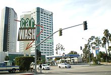
Adjacent Los Angeles River in Sherman Oaks
-
Sunkist Building, Sherman Oaks
-
Westfield Fashion Square in Sherman Oaks
-
Notre Dame High School, Sherman Oaks
-
Bob's Big Boy in Burbank
-
Burbank media district
-
Warner Bros. Studios, Burbank
-
ABC Studios
-
Disney Animation Building, Burbank
-
Los Angeles Equestrian Center
-
Riverside-Zoo Drive Bridge
-
Los Angeles Zoo
-
Autry National Center
-
Griffith Observatory
-
Dodger Stadium
-
Elysian Park, looking south from Riverside Drive
Sport
[
edit
]
The drive hosted part of the
50 km walk athletic event
near Griffith Park for the
1932 Summer Olympics
.
[16]
See also
[
edit
]
References
[
edit
]
|
|---|
| Numbered streets
| |
|---|
| North?south streets
| |
|---|
| East?west streets
| |
|---|
| The Valleys
| |
|---|
Intersections and
traffic circles
| |
|---|
| Diagonal streets
| |
|---|
| Streets in San Pedro
| |
|---|
| Alleyways
| |
|---|
| In popular culture
| |
|---|
All un-suffixed roads are streets unless otherwise noted.
|
|
|---|
Districts and
neighborhoods
| | |
|---|
| Points of interest
| | Bridges
| |
|---|
| Hospitals
| |
|---|
| Museums
| |
|---|
| Parks
| |
|---|
| Religious
| |
|---|
| Residences
| |
|---|
| Restaurants
| |
|---|
| Schools
| |
|---|
| Studios
| |
|---|
| Theaters
| |
|---|
Other
Buildings
| |
|---|
| Other Sites
| |
|---|
|
|---|
| Transportation
| | Freeways
| |
|---|
| Metro
| |
|---|
| Streets
| | East-West
| |
|---|
| North-South
| |
|---|
| Intersections
| |
|---|
|
|---|
| Other
| |
|---|
|
|---|
| Neighboring cities
| |
|---|
|
|
|---|
| 19th century
| | |
|---|
| 20th century
|
- 1900
:
Croix-Catelan Stadium
- 1904
:
Francis Field
- 1908
:
White City Stadium
- 1912
:
Stockholm Olympic Stadium
- 1920
:
Olympisch Stadion
- 1924
:
Stade Yves-du-Manoir
- 1928
:
Olympic Stadium
- 1932
:
Olympic Stadium
,
Riverside Drive at Griffith Park
- 1936
:
Avus Motor Road
,
Olympic Stadium
- 1948
:
Empire Stadium
- 1952
:
Olympic Stadium
- 1956
:
Melbourne Cricket Ground
- 1960
:
Arch of Constantine
,
Raccordo Anulare
,
Stadio Olimpico
,
Via Appia Antica
,
Via Cristoforo Colombo
- 1964
:
Fuchu City
,
Karasuyama-machi
,
National Stadium
,
Sasazuka-machi
,
Shinjuku
- 1968
:
Estadio Olimpico Universitario
,
Zocalo
- 1972
:
Olympiastadion
- 1976
:
Montreal Botanical Garden
,
Olympic Stadium
, Streets of
Montreal
- 1980
:
Grand Arena
, Streets of
Moscow
- 1984
:
Los Angeles Memorial Coliseum
,
Santa Monica College
, Streets of
Los Angeles
, Streets of
Santa Monica
- 1988
:
Seoul Olympic Stadium
, Streets of
Seoul
- 1992
:
Estadi Olimpic de Monjuic
, Marathon course,
Mataro
, Walking course
- 1996
: Marathon course,
Olympic Stadium
, Walking course
|
|---|
| 21st century
|
- 2000
: Marathon course,
North Sydney
,
Olympic Stadium
- 2004
:
Marathon (city)
,
Olympic Stadium
,
Panathenaic Stadium
,
Stadium at Olympia
- 2008
:
Beijing National Stadium
,
Olympic Green Promenade
Walking course, Streets of
Beijing
Marathon course
- 2012
:
Marathon Course
,
Olympic Stadium
- 2016
:
Estadio Olimpico Joao Havelange
,
Pontal
,
Sambodromo
- 2020
:
Japan National Stadium
,
Odori Park
- 2024
:
Stade de France
,
Champs-Elysees
- 2028
:
Los Angeles Memorial Coliseum
,
BMO Stadium
,
Grand Park
- 2032
:
Queensland Sport and Athletics Centre
,
Alexandra Headland
|
|---|
