River in West Yorkshire, England
| Calder
|
|---|
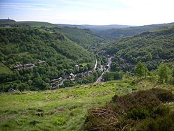 View of the Calder Valley west of Hebden Bridge
|
|
| Country
| England
|
|---|
| Metropolitan County
| West Yorkshire
|
|---|
| Towns/Cities
| Todmorden
,
Hebden Bridge
,
Sowerby Bridge
,
Elland
,
Brighouse
,
Mirfield
,
Dewsbury
,
Wakefield
|
|---|
|
|
| Source
| Heald Moor
|
|---|
| • location
| Todmorden
,
Calderdale
,
West Yorkshire
|
|---|
| • elevation
| 1,312 ft (400 m)
|
|---|
|
|
| Mouth
|
|
|---|
• location
| River Aire
,
Castleford
|
|---|
| Length
| 45 mi (72 km)
|
|---|
The
River Calder
is a river in
West Yorkshire
, in
Northern England
.
The Calder rises on Heald Moor in Lancashire close to the source of
another river with the same name
, and then flows east into West Yorkshire through green countryside, former woollen-mill villages and towns before joining the
River Aire
near
Castleford
.
The river's valley is generally known as the
Calder Valley
. The name
Calderdale
usually refers to the large urban and rural borough (centred on
Halifax
) through which the upper river flows. The lower reaches flow through the boroughs of
Kirklees
(based on Huddersfield) and
Wakefield
. However, the river does not flow through the centres of Halifax and Huddersfield, which are on the Calder's main tributaries,
Hebble Brook
and the
River Colne
respectively. The only large town centres through which the Calder flows are
Brighouse
,
Mirfield
,
Dewsbury
and the city of
Wakefield
.
The river itself is only navigable in short sections, but these sections are connected by artificial "cuts" (e.g. Horbury Cut) to form the
Calder and Hebble Navigation
, a popular leisure waterway which is part of the connected
inland waterway
network of England and Wales.
Etymology
[
edit
]
The word ultimately derives from the
Brythonic language
, with most scholars agreeing that the name is a compound of two elements related to the
Modern Welsh
words
caled
(hard) and
dwr
(water). However, it is still a subject of debate if the hard element refers to the river's bed, or figuratively to the strength of its currents. As such two separate meanings are commonly derived with 'hard (or violent) water',
[1]
or
river of stones
[2]
being commonly given translations.
The name 'Calder' is common in Northern Britain, being found in various places across Lancashire and Yorkshire, as well as
Calderstones
,
Liverpool
,
East Calder
and
West Calder
near
Edinburgh
and
Calderwood
near
Glasgow
, and as the name of the Scottish
Clan Calder
.
[3]
The late survival of Celtic speaking peoples in the vicinity of the river Calder is perhaps evidenced in the names of villages such as
Walsden
, in upper Calderdale, which probably derives from
*Walhaz
Dene, meaning "Valley of the "Welsh" ('Welsh' being what the Anglo-Saxons called the native Celts who would have spoken
Old Welsh
).
[4]
Geography
[
edit
]
The river rises approximately 1,300 feet (400 m) above sea level at Heald Moor,
[5]
north-west of
Todmorden
, and drains an area of 369 square miles (957 km
2
). It flows for a distance of around 45 miles (72 km) through
Cornholme
,
Todmorden
,
Eastwood
,
Hebden Bridge
,
Mytholmroyd
,
Luddendenfoot
,
Sowerby Bridge
,
Copley
,
Elland
,
Brighouse
,
Mirfield
,
Dewsbury
,
Horbury Bridge
and on to Wakefield.
The catchment lies on
Carboniferous
rocks of
Millstone Grit
, and is heavily reservoired, with 39
reservoirs
licensed to provide water. The river is joined by Hebden Water at Hebden Bridge, and by the River Ryburn at Sowerby Bridge; it is linked to the town of
Rochdale
,
Greater Manchester
across the
Pennines
via the
Rochdale Canal
.
For much of its length, the Calder is canalised and becomes the
Calder and Hebble Navigation
. It is also part of the
Aire and Calder Navigation
, and to the east of
Castleford
,
[6]
it merges into the
River Aire
, going on to join the
Humber Estuary
and the
North Sea
.
History
[
edit
]
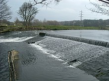 Example of a weir on the river
The river was central to establishment of the textile industries in the local area, and flows through the area known as the Yorkshire
Heavy Woollen District
. Many major mills were constructed along its banks, particularly at
Dewsbury
and
Wakefield
, but also in the smaller communities of
Brighouse
,
Hebden Bridge
,
Sowerby Bridge
and
Todmorden
, as well as along its tributaries: the Hebble at
Halifax
, and the Colne at
Huddersfield
. The mills in the
Upper Calder Valley
specialised in cotton weaving, with some cotton spinning, while those in the lower part of the valley specialised in wool and shoddy. Some of these structures still exist as listed buildings, although the large scale production of
yarn
and
textile
has now ceased.
The river formed an important transportation system for raw materials and the products of the mills, particularly prior to the development of other infrastructures such as
road
and
railway
links to the area. At many places, the river is not navigable because of weirs or the shallow depth, and passage for boats was made by the creation of cuts where boats are able to enter the
Calder and Hebble Navigation
. Work began to make the Calder navigable above Wakefield in 1758.
Wakefield's
medieval
nine-arched bridge is 320 feet (98 m) long, was built in
sandstone
between 1342 and 1356, and replaced an earlier wooden structure on the site of an ancient ford. The
chantry chapel
on the bridge was licensed in 1356. At Wakefield, a variety of former
mill
buildings are currently being redeveloped to create a Waterfront project which will combine residential housing, offices, galleries and public spaces.
The Hepworth Wakefield
opened in 2011.
In the late 1830s and early 1840s, the River Calder was diverted at Kirkthorpe to aid the building of the railway between
Wakefield Kirkgate
and
Normanton
. This also straightened out one of the larger curves in the river and was a cheaper option than building bridges to span the river.
[7]
[8]
[9]
In 2015 a 100 kW hydro installation and fish pass was completed at Whalley Weir on the River Calder in Whalley. The micro hydroelectric generating plant uses a variable speed Archimedean screw.
[10]
[11]
The weir at
Kirkthorpe
was adapted in 2017 to be a hydroelectric generating station, with a capacity of 500 kWh.
[12]
Filming location
[
edit
]
The valley's historic towns and cities have attracted film and television productions. Several films and television series have been filmed in the area, particularly around the town of
Huddersfield
.
[13]
[14]
For example, portions of the BBC television series
Happy Valley
(2014) were filmed in Huddersfield; in addition to exteriors, some of the studio filming was done at North Light Film Studios at Brookes Mill, Huddersfield. As well, interiors for the BBC's
Jamaica Inn
, for the BBC's
Remember Me
and for ITV series
Black Work
, were also filmed at the studios.
[15]
[16]
[17]
[18]
Many of the exteriors of the BBC series
Jericho
(2016) were filmed at the nearby Rockingstone Quarry and some interior work was done at North Light Film Studios.
[19]
The TV series
The Gallows Pole
takes place in Calder Valley in the 1760s, and is partially filmed in
Heptonstall
.
[20]
Environmental
[
edit
]
Wildlife and fish
[
edit
]
Until the 19th century, the Calder was home to large numbers of
salmon
but pollution from the textile and chemical industries along its banks led to the death of the salmon population by the mid 19th century. The last salmon on record was caught at Wakefield in 1850, however there is evidence that they are returning, with sightings on the lower river at Castleford in 2008
[21]
and alleged catchings much further upstream. Around
Huddersfield
,
Mirfield
and
Wakefield
are popular areas for coarse fishing,
roach
,
perch
,
chub
,
dace
,
minnows
,
gudgeon
,
pike
,
bream
and
trout
. The areas upstream of Dewsbury are quickly becoming cleaner and more suited to game and specialised river
cyprinids
like
barbel
, as well as general coarse fish that are also doing well.
Alongside the river are four
Sites of Special Scientific Interest
.
Recent improvements in reducing the amount of pollution have led to the return of native wildlife, such as the
otter
and
kingfisher
to stretches of the river.
Kingfishers are easily spotted (all year round, due to its orange underbelly) all the way up and down the river's course and are quite numerous around the Mirfield area.
Pollution
[
edit
]
The river has been heavily polluted by the textile industry, and, more recently, chemical works along its banks.
Close to its source at Heald Foot, the water is polluted by the remains of past opencast
mining
activities and a landfill site. This has also led to a significant amount of
soil erosion
, with major mudslides into the river and its tributaries in 1947, 1982, 1991 and 2001.
As the river reached Huddersfield, the traditional
textile
industries created a considerable amount of water pollution, particularly through the processes involved in the production of synthetic
dyes
and in scouring the wool clean. The enormous growth of the population over the last hundred years (currently over 800,000 people live within the river's catchment) has caused other problems in relation to
sewage
. Another major source of pollution until recently came from a disused tar distillery in
Mirfield
.
[22]
In the middle 1950s the river was so polluted by dyeworks in the middle reaches between Todmorden and Sowerby Bridge, that it ran different opaque colours from day to day. On Easter Monday, after a long weekend holiday shutdown, the water cleared and the river bottom could actually be seen, looking like a grey wool blanket. Tighter controls during the 1950s led to an improvement in water quality, and presently organisations such as Calder Future are working collaboratively with local industries and
Yorkshire Water
to promote more responsible use of the river and to re-establish lost wildlife along its banks.
Flooding and flood defences
[
edit
]
The river has a history of flooding, mainly due to the high sides of its banks in its earlier stages, which cause rapid runoff of water following heavy rain. Much of the lower part of the river has been
urbanised
, therefore trapping flowing water within the engineered river channels. Fast flows of water cause the deposition of sediment collected from the river banks, raising the river height further.
A variety of flood defences are in operation along the Calder Valley to prevent the recurrence of floods which devastated communities in the early part of this century. At Wakefield, for example, the lake at
Pugneys Country Park
is used as an overflow for the river in order to protect the town.
The recently regenerated Wakefield Waterfront area is defended by one of the most sophisticated flood defence systems in Europe. This complex of computer controlled automatic flood barriers are housed below ground and rise automatically when a flood threat is detected.
Leisure use of the river
[
edit
]
The river is host to a variety of watersports activities:
- a
canoeing
centre at Sowerby Bridge
- waterskiing
in gravel pits at Cromwell Bottom
- watersports and
angling
at Pugneys Country Park
- the use of leisure craft and narrowboats along the lower stretch of the river where navigation is made easier through the canals built during the
Industrial Revolution
- Walking routes along the
Pennine Way
and
Calderdale Way
- Angling in areas is distributed between the following; Bradford No.1 angling association, Mirfield AC, Thornhill AC, and Wakefield AC. Some stretches are free and only require a valid Environment agency rod licence
See also
[
edit
]
References
[
edit
]
- ^
Watts, Victor, ed. (2010). "Calder".
The Cambridge Dictionary of English Place-Names
. Cambridge University Press.
- ^
"Fact File"
. www.kirklees-ednet.org.uk
. Retrieved
23 September
2009
.
- ^
Price, Glanville (2000).
Languages in Britain & Ireland
. Oxford: Blackwell Publishers. p. 74.
ISBN
9780631215806
.
- ^
Watts, Victor, ed. (2010). "Walsden".
The Cambridge Dictionary of English Place-Names
. Cambridge University Press.
- ^
53°43′19″N
2°10′23″W
/
53.722°N 2.173°W
/
53.722; -2.173
- ^
53°43′55″N
1°21′32″W
/
53.732°N 1.359°W
/
53.732; -1.359
- ^
"Stanley History Online - Stanley Ferry History"
.
stanleyhistoryonline.com
. Retrieved
23 July
2019
.
- ^
"Plan of Kirkthorpe dam and cut diversion of the river Calder"
.
discovery.nationalarchives.com
. Retrieved
23 July
2019
.
- ^
Herepath, John (1839). "Reports".
Herepath's Railway and Commercial Journal
.
6
. Charing Cross: James Wyld: 245.
OCLC
221127091
.
- ^
"Whalley Hydro powers up"
.
Premier Construction News
. 13 January 2015
. Retrieved
6 February
2021
.
- ^
"Whalley Community Hydro | Community Renewable Energy Scheme"
. 2 August 2015. Archived from
the original
on 2 August 2015
. Retrieved
6 February
2021
.
- ^
Snowden, Ros (19 July 2019).
"Yorkshire green energy firm snapped up in multi-million pound deal"
.
The Yorkshire Post
. Retrieved
24 July
2019
.
- ^
"Productions at North Light Film Studios"
.
North Light Film Studios
. North Light Film Studios. 2017
. Retrieved
10 February
2017
.
- ^
"Film & TV"
.
Examiner
. Huddersfield. 29 October 2016
. Retrieved
10 February
2017
.
- ^
Ballinger, Lauren (5 December 2014).
"North Light Film Studios - Remember Me filming locations"
.
Examiner
. Huddersfield
. Retrieved
10 February
2017
.
- ^
Rees, Caroline (3 November 2013).
"Sally Wainwright: not the same old"
.
The Guardian
. Retrieved
19 January
2014
.
- ^
Bremner, Jade (11 December 2013).
"Last Tango in Halifax actress Sarah Lancashire begins shooting new crime drama in Yorkshire"
.
Radio Times
. Retrieved
19 January
2014
.
- ^
"Creative England provides filming location and crew support to new BBC drama Happy Valley when filming in Yorkshire"
.
Creative England
. 29 April 2014
. Retrieved
12 June
2014
.
- ^
Gildea, Samantha (1 February 2016).
"Jericho filming locations"
.
Examiner
. Huddersfield
. Retrieved
10 February
2017
.
- ^
Vinter, Robyn (16 June 2023).
"
'Definitely a lot busier': TV show lures visitors to coin gang's Yorkshire home"
.
The Guardian
. Retrieved
9 March
2024
.
- ^
"Return of the Salmon"
. 29 January 2008
. Retrieved
14 August
2010
.
- ^
"A good clean up"
.
EHJ online
. 2 January 2005. Archived from
the original
on 26 May 2005.
Sources
[
edit
]
External links
[
edit
]
Rivers of Yorkshire
|
|---|
| North Yorkshire
| |
|---|
| West Yorkshire
| |
|---|
| East Riding of Yorkshire
| |
|---|
| South Yorkshire
| |
|---|