River in Virginia, United States
| Rappahannock River
|
|---|
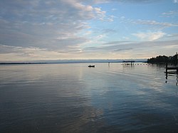 The Rappahannock River at sunset in October 2005
|
 Rappahannock River drainage basin
|
|
| Country
| United States
|
|---|
| State
| Virginia
|
|---|
| Counties
| Lancaster
,
Middlesex
,
Essex
,
Richmond
,
Westmoreland
,
King George
,
Caroline
,
Stafford
,
Spotsylvania
,
Culpeper
,
Fauquier
,
Rappahannock
|
|---|
| City
| Fredericksburg
|
|---|
|
|
| Source
|
|
|---|
| • location
| Chester Gap
|
|---|
| • elevation
| 1,720 feet (520 m)
|
|---|
|
|
| Mouth
|
|
|---|
• location
| Chesapeake Bay
|
|---|
| Length
| 195 miles (314 km)
|
|---|
| Basin size
| 2,848 sq mi (7,380 km
2
)
|
|---|
|
| Discharge
|
|
|---|
| • average
| 1,670 cubic feet per second (47 m
3
/s)
[1]
|
|---|
|
|
The
Rappahannock River
is a river in eastern
Virginia
, in the United States,
[2]
approximately 195 miles (314 km) in length.
[3]
It traverses the entire northern part of the state, from the
Blue Ridge Mountains
in the west where it rises, across the
Piedmont
to the
Fall Line
, and onward through the coastal plain to flow into the
Chesapeake Bay
, south of the
Potomac River
.
An important river in American history, the Rappahannock was long an area of occupation by indigenous peoples. Similarly, during the colonial era, early settlements in the
Virginia Colony
were formed along the river.
During the
American Civil War
, due to the river's acting as a barrier to north?south troop movements, it effectively functioned as the boundary of the eastern theater of the war, between the "North" (the
Union
) and the "South" (the
Confederate States of America
). It was at the center of a major theater of battle where tens of thousands of troops fought against each other. In this period some 10,000 enslaved African Americans escaped to freedom across the river to Union lines, after the first
Battle of Fredericksburg
.
The river drains an area of 2,848 square miles (7,380 km
2
), approximately 6% of Virginia. Much of the watershed is rural and forested. Development in the area has increased since the late 20th century with the southward expansion of the metropolitan
Washington, D.C.
suburbs.
Course
[
edit
]
The Rappahannock River rises at
Chester Gap
, a
wind gap
in the Blue Ridge Mountains a few miles southeast of
Front Royal, Virginia
, near the single point where
Warren
,
Fauquier
, and
Rappahannock
counties come together. It flows southeastward, past
Remington
,
Kelly's Ford
, and
Richardsville
, before it is joined from the right by the
Rapidan River
, its largest
tributary
. The Rappahannock passes through the city of
Fredericksburg
.
Southeast of Fredericksburg, the river begins to slow and widens into a brackish
tidal estuary
approximately 50 miles (80 km) long. It passes two small, important historic, river towns,
Port Royal
and
Port Conway
, which developed opposite each other, the former on the south bank, the latter on the north. The last navigable points for ocean-going ships, they were early ports for the export of tobacco, the major commodity crop.
As it flows past
Tappahannock
on its southern bank, the river is well over a mile wide. The last settlements of any size before it reaches the Chesapeake Bay are
Irvington
,
Urbanna
,
Stingray Point
, and
White Stone Beach
.
The broad river enters the Chesapeake Bay approximately 20 miles (32 km) south of the mouth of the Potomac River and approximately 60 miles (97 km) east of the state capital,
Richmond
. At the point where the river enters the bay, between Windmill Point, on the north, and
Stingray Point
, on the south, it is more than 3.5 miles (5.6 km) wide. This
estuary
, south of the
Northern Neck
peninsula, is a productive
oyster
and
crab
fishery.
Above Fredericksburg, the Rappahannock provides fine opportunities for recreational
canoeing
and
kayaking
. Most of the rapids are Class I and Class II in difficulty, but, near Remington, there are some rapids that are considered to be Class III.
The river's watershed is protected in various places as parcels of the
Rappahannock River Valley National Wildlife Refuge
.
Oysters
[
edit
]
The
oysters
that thrive in the estuary of the Rappahannock River are the least salty oysters of the East Coast. They are renowned for their sweet and smooth flavor, described as almost buttery. The low salinity allows a
Blue Ridge
minerality
[4]
to come through. These oysters are known for being good to consume with wine.
The nutritious oysters were eaten on a large scale in 19th-century Washington. They were served fresh, grilled, stewed, or as part of a pie.
History
[
edit
]
 Fredericksburg, Virginia
, March 1863. View from the north across the Rappahannock River.
Fredericksburg, Virginia
, March 1863. View from the north across the Rappahannock River.
The name of the river comes from an
Algonquian
word,
lappihanne
(also recorded as
toppehannock
), meaning "river of quick, rising water" or "where the tide ebbs and flows," the name used by the local
Rappahannock tribe
. In 2018 it became one of the
federally recognized tribes
in Virginia.
Although a few small hamlets developed along the lower Rappahannock during early colonial times, the settlement of the Rappahannock River valley began in earnest during the first years of the eighteenth century, at the urging of
Governor
Alexander Spotswood
. The
James River
had been surveyed up to its
fall line
, the point where, geologically, continental bedrock of the
Piedmont
meets the
sedimentary rocks
and
alluvial
soils of the coastal plain. It is usually the last navigable portion of a river from the sea.
Spotswood encouraged settlement in a river valley other than that of the James. In 1714, he began recruiting Protestant immigrants from the
Rhineland-Palatinate
and
Switzerland
to homestead on lands he controlled near the confluence of the Rappahannock and the Rapidan. Known as the
Germanna
settlement(s), these villages were founded in order to exploit the
iron ore
deposits of the region.
During the
War of 1812
, the
Battle of Rappahannock River
was fought on the river. Seventeen
British
boats filled with hundreds of marines and sailors captured four American
privateers
.
During the
American Civil War
, the river, with few convenient fords and fewer bridges, provided a barrier and defensive line behind which movements of troops could be accomplished with little fear of attack from the river-side flank. It was an especially difficult barrier for
Union
troops to overcome in their attempts to thrust into southern Virginia, as they were vulnerable to attack while trying to cross the river on temporary bridges. Control of the river changed hands many times during the course of the war. Significant battles fought along the river include the
Battle of Fredericksburg
and two
Battles of Rappahannock Station
. The defensive line at the river was finally circumvented by General
Ulysses S. Grant
in the
Wilderness (or Overland) Campaign
of 1864, ending in the ultimate Union victory.
During and after the first battle at Fredericksburg in late December 1862, about 10,000 enslaved African Americans from area plantations and the city reached for their futures, crossing the river to gain freedom behind Union lines. This exodus and its "Trail of Freedom" was commemorated in 2010 by installation of historical markers on both sides of the river, in Fredericksburg and in Stafford County.
[5]
The exodus to freedom is now celebrated in an annual re-enactment starting in Fredericksburg.
In some 18th- and 19th-century documents, including some Civil War records, the Rappahannock River was referred to as "Hedgeman's River".
[6]
A 1736–1737 survey labeled the Rappahannock above the mouth of the Rapidan as "Cannon", and further upstream it was identified as "Hedgeman's River," named after Nathaniel Hedgeman, an early settler of the region.
[7]
See also
[
edit
]
References
[
edit
]
External links
[
edit
]
37°35′15″N
76°17′21″W
/
37.58750°N 76.28917°W
/
37.58750; -76.28917
|
|---|
| International
| |
|---|
| National
| |
|---|
| Other
| |
|---|