Department of Haiti
Department in Port-au-Prince, Haiti
Ouest
Lwes
|
|---|
|
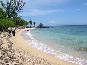 Taino Beach, Grand-Goave
|
 Ouest in Haiti
|
| Country
|  Haiti Haiti
|
|---|
| Capital
| Port-au-Prince
|
|---|
| Region
| South-Central
|
|---|
| Symbole
| Boat, tower, queen bee
|
|---|
|
| ? Type
| Departmental Council
|
|---|
|
| ?
Department
| 4,982.56 km
2
(1,923.78 sq mi)
|
|---|
|
| ?
Department
| 4,029,705
|
|---|
| ? Density
| 810/km
2
(2,100/sq mi)
|
|---|
| ?
Urban
| 3,397,404
|
|---|
| ?
Rural
| 632,301
|
|---|
| Time zone
| UTC-5
(
Eastern
)
|
|---|
| ISO 3166 code
| HT-OU
|
|---|
| HDI
(2021)
| 0.565
[2]
medium
·
1st
|
|---|
Ouest
(
French
) or
Lwes
(
Haitian Creole
; both meaning "West") is one of the ten
departments of Haiti
. It is located in south-central Haiti, linking the Great-North and the
Tiburon Peninsula
.
It is the jurisdictional seat of the national capital, the city of
Port-au-Prince
.
It has an area of 4,982.56 square kilometres (1,923.78 sq mi) and a population of 4,029,705 (2015 estimate), making it both the largest department by area and the most populated department in Haiti.
History
[
edit
]
Taino period
[
edit
]
The department was part of the
Xaragua kasika
under the leadership of Anacaona.
There are many native settlements in the department notably around
Akaya
,
Azuei
Lake,
Yaguana
, the
island of Guanabo
and
Goava
. It is understood that the Azuei Plaine region was used as a hunting ground for the natives.
The island of Gonave is the last point of refuge for the Taino natives.
Spanish period
[
edit
]
One of the only Spanish settlements in the area was a destroyed Spanish town called Santa-Maria-de-la-Paz-Verdadera, the actual city of
Tabarre
.
French period
[
edit
]
The earliest French settlement in the area was a hospital named Morne L'Hopital. In the second half of the 18th century, the French wanted to build a new colonial capital outside the troubled North. One of the suggestions was Petit-Goave but later they chose the region of l'Hopital building which would become the City of
Port-au-Prince
.
English period
[
edit
]
In 1793 the city fell to the British troops where they built the Fort-National until Toussaint gained it back for the French government.
Haitian period
[
edit
]
Haitian Revolution
[
edit
]
Many
maroon
troops controlled the mountain around Port-au-Prince mainly
Romaine-la-Prophetesse
and
Lamour Derance
and Cange.
Around 1772,
Romaine-la-Prophetesse
acquired a plantation named Trou Coffy in the department (likely in what is now
Fondwa
), becoming a prominent coffee grower and trader.
[3]
In 1791 and 1792, during the early
Haitian Revolution
, Romaine led some thirteen thousand slaves and rebels in freeing slaves from and burning the provinces plantations and briefly controlling two major cities,
Leogane
and
Jacmel
.
[4]
[5]
[6]
[7]
Oge and Chavannes organized more than 300 blacks the Suisses to rebel against their so-called master. Caradeux the rough slave master in the region orderer their execution in
Omol
.In 1791, Petion, Pinchinnat, Beauvais, and more rebelled against the French authority and reclaimed their civil rights. After the Battles of Pernier,
Croix-des-Bouquets
, and
Mirebalais
they gained a Concordat, although the slaves did not gain anything.
In Arcahaie, on May 18, 1803, the generals of the North and West and Maroons met for a Congress and chose
Jean-Jacques Dessalines
as commander of the
Armee Indigenes
and chose the
Haiti Flag
designed by
Catherine Flon
.
Independence
[
edit
]
According to
Thomas Madiou
's recount of the Haitian Revolution, the fight for
Port-au-Prince
is one of the most important fights. After Gabart gained control of
St-Marc
, the entire
Artibonite
region was under the control of
Dessalines
and the
Armee Indigene
. In the south, only the major port town of
Les Cayes
was still under French control. In the north,
Cap-Haitian
and
Mole-St-Nicolas
are still under French control.
Rochambeau
anticipated that the next step for
Dessalines
would be the conquer of Port-au-Prince, so he moved the capital of the colony back to
Cap-Francois
which would be harder for the British Navy to put under blockade versus Port-au-Prince located in the
Gulf of Gonave
. Leaving
Petite-Riviere-de-l'Artibonite
on September 15, the general stopped in St-Marc by
Gabart
and was in
Arcahaie
by
Petion
on September 17. The same night for
Croix-des-Bouquets
where he camped by Frere. Petion continued to march toward
P-au-P
and was by habitation Drouillard the next day. The French general of Croix-des-Bouquets Lux left the arrondissement to go help the French troops in P-au-P, he passed by Damien, Sarthe and the convoy was attacked by the Indigenes. By September 23,
Cange
left
Leogane
, marched toward Port-au-Prince, and attacked the Fort-Bizoton in
Carrefour
, Gabart was at the St-Joseph gate and Dessalines camped in Turgeau a neighborhood located east of the city. The city of Port-au-Prince is officially sieged by the Armee Indigenes. The very next day Petion was located in the habitation Philippeaux and started bombarding the French troops. By October 5, an
aide-de-camp
of
Lavalette
brought a letter to Dessalines with the terms of their capitulation. Dessalines accepted with an exchange of prisoners and
adjuvant-general
Bonnet came back to the Haitians and gave the French 4 days to leave the city. Thus on September 9 Port-au-Prince was freed from the French troops and Dessalines enter the city proudly with Petion on his right and Gabart on his left.
Petion
,
Germain Frere
and
Yayou
are signatories of the
Haitian Declaration of Independence
.
Ouest was part of the Second Military Division of the West with Petion as commander.
Petion build the twin forts
Jacques and Alexandre
on the order of Dessalines.
On October 17, 1806, coming from
Dessalinesville
,
Emperor Jacques 1st
was ambushed and assassinated plunging the country into a civil war. His body was buried in St-Anne Cemetery. On January 2, 1904, he received state funerals and later on his body was moved to the Autel de la Patrie in Champs-de-Mars along with
Petion's
body.
On January 1, 1807, only three years after the
Haitian Declaration of Independence
, the northern troops fought the western troops in the Sibert Battle, where Petion almost died.
Cabaret
was the de facto border between the two states.
Under
Jean-Pierre Boyer
, fearing the return of the French boat, he ordered the construction of a city in the heights like Toussaint with
Ennery
, Dessalines with
Dessalines
and Christophe with
Milot
and naming it after his mentor
Petionville
.
Being the political center of the country, most of Haiti's political instability and economical fight happen in the Port-au-Prince area since 1749 until today.
Geography
[
edit
]
The department is bordered to the north by
Artibonite
and
Centre
and the
Mattheux mountain chain
, the west by the Gulf of Gonave, the south by the Sud-Est department and the
La Selle Mountain Chain
, and the
Dominican Republic
to the east through the province of
Independencia
.
It is the second largest department in Haiti after
Artibonite
.
Gonave Island
is also part of the Ouest department. The department's stretch of coastline lies entirely in the
Gulf of Gonave
.
A part majority of the department lies in the
Plaine-de-Cul-de-Sac
which continues to the Dominican Rep. as the
Hayo de Enriquillo
. Two other plains that lie in the region are the Plain of Arcahaie-Cabaret and the
Plain of Leoganes
.
Gulf and coast
[
edit
]
The Golfe is more than 500 km in length from Mole-Saint-Nicolas to Abricots and it consists of more than a dozen bays and harbors.
The Bay of Port-au-Prince is the largest in the country and one of the biggest in the Caribbean harboring many islands, cays, and reefs. The island of Gonave is the largest
satellite island on Hispaniola being the size of
Singapore
.
Environment
[
edit
]
The largest lake in the country is a salty lake in a depression in the plain of the same name, Azuei Lake. A smaller lake lies next to it Caiman Lake. Both lakes form a national park harboring
flamingos
and
caimans
.
The hills of Port-au-Prince consist of a mountain from the
Massif de la Selle
-
Cordillera Meridional
, where one can find multiple forests such as Foret-des-Pins and Parc-la-Visite.
The most important rivers in the department are Blanche River, Froide River, Monance River, and Bois-de-Chene Ravine.
Geology
[
edit
]
The earthquake activities in the area are a result of the
Enriquillo-Plantain-Garden
fault going from
Jamaica
to the
Dominican Rep
passing through the
Xaragua Peninsula
and the
Gonave Microplate
. Two well-documented earthquakes happen in the area.
- 1751 earthquake
- 2010 earthquake
or
Goudougoudou
. The epicenter was in Leoganes affecting
Jacmel
,
Leoganes
, and Port-au-Prince and causing millions in damages and counting hundreds-thousand of casualties.
 Shake map of 2010 Haiti earthquake
On 12 January 2010, a magnitude 7.0 earthquake struck in the department, the largest in Haiti in two centuries.
[8]
In the
Port-au-Prince Arrondissement
, many areas suffered damage.
[9]
In the
Leogane Arrondissement
, the city of
Leogane
suffered 80-90% destruction.
[10]
Other places
[
which?
]
in Leogane were also affected.
Economy
[
edit
]
Ouest is the wealthiest department in Haiti, with economic poles in different sectors.
Tourism
[
edit
]
Ouest's tourism sector touches on different branches such as leisure tourism in the Cotes-des-Arcadins,
eco-tourism
with Park Azuei-Caiman and Park La Selle, historical tourism with the countless historical monuments especially the
National Museum
, and cultural tourism.
Agriculture
[
edit
]
For many years, agriculture was a part of the economy of the department, with the Arcahaie plain being a center for
plantain
, the Cul-de-Sac and Leogane being known for large
sugar-cane
plantations mostly for the production of
rum
, and the hills of
Kenscoff
cultivating different vegetables. Unfortunately, over-construction and the ever-expansion of the city, those areas see their fertile land now covered with asphalt and concrete.
[11]
Transport
[
edit
]
Much of Haiti's road network extends out of Ouest.
- The RN1 connects the West to the North by the coast
- The RN2 connects the West to the South
- The RN3 connects the West to the North through the mountains
- The RN4 connects the West to the South-East
- The RN8 connects the West to the
Jimani
, in the Dominican Rep.
The bay harbors many ports of sizable capacity owned or operated by the state or private parties.
Haiti's largest airport, the
Toussaint Louverture Airport
, is located in
Delmas
.
Administrative divisions
[
edit
]
The Department of Ouest is subdivided into five
arrondissements
, which are further subdivided into twenty
communes
.
 Haitian-Dominican border in Grand-Bois, Cornillon, Haiti, June 2017
(with 2009 Population Estimates in parentheses)
[12]
References
[
edit
]
- ^
"Population Totale, De 18 ANS ET Plus"
(PDF)
. Ministere De Le E'Conomie Et Des Finances (MEF)
. Retrieved
19 August
2018
.
- ^
"Sub-national HDI - Area Database - Global Data Lab"
.
hdi.globaldatalab.org
. Retrieved
2018-09-13
.
- ^
Rey 2017
, pp. 28, 47, 49
harvnb error: no target: CITEREFRey2017 (
help
)
- ^
Terry Rey (2017).
The Priest and the Prophetess: Abbe Ouviere, Romaine Riviere, and the Revolutionary Atlantic World
. pp. 28, 32?35, 48?49, 52.
- ^
Matthias Middell; Megan Maruschke (2019).
The French Revolution as a Moment of Respatialization
. p. 71.
- ^
James Alexander Dun (2016).
Dangerous Neighbors: Making the Haitian Revolution
. p. 65.
- ^
David F. Marley (2008).
Wars of the Americas: A Chronology of Armed Conflict
. p. 534.
- ^
CNN News Morning
. 13 January 2010.
- ^
"The Situation Room".
CNN
. 15 January 2010.
- ^
Lisa Millar (17 January 2010).
"Haiti Disaster Like "No Other"
"
.
ABC News
. AFP
. Retrieved
17 January
2010
.
- ^
"Mapping Inequality in the Caribbean"
. December 4, 2010.
- ^
"IHSI"
(PDF)
.
Institut Haitien de Statistique et d'Informatique
. Retrieved
2 September
2014
.