From Wikipedia, the free encyclopedia
River in Cameroon
Nyong river
Yong
|
|---|
 Nyong River
|
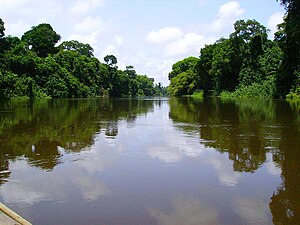
 The Nyong River in Cameroon
|
|
| Country
| Cameroon
|
|---|
| Regions
| Littoral Region
,
East Region
,
South Region
,
Centre Region
Centre Region
|
|---|
| Cities
| Abong-Mbang
,
Mbalmayo
|
|---|
|
|
| Source
|
|
|---|
| • location
| Near Abong-Mbang
|
|---|
| • coordinates
| 3°52′00″N
13°28′00″E
/
3.86667°N 13.46667°E
/
3.86667; 13.46667
|
|---|
| • elevation
| 690 m (2,260 ft)
|
|---|
|
|
| Mouth
| Bight of Biafra
|
|---|
• coordinates
| 3°15′39″N
9°54′16″E
/
3.26083°N 9.90444°E
/
3.26083; 9.90444
|
|---|
• elevation
| 0 m
|
|---|
| Length
| 690 km (430 mi)
|
|---|
| Basin size
| 27,800 km
2
(10,734 sq mi)
[1]
|
|---|
|
| Discharge
|
|
|---|
| • location
| Dehane
|
|---|
| • average
| 446 m
3
/s (15,800 cu ft/s)
|
|---|
| • minimum
| 40 m
3
/s (1,400 cu ft/s)
|
|---|
| • maximum
| 1,226 m
3
/s (43,300 cu ft/s)
|
|---|
|
|
|
| River system
| Nyong River
|
|---|
| Population
| 1,179,200
|
|---|
| Tributaries
|
|
|---|
| • left
| Long Mafok, Soo, Soumou, Kama
[1]
|
|---|
| • right
| Kom, Mfoumou, Afamba, Ato, Mefou, Akono, Liyeke, Kelle
[1]
|
|---|
| Waterfalls
| Trappenbeck Rapids
|
|---|
The
Nyong
(formerly
German
:
Yong
) is a river in
Cameroon
. The river flows approximately 690 kilometres (430 mi) to empty into the
Gulf of Guinea
.
Course
[
edit
]
The Nyong originates 40 km (25 mi) east of the town of
Abong-Mbang
, where the northern rain forest feeds it.
[2]
The river's length is almost parallel to the lower reaches of the
Sanaga River
. Its mouth is in Petit Batanga, 60 km (40 mi) south-southwest of
Edea
.
[3]
In two places,
Mbalmayo
and Dehane, the river has huge rapids. The first 400 km (250 mi) of the river, between Abong-Mbang and Mbalmayo, are navigable for small boats from April to November.
 Slope of Nyong River
Hydrology
[
edit
]
The flow of the river as measured at Dehane in m³/s:
[1]
Transport
[
edit
]
The town of
Mbalmayo
, which has a
railhead
, lies on the north bank of this river.
[2]
The towns of
Akonolinga
and Abong-Mbang also lie on it.
References
[
edit
]
