Geological formation in the United States
 Monument Rocks, Smoky Hill Chalk
[
clarification needed
]
Monument Rocks, Smoky Hill Chalk
[
clarification needed
]
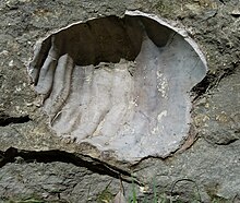 Cremnoceramus deformis
is an index fossil of the Fort Hays Limestone Member.
Cremnoceramus deformis
is an index fossil of the Fort Hays Limestone Member.
 Niobrara Chalk was weathered and opalized in the
Valentine phase
of the
Ogallala Formation
.
Niobrara Chalk was weathered and opalized in the
Valentine phase
of the
Ogallala Formation
.
The
Niobrara Formation
, also called the
Niobrara Chalk
, is a
geologic formation
in North America that was deposited between 87 and 82 million years ago during the
Coniacian
,
Santonian
, and
Campanian
stages of the
Late Cretaceous
. It is composed of two structural units, the
Smoky Hill Chalk Member
overlying the
Fort Hays Limestone Member
. The chalk formed from the accumulation of
coccoliths
from microorganisms living in what was once the
Western Interior Seaway
, an inland sea that divided the continent of North America during much of the
Cretaceous
. It underlies much of the Great Plains of the US and Canada. Evidence of vertebrate life is common throughout the formation and includes specimens of
plesiosaurs
,
mosasaurs
,
pterosaurs
, and several primitive aquatic
birds
. The
type locality
for the Niobrara Chalk is the
Niobrara River
in
Knox County
in northeastern
Nebraska
. The formation gives its name to the
Niobrara cycle
of the Western Interior Seaway.
History of exploration
[
edit
]
The Niobrara Chalk was recorded in 1857 and named in 1862 by
Meek, F.B.
, and
Hayden, F.V.
[1]
It was first studied during an expedition led by
Othniel Charles Marsh
of
Yale University
in 1870. This and following expeditions to the area in 1871 and 1872 yielded the first of many fossil vertebrate remains commonly attributed with the formation. Excavations continued through the following years up to 1879 under the direction of professional fossil collectors such as
B. F. Mudge
and
S. W. Williston
appointed by Marsh.
The Niobrara Chalk has been continuously explored ever since, with specimens being found by H. T. Martin of the
University of Kansas
and
George F. Sternberg
, the son of the famous fossil collector
Charles H. Sternberg
. Much of the best material from the formation is on display at the
Sternberg Museum of Natural History
in
Hays
,
Kansas
.
Stratigraphy
[
edit
]
The Smoky Hill Chalk Member of the Niobrara Chalk contains the majority of the fossils found in the formation, and is subdivided into 23 marker beds. Most vertebrates are present from the upper half of the member. Most of the vertebrate remains were collected and described before the
stratigraphy
of the Niobrara Chalk was fully understood. Specimens were described as being from layers referred to as being either of gray-blue
shale
or yellow
chalk
. This dichotomy is not indicative of different stratigraphic units as was previously thought, but rather is seen as a weathering phenomenon that can be found at varying points in the same outcrop.
[2]
The Fort Hays Limestone Member consists of somewhat harder, massive limestone beds.
[3]
The Niobrara Formation is overlain by the marine
Pierre Shale
and is underlain by the
Carlile Shale
or
Benton Shale
.
Flora and fauna
[
edit
]
During the time of the deposition of the Niobrara Chalk, much life inhabited the seas of the Western Interior Seaway. By this time in the Late Cretaceous many new lifeforms appeared such as mosasaurs, which were to be some of the last of the aquatic lifeforms to evolve before the end of the
Mesozoic
. Life of the Niobrara Chalk is comparable to that of the
Dakota Formation
, although the Dakota Formation, which was deposited during the
Cenomanian
, predates the chalk by about 10 million years.
Mineral resources
[
edit
]
Various exposures of Niobrara Chalk were covered and partially silicified as the Ogallala sediments covered the
Neogene
plains. Re-exposed during the
Quaternary
,
[4]
these cherty materials, known as
Smoky Hill Jasper
and
Smoky Hill silicified chalk
, or more recently as
Niobrara Jasper
or
Niobrarite
, became source material for stone tools from the earliest human habitation of the High Plains.
[5]
[6]
In some regions, the Niobrara is a commercial hydrocarbon reservoir.
Natural gas
is produced from the Niobrara in the eastern
Denver Basin
. Oil is produced from the Niobrara in the
North Park Basin
, and new fracturing methods are allowing much larger areas to be tapped for oil.
[7]
The Fort Hays member was historically quarried on the
High Plains
for the manufacture of
Portland cement
at
Superior, Nebraska
, and
Yocemento, Kansas
, as well as along the
Dakota Hogback
in Colorado from
Lyons
to
Boulder
, and around
Pueblo
and
Florence
.
[8]
Along the Dakota Hogback north of
Laporte, Colorado
, the Fort Hays Limestone formed a secondary hogback, which was extensively quarried for manufacture of up to 450,000 tons of cement a year.
[9]
The full depth of the Niobrara was quarried by the
Western Portland Cement Company
at
Yankton, South Dakota
, which supplied cement to the Panama Canal project.
[10]
References
[
edit
]
- ^
a
b
"Geologic Unit: Niobrara"
.
National Geologic Database
. Geolex ? Significant Publications. United States Geological Survey
. Retrieved
June 5,
2020
.
- ^
Williston, S. W., 1897, The Kansas Niobrara Cretaceous: The University Geological Survey of Kansas, v. 2, p. 237?246.
- ^
Howard E. Simpson.
"Geology of the Yankton Area South Dakota and Nebraska"
(PDF)
.
Geological Survey Professional Paper
. U.S. Department of the Interior.
- ^
Alvin R. Leonard; Delmar W. Berry (1961).
Geology and Ground-water Resources of Southern Ellis County and Parts of Trego and Rush Counties, Kansas, Bulletin 149
. University of Kansas Publications, State Geological Survey of Kansas. p. Geomorphology / Stream Development.
At the close of Pliocene time, the area from the Rocky Mountains to the
Flint Hills
was a nearly featureless aggradational plain crossed by streams flowing toward the east. During the formation of this [Ogallala] plain in central Kansas the Cretaceous [Niobrara] rocks were buried under a mantle of debris, ...
- ^
"Smoky Hill Jasper"
.
Kansas Memory
. Kansas Historical Society.
- ^
Carl M. Wright (1985).
"Complex Aspects of the "Smoky Hill Jasper", Now Known as Niobrarite"
.
Missing Journal Name Rmks0301: Cnpo
.
5
(3): 87?90.
- ^
Google article
- ^
Kansas Geological Survey:
Fort Hays Chalk
, accessed January 20, 2009.
- ^
AggregateResearch.com:
Cement plant closure opens door to uncertain future
, accessed July 4, 2016.
- ^
Kathy K. Grow; Lois H. Varvel (2004).
Yankton, South Dakota in Vintage Postcards
. Arcadia. p. 24.
ISBN
978-0-7385-3233-2
. Retrieved
August 3,
2018
.
Further reading
[
edit
]
|
|---|
Cenozoic chronostratigraphy of Colorado
|
|---|
| Ph
| |
|---|
|
Mesozoic chronostratigraphy of Colorado
|
|---|
| Ph
| |
|---|
|
Paleozoic chronostratigraphy of Colorado
|
|---|
| Ph
| |
|---|
|
Precambrian chronostratigraphy of Colorado
|
|---|
| p?
| |
|---|
|