From Wikipedia, the free encyclopedia
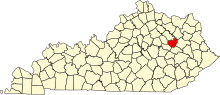 Location of Menifee County in Kentucky
This is a list of the
National Register of Historic Places listings in Menifee County, Kentucky
.
It is intended to be a complete list of the properties on the
National Register of Historic Places
in
Menifee County
,
Kentucky
,
United States
. The locations of National Register properties for which the latitude and longitude coordinates are included below, may be seen in a map.
[1]
There are 6 properties listed on the National Register in the county.
This
National Park Service
list is complete through
NPS recent listings
posted June 14, 2024.
[2]
Contents:
Counties in Kentucky
Current listings
[
edit
]
| [3]
|
Name on the Register
|
Image
|
Date listed
[4]
|
Location
| City or town
|
Description
|
| 1
|
Archeological Site 15MF355
|
Upload image
|
July 11, 1985
(
#85001505
)
|
Address Restricted
| Frenchburg
|
|
| 2
|
Frenchburg School Campus
|
 Frenchburg School Campus Frenchburg School Campus
|
December 22, 1978
(
#78001387
)
|
U.S. Route 460
37°57′07″N
83°37′46″W
/
37.951944°N 83.629444°W
/
37.951944; -83.629444
(
Frenchburg School Campus
)
| Frenchburg
|
|
| 3
|
Red River Gorge District
|
Upload image
|
September 12, 2003
(
#03000919
)
|
Includes the confluence of Gladie Creek with the Red River
[5]
37°50′12″N
83°36′44″W
/
37.836667°N 83.612222°W
/
37.836667; -83.612222
(
Red River Gorge District
)
| Daniel Boone National Forest
|
A large area in the national forest with extensive archaeological resources, having 442
contributing sites
including numerous
rock shelters
. Extends also into
Powell County
and
Wolfe County
.
[6]
|
| 4
|
Skidmore Petroglyphs
|
Upload image
|
January 2, 1992
(
#91001887
)
|
Address Restricted
| Fagan
|
|
| 5
|
Spratt's Petroglyphs (15MF353)
|
Upload image
|
September 8, 1989
(
#89001197
)
|
Address Restricted
| Frenchburg
|
|
| 6
|
W.S. Webb Memorial Rock Shelter
|
Upload image
|
January 9, 1979
(
#79001022
)
|
Address Restricted
| Frenchburg
|
Site of a hunting camp, where objects such as triangular arrowheads, ceramic jars, cornhusks, corn kernels, cut cane, and cordage were left by ancient peoples. Included in
Red River Gorge District
.
[7]
|
See also
[
edit
]
References
[
edit
]
- ^
The latitude and longitude information provided in this table was derived originally from the National Register Information System, which has been found to be fairly accurate for about 99% of listings. Some locations in this table may have been corrected to current GPS standards.
- ^
National Park Service,
United States Department of the Interior
,
"National Register of Historic Places: Weekly List Actions"
, retrieved June 14, 2024.
- ^
Numbers represent an alphabetical ordering by significant words. Various colorings, defined
here
, differentiate
National Historic Landmarks
and
historic districts
from other NRHP buildings, structures, sites or objects.
- ^
The eight-digit number below each date is the number assigned to each location in the
National Register Information System
database, which can be viewed by clicking the number.
- ^
Wyss, James D., and Sandra K. Wyss.
An Archaeological Assessment of Portions of the Red River Gorge, Daniel Boone National Forest, Kentucky
.
Lexington
: Ohio Valley Archaeological Research Associates, 1977, 233.
- ^
Memorandum of Agreement Among the U.S. Department of Agriculture, Forest Service, the Kentucky Heritage Council, and the Advisory Council on Historic Preservation Concerning the Management of Heritage Resources and the Limits of Acceptable Change Study of the Red River Gorge National Register District on the Daniel Boone National Forest
(PDF)
. 2005
. Retrieved
July 14,
2022
.
- ^
Living Archaeology Weekend Steering Committee (2008).
Living in the Red River Gorge: An Archaeological Study
(PDF)
. Retrieved
July 14,
2022
.
|
|---|
| Topics
| |
|---|
| Lists by state
| |
|---|
| Lists by insular areas
| |
|---|
| Lists by associated state
| |
|---|
| Other areas
| |
|---|
| Related
| |
|---|
|
