| [3]
|
Name on the Register
|
Image
|
Date listed
[4]
|
Location
| City or town
|
Description
|
| 1
|
Butler County Courthouse
|
 Butler County Courthouse Butler County Courthouse
|
December 1, 1994
(
#94001400
)
|
Public Sq.
36°45′23″N
90°23′32″W
/
36.756389°N 90.392222°W
/
36.756389; -90.392222
(
Butler County Courthouse
)
| Poplar Bluff
|
|
| 2
|
Cynthia-Kinzer Historic District
|
Upload image
|
July 21, 2015
(
#15000441
)
|
900-1000 blocks of Cynthia & Kinzer, 918-924 Maud & 838-842 Kinzer Sts.
36°45′40″N
90°24′16″W
/
36.7612°N 90.4044°W
/
36.7612; -90.4044
(
Cynthia-Kinzer Historic District
)
| Poplar Bluff
|
|
| 3
|
Garfield Historic District
|
 Garfield Historic District Garfield Historic District
|
October 2, 2017
(
#100001686
)
|
914-916, 915, 921 Garfield St.
36°45′53″N
90°23′50″W
/
36.764860°N 90.397183°W
/
36.764860; -90.397183
(
Garfield Historic District
)
| Poplar Bluff
|
Includes historic Negro school, a church, and a grocery store/house
|
| 4
|
Alfred W. Greer House
|
 Alfred W. Greer House Alfred W. Greer House
|
February 12, 1998
(
#98000029
)
|
955 Kinzer St.
36°45′39″N
90°24′10″W
/
36.760833°N 90.402778°W
/
36.760833; -90.402778
(
Alfred W. Greer House
)
| Poplar Bluff
|
|
| 5
|
Hargrove Pivot Bridge
|
 Hargrove Pivot Bridge Hargrove Pivot Bridge
|
October 15, 1985
(
#85003234
)
|
Carries CR 159 over the Black River
36°38′50″N
90°18′00″W
/
36.647222°N 90.3°W
/
36.647222; -90.3
(
Hargrove Pivot Bridge
)
| Poplar Bluff
|
|
| 6
|
Koehler Fortified Archeological Site
|
Upload image
|
December 18, 1970
(
#70000323
)
|
Southeastern quarter of Section 36, Township 23 North, Range 4 East
[5]
36°35′39″N
90°34′48″W
/
36.594167°N 90.580000°W
/
36.594167; -90.580000
(
Koehler Fortified Archeological Site
)
| Naylor
|
Also known as Powers Fort;
[6]
a cultural center during
Mississippian
times
[5]
|
| 7
|
Little Black River Archeological District
|
Upload image
|
April 21, 1975
(
#75001064
)
|
Sharecropper, Harris, and Mackintosh Ridges
[5]
36°33′20″N
90°32′40″W
/
36.555556°N 90.544444°W
/
36.555556; -90.544444
(
Little Black River Archeological District
)
| Naylor
|
Hundreds of
Mississippian
archaeological sites, many of them small
[5]
|
| 8
|
Mark Twain School
|
 Mark Twain School Mark Twain School
|
February 5, 1998
(
#98000031
)
|
1012 N. Main St.
36°45′58″N
90°24′04″W
/
36.766111°N 90.401111°W
/
36.766111; -90.401111
(
Mark Twain School
)
| Poplar Bluff
|
|
| 9
|
J. Herbert Moore House
|
 J. Herbert Moore House J. Herbert Moore House
|
February 12, 1998
(
#98000032
)
|
445 N. Eleventh St.
36°45′40″N
90°22′20″W
/
36.761111°N 90.372222°W
/
36.761111; -90.372222
(
J. Herbert Moore House
)
| Poplar Bluff
|
|
| 10
|
Thomas Moore House
|
 Thomas Moore House Thomas Moore House
|
February 12, 1998
(
#98000033
)
|
435 Lester St.
36°45′35″N
90°23′39″W
/
36.759722°N 90.394167°W
/
36.759722; -90.394167
(
Thomas Moore House
)
| Poplar Bluff
|
|
| 11
|
Moore-Dalton House
|
 Moore-Dalton House Moore-Dalton House
|
December 1, 1994
(
#94001398
)
|
421 N. Main St.
36°45′35″N
90°23′38″W
/
36.759722°N 90.393889°W
/
36.759722; -90.393889
(
Moore-Dalton House
)
| Poplar Bluff
|
|
| 12
|
North Main Street Historic District
|
 North Main Street Historic District North Main Street Historic District
|
July 14, 2011
(
#11000440
)
|
400 block of N. Main St.
36°45′38″N
90°23′40″W
/
36.760556°N 90.394444°W
/
36.760556; -90.394444
(
North Main Street Historic District
)
| Poplar Bluff
|
|
| 13
|
John Archibald Phillips House
|
 John Archibald Phillips House John Archibald Phillips House
|
February 12, 1998
(
#98000034
)
|
522 Cherry St.
36°45′14″N
90°23′50″W
/
36.753889°N 90.397222°W
/
36.753889; -90.397222
(
John Archibald Phillips House
)
| Poplar Bluff
|
|
| 14
|
Poplar Bluff Commercial Historic District
|
Upload image
|
December 1, 1994
(
#94001401
)
|
Roughly, S. Broadway from Cedar St. to Vine St. and Vine from Fifth St. to S. Broadway
36°45′21″N
90°23′40″W
/
36.755833°N 90.394444°W
/
36.755833; -90.394444
(
Poplar Bluff Commercial Historic District
)
| Poplar Bluff
|
|
| 15
|
Poplar Bluff Public Library
|
 Poplar Bluff Public Library Poplar Bluff Public Library
|
December 1, 1994
(
#94001399
)
|
318 N. Main St.
36°45′29″N
90°23′32″W
/
36.758056°N 90.392222°W
/
36.758056; -90.392222
(
Poplar Bluff Public Library
)
| Poplar Bluff
|
|
| 16
|
Rodgers Theatre Building
|
 Rodgers Theatre Building Rodgers Theatre Building
|
July 19, 2001
(
#01000750
)
|
204, 214, 216, 218, 220, 222 and 224 N. Broadway
36°45′26″N
90°23′36″W
/
36.757222°N 90.393333°W
/
36.757222; -90.393333
(
Rodgers Theatre Building
)
| Poplar Bluff
|
|
| 17
|
South Sixth Street Historic District
|
Upload image
|
February 12, 1998
(
#98000035
)
|
205-225-303 S. Sixth St.
36°45′21″N
90°23′50″W
/
36.755833°N 90.397222°W
/
36.755833; -90.397222
(
South Sixth Street Historic District
)
| Poplar Bluff
|
|
| 18
|
St. Louis, Iron Mountain and Southern Railroad Depot
|
 St. Louis, Iron Mountain and Southern Railroad Depot St. Louis, Iron Mountain and Southern Railroad Depot
|
December 1, 1994
(
#94001397
)
|
400 S. Main St.
36°45′13″N
90°23′36″W
/
36.753611°N 90.393333°W
/
36.753611; -90.393333
(
St. Louis, Iron Mountain and Southern Railroad Depot
)
| Poplar Bluff
|
|
| 19
|
St. Louis-San Francisco Railroad Depot
|
 St. Louis-San Francisco Railroad Depot St. Louis-San Francisco Railroad Depot
|
December 1, 1994
(
#94001396
)
|
303 Moran St.
36°45′15″N
90°23′43″W
/
36.754167°N 90.395278°W
/
36.754167; -90.395278
(
St. Louis-San Francisco Railroad Depot
)
| Poplar Bluff
|
|
| 20
|
Wheatley Public School
|
 Wheatley Public School Wheatley Public School
|
February 13, 1998
(
#98000037
)
|
921 Garfield St.
36°45′53″N
90°23′49″W
/
36.764722°N 90.396944°W
/
36.764722; -90.396944
(
Wheatley Public School
)
| Poplar Bluff
|
Historic school for Negro children during
Jim Crow
era
|
| 21
|
Wilborn-Steinberg Site
|
Upload image
|
November 9, 1972
(
#72000706
)
|
Northwestern quarter of the southeastern quarter of Section 9, Township 22 North, Range 5 East
[5]
36°34′03″N
90°31′42″W
/
36.567500°N 90.528333°W
/
36.567500; -90.528333
(
Wilborn-Steinberg Site
)
| Neelyville
|
|
| 22
|
Williams-Gierth House
|
 Williams-Gierth House Williams-Gierth House
|
November 6, 2012
(
#12000909
)
|
848 Vine St.
36°45′27″N
90°24′04″W
/
36.757487°N 90.401151°W
/
36.757487; -90.401151
(
Williams-Gierth House
)
| Poplar Bluff
|
|
| 23
|
Williamson-Kennedy School
|
 Williamson-Kennedy School Williamson-Kennedy School
|
February 12, 1998
(
#98000036
)
|
614 Lindsay St.
36°45′38″N
90°23′30″W
/
36.760556°N 90.391667°W
/
36.760556; -90.391667
(
Williamson-Kennedy School
)
| Poplar Bluff
|
|
| 24
|
Wright-Dalton-Bell-Anchor Department Store Building
|
 Wright-Dalton-Bell-Anchor Department Store Building Wright-Dalton-Bell-Anchor Department Store Building
|
April 12, 2006
(
#06000247
)
|
201-205 S. Main
36°45′19″N
90°23′36″W
/
36.755278°N 90.393333°W
/
36.755278; -90.393333
(
Wright-Dalton-Bell-Anchor Department Store Building
)
| Poplar Bluff
|
|
| 25
|
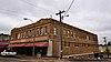
Zehe Building
|
 Zehe Building Zehe Building
|
December 1, 1994
(
#94001402
)
|
203 Poplar St.
36°45′20″N
90°23′32″W
/
36.755556°N 90.392222°W
/
36.755556; -90.392222
(
Zehe Building
)
| Poplar Bluff
|
|