Island and region of Japan
This article is about the location in Japan. For the Chinese place with the cognate name
Jiuzhou
, see
Nine Provinces
.
Ky?sh?
(
九州
,
Ky?sh?
,
pronounced
[k???ː??ː]
ⓘ
,
lit.
'Nine
Provinces
')
is the third-largest island of
Japan
's
four main islands
and the most southerly of the four largest islands (
i.e.
excluding
Okinawa
).
[3]
[4]
In the past, it has been known as
Ky?koku
(
九?
, "Nine Countries")
,
Chinzei
(
?西
, "West of the Pacified Area")
and
Tsukushi-no-shima
(
筑紫島
, "Island of Tsukushi")
. The historical regional name
Saikaid?
(
西海道
,
lit.
West Sea
Circuit
)
referred to Kyushu and its surrounding islands. Kyushu has a land area of 36,782 square kilometres (14,202 sq mi) and a population of 14,311,224 in 2018.
[5]
In the 8th-century
Taih? Code
reforms,
Dazaifu
was established as a special administrative term for the region.
[6]
Geography
[
edit
]
 Kyushu from the
International Space Station
Kyushu from the
International Space Station
 Geofeatures map of Kyushu
The island is mountainous, and Japan's most active volcano,
Mount Aso
at 1,591 metres (5,220 ft), is on Kyushu. There are many other signs of tectonic activity, including numerous areas of
hot springs
. The most famous of these are in
Beppu
, on the east shore, and around Mt. Aso in central Kyushu. The island is separated from
Honshu
by the
Kanmon Straits
. Being the nearest island to the
Asian continent
,
[7]
historically it is the gateway to Japan.
[8]
The total area is 36,782.37 km
2
(14,201.75 sq mi) which makes it the 37th
largest island
in the world.
[1]
It's slightly larger than
Taiwan
island 35,808 km
2
(13,826 sq mi).
[5]
The highest elevation is 1791 meters (5876 feet) on
Mount Kuj?
.
[9]
The name
Ky?sh?
comes from the nine ancient provinces of
Saikaid?
situated on the island:
Chikuzen
,
Chikugo
,
Hizen
,
Higo
,
Buzen
,
Bungo
,
Hy?ga
,
Osumi
, and
Satsuma
.
[10]
Today's Kyushu Region
(
九州地方
,
Ky?sh?-chih?
)
is a politically defined region that consists of the seven
prefectures
on the island of Kyushu (which also includes the former
Tsushima
and
Iki
as part of Nagasaki), plus
Okinawa Prefecture
to the south:
Population
[
edit
]
Kyushu has 10.3
percent of the population of Japan.
[11]
Most of Kyushu's population is concentrated along the northwest, in the cities of
Fukuoka
and
Kitakyushu
, with population corridors stretching southwest into
Sasebo
and
Nagasaki
and south into
Kumamoto
and
Kagoshima
. Except for
Oita
and
Miyazaki
, the eastern seaboard shows a general
decline in population
.
Politically, Kyushu is described as a stronghold of the
Liberal Democratic Party
.
[12]
Per Japanese census data,
[13]
[14]
the Kyushu region's population with
Ryukyu Islands
(
Okinawa
and
Kagoshima
Prefectures) has experienced a large population decline since around 2000. However, the population decline in total is mild because of the relatively high birth rate of
Ryukyuans
both within the Ryukyuan lands (
Okinawa
and
Kagoshima
) and throughout the Kyushu region. In addition, the other prefectures in Kyushu also have exceptionally high
TFRs
compared to the rest of Japan.
[15]
[16]
The Ryukyuans are an
indigenous
minority group in Japan.
Historical populations
Including
Ryukyu Islands
Historical population
| Year
| Pop.
| ±%
|
|---|
| 1873
| 5,163,730
| ?
|
|---|
| 1920
| 8,730,000
| +69.1%
|
|---|
| 1930
| 9,647,000
| +10.5%
|
|---|
| 1940
| 10,511,000
| +9.0%
|
|---|
| 1950
| 13,011,000
| +23.8%
|
|---|
| 1960
| 13,787,000
| +6.0%
|
|---|
| 1970
| 13,016,000
| ?5.6%
|
|---|
| 1980
| 14,073,000
| +8.1%
|
|---|
| 1990
| 14,518,000
| +3.2%
|
|---|
| 2000
| 14,763,781
| +1.7%
|
|---|
| 2010
| 14,596,783
| ?1.1%
|
|---|
| 2018
| 14,311,224
| ?2.0%
|
|---|
| Includes Okinawa and Kagoshima prefecture populations.
|
|
Excluding Ryukyu Islands
Historical population
| Year
| Pop.
| ±%
|
|---|
| 1873
| 4,776,363
| ?
|
|---|
| 1920
| 6,742,000
| +41.2%
|
|---|
| 1930
| 7,512,000
| +11.4%
|
|---|
| 1940
| 8,347,000
| +11.1%
|
|---|
| 1950
| 10,292,000
| +23.3%
|
|---|
| 1960
| 10,941,000
| +6.3%
|
|---|
| 1970
| 10,342,000
| ?5.5%
|
|---|
| 1980
| 11,181,000
| +8.1%
|
|---|
| 1990
| 11,498,000
| +2.8%
|
|---|
| 2000
| 11,659,367
| +1.4%
|
|---|
| 2010
| 11,497,723
| ?1.4%
|
|---|
| 2018
| 11,249,154
| ?2.2%
|
|---|
| In 1873,
?sumi Province
represents portion of Kagoshima with Ryukyu islands
|
|
Designated cities
[
edit
]
Core cities
[
edit
]
Environment and agriculture
[
edit
]
Parts of Kyushu have a
subtropical climate
, particularly
Miyazaki Prefecture
and
Kagoshima Prefecture
. Major agricultural products are
rice
,
tea
,
tobacco
,
sweet potatoes
, and
soy
; also,
silk
is widely produced.
Besides the
volcanic
area of the south, there are significant mud
hot springs
in the northern part of the island, around
Beppu
. The springs are the site of occurrence of certain
extremophile
microorganisms
, which are capable of surviving in extremely hot environments.
[17]
There are two World Natural Heritage sites in Kyushu:
Yakushima
(registered in 1993) and
Amami-?shima Island, Tokunoshima Island, northern part of Okinawa Island, and Iriomote Island
(registered in 2021).
[18]
Economy
[
edit
]
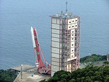 M-V rocket launch rehearsal at USC
Kyushu's economy accounts for about 10% of Japan's total, and with a GDP equivalent to that of Iran, the 26th largest country in the world, it is the fourth largest economic zone after the three major metropolitan areas of
Tokyo
,
Osaka
, and
Nagoya
.
[19]
Kyushu's economy has a well-balanced industrial structure, ranging from primary industries such as agriculture, to secondary industries such as manufacturing, and tertiary industries such as retail, services, and tourism. Agricultural output in the region amounts to 1.8 trillion yen (20% share of the national total), and the region is a major domestic production center for the
automobile
and
semiconductor
industries. Kyushu also has a thriving healthcare industry, including medical and nursing care, and numerous research and manufacturing facilities in the fields of
hydrogen
,
solar power
, and other renewable energies. Furthermore,
Fukuoka City
,
Kitakyushu City
and
Okinawa Prefecture
have been designated as
National Strategic Special Zones
, which are expected to have an economic ripple effect on the entire Kyushu region through the creation of innovation in industry and the promotion of new entrepreneurship and start-ups.
[19]
Kyushu is a region with strong economic ties to Asia. For example, Asia accounted for 420 (77.9%) of the 539 overseas expansion cases of Kyushu-Yamaguchi companies from 2010 to 2019, and Asia accounted for 61.1% of Kyushu-Yamaguchi's total exports in 2019, 7.4 percentage points higher than the nation as a whole. As the logistics node between Japan and Asia, the ports of Hakata and Kitakyushu handle a large number of international containers. In addition, the number of cruise ship calls in 2019 was 772, with Kyushu accounting for 26.9% of the nation's total.
[20]
Kyushu is noted for various types of
porcelain
, including Arita, Imari, Satsuma, and Karatsu.
Heavy industry
is concentrated in the north around Fukuoka, Kitakyushu, Nagasaki, and Oita and includes chemicals, automobiles, semiconductors, metal processing, shipbuilding, etc.
[21]
The island of
Tanegashima
hosts the
Tanegashima Space Center
, which is the largest rocket-launch complex in Japan.
Transportation
[
edit
]
Kyushu is linked to the larger island of
Honshu
by the
Kanmon Railway Tunnel
,
[22]
which carries the non-
Shinkansen
trains of the
Kyushu Railway Company
, and the newer
Shin-Kanmon Tunnel
carrying the
San'y? Shinkansen
. Railways on the island are operated by the Kyushu Railway Company and
West Japan Railway Company
, as well as a variety of smaller companies such as
Amagi Railway
[23]
and
Nishitetsu Railway
.
[24]
Kyushu Shinkansen
trains operate between major cities on the island,
[25]
such as
Fukuoka
and
Kagoshima
,
[26]
with an additional route between
Takeo-Onsen
and
Nagasaki
which is in operation since September 2022.
[27]
Kyushu is also known for its scenic train services, such as the Limited Express Yufuin no Mori and Limited Express Kawasemi Yamasemi.
[25]
The
Kanmon Bridge
and
Kanmon Roadway Tunnel
also connect the island with Honshu, allowing for vehicular transport between the two.
[28]
The
Kyushu Expressway
spans the length of the island, linking the
Higashikyushu Expressway
and Ibusuki Skyline, connecting major cities such as
Fukuoka
and
Kumamoto
along the way.
[29]
There are also many quiet country roads, including popular tourist routes such as the
Nichinan
coast road and the Aso Panorama Line in
Kumamoto Prefecture
. Bus services are available and cover 2,400 routes within Kyushu's cities, connecting many other destinations.
[25]
Several passenger and car ferry services connect both northern and southern Kyushu with main port cities on the main island of Honshu (Kobe, Osaka, Tokyo) and
Shikoku
.
[30]
Education
[
edit
]
 Map of Kyushu region with prefectures
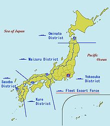 JMSDF District Forces
, including the Sasebo District Force
JMSDF District Forces
, including the Sasebo District Force
Major universities and colleges in Kyushu:
- National universities
- Universities run by local governments
- Major private universities
Culture
[
edit
]
World Heritage Sites in Kyushu
[18]
See also
[
edit
]
References
[
edit
]
- ^
a
b
"平成28年全?都道府?市?町村別面積調 島面積"
(PDF)
.
?土地理院
. 2016-10-01
. Retrieved
2017-02-27
.
- ^
"Kuj?-san, Japan"
.
Peakbagger.com
.
- ^
"離島とは(島の基礎知識) (what is a remote island?)"
.
MLIT (Ministry of Land, Infrastructure, Transport and Tourism)
(in Japanese).
Ministry of Land, Infrastructure, Transport and Tourism
. 22 August 2015. Archived from
the original
(website)
on 2007-11-13
. Retrieved
9 August
2019
.
MILT classification 6,852 islands(main islands: 5 islands, remote islands: 6,847 islands)
- ^
Nussbaum, Louis-Frederic. (2005). "Ky?sh?" in
Japan Encyclopedia
, p. 588
, p. 588, at
Google Books
- ^
a
b
"Discover the Geography of the 4 Main Islands of Japan"
.
ThoughtCo
. Retrieved
2018-09-26
.
- ^
Nussbaum, "Dazaifu" in
p. 150
, p. 150, at
Google Books
;
Dazaifu
- ^
Nussbaum, Louis-Frederic and Kathe Roth (2005).
Japan Encyclopedia
. Cambridge, Mass.: Harvard University Press.
ISBN
978-0-674-01753-5
.
OCLC
58053128
.
- ^
Cobbing, Andrew (2009).
Kyushu, gateway to Japan : a concise history
. Global Oriental. p. 157.
ISBN
9789004213128
.
OCLC
754792858
.
- ^
"Japan Ultra-Prominences"
. Peaklist.org
. Retrieved
2015-01-01
.
- ^
Cobbing, Andrew (2009).
Kyushu, Gateway to Japan: A Concise History
. Global Oriental. p. 3.
ISBN
9789004213128
.
OCLC
754792858
.
- ^
Boquet, Yves (2017).
The Philippine Archipelago
. Springer. p. 16.
ISBN
9783319519265
.
- ^
"Japanese voters want a plan to handle a declining population"
.
The Economist
. 5 October 2017.
- ^
"Fukuoka (Japan): Prefecture, Major Cities & Towns - Population Statistics, Maps, Charts, Weather and Web Information"
.
www.citypopulation.de
.
- ^
"Japan Prefectures Population from 1920 and Area"
.
www.demographia.com
.
- ^
「都市と地方における子育て環境の違いから得られた知見」
- ^
"令和2年(2020)人口動態統計月報年計(??)の?況"
(PDF)
.
- ^
C. Michael Hogan. 2010.
Extremophile
. eds. E. Monosson and C. Cleveland. Encyclopedia of Earth. National Council for Science and the Environment, Washington DC
- ^
a
b
"日本の世界遺産一?"
.
文化?
(in Japanese)
. Retrieved
2023-05-22
.
- ^
a
b
"potential of Kyushu"
.
Fukuoka financial group
(in Japanese)
. Retrieved
2023-05-16
.
- ^
"はじめての九州??"
.
Kyushu economic research center
(in Japanese)
. Retrieved
2023-05-22
.
- ^
"JAPAN PRODUCTS: Business Directory of Japanese Companies"
. Retrieved
2020-05-28
.
- ^
"Kanmon Tunnel | Description, History, Construction, & Facts"
.
Encyclopedia Britannica
. Retrieved
2021-10-20
.
- ^
"Railways in Kyushu"
.
www.sinfin.net
. Retrieved
2021-10-20
.
- ^
"Railways in Northern Kyushu"
.
www.japaneserailwaysociety.com
. Retrieved
2021-10-20
.
- ^
a
b
c
"Getting Around | Kyushu Tourism Promotion Organization"
.
www.visit-kyushu.com
. Retrieved
2021-10-20
.
- ^
"Kyushu Shinkansen"
.
Japan Visitor
.
Archived
from the original on 2021-10-20
. Retrieved
2021-10-20
.
- ^
"Fukuoka to Nagasaki: How to go from Fukuoka to Nagasaki? | Japan-Rail-Pass"
.
Japan Rail Pass | Japan Rail Pass
. 2020-07-10
. Retrieved
2022-04-21
.
- ^
MATCHA.
"Walk From Honshu To Kyushu! 4 Ways To Cross Between The Two Islands"
.
MATCHA - JAPAN TRAVEL WEB MAGAZINE
. Retrieved
2021-10-20
.
- ^
"Kyushu Expy · Japan"
.
Kyushu Expy · Japan
. Retrieved
2022-11-18
.
- ^
"Domestic Ferries"
. May 2022.
External links
[
edit
]
 The dictionary definition of
Kyushu
at Wiktionary
The dictionary definition of
Kyushu
at Wiktionary
 Media related to
Kyushu
(
category
) at Wikimedia Commons
Media related to
Kyushu
(
category
) at Wikimedia Commons
 Kyushu
travel guide from Wikivoyage
Kyushu
travel guide from Wikivoyage
|
|---|
100,000 km
2
(38,610 sq mi) and greater
| | |
|---|
20,000?99,999 km
2
(7,722?38,610 sq mi)
| |
|---|
|
|---|
| International
| |
|---|
| National
| |
|---|
| Other
| |
|---|