From Wikipedia, the free encyclopedia
Space Force Station in Hawaii
Kaena Point Space Force Station
is a
United States Space Force
installation
in
Kaena Point
on the
island
of
Oahu
in
Hawaii
. It is a remote
tracking station
of the
Satellite Control Network
responsible for tracking
satellites
in
orbit
, many of which support the
United States Department of Defense
, receiving and processing data and in turn, enabling control of satellites by
relaying
commands from control centers.
The station originally opened in 1959 to support the
Corona
reconnaissance program.
Detachment 3,
21st Space Operations Squadron
, part of
Space Delta 6
, operates Hawaii Tracking Station on the site. It was constructed in 1959, one of three built that year. The facility is placed near the westernmost point of the island of Oahu, atop a 1,500-foot (460 m) high ridge. The two
radomes
are locally known as the "golf balls", and are a popular landmark for fishing vessels in the surrounding waters.
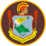 Kaena Point Satellite Tracking Station emblem. By Earl Kokobun, 1983
Yokohama Bay State Park is at the base of the ridge, with a hiking trail that goes to the point and around to the northern side of the ridge, to
Mokuleia Beach
. The station roadways provide access to state hiking and hunting trails, as well as a camping site about 10 miles (16 km) inland called
Peacock Flats
by permit only. Permits to enter through the station to hike, hunt, or camp on the surrounding State lands can be obtained from the
Hawaii Department of Land and Natural Resources
in downtown Honolulu.
On 16 June 2021, it was renamed from Kaena Point Satellite Tracking Station to Kaena Point Space Force Station.
[1]
References
[
edit
]
External links
[
edit
]
- Permission form
- Historic American Engineering Record
(HAER) documentation, filed under Ka'ena Point, Wai'anae Mountains above Keawaula Bay, Waialua, Honolulu County, HI:
- HAER No. HI-97, "
Ka'ena Point Satellite Tracking Station
", 10 photos, 21 data pages, 2 photo caption pages
- HAER No. HI-97-A, "
Ka'ena Point Satellite Tracking Station, Building 20
", 13 photos, 2 photo caption pages
- HAER No. HI-97-B, "
Ka'ena Point Satellite Tracking Station, Building 14111
", 9 photos, 1 photo caption page
- HAER No. HI-97-C, "
Ka'ena Point Satellite Tracking Station, Building 21
", 5 photos, 1 photo caption page
- HAER No. HI-97-D, "
Ka'ena Point Satellite Tracking Station, Building 11
", 8 photos, 6 data pages, 1 photo caption page
- HAER No. HI-97-E, "
Ka'ena Point Satellite Tracking Station, Building 35
", 14 photos, 8 data pages, 2 photo caption pages
- HAER No. HI-97-F, "
Ka'ena Point Satellite Tracking Station, Building 39005
", 12 photos, 7 data pages, 2 photo caption pages
- HAER No. HI-97-G, "
Ka'ena Point Satellite Tracking Station, Building 39006
", 11 photos, 7 data pages, 2 photo caption pages
|
|---|
| Leadership
|
| |
|---|
| Structure
| | Field commands
| |
|---|
| Component Field Commands
| |
|---|
| Deltas
| |
|---|
| Squadrons
| |
|---|
| Direct reporting units
| |
|---|
|
|---|
| Locations
| | Space Force Bases
| |
|---|
| Space Bases
| |
|---|
| Space Force Stations
| |
|---|
|
|---|
Personnel
and training
| |
|---|
History and
traditions
|
|
|---|
|
|---|
| Army
| | Fort
| |
|---|
| Airfield
| |
|---|
| Barracks
| |
|---|
| Medical Center
| |
|---|
| Training Area
| |
|---|
| Army National Guard
| |
|---|
| Decommissioned
| |
|---|
| |
|---|
| Marine Corps
| | Base
| |
|---|
| Air Station
| |
|---|
| Camp
| |
|---|
| Ranges
| |
|---|
| Decommissioned
| |
|---|
|
|---|
| Navy
| | Naval Air Station
| |
|---|
| Radio Station
| |
|---|
| Base
| |
|---|
| Ranges
| |
|---|
| Other
| |
|---|
|
|---|
| Air Force
| | Base
| |
|---|
| Station
| |
|---|
| Air National Guard
| |
|---|
|
|---|
| Space Force
| |
|---|
| Coast Guard
| |
|---|
