From Wikipedia, the free encyclopedia
River in Brazil, Peru
| Yurua River
|
|---|
 |
 Map of the Amazon Basin with the Jurua River highlighted
|
|
| Country
| Brazil
,
Peru
|
|---|
|
|
| Source
|
|
|---|
| • location
| Ucayali Region
,
Peru
|
|---|
| • coordinates
| 10°5′36.4776″S
72°11′56.4576″W
/
10.093466000°S 72.199016000°W
/
-10.093466000; -72.199016000
|
|---|
| • elevation
| 377 m (1,237 ft)
[1]
|
|---|
|
|
| Mouth
| Amazon River
|
|---|
• coordinates
| 2°38′9″S
65°45′22″W
/
2.63583°S 65.75611°W
/
-2.63583; -65.75611
|
|---|
• elevation
| 36 m (118 ft)
[1]
|
|---|
| Length
| 2,682.29 km (1,666.70 mi)
[1]
3,283 km (2,040 mi)
|
|---|
| Basin size
| 190,573 km
2
(73,581 sq mi)
[2]
|
|---|
|
| Discharge
|
|
|---|
| • location
| Confluence of
Solimoes
,
Amazonas State
(near mouth)
|
|---|
| • average
| (Period: 1979?2015)6,004.1 m
3
/s (212,030 cu ft/s)
[2]
(Period: 1973?1990)6,600 m
3
/s (230,000 cu ft/s)
[3]
(Period: 1971?2000)6,662.1 m
3
/s (235,270 cu ft/s)
[4]
|
|---|
|
|
|
| Discharge
|
|
|---|
| • location
| Gaviao,
Amazonas State
(Basin size: 163,859 km
2
(63,266 sq mi)
|
|---|
| • average
| (Period: 1979?2015)4,844 m
3
/s (171,100 cu ft/s)
[2]
(Period of data: 1970?1996)4,780 m
3
/s (169,000 cu ft/s)
[5]
|
|---|
|
|
|
| Discharge
|
|
|---|
| • location
| Cruzeiro do Sul
,
Acre State
(Basin size: 38,537 km
2
(14,879 sq mi)
|
|---|
| • average
| (Period of data: 1970?1996)913 m
3
/s (32,200 cu ft/s)
[5]
|
|---|
|
|
|
| Progression
| Amazon
→
Atlantic Ocean
|
|---|
| River system
| Solimoes
|
|---|
| Tributaries
|
|
|---|
| • left
| Moa
,
Ipixuna
|
|---|
| • right
| Gregorio
,
Tarauaca
,
Xerua
,
Andira
|
|---|
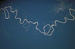
The
Jurua River
(Portuguese
Rio Jurua
; Spanish
Rio Yurua
) is a southern
affluent
river
of the
Amazon River
west of the
Purus River
, sharing with this the bottom of the immense inland Amazon depression, and having all the characteristics of the Purus as regards curvature, sluggishness and general features of the low, half-flooded
forest
country it traverses.
For most of its length, the river flows through the
Purus varzea
ecoregion.
[6]
This is surrounded by the
Jurua-Purus moist forests
ecoregion.
[7]
It rises among the
Ucayali
highlands, and is navigable and unobstructed for a distance of 1,133 km (704 mi) above its junction with the Amazon. It has a total length of approximately 3,283 km (2,040 mi), and is one of the longest tributaries of the Amazon.
The 251,577 hectares (621,660 acres)
Medio Jurua Extractive Reserve
, created in 1997, is on the left bank of the river as it meanders in a generally northeast direction through the municipality of
Carauari
.
[8]
The lower Jurua River forms the western boundary of the 187,982 hectares (464,510 acres)
Baixo Jurua Extractive Reserve
, created in 2001.
[9]
Since 2018, the lower portion of the river in Brazil has been designated a protected
Ramsar site
.
[10]
References
[
edit
]
- ^
a
b
c
Peru: Anuario de Estadisticas Ambientales 2022
(PDF)
. 2022.
- ^
a
b
c
"PLANO ESTADUAL DE RECURSOS HIDRICOS DO AMAZONAS, (PERH/AM) - RT 03 - DIAGNOSTICO, PROGNOSTICO E CENARIOS FUTUROS DO RECURSOS HIDRICOS DO ESTADO - TOMO III"
(PDF)
. Jan 2019. Archived from
the original
(PDF)
on 2021-05-06
. Retrieved
2021-10-03
.
- ^
Thery, Herve; Maurence, Pascale (1997).
HYDROLOGIE DU BASSIN AMAZONIEN
(PDF)
.
ISBN
2-7011-1532-9
.
- ^
"Amazon"
.
- ^
a
b
Michael, T. Coe; Marcos, Heil Costa; Aurelie, Botta; Charon, Birkett (23 Aug 2002). "Long-term simulations of discharge and floods in the Amazon Basin".
CiteSeerX
10.1.1.549.3854
.
- ^
"Purus varzea"
,
Global Species
, Myers Enterprises II, archived from
the original
on 2019-04-22
, retrieved
2017-03-15
- ^
Sears, Robin,
South America: Amazon Basin, northwestern Brazil (NT0133)
, WWF: World Wildlife Fund
, retrieved
2017-03-28
- ^
RESEX do Medio Jurua
(in Portuguese), ISA: Instituto Socioambiental
, retrieved
2016-06-16
- ^
RESEX do Baixo Jurua
(in Portuguese), ISA: Instituto Socioambiental
, retrieved
2016-10-22
- ^
"Rio Jurua"
.
Ramsar
Sites Information Service
. Retrieved
11 January
2019
.
Wikimedia Commons has media related to
Rio Jurua
.
