Commune in Grand Est, France
Huttenheim
(
German
:
Huttenheim
) is a
commune
in the
Bas-Rhin
department
in
Grand Est
in north-eastern
France
.
[3]
History
[
edit
]
The village can trace its recorded history back to the seventh century.
Positioned to the south-west of
Benfeld
, not far from the Roman era road known as the Road of the Heathens ("route des paiens" / "S'Heidestressel"), the village was included in the property of the feudal
lordship of Eticho
, and was bequeathed in 667 to the
Abbey of Ebersmunster
. With the arrival of missionary friars from the north, dedicated, for the next three centuries, to the Christianisation of the region, the village walls were transformed and a new mentality seized the entire region. The villagers were early adopters of the
Christian religion
. Hardworking and combative, people mostly lived by fishing and by hunting: fish and game were abundant in the region. They lived in huts on the banks of the
River Ill
: the surrounding fields would have been criss-crossed by meandering streams.
Over the centuries, the name of the village changed as the local dialects evolved. Around 728 it was Hittenheim which had become Hudenheim by 770 and Hivatinquhaim in 798. In 884 it is written as Hindingheim, in 959 Hitingheim and in 1039 Hutenheim. The name Hittenheim was used in 1174 and Huttenheim (
"Hittene"
in the local version of
Alsatian
) first appears in 1560.
Geography
[
edit
]
Huttenheim is located on the eastern side of central
Alsace
, some thirty kilometres (19 miles) south of
Strasbourg
and forty kilometres (25 miles) north-north-east of
Colmar
.
Selestat
and
Obernai
are each some fifteen kilometres (9.3 miles) distant while to the east the
Rhinau
ferry crossing into
Germany
is some ten kilometres (6.2 miles) away.
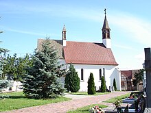 Church
The district is known as the reed country, on account of the reeds that grew in the surrounding marshland. In recent centuries the
Rhine
has been channelled which along with agriculturally driven drainage projects has made the land less marshy and more cultivable. The
water table
, though lower than in Roman times, remains unusually close to the surface, however.
Huttenheim is administratively linked with the neighbouring commune of
Benfeld
.
Although the Rhine is some distance to the east, Huttenheim is positioned right on the eastern bank of the
River Ill
a major river originating in
the Jura region
and which is thought to have given
Alsace/Elsaß
its name: the Ill here flows from south to north, approximately parallel with the Rhine, before the two rivers fully connect at
Strasbourg
. Because of the historically marshy nature of the landscape there are, following drainage of the region, numerous other water courses in the area.
Demographics
[
edit
]
Historical population
| Year
| Pop.
| ±% p.a.
|
|---|
| 1793
| 840
| ?
|
|---|
| 1831
| 1,319
| +1.19%
|
|---|
| 1851
| 2,186
| +2.56%
|
|---|
| 1880
| 2,359
| +0.26%
|
|---|
| 1900
| 2,017
| ?0.78%
|
|---|
| 1936
| 1,752
| ?0.39%
|
|---|
| 1962
| 1,625
| ?0.29%
|
|---|
| 1968
| 1,893
| +2.58%
|
|---|
| | Year
| Pop.
| ±% p.a.
|
|---|
| 1975
| 2,062
| +1.23%
|
|---|
| 1982
| 1,974
| ?0.62%
|
|---|
| 1990
| 1,999
| +0.16%
|
|---|
| 1999
| 2,094
| +0.52%
|
|---|
| 2007
| 2,461
| +2.04%
|
|---|
| 2012
| 2,591
| +1.03%
|
|---|
| 2017
| 2,701
| +0.84%
|
|---|
|
| Source: EHESS
[4]
and INSEE (1968-2017)
[5]
|
People
[
edit
]
- Paul Rohmer
(1876?1977), famous French physician, was born at Huttenheim.
- Albert Rohmer
(1913?2006), pediatrician and resistance hero was also born at Huttenheim.
- Louis Feltz
, organist and musician.
See also
[
edit
]
References
[
edit
]
Wikimedia Commons has media related to
Huttenheim
.