Former province of Japan
Fusa Province
(
?? or ??
,
Fusa no kuni
)
was an
ancient province
of
Japan
, in the area of
Shim?sa
("Lower Fusa") and
Kazusa
("Upper Fusa") provinces.
[1]
At the time of the establishment of Kazusa Province, it also included the southern tip of the
B?s? Peninsula
that would later be split off as
Awa Province
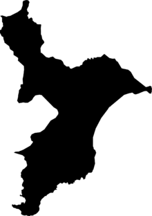
. The ambit of this ancient entity is within
Chiba Prefecture
and
Ibaraki Prefecture
.
[2]
It was sometimes called
S?sh?
(
?州
)
.
Geography
[
edit
]
It was bordered by
Hitachi Province
to the north,
Shimotsuke Province
al northwest,
Musashi Province
and
Tokyo Bay
to the west, and
Pacific Ocean
to the east.
History
[
edit
]
6,000 years ago much of the plain was covered by the sea,
Katori Sea
and
Kuj?kuri Beach
. Shell and funerary
tumulus
were deposited at relatively high altitudes beside the
Shim?sa Plateau
. Canoes excavated in the tumulus, indicates that there was activity during the
J?mon period
.
After thousands of years the land rises and the sea recedes, and in
Yayoi period
and
Kofun period
much of the area was covered by wetlands, lakes and ponds. The cultivation of
rice
was transmitted from the south of the country, and people planted rice in the wetlands, and they lived from agriculture and fishing. Subsequently
hemp
of good quality was planted and then the area was known as the "Country of hemp" (Fusa no kuni), to later be divided into two provinces.
[3]
The hemp was cultivated to make clothes.
 Fusa Province,
Shim?sa in the north,
Kazusa in the center and
Awa in the south.
Fusa was originally a territory known as Fusa Province
(
??, occasionally ??
,
Fusa-no-kuni
)
, which was divided into "lower" and "upper" portions (i.e. Shim?sa and Kazusa) during the reign of
Emperor K?toku
(645?654).
In the first half of the 8th century, the southern part of the Kazusa province was divided into the Awa Province. On 718 the district of Awa was elevated into status to a full province, on 741 it was merged back into Kazusa, but regained its independent status in 757.
Toponymy
[
edit
]
Although Fusa Province has been divided into Shim?sa and Kazusa since ancient times, a toponym
Fusa
has survived into modern times as the name of a village (布佐村
Fusa-mura
), later a town (布佐町
Fusa-machi
), which now forms the eastern part of
Abiko City
along the south bank of the Tone River. There is also a
Fusa Station
on the Abiko branch of JR East Japan's Narita Line, located in the Fusa neighborhood of Abiko City.
Notes
[
edit
]
- ^
Satow, Ernest
. (1874). "The Geography of Japan,"
Transactions of the Asiatic Society of Japan,
Vol. 1-2, p. 35.
, p. 35, at
Google Books
;
Nussbaum, Louis-Frederic
. (2005). "
Fusa no Kuni
" in
Japan Encyclopedia
, p. 224
, p. 224, at
Google Books
.
- ^
Nussbaum, "
Shimosa
" in
p. 862
, p. 862, at
Google Books
; "
Kazusa
" at
p. 502
, p. 502, at
Google Books
- ^
"?の?の誕生 [「農」と?史] (in Japanese) - Birth of Fusa Province ["Agriculture" and history] -"
.
maff.go.jp
. Retrieved
November 30,
2021
.
References
[
edit
]