From Wikipedia, the free encyclopedia
Original file
(SVG file, nominally 880 × 435 pixels, file size: 1.3 MB)
Summary
Licensing
| Public domain
Public domain
false
false
|

|
I, the copyright holder of this work, release this work into the
public domain
. This applies worldwide.
In some countries this may not be legally possible; if so:
I grant anyone the right to use this work
for any purpose
, without any conditions, unless such conditions are required by law.
|
Original upload log
The original description page was
here
. All following user names refer to en.wikipedia.
Upload date | User | Bytes | Dimensions | Comment
- 2011-08-16 00:49:44 |
Haha169
| 1458104 | 880×435 |
Don't know how China got left out. Simply following the table in the article, its got the same designation as Egypt, Greece, etc.,
- 2011-08-14 16:30:31 |
U5K0
| 1458046 | 880×435 |
sorry. my bad
- 2011-08-14 16:15:33 |
U5K0
| 1462776 | 880×435 |
Gabon as per countries table in the article
- 2011-08-12 23:53:26 |
U5K0
| 1459143 | 880×435 |
Botswana as per article and reference in article - see table with countries
- 2011-08-11 14:05:16 |
Brightgalrs
| 1457980 | 880×435 |
Tweaked Sudan-South Sudan border (made it more visible)
- 2011-08-06 21:58:48 |
Brightgalrs
| 1457922 | 880×435 |
Switched Kosovo and Montenegro's color. (Thanks Yalens)
- 2011-08-04 23:46:07 |
Brightgalrs
| 1457784 | 880×435 |
Czech republic light blue Kosovo added back in (why did I delete this again?) as dark blue dot
- 2011-07-29 23:15:03 |
U5K0
| 1456236 | 880×435 |
portugal to dark blue as per talk page article
- 2011-07-21 16:03:28 |
Brightgalrs
| 1457158 | 880×435 |
Montenegro
- 2011-07-20 18:18:56 |
Brightgalrs
| 1457086 | 880×435 |
Added a grey dot for the Republic of Kosovo.
- 2011-07-20 17:34:23 |
U5K0
| 1456212 | 880×435 |
Slovenia recognises NTC as per http://www.mzz.gov.si/nc/si/splosno/cns/novica/article/6/29268/47f4795180/
- 2011-07-18 13:38:54 |
Brightgalrs
| 1455857 | 880×435 |
Albania recognizes the NTC http://www.ora-news.com/v2/index.php?on=details&id=22692&nid=1&PHPSESSID=5d613e9758ecb4b261a2ea894f935fc4
- 2011-07-17 04:50:09 |
Brightgalrs
| 1455841 | 880×435 |
South Sudan, resized
- 2011-07-17 04:05:44 |
Brightgalrs
| 1452050 | 940×477 |
And I forgot Malta.
- 2011-07-17 04:03:51 |
Brightgalrs
| 1451955 | 940×477 |
Added various dependencies of the USA, UK, Netherlands and France.
- 2011-07-16 18:53:29 |
Brightgalrs
| 1444235 | 940×477 |
Forgot Senegal, good catch.
- 2011-07-16 02:24:34 |
Brightgalrs
| 1444231 | 940×477 |
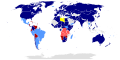
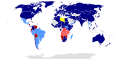
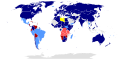
{{Information |Description = {{en|1=A global map of the world showing countries that recognize or have informal relations with the [[Libyan Republic]]}} |Source = [[:File:BlankMap-World-Microstates.svg]]<br>{{Inkscape}} |Date = ~~~
Add a one-line explanation of what this file represents
File history
Click on a date/time to view the file as it appeared at that time.
| Date/Time
| Thumbnail
| Dimensions
| User
| Comment
|
|---|
| current
| 19:31, 7 December 2011
|  | 880 × 435
(1.3 MB)
| Raistuumum
| Mauritania and Eritrea to dark blue
|
| 22:23, 21 October 2011
|  | 880 × 435
(1.3 MB)
| StalwartUK
| background fixed - again
|
| 18:48, 20 October 2011
|  | 880 × 435
(1.3 MB)
| Kudzu1
| Vatican City to dark blue. This is a pretty borderline change, seeing as that hostilities have effectively been concluded. After Abdul Jalil issues the declaration of liberation, I'm going to consider the war to be over and I'm going to stop updating this
|
| 16:06, 20 October 2011
|  | 880 × 435
(1.3 MB)
| StalwartUK
| fixed the background
|
| 14:04, 16 October 2011
|  | 880 × 435
(1.3 MB)
| Kudzu1
| Pakistan to dark blue
|
| 23:35, 14 October 2011
|  | 880 × 435
(1.3 MB)
| Kudzu1
| Bangladesh to dark blue
|
| 17:14, 1 October 2011
|  | 880 × 435
(1.3 MB)
| Kudzu1
| Namibia to dark red
|
| 15:01, 1 October 2011
|  | 880 × 435
(1.3 MB)
| Kudzu1
| Jamaica to dark blue
|
| 00:50, 1 October 2011
|  | 880 × 435
(1.3 MB)
| Kudzu1
| Switzerland, Uganda, Somalia to dark blue
|
| 19:36, 29 September 2011
|  | 880 × 435
(1.3 MB)
| Kudzu1
| Mauritius to light blue, and I think it's best to follow the lead of other maps and leave W. Sahara uncolored
|
File usage
The following pages on the English Wikipedia use this file (pages on other projects are not listed):
Global file usage
The following other wikis use this file:
- Usage on ar.wikipedia.org
- Usage on ast.wikipedia.org
- Usage on de.wikipedia.org
- Usage on de.wikinews.org
- Usage on es.wikipedia.org
- Usage on fa.wikipedia.org
- Usage on fr.wikipedia.org
- Usage on he.wikipedia.org
- Usage on hu.wikipedia.org
- Usage on ja.wikipedia.org
- Usage on lt.wikipedia.org
- Usage on nl.wikipedia.org
- Usage on pl.wikipedia.org
- Usage on pt.wikipedia.org
- Usage on ro.wikipedia.org
- Usage on ru.wikipedia.org
- Usage on ta.wikipedia.org
- Usage on tr.wikipedia.org
- Usage on vi.wikipedia.org
- Usage on zh.wikipedia.org
