From Wikipedia, the free encyclopedia
Original file
(881 × 1,204 pixels, file size: 79 KB, MIME type:
image/png
)
|
|
This is a
retouched picture
, which means that it has been digitally altered from its original version. The original can be viewed here:
Srem baranja.png
:
 . Modifications made by
Ex13
. . Modifications made by
Ex13
.
|
I, the copyright holder of this work, hereby publish it under the following license:
| Public domain
Public domain
false
false
|

|
I, the copyright holder of this work, release this work into the
public domain
. This applies worldwide.
In some countries this may not be legally possible; if so:
I grant anyone the right to use this work
for any purpose
, without any conditions, unless such conditions are required by law.
|
References
- Sve srpske mape - od ?estog veka do Pariza, Specijalno izdanje BLICA, Decembar 1995
- Dr Tomislav Bogavac, Nestajanje Srba, Ni?, 1994.
- Miodrag Milo?evi?, Geografija za 8. razred osnovne ?kole, Beograd, 1994.
- Dragan Rodi?, Geografija za I ili III razred srednje ?kole, Beograd, 1995.
- Istorijski atlas, Geokarta, Beograd, 1999.
- Richard Overy, The Times History of the 20th Century, Times Books, London, 2004.
- The Times History of Europe, Times Books, London, 2002.
- Slavko Vejinovi?, Srbi u dijaspori u pro?losti i sada?njosti, Novi Sad, 1999.
- Tim D?uda, Srbi - istorija, mit i razaranje Jugoslavije, Beograd, 2003.
- D?on R. Lempi, Jugoslavija kao istorija, Beograd, 2004.
- Nada Mileti? Stani?, Pravoslavne crkve u Baranji, Novi Sad, 1999.
- http://web.ku.edu/~eceurope/hist557/lect20_files/yugoslavprovinces.jpg
archive copy
at the
Wayback Machine
- http://terkepek.adatbank.transindex.ro/kepek/netre/292.gif
- http://www.pointernet.pds.hu/touristinfo/croatia/image/g.jpg
archive copy
at the
Wayback Machine
- http://clip2net.com/clip/m6499/1217833413-krajina_army_territorial_division-jpg-34kb.jpg
- http://profile.ak.fbcdn.net/hprofile-ak-snc4/50514_294052851171_2302284_n.jpg
archive copy
at the
Wayback Machine
- http://www.vecernji.hr/slika-500x329/vijesti/otkrivamo-britanci-trazili-da-baranju-dio-istocne-slavonije-predamo-srbiji-slika-85519
[
dead link
]
- http://www.srpskapolitika.com/krajina/mapa211.jpg
archive copy
at the
Wayback Machine
- http://www.srpska-mreza.com/MAPS/Ethnic-groups/map-UN-1994.jpg
- http://www.srpskapolitika.com/krajina/etnicka_karta.jpg
archive copy
at the
Wayback Machine
- http://www.srpskapolitika.com/krajina/mapa311.jpg
archive copy
at the
Wayback Machine
- http://farm1.static.flickr.com/45/110412384_09ffb827cb.jpg
Original upload log
This image is a derivative work of the following images:
- File:Srem_baranja.png
licensed with PD-self
- 2006-10-01T05:27:44Z
Amadalvarez
754x1116 (240718 Bytes)
map of the [[Eastern Slavonia, Baranja and Western Srem]] (self made) I'M NOT THE AUTHOR. It's been copied from english wiki, where it has GFDL self Licensing from his author, [[:en:user:PANONIA]] {{PD-self}} [[Category:Yu
Uploaded with
derivativeFX
Add a one-line explanation of what this file represents
File history
Click on a date/time to view the file as it appeared at that time.
| Date/Time
| Thumbnail
| Dimensions
| User
| Comment
|
|---|
| current
| 10:34, 8 June 2012
|  | 881 × 1,204
(79 KB)
| PANONIAN
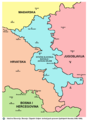
| proposing this compromise version: this image shows borders from 1996-1998 (as was suggested as better solution by user:Ex13, but it shows more accurate and more detailed borders as well as more notable towns. if user:Ex13 does not agree with this prop...
|
| 07:38, 17 April 2012
|  | 754 × 1,116
(212 KB)
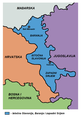
| Ex13
| Reverted to version as of 21:14, 15 April 2012 you can upload another file
|
| 06:11, 17 April 2012
|  | 881 × 1,285
(92 KB)
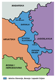
| PANONIAN
| Reverted to version as of 11:26, 4 August 2011 - this is impoved and corrected version, why you reverted to version with wrong borders?
|
| 21:14, 15 April 2012
|  | 754 × 1,116
(212 KB)
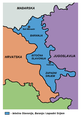
| Ex13
| Reverted to version as of 17:42, 20 February 2010
|
| 11:26, 4 August 2011
|  | 881 × 1,285
(92 KB)
| PANONIAN
| improved version, same as in in original English language file
|
| 17:42, 20 February 2010
|  | 754 × 1,116
(212 KB)
| Ex13
| NEW
|
| 17:40, 20 February 2010
|  | 754 × 1,116
(209 KB)
| Ex13
| {{Information |Description=Map of the Eastern Slavonia, Baranja and Western Srem |Source=*
File:Srem_baranja.png
|Date=2010-02-20 17:38 (UTC) |Author=*
File:Srem_baranja.png
: It's been copied from english wiki, where it has GFDL self Licensin
|
File usage
The following pages on the English Wikipedia use this file (pages on other projects are not listed):
Global file usage
The following other wikis use this file:
- Usage on ar.wikipedia.org
- Usage on azb.wikipedia.org
- Usage on bs.wikipedia.org
- Usage on ca.wikipedia.org
- Usage on ckb.wikipedia.org
- Usage on cs.wikipedia.org
- Usage on de.wikipedia.org
- Usage on el.wikipedia.org
- Usage on fr.wikipedia.org
- Usage on hr.wikipedia.org
- Usage on id.wikipedia.org
- Usage on ko.wikipedia.org
- Usage on pl.wikipedia.org
- Usage on ro.wikipedia.org
- Usage on sh.wikipedia.org
- Usage on sk.wikipedia.org
- Usage on sr.wikipedia.org
- Usage on sv.wikipedia.org
- Usage on th.wikipedia.org
- Usage on tr.wikipedia.org
- Usage on uk.wikipedia.org
- Usage on www.wikidata.org
- Usage on zh.wikipedia.org
