From Wikipedia, the free encyclopedia
Original file
(SVG file, nominally 900 × 600 pixels, file size: 127 KB)
Summary
Licensing
I, the copyright holder of this work, hereby publish it under the following licenses:

|
Permission is granted to copy, distribute and/or modify this document under the terms of the
GNU Free Documentation License
, Version 1.2 or any later version published by the
Free Software Foundation
; with no Invariant Sections, no Front-Cover Texts, and no Back-Cover Texts. A copy of the license is included in the section entitled
GNU Free Documentation License
.
http://www.gnu.org/copyleft/fdl.html
GFDL
GNU Free Documentation License
true
true
|
- You are free:
- to share
? to copy, distribute and transmit the work
- to remix
? to adapt the work
- Under the following conditions:
- attribution
? You must give appropriate credit, provide a link to the license, and indicate if changes were made. You may do so in any reasonable manner, but not in any way that suggests the licensor endorses you or your use.
- share alike
? If you remix, transform, or build upon the material, you must distribute your contributions under the
same or compatible license
as the original.
https://creativecommons.org/licenses/by-sa/4.0
CC BY-SA 4.0
Creative Commons Attribution-Share Alike 4.0
true
true
You may select the license of your choice.
Add a one-line explanation of what this file represents
File history
Click on a date/time to view the file as it appeared at that time.
| Date/Time
| Thumbnail
| Dimensions
| User
| Comment
|
|---|
| current
| 16:36, 11 July 2022
|  | 900 × 600
(127 KB)
| HapHaxion
| reduce file size
|
| 15:26, 1 March 2009
|  | 900 × 600
(805 KB)
| B1mbo
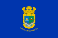
| According to Resolution 187 of the Regional Government of Valparaiso: "Articulo 4º: La bandera de la Region de Valparaiso posee un campo unico de color azul y ostenta en su centro el Escudo de Armas de la Region, con sus contenidos descriptivos y c
|
| 02:22, 15 February 2009
|  | 900 × 600
(805 KB)
| Carlos yo
| m
|
| 02:20, 15 February 2009
|  | 581 × 911
(429 KB)
| Carlos yo
| corona chilena
|
| 21:12, 30 December 2008
|  | 900 × 600
(517 KB)
| B1mbo
| {{Information |Description= |Source= |Date= |Author= |Permission= |other_versions= }}
|
| 14:32, 22 December 2008
|  | 900 × 600
(672 KB)
| B1mbo
| |
| 14:20, 22 December 2008
|  | 900 × 600
(340 KB)
| B1mbo
| |
| 14:17, 22 December 2008
|  | 900 × 600
(340 KB)
| B1mbo
| |
| 14:15, 22 December 2008
|  | 900 × 600
(340 KB)
| B1mbo
| |
| 01:22, 17 December 2008
|  | 900 × 600
(325 KB)
| B1mbo
| == Sumario == {{Information |Description={{en|1=Flag of the
Valparaiso Region
in
Chile
}} {{es|1=Bandera de la
V Region de Valparaiso
en
Chile
}} |Source=trabajo propio (own work) basado
|
File usage
More than 100 pages use this file.
The following list shows the first 100 pages that use this file only.
A
full list
is available.
- 2019 in Oceania
- 2020 Chilean constitutional referendum
- 2020 in Oceania
- 2021 Chilean gubernatorial elections
- 2021 Chilean municipal elections
- 2021 in Oceania
- 2022?2023 mpox outbreak in Chile
- Aconcagua River
- Baron Hill
- COVID-19 pandemic in Chile
- Cabildo, Chile
- Calle Larga
- Casuchas del Rey
- Catemu
- Cerro El Roble
- Cerro Tapado
- Cerro de Los Inocentes
- Colorado River (Aconcagua)
- Copa Chile
- Cuesta La Dormida
- Desventuradas Islands
- El Yali National Reserve
- Estero Catemu
- Estero Limache
- Estero Los Litres
- Estero Los Loros
- Estero Pocuro
- Estero Quilpue
- Fernandezian Region
- Flag of Chile
- Google Street View in Chile
- Google Street View in South America
- Greater Valparaiso
- Hanga Roa
- Indigenous peoples of Oceania
- Isla Negra
- Juan Fernandez Islands
- Juncal River
- La Campana-Penuelas
- La Campana National Park
- La Ligua
- Lago Penuelas National Reserve
- Laguna Verde, Chile
- Laguna del Inca
- Las Palmas de Cocalan National Park
- Las Ventanas
- Leiva River
- List of Chilean flags
- List of World Heritage Sites in Chile
- List of cities in Chile
- List of flags with Spanish-language text
- List of members of the United States Hockey Hall of Fame
- List of political and geographic subdivisions by total area (all)
- List of political and geographic subdivisions by total area from 10,000 to 20,000 square kilometers
- List of political and geographic subdivisions by total area from 5,000 to 20,000 square kilometers
- Llay-Llay
- Llolleo
- Los Andes, Chile
- Los Andes Province, Chile
- Maipo River
- Miss Earth Chile 2015
- Miss Grand Chile
- Nevado Juncal
- Ocoa, Chile
- Ocoa Valley
- Panquehue
- Papudo
- Paso de Los Patos
- Petorca
- Petorca Province
- Petorca River
- Penuelas Lake
- Pichilemu, Valparaiso
- Plan de Valparaiso
- Putaendo
- Putaendo River
- Quillota Province
- Regions of Chile
- Rinconada
- Rio Blanco (Aconcagua)
- Rio Blanco National Reserve
- San Antonio Canyon
- San Esteban, Chile
- San Felipe, Chile
- San Felipe de Aconcagua
- Santa Maria, Chile
- Statistics of the COVID-19 pandemic in Chile
- Television Nacional de Chile
- Uspallata Pass
- Valparaiso Region
- Vina del Mar
- Zapallar
- User:Extended Cut/sandbox
- User:Riinu Tarvas/places
- User:Tir Jalborg/places
- User:TolleWurst/Flags of countries and country subdivisions
- User:Werdoland/sandbox
- Template:COVID-19 pandemic data/Chile medical cases
- Template:COVID-19 pandemic data/Chile medical cases by commune
- Template:Country data Desventuradas Islands
View
more links
to this file.
Global file usage
The following other wikis use this file:
- Usage on af.wikipedia.org
- Usage on als.wikipedia.org
- Usage on ar.wikipedia.org
- Usage on ast.wikipedia.org
- Usage on az.wikipedia.org
- Usage on bar.wikipedia.org
- Usage on ba.wikipedia.org
- Usage on bcl.wikipedia.org
- Usage on be.wikipedia.org
- Usage on bg.wikipedia.org
- Usage on bn.wikipedia.org
- Usage on br.wikipedia.org
- Usage on bs.wikipedia.org
- Usage on ca.wikipedia.org
- Usage on ceb.wikipedia.org
- Usage on ckb.wikipedia.org
View
more global usage
of this file.
This file contains additional information, probably added from the digital camera or scanner used to create or digitize it.
If the file has been modified from its original state, some details may not fully reflect the modified file.
