From Wikipedia, the free encyclopedia
Original file
(SVG file, nominally 1,425 × 934 pixels, file size: 756 KB)
Add a one-line explanation of what this file represents
File history
Click on a date/time to view the file as it appeared at that time.
| Date/Time
| Thumbnail
| Dimensions
| User
| Comment
|
|---|
| current
| 21:13, 1 September 2013
|  | 1,425 × 934
(756 KB)
| Nilfanion
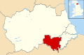
| {{Information |Description=Map of
County Durham
, UK with Darlington highlighted. Equirectangular map projection on WGS 84 datum, with N/S stretched 170% |Source=
Ordnance Survey
[https://www.ordnancesurvey.co.u...
|
File usage
The following pages on the English Wikipedia use this file (pages on other projects are not listed):
Global file usage
The following other wikis use this file:
- Usage on cy.wikipedia.org
- Usage on de.wikipedia.org
- Usage on frr.wikipedia.org
- Usage on ko.wikipedia.org
- Usage on nl.wikipedia.org
- Usage on pl.wikipedia.org
- Usage on pt.wikipedia.org
- Usage on sv.wikipedia.org
- Usage on ur.wikipedia.org
- Usage on www.wikidata.org
- Usage on zh.wikipedia.org
This file contains additional information, probably added from the digital camera or scanner used to create or digitize it.
If the file has been modified from its original state, some details may not fully reflect the modified file.
