Metropolitan area in North Dakota and Minnesota
Metropolitan Statistical Area in the United States
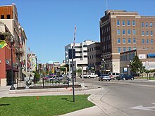
Fargo?Moorhead
, also known as the
FM area
, is a common name given to the
metropolitan area
comprising
Fargo, North Dakota
;
Moorhead, Minnesota
; and the surrounding communities. These two cities lie on the
North Dakota
?
Minnesota
border, on opposite banks of the
Red River of the North
. The region is the cultural, retail, health care, educational, and industrial center of southeastern North Dakota and northwestern Minnesota.
The Fargo?Moorhead area is defined by the
Census Bureau
as comprising all of
Cass County, North Dakota
and
Clay County, Minnesota
, which includes the cities of
Dilworth, Minnesota
,
West Fargo, North Dakota
, and numerous other towns and developments from which commuters travel daily for work, education, and regular activities. A July 1, 2015 census estimate placed the population at 233,836,
[1]
an increase of 34% from the
2000 census
.
Communities
[
edit
]
 The city of
Fargo
,
North Dakota
is the most populous city in the FM area
The city of
Fargo
,
North Dakota
is the most populous city in the FM area
Core cities
[
edit
]
Suburbs/Adjacent towns
[
edit
]
 Concordia College
in
Moorhead, Minnesota
is a noted academic institution in the region
Concordia College
in
Moorhead, Minnesota
is a noted academic institution in the region
Bedroom communities
[
edit
]
- Barnesville, Minnesota
- Sabin, Minnesota
- Mapleton, North Dakota
- Casselton, North Dakota
- Davenport, North Dakota
- Glyndon, Minnesota
- Hawley, Minnesota
- Hickson, North Dakota
- Kindred, North Dakota
- Leonard, North Dakota
- Oxbow, North Dakota
- Walcott, North Dakota
Demographics
[
edit
]
Historical population
| Census
| Pop.
| Note
| %±
|
|---|
| 1860
| 72
| | ?
|
|---|
| 1870
| 92
| | 27.8%
|
|---|
| 1880
| 14,885
| | 16,079.3%
|
|---|
| 1890
| 31,130
| | 109.1%
|
|---|
| 1900
| 46,567
| | 49.6%
|
|---|
| 1910
| 53,575
| | 15.0%
|
|---|
| 1920
| 63,257
| | 18.1%
|
|---|
| 1930
| 71,855
| | 13.6%
|
|---|
| 1940
| 78,186
| | 8.8%
|
|---|
| 1950
| 89,240
| | 14.1%
|
|---|
| 1960
| 106,027
| | 18.8%
|
|---|
| 1970
| 120,238
| | 13.4%
|
|---|
| 1980
| 137,574
| | 14.4%
|
|---|
| 1990
| 153,296
| | 11.4%
|
|---|
| 2000
| 174,367
| | 13.7%
|
|---|
| 2010
| 208,777
| | 19.7%
|
|---|
| 2020
| 249,843
| | 19.7%
|
|---|
| 2021 (est.)
| 252,136
| [2]
| 0.9%
|
|---|
|
According to the
American Community Survey
, the age distribution was as follows:
- Under 5 years: 6.8%
- 5?9 years: 6.1%
- 10?14 years: 5.9%
- 15?19 years: 8.0%
- 20?24 years: 11.9%
- 25?34 years: 16.0%
- 35?44 years: 12.8%
- 45?54 years: 13.2%
- 55?59 years: 5.1%
- 60?64 years: 3.7%
- 65?74 years: 4.9%
- 75?84 years: 3.7%
- 85 years and over: 1.8%
- Median age: 31.6 years
Race
[
edit
]
According to the same survey, the racial composition was as follows:
There were 3,032 African Americans, who made up 1.6% of the population.
The Asian American population is not dominated by a single ancestry group, and is fairly diverse. The largest Asian American group are those of
Chinese
descent, who number at 928 and make up 0.5% of the population. Other sizable groups include
Indians
,
Vietnamese
, and
Koreans
, who number at 393, 379, and 360 respectively; all three groups comprise roughly 0.2% of the population. There are 134
Filipinos
, making up roughly 0.1% of the population. People of
Japanese
descent were very few, with only 40 people identifying themselves as Japanese; they make up a mere 0.02% of the population.
Pacific Islander Americans numbered at 119, and made up approximately 0.06% of the population.
Multiracial Americans make up 1.4% of the metro area's population. Those of white and Native American ancestry made up 0.5% of the population, and numbered at 938. People of white and Asian ancestry numbered at 557, and those of white and black ancestry numbered at 571. Both groupings made up roughly 0.3% of the population. Approximately 72 people identified themselves as black and Native American.
Hispanics and Latinos are the largest minority group in Fargo?Moorhead. Hispanics and Latinos make up 2.5% of the population, of which 2.0% are of
Mexican
descent. Of the 4,786 Hispanics, 3,846 are Mexican. There were 196
Puerto Ricans
and 136
Cubans
; both of these groups made up roughly 0.1% of the population. In addition, 608 individuals identified themselves with other Hispanic or Latino groups other than Mexican, Puerto Rican, and Cuban, making up 0.3% of the population.
The Native American population is predominantly
Ojibwe
, with a
Sioux
minority. Of the 2,679 Native Americans, 1,447 are of the Chippewa tribal grouping. The Chippewa alone make up 0.8% of the population. The 444 Sioux make up 0.2% of the population. In addition, 20 people identified themselves as a member of the
Cherokee
tribal grouping.
NOTE: The source above contains all of the information on population, age, and race.
Ancestry
[
edit
]
The
European American
population is overwhelmingly
German
and
Scandinavian
. Most of the Scandinavian population is of
Norwegian
descent. Smaller Euro-American groups include those of
English
,
Irish
, and
French
descent.
As of the 2006?2008 American Community Survey, the top ten largest European ancestry groups were the following:
- German
: 42.9% (82,398)
- Norwegian
: 36.4% (69,964)
- Irish
: 8.6% (16,589)
- Swedish
: 6.6% (12,641)
- English
: 4.8% (9,286)
- French
: 4.3% (8,283)
- Polish
: 3.2% (6,180)
- Russian
: 2.0% (3,783)
- Czech
: 1.6% (3,047)
- Scottish
: 1.5% (2,871)
Language spoken at home
[
edit
]
- Population 5 years and over: 179,175
- English
only: 93.6% (167,729)
- Language other than English: 6.4% (11,446)
- Spanish
: 2.1% (3,771)
- Other
Indo-European languages
: 2.5% (4,393)
- Asian
and Pacific Islander languages: 0.9% (1,659)
- Other languages: 0.9% (1,623)
NOTE: The source above contains all of the information on ancestry and language.
Politics
[
edit
]
Presidential election results
[7]
| Year
|
Democratic
|
Republican
|
Others
|
| 2020
|
47.9%
56,668
|
48.7%
57,662
|
3.3%
3,962
|
| 2016
|
40.2%
44,332
|
48.4%
53,359
|
11.4%
12,528
|
| 2012
|
48.6%
49,920
|
48.4%
49,775
|
3.0%
3,046
|
| 2008
|
53.7%
54,288
|
44.1%
44,544
|
2.2%
2,261
|
| 2004
|
41.3%
38,999
|
57.2%
53,984
|
1.6%
1,465
|
| 2000
|
38.3%
31,579
|
54.9%
45,248
|
6.7%
5,526
|
| 1996
|
44.8%
32,169
|
46.0%
33,002
|
9.2%
6,619
|
| 1992
|
36.5%
27,922
|
45.7%
34,978
|
17.9%
13,694
|
| 1988
|
47.0%
33,293
|
52.3%
37,079
|
0.7%
470
|
| 1984
|
40.7%
28,348
|
58.6%
40,786
|
0.7%
473
|
| 1980
|
34.0%
22,502
|
51.9%
34,333
|
14.1%
9,293
|
| 1976
|
45.6%
28,755
|
52.1%
32,900
|
2.3%
1,464
|
| 1972
|
40.8%
23,149
|
57.9%
32,859
|
1.2%
698
|
| 1968
|
42.9%
18,806
|
52.8%
23,150
|
4.3%
1,875
|
| 1964
|
57.5%
25,835
|
42.4%
19,057
|
0.1%
62
|
| 1960
|
43.0%
19,454
|
57.0%
25,776
|
0.1%
25
|
The Fargo?Moorhead area has generally leaned
Republican
, voting for that party's presidential candidate in every election between
1968
and
2004
. While Clay County is a
swing county
which has voted for Democrats 9 times and Republicans 7 times since
1960
, Cass County has only voted Democratic twice: for
Lyndon B. Johnson
in
1964
and
Barack Obama
in
2008
.
In recent years, however, Fargo?Moorhead has become very competitive. In 2008, it voted for Obama by a nearly-10-point margin, followed by just 0.2% in 2012. In 2016, it flipped Republican once again, voting for
Donald Trump
by 8 points, and it voted for Trump again in 2020, albeit by a narrow margin of less than a percentage point.
Culture
[
edit
]
Fargo/Wahpeton CSA
[
edit
]
The Census Bureau also tracks a Fargo?Wahpeton
Combined Statistical Area
, consisting of Cass and Clay counties, as well as the
Wahpeton micropolitan area
of
Richland County, North Dakota
and
Wilkin County, Minnesota
. This area includes the twin cities of
Wahpeton, North Dakota
and
Breckenridge, Minnesota
.
The Fargo?Moorhead urban core is actually about forty-five minutes of highway travel from the Wahpeton?Breckenridge core. The main connection between these two pairs of cities is the
Red River Valley
, the flat, fertile land that both depend upon for a major part of their economies. Potatoes and sugar beets are important crops in the region, in addition to most of the other crops produced elsewhere in Minnesota and North Dakota.
See also
[
edit
]
References
[
edit
]
- ^
"Metropolitan and Micropolitan Statistical Areas"
.
Census Bureau
. Archived from
the original
on 10 May 2015
. Retrieved
26 March
2014
.
- ^
a
b
c
"U.S. Census Bureau QuickFacts: Cass County, North Dakota"
.
www.census.gov
. United States Census Bureau
. Retrieved
March 24,
2022
.
- ^
"US Decennial Census"
. United States Census Bureau
. Retrieved
January 28,
2015
.
- ^
"Historical Census Browser"
. University of Virginia Library
. Retrieved
January 28,
2015
.
- ^
Forstall, Richard L., ed. (March 27, 1995).
"Population of Counties by Decennial Census: 1900 to 1990"
. United States Census Bureau
. Retrieved
January 28,
2015
.
- ^
"Census 2000 PHC-T-4. Ranking Tables for Counties: 1990 and 2000"
(PDF)
. United States Census Bureau. April 2, 2001
. Retrieved
January 28,
2015
.
- ^
"Our Campaigns"
. Retrieved
February 16,
2021
.
|
|---|
| Counties
| | |
|---|
| Main cities
| |
|---|
Surrounding
areas
| |
|---|
|
46°51′N
96°47′W
/
46.850°N 96.783°W
/
46.850; -96.783