Conurbation in the United States
Dallas?Fort Worth Area
|
|---|
|
Dallas?Fort Worth?Arlington, TX
Metropolitan Statistical Area
|
|
 Map of Dallas?Fort Worth, TX?OK
CSA
|
Dallas?Fort Worth?Arlingon, TX
MSA
Fort Worth?Arlington?Grapevine, TX
Other Statistical Areas in Dallas?Fort Worth CSA
Granbury, TX μSA
Corsicana, TX μSA
Durant, OK μSA
Gainesville, TX μSA
Sulphur Springs, TX μSA
Bonham, TX μSA
Mineral Wells, TX μSA
| |
| Country
| United States
|
|---|
| State
| Texas
Oklahoma
|
|---|
| Principal cities
[1]
|
|
|---|
|
| ? Urban
| 1,746.90 sq mi (4,524.44 km
2
)
|
|---|
| ? Metro
| 8,675 sq mi (22,468 km
2
)
|
|---|
| Highest elevation
| 1,368 ft (417 m)
|
|---|
|
| ?
Conurbation
| 7,637,387 (
4th
)
|
|---|
| ?
Urban
| 5,732,354 (
6th
)
|
|---|
| ? Urban density
| 3,281.45/sq mi (1,266.98/km
2
)
|
|---|
| ? Metro density
| 880.4/sq mi (339.9/km
2
)
|
|---|
| ?
MSA
| 7,637,387 (
4th
)
|
|---|
| ?
CSA
| 8,121,108 (
7th
)
|
|---|
|
| ? MSA
| $688.928 billion (2022)
|
|---|
| Time zone
| UTC-6
(
CST
)
|
|---|
| ? Summer (
DST
)
| UTC-5
(
CDT
)
|
|---|
| Area codes
| 214
,
254
,
430
,
469
,
682
,
817
,
903
,
940
,
945
,
972
|
|---|
The
Dallas?Fort Worth metroplex
, officially designated
Dallas?Fort Worth?Arlington
by the
U.S. Office of Management and Budget
,
[a]
is the most populous
metropolitan statistical area
in the
U.S. state
of
Texas
and the
Southern United States
, encompassing 11
counties
. Its historically dominant
core cities
are
Dallas
and
Fort Worth
.
[5]
It is the economic and cultural hub of
North Texas
. Residents of the area also refer to it as
DFW
(the
code
for
Dallas Fort Worth International Airport
) or
the Metroplex
. The Dallas?Fort Worth?
Arlington
metropolitan statistical area's population was 7,637,387 according to the
U.S. Census Bureau
's
2020 census
,
[6]
making it the
fourth-largest
metropolitan area in the U.S. and the
fifteenth-largest
in the
Americas
. In 2016, the Dallas?Fort Worth metroplex had the highest annual population growth in the United States.
[7]
By 2023, the U.S. Census Bureau estimated that the Dallas-Fort Worth metropolitan area's population had increased to 8,100,037, with the highest numerical growth of any metropolitan area in the United States.
[8]
The metropolitan region's economy, also referred to as Silicon Prairie, is primarily based on
banking
,
commerce
,
insurance
,
telecommunications
,
technology
,
energy
,
healthcare
,
medical research
,
transportation
and
logistics
. As of 2022, Dallas?Fort Worth is home to 23
Fortune 500
companies, the 4th-largest concentration of Fortune 500 companies in the United States behind
New York City
(62),
Chicago
(35), and
Houston
(24).
[9]
In 2016, the metropolitan economy surpassed Houston, the second largest metro area in Texas, to become the fourth-largest in the U.S. The Dallas?Fort Worth metroplex boasted a GDP of just over $620.6 billion in 2020 (although both metropolitan regions have switched places multiple times since GDP began recording).
[10]
If the Metroplex were a
sovereign state
, it would have the
twentieth largest economy
in the world as of 2019. In 2015, the conurbated metropolitan area would rank the
ninth-largest economy
if it were a U.S. state.
[11]
In 2020, Dallas?Fort Worth was recognized as the 36th best metropolitan area for
STEM
professionals in the U.S.
[12]
The Dallas?Fort Worth metroplex comprises the highest concentration of colleges and universities in Texas. The
UT Southwestern Medical Center
is home to six Nobel Laureates and was ranked No. 1 in the world among healthcare institutions in biomedical sciences.
[13]
[14]
The Metroplex is also the second most popular metropolis for megachurches in Texas (trailing the
Greater Houston metropolitan area
),
[15]
ranked the largest Christian metropolitan statistical area in the U.S.,
[16]
[17]
[18]
and has one of the largest
LGBT communities in Texas
since 2005.
[19]
[20]
[21]
[22]
Etymology
[
edit
]
A
portmanteau
of
metropolis
and
complex
, the term
metroplex
is credited to Harve Chapman, an executive vice president with Dallas-based Tracy-Locke, one of three advertising agencies that worked with the North Texas Commission (NTC) on strategies to market the region.
[23]
The NTC copyrighted the term "Southwest Metroplex" in 1972 as a replacement for the previously-ubiquitous "North Texas",
[24]
which studies had shown lacked identifiability outside the state. In fact, only 38 percent of a survey group identified
Dallas
and
Fort Worth
as part of "North Texas", with the
Texas Panhandle
also a perceived correct answer, being the northernmost region of Texas.
[25]
Geography
[
edit
]
The United States Census Bureau determined the Metroplex encompasses 9,286 square miles (24,100 km
2
) of total area; 8,991 sq mi (23,290 km
2
) is land, and 295 sq mi (760 km
2
) is covered by water. The
conurbated
metropolitan area is larger in area than the U.S. states of
Rhode Island
and
Connecticut
combined,
[26]
and larger than
New Jersey
.
[26]
If the metropolitan area were a sovereign state, it would rank the
162nd largest state
by total area after
Lebanon
. The
U.S. Office of Management and Budget
combines the Dallas?Fort Worth metroplex with the
Sherman?Denison metropolitan area
and seven
micropolitan statistical areas
to form the Dallas?Fort Worth TX?OK combined statistical area.
The Dallas?Fort Worth metroplex overlooks mostly
prairie
land with a few rolling hills dotted by
human-made lakes
cut by streams, creeks and rivers surrounded by forested land. The Dallas?Fort Worth metroplex is situated in the
Texas blackland prairies
region,
[27]
so named for its fertile black soil found especially in the rural areas of
Collin
,
Dallas
,
Ellis
,
Hunt
,
Kaufman
, and
Rockwall
counties.
Many areas of
Denton
,
Johnson
,
Parker
,
Tarrant
, and
Wise
counties are located in the Fort Worth
Prairie
region of North Texas,
[28]
which has less fertile and more rocky soil than that of the Texas blackland prairie; most of the rural land on the Fort Worth Prairie is ranch land. A large onshore
natural gas field
, the
Barnett Shale
, lies underneath this area; Denton, Tarrant and Wise counties feature many natural gas wells. Continuing land use change results in scattered crop fields surrounded by residential or commercial development. South of Dallas and Fort Worth is a line of rugged hills that goes north to south about 15 miles (24 km) that looks similar to the
Texas Hill Country
200 miles (320 km) to the south.
Metropolitan divisions and counties
[
edit
]
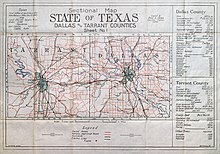 1915 map of Dallas and Tarrant Counties
The Dallas?Fort Worth?Arlington metropolitan statistical area is formed by a combination of two separate metropolitan statistical divisions. The Dallas?Plano?Irving MDA and Fort Worth?Arlington?Grapevine MDA come together to form one full metropolitan area or conurbation.
[29]
[1]
Dallas?Plano?Irving metropolitan division
[
edit
]
Fort Worth?Arlington?Grapevine metropolitan division
[
edit
]
[30]
[32]
Climate
[
edit
]
Dallas?Fort Worth has a
humid subtropical climate
(
Koppen climate classification
: Cfa).
It is also continental, characterized by a relatively wide annual temperature range for the latitude. The Dallas?Fort Worth metroplex is located at the lower end of
Tornado Alley
, and can experience extreme weather.
[33]
In the Metroplex, summers are very hot and humid, although low humidity characteristics of desert locations can appear at any time of the year. July and August are typically the hottest months, with an average high of 96.0
°F
(36
°C
) and an average low of 76.7 °F (25 °C). Heat indexes regularly surpass 105 °F (41 °C) at the height of summer. The all-time record high is 113 °F (45 °C), set on June 26 and 27, 1980 during the
Heat Wave of 1980
at nearby
Dallas/Fort Worth International Airport
.
[34]
[35]
Winters in the area are cool to mild, with occasional cold spells. The average date of first frost is November 12, and the average date of last frost is March 12.
[36]
January is typically the coldest month, with an average daytime high of 56.8 °F (14 °C) and an average nighttime low of 37.3 °F (3 °C). The normal daily average temperature in January is 47.0 °F (8 °C) but sharp swings in temperature can occur, as strong cold fronts known as "
Blue Northers
" pass through the Metroplex, forcing daytime highs below the 50 °F (10 °C) mark for several days at a time and often between days with high temperatures above 80 °F (27 °C). Snow accumulation is seen in the city in about 70% of winter seasons, and snowfall generally occurs 1?2 days out of the year for a seasonal average of 1.5 inches (4 cm). Some areas in the region, however, receive more than that, while other areas receive negligible snowfall or none at all.
[37]
The all-time record low temperature within the city is ?3 °F (?19 °C), set on January 18, 1930, however the temperature at
Dallas/Fort Worth International Airport
reached ?2 °F (?19 °C) on February 16, 2021, during
Winter Storm Uri
.
Climate data for Dallas (
Love Field
), 1991?2020 normals,
[b]
extremes 1913?present
[c]
|
| Month
|
Jan
|
Feb
|
Mar
|
Apr
|
May
|
Jun
|
Jul
|
Aug
|
Sep
|
Oct
|
Nov
|
Dec
|
Year
|
| Record high °F (°C)
|
88
(31)
|
95
(35)
|
97
(36)
|
100
(38)
|
103
(39)
|
112
(44)
|
112
(44)
|
111
(44)
|
110
(43)
|
100
(38)
|
92
(33)
|
89
(32)
|
112
(44)
|
| Mean maximum °F (°C)
|
76.7
(24.8)
|
80.5
(26.9)
|
85.9
(29.9)
|
89.0
(31.7)
|
95.0
(35.0)
|
98.9
(37.2)
|
103.6
(39.8)
|
104.1
(40.1)
|
99.1
(37.3)
|
92.5
(33.6)
|
82.9
(28.3)
|
77.9
(25.5)
|
105.5
(40.8)
|
| Mean daily maximum °F (°C)
|
57.7
(14.3)
|
62.0
(16.7)
|
69.9
(21.1)
|
77.4
(25.2)
|
84.9
(29.4)
|
92.7
(33.7)
|
96.9
(36.1)
|
97.1
(36.2)
|
90.0
(32.2)
|
79.5
(26.4)
|
67.8
(19.9)
|
59.2
(15.1)
|
77.9
(25.5)
|
| Daily mean °F (°C)
|
47.8
(8.8)
|
52.0
(11.1)
|
59.6
(15.3)
|
67.1
(19.5)
|
75.4
(24.1)
|
83.3
(28.5)
|
87.3
(30.7)
|
87.3
(30.7)
|
80.1
(26.7)
|
69.1
(20.6)
|
57.8
(14.3)
|
49.5
(9.7)
|
68.0
(20.0)
|
| Mean daily minimum °F (°C)
|
37.9
(3.3)
|
41.9
(5.5)
|
49.4
(9.7)
|
56.8
(13.8)
|
66.0
(18.9)
|
73.8
(23.2)
|
77.7
(25.4)
|
77.4
(25.2)
|
70.1
(21.2)
|
58.7
(14.8)
|
47.8
(8.8)
|
39.8
(4.3)
|
58.1
(14.5)
|
| Mean minimum °F (°C)
|
22.5
(?5.3)
|
26.5
(?3.1)
|
31.1
(?0.5)
|
41.3
(5.2)
|
52.0
(11.1)
|
64.2
(17.9)
|
70.8
(21.6)
|
69.4
(20.8)
|
56.8
(13.8)
|
42.0
(5.6)
|
31.2
(?0.4)
|
25.1
(?3.8)
|
19.1
(?7.2)
|
| Record low °F (°C)
|
?3
(?19)
|
2
(?17)
|
11
(?12)
|
30
(?1)
|
39
(4)
|
53
(12)
|
56
(13)
|
57
(14)
|
36
(2)
|
26
(?3)
|
17
(?8)
|
1
(?17)
|
?3
(?19)
|
| Average
precipitation
inches (mm)
|
2.59
(66)
|
2.78
(71)
|
3.45
(88)
|
3.15
(80)
|
4.57
(116)
|
3.83
(97)
|
2.54
(65)
|
2.31
(59)
|
3.10
(79)
|
4.79
(122)
|
2.93
(74)
|
3.23
(82)
|
39.33
(999)
|
| Average snowfall inches (cm)
|
0.1
(0.25)
|
0.9
(2.3)
|
0.3
(0.76)
|
0.0
(0.0)
|
0.0
(0.0)
|
0.0
(0.0)
|
0.0
(0.0)
|
0.0
(0.0)
|
0.0
(0.0)
|
0.0
(0.0)
|
0.1
(0.25)
|
0.3
(0.76)
|
1.7
(4.3)
|
| Average precipitation days
(≥ 0.01 in)
|
7.0
|
6.9
|
8.1
|
7.3
|
9.4
|
7.3
|
4.9
|
5.1
|
5.6
|
7.2
|
6.5
|
6.9
|
82.2
|
| Average snowy days
(≥ 0.1 in)
|
0.4
|
0.5
|
0.2
|
0.0
|
0.0
|
0.0
|
0.0
|
0.0
|
0.0
|
0.0
|
0.1
|
0.3
|
1.5
|
| Average
relative humidity
(%)
|
67.5
|
66.4
|
63.7
|
65.3
|
69.7
|
65.8
|
60.0
|
60.5
|
66.5
|
65.7
|
67.4
|
67.5
|
65.4
|
| Average
dew point
°F (°C)
|
31.3
(?0.4)
|
35.2
(1.8)
|
42.6
(5.9)
|
52.0
(11.1)
|
61.0
(16.1)
|
66.6
(19.2)
|
67.6
(19.8)
|
66.7
(19.3)
|
63.3
(17.4)
|
53.2
(11.8)
|
43.7
(6.5)
|
34.7
(1.5)
|
51.5
(10.8)
|
| Mean monthly
sunshine hours
|
183.5
|
178.3
|
227.7
|
236.0
|
258.4
|
297.8
|
332.4
|
304.5
|
246.2
|
228.1
|
183.8
|
173.0
|
2,849.7
|
| Percent
possible sunshine
|
58
|
58
|
61
|
61
|
60
|
69
|
76
|
74
|
66
|
65
|
59
|
56
|
64
|
| Average
ultraviolet index
|
3
|
5
|
7
|
9
|
10
|
10
|
10
|
10
|
8
|
6
|
4
|
3
|
7
|
| Source 1:
NOAA
(sun, relative humidity, and dew point 1961?1990 at
DFW Airport
)
[d]
[39]
[40]
[41]
[42]
|
| Source 2: Weather Atlas (Average UV index)
[43]
|
| Climate data for Fort Worth, Texas
|
| Month
|
Jan
|
Feb
|
Mar
|
Apr
|
May
|
Jun
|
Jul
|
Aug
|
Sep
|
Oct
|
Nov
|
Dec
|
Year
|
| Record high °F (°C)
|
80
(27)
|
79
(26)
|
87
(31)
|
92
(33)
|
97
(36)
|
113
(45)
|
110
(43)
|
113
(45)
|
111
(44)
|
103
(39)
|
95
(35)
|
83
(28)
|
113
(45)
|
| Mean daily maximum °F (°C)
|
54.1
(12.3)
|
60.1
(15.6)
|
68.3
(20.2)
|
75.9
(24.4)
|
83.2
(28.4)
|
91.1
(32.8)
|
95.4
(35.2)
|
94.8
(34.9)
|
87.7
(30.9)
|
77.9
(25.5)
|
65.1
(18.4)
|
56.5
(13.6)
|
75.8
(24.3)
|
| Daily mean °F (°C)
|
44.1
(6.7)
|
49.4
(9.7)
|
57.4
(14.1)
|
65.0
(18.3)
|
73.1
(22.8)
|
80.9
(27.2)
|
85.0
(29.4)
|
84.4
(29.1)
|
77.5
(25.3)
|
67.2
(19.6)
|
55.1
(12.8)
|
46.7
(8.2)
|
65.5
(18.6)
|
| Mean daily minimum °F (°C)
|
34.0
(1.1)
|
38.7
(3.7)
|
46.4
(8.0)
|
54.0
(12.2)
|
63.0
(17.2)
|
70.7
(21.5)
|
74.6
(23.7)
|
74.0
(23.3)
|
67.2
(19.6)
|
56.4
(13.6)
|
45.1
(7.3)
|
36.8
(2.7)
|
55.1
(12.8)
|
| Record low °F (°C)
|
?7
(?22)
|
?8
(?22)
|
?2
(?19)
|
21
(?6)
|
32
(0)
|
43
(6)
|
52
(11)
|
59
(15)
|
31
(?1)
|
24
(?4)
|
?3
(?19)
|
?5
(?21)
|
?8
(?22)
|
| Average
precipitation
inches (mm)
|
1.89
(48)
|
2.37
(60)
|
3.06
(78)
|
3.20
(81)
|
5.15
(131)
|
3.23
(82)
|
2.12
(54)
|
2.03
(52)
|
2.42
(61)
|
4.11
(104)
|
2.57
(65)
|
2.57
(65)
|
34.72
(882)
|
| Average precipitation days
|
7.2
|
6.1
|
7.5
|
7.2
|
9.3
|
7.2
|
4.7
|
4.5
|
5.8
|
7.1
|
6.7
|
6.5
|
79.8
|
| Mean monthly
sunshine hours
|
186.0
|
169.5
|
217.0
|
240.0
|
248.0
|
300.0
|
341.0
|
310.0
|
240.0
|
217.0
|
180.0
|
186.0
|
2,834.5
|
| Percent
possible sunshine
|
60
|
55
|
58
|
62
|
57
|
71
|
79
|
77
|
67
|
64
|
60
|
60
|
64
|
| Average
ultraviolet index
|
3
|
5
|
7
|
9
|
10
|
11
|
10
|
10
|
8
|
6
|
4
|
3
|
7
|
| Source 1: National Climatic Data Center
[44]
|
| Source 2: Weather Atlas
[45]
(sunshine data, UV index)
|
Principal communities
[
edit
]
 January 3, 2020: The International Space Station was orbiting 260 miles above central Texas when this nighttime photograph was taken of the Dallas-Fort Worth metropolitan area. Courtesy of NASA.
The following are cities and towns categorized based on the latest population estimates from the
North Central Texas Council of Governments
(as of July 1, 2022).
[46]
No population estimates are released for
census-designated places
(CDPs), which are marked with an asterisk (*). These places are categorized based on their 2020 census population.
[47]
Places with more than 100,000 inhabitants
[
edit
]
 Downtown Fort Worth
Places designated "principal cities" by the
U.S. Office of Management and Budget
are italicized.
[48]
1,000,000+
500,000?999,999
200,000?499,999
100,000?199,999
Places with 10,000 to 99,999 inhabitants
[
edit
]
Places with fewer than 10,000 inhabitants
[
edit
]
Unincorporated places
[
edit
]
Demographics
[
edit
]
Historical populations ? Dallas?Fort Worth (1980?2020)
| Census
| Pop.
| Note
| %±
|
|---|
| 1980
| 2,974,805
| | ?
|
|---|
| 1990
| 3,885,415
| | 30.6%
|
|---|
| 2000
| 5,221,801
| | 34.4%
|
|---|
| 2010
| 6,426,214
| | 23.1%
|
|---|
| 2020
| 7,637,387
| | 18.8%
|
|---|
| 2023 (est.)
| 8,100,037
| | 6.1%
|
|---|
|
| County
|
2023 estimate
[49]
|
2020 census
|
Change
|
Area
|
Density
|
| Dallas County
|
2,606,358
|
2,613,539
|
?0.27%
|
2,613,539
|
?0.49%
|
871.28 sq mi (2,256.6 km
2
)
|
2,985/sq mi (1,153/km
2
)
|
| Tarrant County
|
2,182,947
|
2,110,640
|
+3.43%
|
2,110,640
|
+2.08%
|
863.61 sq mi (2,236.7 km
2
)
|
2,495/sq mi (963/km
2
)
|
| Collin County
|
1,195,359
|
1,064,465
|
+12.30%
|
1,064,465
|
+8.85%
|
841.22 sq mi (2,178.7 km
2
)
|
1,377/sq mi (532/km
2
)
|
| Denton County
|
1,007,703
|
906,422
|
+11.17%
|
906,422
|
+7.82%
|
878.43 sq mi (2,275.1 km
2
)
|
1,113/sq mi (430/km
2
)
|
| Ellis County
|
222,829
|
192,455
|
+15.78%
|
192,455
|
+10.25%
|
935.49 sq mi (2,422.9 km
2
)
|
227/sq mi (88/km
2
)
|
| Johnson County
|
202,906
|
179,927
|
+12.77%
|
179,927
|
+8.66%
|
724.69 sq mi (1,876.9 km
2
)
|
270/sq mi (104/km
2
)
|
| Kaufman County
|
185,690
|
145,310
|
+27.79%
|
145,310
|
+18.62%
|
780.70 sq mi (2,022.0 km
2
)
|
221/sq mi (85/km
2
)
|
| Parker County
|
173,494
|
148,222
|
+17.05%
|
148,222
|
+11.88%
|
903.48 sq mi (2,340.0 km
2
)
|
184/sq mi (71/km
2
)
|
| Rockwall County
|
131,307
|
107,819
|
+21.78%
|
107,819
|
+14.27%
|
127.04 sq mi (329.0 km
2
)
|
970/sq mi (374/km
2
)
|
| Hunt County
|
113,347
|
99,956
|
+13.40%
|
99,956
|
+8.33%
|
840.32 sq mi (2,176.4 km
2
)
|
129/sq mi (50/km
2
)
|
| Wise County
|
78,097
|
68,632
|
+13.79%
|
68,632
|
+9.13%
|
904.42 sq mi (2,342.4 km
2
)
|
83/sq mi (32/km
2
)
|
| Total
|
8,100,037
|
7,637,387
|
+6.06%
|
7,637,387
|
+4.01%
|
8,670.68 sq mi (22,457.0 km
2
)
|
916/sq mi (354/km
2
)
|
Numerically, the Metroplex is the fastest growing metropolitan area in the U.S.
[50]
At the
2020 U.S. census
7,637,387 people lived in the area,
[6]
up from 6,371,773 in 2010,
[51]
and 2,974,805 in 1970. In 2020, the Dallas?Fort Worth metroplex's racial composition was 42%
non-Hispanic white
, 16% Black or African American, 8% Asian, 3-4% two or more races, and 29% Hispanic or Latino American of any race.
[52]
According to information gathered from the North Texas Commission, the Metroplex's racial and ethnic makeup was 46% non-Hispanic white, 15%
Black or African American
, 7%
Asian American
, and 3% from other races in 2017. Ethnically,
Hispanics and Latinos
of any race made up 29% of the metropolitan population.
[53]
From 2010 to 2017, Hispanics and Latinos increased an estimated 38.9% followed by Blacks and African Americans.
[53]
In 2015, an estimated 101,588 foreign-born residents moved to the Metroplex. Of the immigrant population, 44.1% were from
Latin America
, 35.8%
Asia
, 7.1%
Europe
, and 13.1%
Africa
. In 2010, 77,702 foreign nationals immigrated; approximately 50.6% came from Latin America, 33.0% from Asia, 7.3% Europe, and 9.1% Africa.
[53]
During the 2020 American Community Survey, an estimated 18.5% of its population were foreign-born, with 56% from Latin America, 30% Asia, 8% Africa, 4% Europe, and 1% elsewhere from North America.
[54]
The median household income in Dallas?Fort Worth was higher than the state average in 2017, and its unemployment and poverty rate was lower.
[53]
The median income for males was $51,498 and $44,207 for females. In 2019, the per capita income of DFW was $72,265. In 2010, the median income for a household in the metropolitan area was $48,062, and the median income for a family was $55,263. Males had a median income of $39,581 versus $27,446 for females. The
per capita income
for the Metroplex altogether was $21,839.
The Dallas?Fort Worth metroplex's religious population are predominantly
Christian
and the largest metro area that identify with the religion in the United States (78%).
[18]
[16]
Methodist
,
Baptist
,
Presbyterian
, and
Catholic
churches are prominent in many cities and towns in the metropolitan region. The Methodist and Baptist communities anchor two of the area's major private universities (
Southern Methodist University
and
Dallas Baptist University
). Non-Christian faiths including
Islam
,
Judaism
,
Hinduism
,
Sikhism
,
Buddhism
, and
contemporary paganism
collectively form a little over 4% of the religious population.
[55]
Combined statistical area
[
edit
]
The Dallas?Fort Worth, TX?OK
combined statistical area
is made up of 20 counties in
North Central Texas
and one county in
South Central Oklahoma
. The statistical area includes two
metropolitan areas
and seven
micropolitan areas
. The CSA definition encompasses 14,628 sq mi (37,890 km
2
) of area, of which 14,126 sq mi (36,590 km
2
) is land and 502 sq mi (1,300 km
2
) is water. The population density was 485 people per square mile according to estimates from the U.S. Census Bureau.
[56]
Metropolitan statistical areas (MSAs)
[
edit
]
- Dallas?Fort Worth?Arlington (Collin, Dallas,
Denton
, Ellis, Hunt, Johnson, Kaufman, Parker, Rockwall, Tarrant, and Wise counties)
- Sherman-Denison
(
Grayson County
); population 143,131 (2022 estimate)
[57]
Micropolitan statistical areas (μSAs)
[
edit
]
- Athens (
Henderson County
); population 84,511 (2022 estimate)
[57]
- Bonham (
Fannin County
) (delineated and added in 2015); population 37,125 (2022 estimate)
[57]
- Corsicana (
Navarro County
); population 54,636 (2022 estimate)
[57]
- Durant, OK (
Bryan County, Oklahoma
); population 48,182 (2022 estimate)
[57]
- Gainesville (
Cooke County
); population 43,050 (2022 estimate)
[57]
- Granbury (
Hood County
) (delineated and added in 2018); population 66,373 (2022 estimate)
[57]
- Mineral Wells (
Palo Pinto County
); population 29,239 (2022 estimate)
[57]
- Sulphur Springs (
Hopkins County
); population 37,793 (2022 estimate)
[57]
Demographics
[
edit
]
At the
2000 U.S. census
,
[51]
there were 5,487,956 people, 2,006,665 households, and 1,392,540 families residing within the CSA. The racial makeup of the CSA was 70.41%
White
, 13.34%
Black or African American
, 0.59%
Native American
, 3.58%
Asian
, 0.08%
Pacific Islander
, 9.62% from
other races
, and 2.39% from
two or more races
.
Hispanics or Latinos
of any race were 20.83% of the population. The median income for a household in the CSA was $43,836, and the median income for a family was $50,898. Males had a median income of $37,002 versus $25,553 for females. The
per capita income
for the CSA was $20,460.
At the 2020 census, the DFW CSA had a population of 8,121,108 (though a July 1, 2015 estimate placed the population at 7,504,362).
[58]
In 2018 it had an estimated 7,994,963 residents.
[56]
The American Community Survey determined 18% of the population was foreign-born. The median household income was $67,589 and the per capita income was $34,455. An estimated 11.5% lived below the poverty line. The median age of the DFW CSA was 35.3.
Urban areas within
[
edit
]
 Urban areas within the Dallas?Fort Worth, TX?OK combined statistical area as of the 2020 census, according to the U.S. Census Bureau.
Urban areas
Counties in the Dallas?Fort Worth MSA
Counties in the Dallas?Fort Worth CSA but not the MSA
At the core of the Dallas?Fort Worth combined statistical area (CSA) lies the Dallas?Fort Worth?Arlington, TX
urban area
, the sixth-most populous in the United States.
[3]
Within the boundaries of the CSA the Census Bureau defines 31 other urban areas as well, some of which form the core of their own metro or micro statistical areas separate from the Dallas?Fort Worth metropolitan statistical area. Urban areas situated primarily outside the Dallas?Fort Worth metropolitan statistical area but within the CSA are identified with a cross (†) in the table below.
| Urban area
|
Population
(2020 census)
|
Land area
(sq mi)
|
Land area
(km
2
)
|
Density
(population / sq mi)
|
Density
(population / km
2
)
|
| Dallas
?
Fort Worth
?
Arlington
, TX
|
5,732,354
|
1,746.90
|
4,524.44
|
3,281.45
|
1,266.98
|
| McKinney
?
Frisco
, TX
|
504,803
|
151.64
|
392.75
|
3,328.93
|
1,285.31
|
| Denton
?
Lewisville
, TX
|
429,461
|
150.48
|
389.74
|
2,853.94
|
1,101.91
|
| Sherman
?
Denison
, TX †
|
66,691
|
38.49
|
99.70
|
1,732.52
|
668.93
|
| Weatherford
, TX
|
48,112
|
38.69
|
100.20
|
1,243.60
|
480.16
|
| Cleburne
, TX
|
43,901
|
24.51
|
63.48
|
1,791.10
|
691.55
|
| Forney
, TX
|
41,112
|
19.68
|
50.97
|
2,089.25
|
806.66
|
| Melissa
?
Anna
, TX
|
34,516
|
16.95
|
43.89
|
2,036.73
|
786.39
|
| Midlothian
, TX
|
30,908
|
24.72
|
64.03
|
1,250.30
|
482.75
|
| Granbury
, TX †
|
29,706
|
21.87
|
56.63
|
1,358.53
|
524.53
|
| Greenville
, TX
|
27,054
|
17.30
|
44.81
|
1,563.59
|
603.70
|
| Corsicana
, TX †
|
24,380
|
15.52
|
40.20
|
1,570.65
|
606.43
|
| Ennis
, TX
|
19,763
|
12.42
|
32.16
|
1,591.54
|
614.50
|
| Durant
, OK †
|
19,324
|
12.01
|
31.10
|
1,609.52
|
621.44
|
| Gun Barrel City
, TX †
|
18,309
|
18.41
|
47.67
|
994.74
|
384.07
|
| Princeton
, TX
|
18,184
|
8.24
|
21.33
|
2,207.88
|
852.47
|
| Terrell
, TX
|
16,581
|
12.30
|
31.86
|
1,347.74
|
520.37
|
| Gainesville
, TX †
|
16,544
|
9.56
|
24.75
|
1,731.38
|
668.49
|
| Mineral Wells
, TX †
|
14,211
|
8.86
|
22.94
|
1,604.73
|
619.59
|
| Denton Southwest
, TX
|
14,105
|
7.06
|
18.29
|
1,997.20
|
771.12
|
| Royse City
, TX
|
13,922
|
6.13
|
15.89
|
2,269.52
|
876.27
|
| Athens
, TX †
|
12,050
|
9.32
|
24.14
|
1,292.92
|
499.20
|
| Heartland
, TX
|
9,841
|
2.77
|
7.17
|
3,556.92
|
1,373.33
|
| Commerce
, TX
|
8,320
|
3.34
|
8.66
|
2,489.33
|
961.14
|
| Sanger
, TX
|
8,279
|
4.39
|
11.37
|
1,885.57
|
728.02
|
| Bonham
, TX †
|
7,799
|
5.03
|
13.02
|
1,550.96
|
598.83
|
| Pecan Plantation
, TX †
|
6,831
|
8.12
|
21.04
|
841.04
|
324.73
|
| Decatur
, TX
|
6,486
|
6.20
|
16.05
|
1,046.54
|
404.07
|
| Kaufman
, TX
|
6,127
|
3.07
|
7.94
|
1,997.39
|
771.20
|
| Krum
, TX
|
5,876
|
3.27
|
8.47
|
1,796.71
|
693.71
|
| Aubrey
, TX
|
5,116
|
2.74
|
7.10
|
1,867.03
|
720.86
|
| Alvarado
, TX
|
5,034
|
3.04
|
7.88
|
1,653.89
|
638.57
|
Economy
[
edit
]
 Headquarters of
AMR Corporation
and
American Airlines
Headquarters of
AMR Corporation
and
American Airlines
The cities of Dallas and Fort Worth are the two central cities of the Metroplex, with Arlington being a third economically important city; it is a center for sporting events, tourism and manufacturing. Most other incorporated cities in the Metroplex are "
bedroom communities
" serving largely as residential and small-business centers, though there are several key employers in these regions. Due to the large number of smaller, less well-known cities, Metroplex residents commonly divide the region roughly in half along Texas
Interstate 35
, which runs north?south, splitting into two 'branches' (
I-35E
in Dallas and
I-35W
in Fort Worth) through the Metroplex. They refer to places as being on the "Dallas side" or the "Fort Worth side", or in "the Arlington area", which is almost directly south of the airport; cities in the Arlington area form the
Mid-Cities
. It is nominally between the two major east?west interstates in the region (
I-20
, passing to the south of both downtowns, and
I-30
, connecting Dallas and Fort Worth city centers).
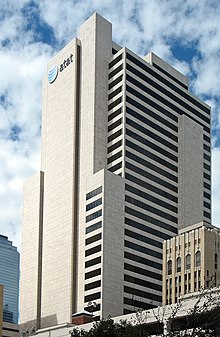 AT&T headquarters in Dallas
Business management and operations play a central role in the area's economy. Dallas and its suburbs have the third-largest concentration of corporate headquarters in the United States. Moreover, it is the only metro area in the country home to three of the top-ten largest Fortune 500 companies by revenue. The area continues to draw corporate relocation from across the nation, and especially from
California
. From late 2018 to early 2019, both McKesson and
Charles Schwab
announced they would be relocating from San Francisco to the DFW area.
[59]
Later in 2019, San Francisco-based
Uber
announced a massive corporate expansion just east of downtown Dallas.
Banking and finance play a key role in the area's economy. DFW recently surpassed Chicago to become the second-largest financial services hub in the nation, eclipsed only by New York.
[60]
Bank of America
,
JPMorgan Chase
,
Liberty Mutual
,
Goldman Sachs
,
State Farm
,
Charles Schwab Corporation
, and
Fidelity Investments
maintain significant operations in the area. The Metroplex also contains the largest
Information Technology
industry base in the state (often referred to as
Silicon Prairie
or the
Telecom Corridor
, especially when referring to US-75 through
Richardson
,
Plano
and
Allen
just north of Dallas itself). This area has a large number of corporate IT projects and the presence of numerous electronics, computing and telecommunication firms such as
Microsoft
,
Texas Instruments
,
HP Enterprise Services
,
Dell Services
,
Samsung
,
Nokia
,
Cisco
,
Fujitsu
,
i2
,
Frontier
,
Alcatel
,
Ericsson
,
CA
,
Google
,
T-Mobile US
, and
Verizon
.
AT&T
, the second largest telecommunications company in the world, is headquartered at the
Whitacre Tower
in
downtown Dallas
.
ExxonMobil
and
McKesson
, respectively the 2nd and 7th largest
Fortune 500
companies by revenue, are headquartered in
Irving, Texas
.
Fluor
, the largest engineering & construction company in the Fortune 500, is also headquartered in Irving.
[61]
In October 2016,
Jacobs Engineering
, a Fortune 500 company and one of the world's largest engineering companies, relocated from
Pasadena, California
to Dallas.
[62]
Toyota USA, in 2016, relocated its corporate headquarters to
Plano, Texas
.
Southwest Airlines
is headquartered in Dallas. The airline has more than 53,000 employees as of October 2016 and operates more than 3,900 departures a day during peak travel season.
On the other side of the Metroplex, the Texas
farming
and
ranching
industry is based in Fort Worth, though the area's economy is diverse.
American Airlines
, the largest airline in the world, recently completed their new $350M corporate HQ complex in Fort Worth.
[63]
American Airlines is also the largest employer in the Metroplex.
[64]
Several major defense manufacturers, including
Lockheed Martin
,
Bell Helicopter Textron
, and
Raytheon
, maintain significant operations in the Metroplex, primarily on the "Fort Worth side." They are concentrated along
State Highway 170
near I-35W, commonly called the "Alliance Corridor" due to its proximity to the
Fort Worth Alliance
regional airport.
Changes in
house prices
for the Metroplex are publicly tracked on a regular basis using the
Case?Shiller index
; the statistic is published by
Standard & Poor's
and is also a component of S&P's 20-city
composite index
of the value of the U.S. residential real estate market.
Sports
[
edit
]
The Metroplex is one of the
13 U.S. metropolitan areas
that has a team in each of the four major professional sports leagues. Major professional sports first came to the area in 1952, when the
Dallas Texans
competed in the
National Football League
for one season.
[65]
In 1960, major professional sports returned when the
Dallas Cowboys
began competing in the
National Football League
and the Dallas Texans began competing in the
American Football League
.
[66]
[67]
The Dallas Texans later relocated to
Kansas City
and became the
Chiefs
.
[68]
In 1972,
Major League Baseball's
Washington Senators moved to Arlington to become the
Texas Rangers
,
[69]
named after the
statewide law enforcement agency
. The
National Basketball Association
expanded into North Texas in 1980 when the
Dallas Mavericks
were added to the league.
[70]
The fourth sport was added in 1993 when the
Minnesota North Stars
of the
National Hockey League
moved to Dallas, becoming the
Dallas Stars
.
[71]
The
Major League Soccer
team
FC Dallas
is based in Frisco, and the
Dallas Wings
of the
WNBA
play in Arlington. The area is also home to many minor-league professional teams, and four colleges that compete in
NCAA
Division I
athletics. A
NASCAR Cup Series
race is hosted annually at
Texas Motor Speedway
, the
AAA Texas 500
, and two
PGA Tour
events are held annually in the Metroplex, the
AT&T Byron Nelson
and the
Colonial National Invitation
Tournament. The Metroplex has hosted many premiere sports events on both an annual and one-time basis.
[72]
[73]
Major professional sports teams
[
edit
]
^- Indicates year team relocated to the area
Other notable professional and amateur teams
[
edit
]
^- Indicates year team relocated to the area
Division I college athletics
[
edit
]
The headquarters for both the Big 12 and American Athletic Conference are located in
Irving
,
Conference USA
headquarters are in Dallas, the
Southland Conference
headquarters are in
Frisco
, and the Western Athletic Conference is headquartered in Arlington.
Sports events hosted
[
edit
]
Note:
Venues are listed with their current names, not necessarily those in use when an event took place.
| Event
|
Sport
|
Year(s)
|
Venue
|
| Red River Showdown
|
College Football
|
1912?present
|
Cotton Bowl
|
| Battle for the Iron Skillet
|
College Football
|
1915?present
|
Cotton Bowl
,
Amon G. Carter Stadium
,
Ownby Stadium
,
Texas Stadium
,
Ford Stadium
|
| Fort Worth Classic
|
College Football
|
1921
|
Panther Park
|
| Dixie Classic
|
College Football
|
1922, 1925, 1934
|
Fair Park Stadium
|
| State Fair Classic
|
College Football
|
1925?present
|
Cotton Bowl
|
| PGA Championship
|
Golf
|
1927
,
1963
|
Cedarcrest Golf Course
,
Dallas Athletic Club
|
| AT&T Cotton Bowl Classic
|
College Football
|
1937?present
|
Cotton Bowl
,
AT&T Stadium
|
| U.S. Open
|
Golf
|
1941
,
1952
|
Colonial Country Club
,
Northwood Club
|
| Byron Nelson Golf Classic
|
Golf
|
1944?present
|
Multiple courses in Dallas
|
| Colonial National Invitational
|
Golf
|
1946?present
|
Colonial Country Club
|
| Pro Bowl
|
Football
|
1973
|
Texas Stadium
|
| The Players Championship
|
Golf
|
1975
|
Colonial Country Club
|
| Dallas Grand Prix
|
Auto Racing
|
1984?1996
|
Fair Park
,
Addison
,
Reunion Arena
|
| NBA All-Star Game
|
Basketball
|
1986
,
2010
|
Reunion Arena
,
AT&T Stadium
|
| NCAA Men's Final Four
|
Basketball
|
1986
,
2014
|
Reunion Arena
,
AT&T Stadium
|
| U.S. Women's Open
|
Golf
|
1991
|
Colonial Country Club
|
| FIFA World Cup Preliminaries
|
Soccer
|
1994
|
Cotton Bowl
|
| Major League Baseball All-Star Game
|
Baseball
|
1995
|
Globe Life Park in Arlington
|
| Duck Commander 500
|
Auto Racing
|
1997?2020
|
Texas Motor Speedway
|
| Bombardier Learjet 550
|
Auto Racing
|
1997?present
|
Texas Motor Speedway
|
| Big 12 Championship Game
|
College Football
|
2001
,
2009
,
2010
, 2017?present
|
Texas Stadium
,
AT&T Stadium
|
| Bell Helicopter Armed Forces Bowl
|
College Football
|
2003?present
|
Amon G. Carter Stadium
|
| Breeders' Cup
|
Horse Racing
|
2004
|
Lone Star Park
|
| Autotrader EchoPark Automotive 400
|
Auto Racing
|
2005?present
|
Texas Motor Speedway
|
| MLS Cup
|
Soccer
|
2005
,
2006
|
Toyota Stadium
|
| NHL All-Star Game
|
Hockey
|
2007
|
American Airlines Center
|
| CONCACAF Gold Cup
|
Soccer
|
2009
,
2011
,
2013
,
2015
|
AT&T Stadium
,
Toyota Stadium
|
| Cowboys Classic
|
College Football
|
2009?2021
|
AT&T Stadium
|
| Southwest Classic
|
College Football
|
2009?2011, 2014?2019, 2021?present
|
AT&T Stadium
|
| First Responder Bowl
|
College Football
|
2010?present
|
Gerald J. Ford Stadium
|
| Manny Pacquiao vs. Antonio Margarito
|
Professional Boxing
|
November 13, 2010
|
AT&T Stadium
|
| NCAA Division I Football Championship
|
College Football
|
2011?2014
|
Toyota Stadium
|
| Super Bowl XLV
|
Football
|
2011
|
AT&T Stadium
|
| College Football Playoff National Championship
|
College Football
|
2015
|
AT&T Stadium
|
| WrestleMania 32
|
Wrestling
|
2016
|
AT&T Stadium
|
| NCAA Women's Final Four
|
Basketball
|
2017
,
2023
|
American Airlines Center
|
| Frisco Bowl
|
College Football
|
2017?present
|
Toyota Stadium
|
| NFL Draft
|
Football
|
2018
|
AT&T Stadium
|
| NHL Entry Draft
|
Hockey
|
2018
|
American Airlines Center
|
| NHL Winter Classic
|
Hockey
|
2020
|
Cotton Bowl
|
| 2021 Frisco Football Classic
|
College Football
|
2021
|
Toyota Stadium
|
The AT&T Stadium in Arlington is set to host the most matches during the
2026 FIFA World Cup
.
[74]
[75]
Education
[
edit
]
Notable colleges and universities
[
edit
]
Politics
[
edit
]
Presidential Election Results in Dallas-Fort Worth-Arlington MSA
[77]
[78]
[
better source needed
]
| Year
|
Republican
|
Democratic
|
| 2020
|
48.5%
1,495,550
|
49.8%
1,535,525
|
| 2016
|
50.7%
1,218,897
|
44.4%
1,066,312
|
| 2012
|
56.4%
1,205,855
|
42.2%
900,749
|
| 2008
|
54.6%
1,188,570
|
44.6%
969,541
|
| 2004
|
61.5%
1,188,915
|
37.9%
732,160
|
| 2000
|
60.8%
971,927
|
36.7%
587,163
|
[
clarification needed
]
The Dallas-Fort Worth metroplex is the most populous Republican-leaning metropolitan area in the country. However, since 2016 Democrats have been making inroads in the area's suburbs.
[79]
As of 2024, both the
mayor of Dallas
and the
mayor of Fort Worth
are Republicans, with Dallas being the largest city in the United States to have a Republican mayor.
[80]
The Republican Party has historically been dominant in the Dallas?Fort Worth area, including in presidential elections. Democrats have consistently won Dallas county since 2008. In
2020
,
Joe Biden
narrowly won Tarrant County, whose county seat is Fort Worth, for the time since 1964.
[79]
[81]
Media
[
edit
]
The cities of Dallas and Fort Worth have their own newspapers,
The Dallas Morning News
and the
Fort Worth Star-Telegram
, respectively. Historically, the two papers had readership primarily in their own counties. As the two cities' suburbs have grown together in recent years (and especially since the demise of the
Dallas Times Herald
in 1991), many sites sell both papers. This pattern of crossover has been repeated in other print media, radio, and television.
Since the 1970s all of the television stations and most of the FM radio stations have chosen to transmit from
Cedar Hill
so as to serve the entire market, and are programmed likewise. There has been a rise in "80?90 move-ins", whereby stations have been moved from distant markets, in some cases as far away as Oklahoma, and relicensed to anonymous small towns in the Metroplex to serve as additional DFW stations. According to
RadioTime
,
the market had 38
AM
stations, 58
FM
stations (many of them
class Cs
), and 18 full-power television stations. Per another study the area has a total of 62 FM stations and 40 AM stations as of 2020.
[82]
Dallas?Fort Worth is the fifth-largest television market in the United States, behind only New York City, Los Angeles, Chicago, and Philadelphia. Two of the Metroplex's AM radio stations, 820
WBAP
and 1080
KRLD
, are 50,000-watt stations with coverage of much of the North American continent and beyond during nighttime hours. The South Asian population (Indian Sub-continent) has increased considerably in the DFW metroplex. They have the FM 104.9 radio channel and 700 AM radio.
[83]
Recently Sony TV, a subsidiary of Sony TV Asia, launched its FTA (free to Air OTA) channel on 44.2 station in DFW. It was one of the two locations they chose in the United States, the other being New York City, where there is also a large South Asian demographic.
TV stations
[
edit
]
The following are full-powered stations serving the Dallas?Fort Worth television market. Network
owned-and-operated stations
are highlighted in
bold
.
| Channel
|
Call sign
(branding)
|
Primary network affiliation
|
Subchannel(s)
|
City of license
|
Owner
|
| 2.1
|
KDTN
|
Daystar
|
None
|
Denton
|
Word of God Fellowship
(Community Television Educators of DFW, Inc.)
|
| 4.1
|
KDFW
(FOX 4)
|
FOX
|
None
|
Dallas
|
Fox Television Stations
(
NW Communications of Texas, Inc.
)
|
| 5.1
|
KXAS-TV
(NBC 5)
|
NBC
|
5.2
Cozi TV
|
Fort Worth
|
NBCUniversal Owned Television Stations
(Station Venture Operations, LP)
|
| 8.1
|
WFAA
(WFAA-TV Channel 8)
|
ABC
|
8.2
AccuWx
8.3
True Crime Network
8.4
Quest
|
Dallas
|
Tegna Media
(
WFAA-TV, Inc.
)
|
| 11.1
|
KTVT
(CBS 11)
|
CBS
|
11.2
Start TV
|
Fort Worth
|
Paramount Global
(CBS Stations Group of Texas, Inc.)
|
| 13.1
|
KERA-TV
(KERA)
|
PBS
|
13.2
KERA Kids
13.3
Create
|
Dallas
|
North Texas Public Broadcasting
|
| 18.1
|
KPFW-LD
|
Hope Channel
broadcasting
|
None
|
Dallas
|
DTV America Corporation
|
| 20.1
|
KBOP-LD
|
Infomercial
|
20.2
Infomercial
20.3
3ABN
(Spanish)
20.4
3ABN
|
Dallas
|
Randolph W. Weigner
(D.T.V., LLC.)
|
| 21.1
|
KTXA
(TXA 21)
|
Independent
|
21.2
CBS News Dallas?Fort Worth
|
Fort Worth
|
Paramount Global
(Television Station KTXA Inc.)
|
| 22
|
KNAV-LD
|
Hot TV Network
|
None
(low-power analog)
|
Dallas
|
Tuck Properties
|
| 23.1
|
KUVN-DT
(Univision 23)
|
Univision
|
23.2
Bounce TV
23.3
Escape
23.4
LAFF
|
Garland
|
TelevisaUnivision
(KUVN License Partnership, LP)
|
| 25.1
|
K07AAF-D
|
HSN
|
None
|
Corsicana
|
Ventana Television, Inc.
|
| 26.1
|
KODF-LD
(KODF-TV)
|
Guide US TV
|
26.2
Soul of the South TV
26.3
Almavision
26.4
HSN2
|
Britton
|
Mako Communications, LLC
|
| 27.1
|
KDFI
(My27)
|
MyNetworkTV
|
27.2
Movies!
27.3
Buzzr
27.4
Heroes and Icons
27.5
Light TV
|
Dallas
|
Fox Television Stations
(
NW Communications of Texas, Inc.
)
|
| 28.1
|
KHPK-LD
|
SonLife
|
28.2 Guide US TV
28.3
Shop LC
28.4
Soul of the South TV
|
DeSoto
|
Mako Communications, LLC
|
| 29.1
|
KMPX
(Estrella TV KMPX 29)
|
Estrella TV
|
29.2
Inmigrante TV
|
Decatur
|
Liberman Broadcasting
(Liberman Television of Dallas License LLC)
|
| 31.1
|
K07AAD-D
|
SonLife
|
31.2
Hot TV Network
31.3
Hot TV Network
31.4
RTV
|
Fort Worth
|
Mako Communications, LLC
|
| 33.1
|
KDAF
(CW33)
|
The CW
|
33.2
Antenna TV
33.3
This TV
33.4 Charge
|
Dallas
|
Nexstar Media Group
(Tribune Media Company)
|
| 34.1
|
KJJM-LD
(Access 34)
|
HSN
|
34.2
Shop LC
34.3
HSN2
34.4
Jewelry TV
34.5
Infomercial
|
Dallas & Mesquite
|
Mako Communications, LLC
|
| 39.1
|
KXTX-TV
(Telemundo 39)
|
Telemundo
|
39.2
TeleXitos
|
Dallas
|
NBCUniversal
(NBC Telemundo License LLC)
|
| 44.1
|
KLEG-CD
(Vmas)
|
TVC+Latino
|
44.3 Diya TV - America's first
South Asian
broadcast television network
44.4
SAB TV
(Indian)
|
Dallas
|
Dilip Viswanath
|
| 46.1
|
KUVN-CD
(Univision 23)
|
Univision
|
None
(mirror broadcast of
KUVN-DT
)
|
Garland
|
Univision Communications
(KUVN License Partnership, LP)
|
| 47.1
|
KTXD-TV
(Texas 47)
|
Independent
|
47.2
Comet
47.3 Charge
47.4 TBD
47.5
SonLife
|
Greenville
|
London Broadcasting Company
(KTXD License Company, LLC)
|
| 49.1
|
KSTR-DT
(UniMas 49)
|
UniMas
|
49.2
GetTV
49.3
Grit
|
Irving
|
TelevisaUnivision
(UniMas Dallas, LLC)
|
| 51.1
|
KHFD-LD
|
The Walk TV
|
51.2
Cornerstone Television
51.4 Global Christian Network
|
Cedar Hill
|
Randall & Adrienne Weiss
(EICB-TV West LLC)
|
| 52.1
|
KFWD
|
SonLife
|
52.3
QVC Plus
52.4
Evine
|
Fort Worth
|
NRJ Holdings LLC
(NRJ TV DFW License Co, LLC)
|
| 55.1
|
KAZD
(Spectrum News 1)
|
Spectrum News 1
|
55.2
Decades
55.3
Azteca America
|
Lake Dallas
|
Weigel Broadcasting
|
| 58.1
|
KDTX-TV
|
TBN
|
58.2
Hillsong Channel
58.3
JUCE TV
58.4
Enlace
58.5
Smile
|
Dallas
|
Trinity Broadcasting Network
(Trinity Broadcasting of Texas, Inc.)
|
| 68.1
|
KPXD-TV
(Ion Television)
|
Ion Television
|
68.2
Court TV
68.3
Grit
68.4
Laff
68.5
QVC
68.6
HSN
|
Arlington
|
Ion Media Networks
(Ion Media Dallas License, Inc.)
|
Transportation
[
edit
]
Air travel
[
edit
]
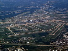 Dallas Fort Worth International Airport
The
Dallas Fort Worth International Airport
(
IATA airport code
: DFW), located between the cities of Dallas and Fort Worth, is the largest and busiest airport in the state of
Texas
. At 17,207 acres (6,963 ha) of total land area, DFW is also the second-largest airport in the country and the sixth-largest in the world. It is the third-busiest airport in the world in terms of aircraft movements and the world's seventh-busiest by passenger traffic, transporting 62.9 million passengers in FY 2014.
[84]
Based in Fort Worth,
American Airlines
' headquarters are adjacent to DFW. Recently having regained the title as the largest airline in the world in terms of both passengers transported and fleet size, American is a predominant leader in domestic routes and operations.
[85]
The
Dallas Love Field Airport
(IATA airport code: DAL) is located in northwest Dallas. Based in Dallas,
Southwest Airlines
is headquartered next to Love Field.
Freeways
[
edit
]
 DFW freeway map
The Dallas?Fort Worth area has thousands of lane-miles of freeways and interstates. The Metroplex has the second-largest number of freeway-miles per capita in the nation, behind only the
Kansas City metropolitan area
. As in most major metropolitan areas in Texas, most interstates and freeways have access or frontage roads where most of the businesses are located; these access roads have slip ramps allowing traffic to transition between the freeway and access road. North?south interstates include
I-35
and
I-45
. East?west routes include
I-30
and
I-20
. I-35 splits into
I-35E
and
I-35W
from Denton to Hillsboro: I-35W goes through Fort Worth while I-35E goes through Dallas. (This is one of only two examples of an interstate splitting off into branches and then rejoining as one; the other such split is in
Minneapolis-St. Paul
where I-35E goes into
St. Paul
and I-35W goes through
Minneapolis
.)
I-30
connects Dallas and Fort Worth, and I-45 connects Dallas to Houston. The "multiple-of-5" numbers used for the interstate designations are notable, as these numbers were designed to be used for major multi-state arteries of the
U.S. Interstate Highway System
. The North Texas region is the terminus for two of them, and I-45 is located only within Texas.
HOV lanes
exist along I-35E, I-30,
I-635
,
US 67
, and
US 75
. I-20 bypasses both Dallas and Fort Worth to the south while its loop,
I-820
, goes around Fort Worth.
I-635
splits to the north of I-20 and loops around east and north Dallas, ending at
SH 121
north of
Dallas Fort Worth International Airport
. I-35E,
Loop 12
, and
Spur 408
ultimately connect to I-20 southwest of Dallas, completing the west bypass loop around Dallas. A large number of construction projects are planned or are already underway in the region to alleviate congestion. Due largely to funding issues, many of the new projects involve building new tollways or adding tolled express lanes to existing highways, which are managed by the
North Texas Tollway Authority
. It was originally established to manage the
Dallas North Tollway
and oversees several other toll projects in the area.
[
citation needed
]
Public transit
[
edit
]
 Map of rail transit in the Dallas?Fort Worth area
Public transit options continue to expand significantly throughout the Metroplex. However, it is limited in several outlying and rural suburbs. Dallas County and portions of Collin and Rockwall counties have bus service and
light rail
operated by
Dallas Area Rapid Transit
(DART), covering thirteen member cities. DART's rail network currently sprawls for 93 miles throughout the area. The
Red Line
extends north to Plano and southwest to
Oak Cliff
. The
Blue Line
reaches from Rowlett in the northeast to the
University of North Texas at Dallas
campus near I-20 in the south. The 28-mile
Green Line
, which opened in December 2010, connects Carrollton in the northwest through downtown Dallas to
Pleasant Grove
in the southeast. The
Orange Line
, which completed expansion in 2014, parallels the Red Line from Plano to downtown Dallas and the Green Line from downtown Dallas to Northwest Hwy before extending through the
Las Colinas
area of Irving to reach DFW International Airport.
Denton County has bus service limited to Denton, Highland Village, and Lewisville (with commuter service to downtown Dallas) provided by the
Denton County Transportation Authority
(DCTA). The
A-train
, a diesel commuter rail line, parallels
I-35E
to connect Denton, Highland Village, Lewisville, and Carrollton. Several smaller towns along this line, Corinth, Shady Shores, and Lake Dallas, voted to abstain from DCTA and do not have stations. There is an across-the-platform transfer in Carrollton to the DART Green Line. A-Train service began June 20, 2011.
[86]
Tarrant County has bus services operated by
Trinity Metro
(formerly the Fort Worth Transportation Authority, popularly known as 'The T'), available only in Fort Worth. It additionally operates
TEXRail
commuter rail, which serves to connect downtown Fort Worth with DFW Airport and the DART Orange Line. The diesel commuter train that serves Fort Worth and its eastern suburbs is operated as the
Trinity Railway Express
; it connects downtown Fort Worth to downtown Dallas, where it links to the DART light rail system. A station near its midpoint, Centerport, also serves DFW Airport via a free airport shuttle bus. The TRE is jointly owned by FWTA and DART.
[87]
Amtrak
serves two stations in the Metroplex?
Dallas Union Station
and
Fort Worth Central Station
. Both are served by the
Texas Eagle
route, which operates daily between Chicago and San Antonio (continuing on to Los Angeles three days a week), though only Fort Worth is served by the Fort Worth-Oklahoma City
Heartland Flyer
.
As of 2016 the Taiwanese airline
EVA Air
operates a shuttle bus service from
George Bush Intercontinental Airport
in Houston to
Richardson
, so that Dallas-based customers may fly on its services to and from Houston.
[88]
See also
[
edit
]
Notes
[
edit
]
- ^
This has been rendered various different ways, with and without capitalization, with hyphens or slashes instead of dashes, and with or without spaces around those marks, and in abbreviated forms, sometimes without "Arlington", such as "Dallas?Fort Worth?Arlington MSA", "Dallas?Fort Worth Metropolitan Area", "Dallas?Fort Worth?Arlington Statistical Area", "Dallas?Fort Worth?Arlington Metro Area", "Dallas?Fort Worth Area", etc. The term is often rendered, especially in government documents, as "Dallas?Fort Worth?Arlington, TX Metropolitan Statistical Area", "Dallas?Fort Worth?Arlington, TX (MSA)", "Dallas?Fort Worth?Arlington, TX Metro Area", etc., using the US Postal Service code "TX" for Texas, and often without the syntactically expected comma after "TX". Other versions include the full word "Texas", and some give a shortened but redundant form such as "Dallas Area, Texas (Metro Area)". Other words are sometimes used, e.g. "Dallas?Fort Worth?Arlington Urbanized Area".
- ^
Mean monthly maxima and minima calculated based on data at said location from 1991 to 2020.
- ^
Official records for Dallas were kept at the Weather Bureau Office in downtown from 15 October 1913 to August 1940, and at Love Field since September 1940.
[38]
- ^
Sunshine normals are based on only 24 years of data.
References
[
edit
]
- ^
a
b
"OMB Bulletin No. 20-01: Revised Delineations of Metropolitan Statistical Areas, Micropolitan Statistical Areas, and Combined Statistical Areas, and Guidance on Uses of the Delineations of These Areas"
(PDF)
.
www.whitehouse.gov
. Retrieved
December 2,
2020
.
- ^
"2020 Population and Housing State Data"
.
United States Census Bureau
, Population Division. August 12, 2021
. Retrieved
January 16,
2022
.
- ^
a
b
"List of 2020 Census Urban Areas"
. United States Census Bureau
. Retrieved
January 7,
2023
.
- ^
"Total Gross Domestic Product for Dallas-Fort Worth-Arlington, TX (MSA)"
.
Federal Reserve Economic Data
.
Federal Reserve Bank of St. Louis
.
- ^
"Metropolitan Areas, Core Cities & Principal Cities"
(PDF)
. Demographia.com
. Retrieved
July 22,
2023
.
- ^
a
b
Bureau, U.S. Census.
"U.S. Census website"
.
United States Census Bureau
. Retrieved
May 14,
2020
.
- ^
"Dallas?Fort Worth?Arlington, TX MSA Population"
. U.S. Census Bureau. Archived from
the original
on March 24, 2017
. Retrieved
March 23,
2017
.
- ^
"More Counties Saw Population Gains in 2023"
.
- ^
"Here are this year's Fortune 500 companies by region"
.
The Dallas Morning News
. Retrieved
June 10,
2022
.
- ^
Burns, David W. (September 27, 2019).
"September 2019 U.S. Metro Economies Report"
.
United States Conference of Mayors
. Retrieved
December 26,
2019
.
- ^
"If the DFW economy were its own state, or a country, here's how it would rank"
.
www.bizjournals.com
. Retrieved
August 18,
2020
.
- ^
January 2020, AVNetwork Staff22 (January 22, 2020).
"2020's Best & Worst Metro Areas for STEM Professionals According to WalletHub"
.
systemscontractor
. Retrieved
June 19,
2020
.
{{
cite web
}}
: CS1 maint: numeric names: authors list (
link
)
- ^
"Nobel Prizes | A Legacy of Research & Discovery | UT Southwestern Medical Center"
.
utswmed.org
. Retrieved
June 19,
2020
.
- ^
"Nature Index 2019 Biomedical Sciences | Supplements"
.
Nature Index
. Retrieved
June 19,
2020
.
- ^
Shellnutt, Kate (March 21, 2011).
"Megachurches getting bigger; Lakewood quadruples in size since 2000"
.
Houston Chronicle
. Archived from
the original
on February 21, 2019
. Retrieved
June 19,
2020
.
- ^
a
b
"Dallas Has the Most Christians"
.
D Magazine
. July 29, 2015
. Retrieved
June 19,
2020
.
- ^
W.L. Tiltte.
"Is Dallas the Most Christian City in the NATION?"
.
D Magazine
.
Dallas
. Retrieved
September 16,
2020
.
- ^
a
b
"Adults in the Dallas metro area - Religion in America: U.S. Religious Data, Demographics and Statistics"
.
Pew Research Center's Religion & Public Life Project
. Retrieved
June 19,
2020
.
- ^
"LGBT"
.
LGBT
. Retrieved
June 19,
2020
.
- ^
"Dallas LGBT Fact Sheet"
.
www.smu.edu
.
- ^
"Same-sex Couples and the Gay, Lesbian, Bisexual Population: New Estimates from the American Community Survey"
(PDF)
. February 5, 2015.
Archived
(PDF)
from the original on February 5, 2015
. Retrieved
June 29,
2020
.
- ^
"
'A historic win': North Texas leaders, LGBTQ organizations react to landmark Supreme Court discrimination ruling"
.
wfaa.com
. June 15, 2020
. Retrieved
June 29,
2020
.
- ^
"The Sulphur Springs News-Telegram"
.
The Sulphur Springs News-Telegram
. Retrieved
June 19,
2020
.
- ^
North Texas Commission.
"History"
. Archived from
the original
on October 4, 2013
. Retrieved
October 1,
2013
.
- ^
North Texas Commission (January 1, 2002).
"
"Dallas/Fort Worth Metroplex" brand serves region well"
. Archived from
the original
on December 28, 2004
. Retrieved
June 27,
2006
.
- ^
a
b
"If North Texas Were a State ..."
North Texas Commission
. February 25, 2016. Archived from
the original
on March 28, 2016
. Retrieved
May 19,
2020
.
- ^
"TPWD:Blackland Prairie"
.
tpwd.texas.gov
. Retrieved
May 19,
2020
.
- ^
"Cross Timbers and Prairies Ecological Region"
.
tpwd.texas.gov
.
- ^
"U.S. Bureau of Labor and Statistics"
.
www.bls.gov
. Retrieved
July 26,
2019
.
- ^
a
b
"OMB Bulletin No. 18-04: Revised Delineations of Metropolitan Statistical Areas, Micropolitan Statistical Areas, and Combined Statistical Areas, and Guidance on Uses of the Delineations of These Areas"
(PDF)
.
United States
Office of Management and Budget
. September 14, 2018
. Retrieved
September 4,
2019
.
- ^
"At the Heart of Texas: Dallas?Plano?Irving"
.
www.dallasfed.org
. Retrieved
October 11,
2019
.
- ^
"At the Heart of Texas: Fort Worth?Arlington"
.
www.dallasfed.org
. Retrieved
October 11,
2019
.
- ^
"Which counties in North Texas are most vulnerable to tornadoes? This new map will show you"
.
Dallas News
. June 25, 2019
. Retrieved
August 19,
2020
.
- ^
"Dallas/Fort Worth ? All-Time Maximum and Minimum Temperatures"
. National Weather Service Fort Worth
. Retrieved
December 5,
2011
.
- ^
"NowData ? NOAA Online Weather Data"
.
National Oceanic and Atmospheric Administration
. Retrieved
November 30,
2012
.
- ^
"
DFW ? Freeze Summary
".
National Weather Service
. Retrieved November 2, 2018.
- ^
DFW Climate
. Retrieved on March 26, 2006.
Archived
October 10, 2008, at the
Wayback Machine
- ^
ThreadEx
- ^
"Station Name: TX DALLAS LOVE FLD"
. National Oceanic & Atmospheric Administration
. Retrieved
March 24,
2021
.
- ^
"Summary of Monthly Normals 1991?2020"
. National Oceanic and Atmospheric Administration
. Retrieved
May 5,
2021
.
- ^
"NOWData ? NOAA Online Weather Data"
. National Oceanic & Atmospheric Administration
. Retrieved
March 24,
2021
.
- ^
"WMO Climate Normals for FORT WORTH/GREATER SW INT'L A,TX 1961–1990"
. National Oceanic and Atmospheric Administration
. Retrieved
March 24,
2021
.
- ^
"Dallas, Texas, USA - Monthly weather forecast and Climate data"
. Weather Atlas. Archived from
the original
on November 12, 2020
. Retrieved
May 5,
2021
.
- ^
"NOW Data-NOAA Online Weather Data"
. National Oceanic and Atmospheric Administration. 2009
. Retrieved
August 2,
2009
.
- ^
"Fort Worth, Texas, USA - Monthly weather forecast and Climate data"
. Weather Atlas
. Retrieved
June 14,
2019
.
- ^
Population by City
Archived
May 20, 2018, at the
Wayback Machine
. North Central Texas Council of Governments, 2018. Retrieved 2018-05-19.
- ^
"2010 Census: Population of Texas Cities Arranged in Alphabetical Order"
.
Austin
: Texas State Library and Archives Commission
. Retrieved
September 5,
2012
.
- ^
"OMB Census"
.
Arlington
:
Arlington City Council
. Retrieved
November 12,
2012
.
- ^
Bureau, US Census.
"County Population Totals and Components of Change: 2020-2023"
.
Census.gov
. Retrieved
March 27,
2024
.
- ^
"Houston region saw second-largest population surge in U.S. In 2021-2022, census analysis finds"
. April 11, 2023.
- ^
a
b
"U.S. Census website"
.
United States Census Bureau
. Retrieved
January 31,
2008
.
- ^
"P2 Hispanic or Latino, and Not Hispanic or Latino by Race"
. Census.gov
. Retrieved
August 13,
2022
.
- ^
a
b
c
d
"Demographic Diversity in Texas and the DFW Metro Area"
(PDF)
.
demographics.texas.gov
. February 14, 2019
. Retrieved
June 19,
2020
.
- ^
"Census profile: Dallas-Fort Worth-Arlington, TX Metro Area"
.
Census Reporter
. Retrieved
June 2,
2022
.
- ^
"Major U.S. metropolitan areas differ in their religious profiles"
.
Pew Research Center
. July 29, 2015
. Retrieved
June 19,
2020
.
- ^
a
b
"Census profile: Dallas-Fort Worth, TX-OK CSA"
.
Census Reporter
. Retrieved
June 19,
2020
.
- ^
a
b
c
d
e
f
g
h
i
"Estimates of Resident Population Change and Rankings for Counties: July 1, 2018 to July 1, 2019"
. Retrieved
March 26,
2020
.
- ^
"Table 2. Annual Estimates of the Population of Combined Statistical Areas: April 1, 2010 to July 1, 2012"
.
2012 Population Estimates
.
United States Census Bureau
, Population Division. March 2013. Archived from
the original
(
CSV
)
on May 17, 2013
. Retrieved
April 19,
2013
.
- ^
"Many Of DFW's Corporate Relocations In 2019 Were Poached From San Francisco"
.
Bisnow
. Retrieved
February 16,
2020
.
- ^
Kotkin, Joel.
"Welcome To Y'all Street: The Cities Challenging New York For Financial Supremacy"
.
Forbes
. Retrieved
February 16,
2020
.
- ^
"Fortune 500"
.
Fortune
. Retrieved
February 4,
2020
.
- ^
Carlisle, Candace.
"Global engineering firm to relocate headquarters from California to Dallas"
.
Dallas Business Journal
.
- ^
"American Airlines unveils new $350 million headquarters in Fort Worth"
.
Dallas News
. September 23, 2019
. Retrieved
February 16,
2020
.
- ^
"Largest Employers in the Dallas Fort Worth Area"
.
www.destinationdfw.com
. August 19, 2013
. Retrieved
February 16,
2020
.
- ^
"Right Place, Wrong Time: How the 1952 Dallas Texans Flamed Out After One Lackluster Season of Football"
.
Texas Monthly
. March 22, 2019
. Retrieved
October 29,
2020
.
- ^
"How the Dallas Cowboys Were Born in 1960"
.
www.dallascowboys.com
. Retrieved
October 29,
2020
.
- ^
"Dallas Texans (Chiefs) Team History"
.
Sports Team History
. January 15, 2017
. Retrieved
October 29,
2020
.
- ^
"Kansas City Chiefs Team History"
.
Pro Football Hall of Fame Official Site
. Retrieved
October 29,
2020
.
- ^
"Washington Senators II team ownership history ? Society for American Baseball Research"
. Retrieved
October 29,
2020
.
- ^
Rathbun, Trevor (May 1, 2018).
"This Day in Mavs History: The Dallas Mavericks are Born"
.
Dallas Sports Fanatic
. Retrieved
October 29,
2020
.
- ^
"The North Stars Move to Dallas"
.
D Magazine
. January 13, 2010
. Retrieved
October 29,
2020
.
- ^
"The Cowboys will host another Super Bowl. But the date just got further away"
.
Dallas News
. May 23, 2018
. Retrieved
October 29,
2020
.
- ^
"Cotton Bowl: History and everything else you need to know"
.
NCAA.com
. Retrieved
October 29,
2020
.
- ^
"AT&T Stadium will host 9 games in upcoming 2026 World Cup - CBS Texas"
.
CBS News
. February 5, 2024.
- ^
"FIFA unveils stellar line-up of FIFA World Cup 2026 Host Cities"
. FIFA. June 16, 2022.
Archived
from the original on June 16, 2022
. Retrieved
June 16,
2022
.
- ^
"Fast Facts"
.
- ^
"Dave Leip's election atlas"
.
- ^
"Office of the Secretary of State"
.
- ^
a
b
"2016 election: Division in a key Texas Republican stronghold?"
.
star-telegram
. Retrieved
November 3,
2017
.
- ^
Fechter, Joshua (September 22, 2023).
"Dallas Mayor Eric Johnson switches to Republican Party"
.
The Texas Tribune
. Retrieved
September 22,
2023
.
- ^
Briseno, Alex (November 12, 2020).
"President-elect Joe Biden wins Tarrant County in final vote tally"
.
The Dallas Morning News
.
- ^
"Radio stations in Dallas, Texas - Radio Lineup"
.
www.radiolineup.com
. Retrieved
October 29,
2020
.
- ^
"Sony launches free-to-air SAB TV in the US"
. Rapid TV News
. Retrieved
February 8,
2022
.
- ^
"DFW End Report Shows Record 62 Million Customers"
. Archived from
the original
on November 17, 2015
. Retrieved
November 16,
2015
.
- ^
IATA.
"Scheduled Passengers Carried"
.
iata.org
. Archived from
the original
on June 12, 2011
. Retrieved
February 17,
2012
.
- ^
Peterson, Matt (June 20, 2011).
"A-train railway begins rolling, carrying commuters from Denton to Carrollton"
.
The Dallas Morning News
. Archived from
the original
on July 1, 2011
. Retrieved
June 20,
2011
.
- ^
"About ? Trinity Railway Express (TRE)"
. Trinity Railway Express. Archived from
the original
on February 4, 2012
. Retrieved
April 22,
2013
.
- ^
"
Dallas ? Houston ? Dallas Free Shuttle Service Schedule
Archived
September 5, 2015, at the
Wayback Machine
."
EVA Air
. Retrieved on February 29, 2016.
External links
[
edit
]
Articles relating to Dallas?Fort Worth metroplex
|
|---|
|
|---|
| Topics
| |
|---|
| Counties
| |
|---|
| Major cities
| |
|---|
Cities and towns
100k?300k
| |
|---|
Cities and towns
25k?99k
| |
|---|
Cities and towns
10k?25k
| |
|---|
|
32°45′47″N
97°01′57″W
/
32.7630°N 97.0326°W
/
32.7630; -97.0326