Province of Indonesia in western Java
Province in Serang
Banten
|
|---|
|
| Province of Banten
|
 Coat of arms
|
Nickname(s):
Tanah Jawara
(
Sundanese
)
??? ???
Land of the Champions
|
| Motto(s):
|
 |
|
| Coordinates:
6°30′S
106°15′E
/
6.500°S 106.250°E
/
-6.500; 106.250
|
| Capital
| Serang
|
|---|
| Largest city
| Tangerang
|
|---|
| Established
| 4 October 2000
|
|---|
|
| ? Body
| Banten Provincial Government
|
|---|
| ? Governor
| Al Muktabar (
Acting
)
|
|---|
| ? Vice Governor
| Vacant
|
|---|
|
| ? Total
| 9,352.77 km
2
(3,611.12 sq mi)
|
|---|
| ? Rank
| 34th in Indonesia
|
|---|
| Highest elevation
| 1,929 m (6,329 ft)
|
|---|
|
| ? Total
| 12,307,732
|
|---|
| ? Rank
| 5th in Indonesia
|
|---|
| ? Density
| 1,300/km
2
(3,400/sq mi)
|
|---|
| Demonym
| Bantenese
|
|---|
|
| ?
Religion
| Islam
(94.62%)
Christianity
(3.94%)
?
Protestant
(2.65%)
?
Catholic
(1.29%)
Buddhism
(1.30%)
Hindu
(0.10%)
Aliran Kepercayaan (0.03%)
Konghucu
(0.01%)
[2]
|
|---|
| ?
Languages
| Indonesian
(official)
Sundanese
(
lingua franca
)
Javanese
(minor areas)
Betawi
|
|---|
| Time zone
| UTC+7
(
Indonesia Western Time
)
|
|---|
| ISO 3166 code
| ID-BT
|
|---|
| GDP
(nominal)
| 2022
[3]
|
|---|
| - Total
| Rp
747.3 trillion (
8th
)
US$
50.3 billion
Int$
157.0 billion (
PPP
)
|
|---|
| - Per capita
| Rp
61.00 million (
15th
)
US$
4,107
Int$
12,817 (
PPP
)
|
|---|
| - Growth
|  5.03%
[4] 5.03%
[4]
|
|---|
| HDI
| 0.738 (
8th
) ?
high
|
|---|
| Website
| bantenprov
.go
.id
|
|---|
Banten
(
Indonesian
:
Banten
,
Sundanese
:
???????
,
romanized:
Banten
) is the westernmost
province
on the island of
Java
,
Indonesia
. Its capital city is
Serang
and its largest city is
Tangerang
. The province borders
West Java
and the
Special Capital Region of Jakarta
on the east, the
Java Sea
on the north, the
Indian Ocean
on the south, and the
Sunda Strait
(which separates Java from the neighbouring island of
Sumatra
) on the west and shares a maritime border with
Bengkulu
and
Lampung
to the east and
Bangka Belitung Islands
to the north. The province covers an area of 9,352.77 km
2
(3,611.12 sq mi). It had a population of over 11.9 million in the
2020 census
,
[5]
up from about 10.6 million in
2010
.
[6]
The estimated mid-2023 population was 12.308 million.
[1]
Formerly part of the province of
West Java
, Banten was split off to become a province on 17 October 2000.
The northern half (particularly the eastern areas near Jakarta and the Java Sea coast) has recently experienced rapid rises in population and
urbanization
, and the southern half (especially the region facing the
Indian Ocean
) has a more traditional character but an equally fast-rising population.
Present-day Banten was part of the Sundanese
Tarumanagara kingdom
from the fourth to the seventh centuries AD. After the fall of Tarumanegara, it was controlled by
Hindu
-
Buddhist
kingdoms such as the
Srivijaya
Empire and the
Sunda Kingdom
. The
spread of Islam
in the region began in the 15th century; by the late 16th century,
Islam
had replaced Hinduism and Buddhism as the dominant religion in the province, with the establishment of the
Banten Sultanate
. European traders began arriving in the region – first the
Portuguese
, followed by the
British
and the
Dutch
. The
Dutch East India Company
(VOC) finally controlled the regional economy, gradually weakening the Banten Sultanate. On 22 November 1808, Dutch
Governor-General
Herman Willem Daendels
declared that the Sultanate of Banten had been absorbed into the
Dutch East Indies
.
[7]
This began the
Bantam Residency
, 150 years of direct Dutch rule. In March 1942, the
Japanese
invaded the Indies and
occupied the region
for three years before their August 1945
surrender
. The region was returned to Dutch control for the next five years before the Dutch left and it was ruled by the
Indonesian government
. Banten became part of the province of West Java, but separatist efforts led to the creation of the separate province of Banten in 2000.
[8]
Etymology
[
edit
]
The name "Banten" has several possible origins. The first is from the
Sundanese
phrase
katiban inten,
which means "struck down by diamonds". The phrase comes from the history of the
Bantenese people
, who were
animists
before adopting
Buddhism
and
Hinduism
. After
Islam
began to spread in Banten, the community began to recognize and embrace Islam. The spread of Islam in Banten is described as being "struck down by diamonds".
[9]
Another origin story is that the
Indonesian Hindu
god
Batara Guru
traveled from east to west, arriving at Surasowan (present-day
Serang
). When he arrived, Batara Guru sat on a stone which became known as
watu gilang
. The stone glowed, and was presented to the king of Surasowan. Surasowan was reportedly surrounded by a clear, star-like river, and was described as a ring covered with diamonds (
Sundanese
:
ban inten
). This evolved into "banten".
[9]
Another possibility is that "Banten" comes from the
Indonesian
word
bantahan
(rebuttal), because the local Bantenese people resisted the
Dutch colonial government
.
[9]
The word "Banten" appeared before the establishment of the
Banten Sultanate
as the
name of a river
. The high plains on its banks were called
Cibanten Girang
, shortened to
Banten Girang
(Upper Banten). Based on research in Banten Girang, the area has been settled since the 11th and 12th centuries.
[10]
During the 16th century, the region developed rapidly towards Serang and the northern coast. The coastal area later became the Sultanate of Banten, founded by
Sunan Gunung Jati
, which controlled almost all of the former
Sunda Kingdom
in West Java.
Sunda Kelapa
(
Batavia
) was captured by the Dutch, and
Cirebon
and the
Parahiyangan
region were captured by the
Mataram Sultanate
. The Banten Sultanate was later converted into a
residency
by the Dutch.
[9]
History
[
edit
]
Early history
[
edit
]
 Bird's-eye view of the town of
Banten
in 1599
Bird's-eye view of the town of
Banten
in 1599
 With his father,
Sunan Gunungjati
, Sultan Maulana Hasanuddin founded the
Sultanate of Banten
.
With his father,
Sunan Gunungjati
, Sultan Maulana Hasanuddin founded the
Sultanate of Banten
.
During the fifth century, Banten was part of the kingdom of
Tarumanagara
. The fourth-century
Lebak inscription
, discovered in 1947 in a lowland village on the Cidanghiyang River in
Munjul, Pandeglang
[
id
]
, contains two lines of
Sanskrit
poetry in the
Pallawa script
[11]
which describes life in the kingdom under the reign of
Purnawarman
.
[12]
The kingdom collapsed after an attack by
Srivijaya
, and western Java became part of the
Sunda Kingdom
. In the Chinese
Chu-fan-chi
, written around 1225,
Chou Ju-kua
wrote that Srivijaya ruled Sumatra, the Malay peninsula, and western Java during the early 13th century.
Chu-fan-chi
identified the port of Sunda as strategic and thriving, with
pepper
from Sunda among the highest quality. The population were made up of farmers, and their houses were built on wooden poles (
rumah panggung
). Robbery, however, was common.
[13]
According to Portuguese explorer
Tome Pires
, Bantam (
Banten
) was an important early-16th-century port in the Kingdom of Sunda along with the ports of
Pontang
, Cheguide (Cigede), Tangaram (
Tangerang
), Calapa (
Sunda Kelapa
) and Chimanuk (on the
Cimanuk river
estuary).
[14]
In 1527, as the Portuguese fleet arrived off the coast, newly-converted
Javanese
Muslims
under
Sunan Gunungjati
captured the port of Banten and the surrounding area from the Sundanese and established the
Sultanate of Banten
. According to Portuguese historian
Joao de Barros
,
Banten
was the center of the sultanate and a major
Southeast Asian
port (rivaling
Malacca
and
Makassar
). The town of Banten was in the middle of the bay, about 3 mi (4.8 km) across. It was 850
fathoms
in length. A river, navigable by
junks
, flowed through the center of the town; a small tributary extended to the town's edge. The present-day river is smaller, and only navigable by small boats. A fortress near the town had brick walls seven
palms
thick. Armed, wooden defence buildings were two stories high. The town square was used for military activities and folk art, with a market in the morning. The palace was on the south side of the square. Next to the palace is a tall, flat-roofed building known as Srimanganti, which was used by the king to meet his subjects. West of the square is the
Great Mosque of Banten
.
Colonial era
[
edit
]
 Warriors of Banten in 1596
 In 1808, Dutch
Governor-general
Herman Willem Daendels
ordered the annexation of the
Banten Sultanate
. This marked the end of the four-century-old sultanate and the beginning of 150 years of
Dutch rule
in the region.
In 1808, Dutch
Governor-general
Herman Willem Daendels
ordered the annexation of the
Banten Sultanate
. This marked the end of the four-century-old sultanate and the beginning of 150 years of
Dutch rule
in the region.
When the Dutch arrived in Indonesia, the Portuguese had long been in Banten. The English established a
factory
in Banten, followed by the Dutch. The French and the Danish also came to trade in Banten. In the competition among European traders, the Dutch emerged victorious. The Portuguese left Banten in 1601 after their fleet was destroyed by the Dutch off the coast during the
Dutch?Portuguese War
.
Although the Dutch won the war, they preserved the
Banten Sultanate
. The maritime sultanate relied on trade, and the pepper monopoly in
Lampung
made the Banten authorities intermediaries. The sultanate grew rapidly, becoming a commercial center.
[15]
As sea trade increased throughout the archipelago, Banten became a multi-ethnic region. Assisted by the British, Danish and Chinese, Banten traded with
Persia
,
India
,
Siam
,
Vietnam
,
the Philippines
,
China
and
Japan
.
[16]
The reign of Sultan
Ageng Tirtayasa
was the sultanate's height.
[17]
Under his reign, Banten had one of the strongest navies in the region, built to European standards with help from European shipbuilders and attracted Europeans to the sultanate.
[18]
To secure its shipping lanes, Banten sent its fleet to
Sukadana
(the present-day
Ketapang Regency
in
West Kalimantan
) and conquered it in 1661.
[19]
Banten also tried to escape the pressure of the
Dutch East India Company
(VOC), which had blockaded incoming merchant ships.
[18]
A power struggle developed around 1680 between
Ageng Tirtayasa
and his son,
Abu Nashar Abdul Qahar
(also known as Sultan Haji). The disagreement was exploited by the VOC, who supported Haji and causing a civil war. Strengthening his position, Haji sent two envoys to meet King
Charles II of England
in
London
in 1682 to obtain support and weapons.
[20]
In the ensuing war, Ageng withdrew from his palace to Tirtayasa (present-day
Tangerang
); on 28 December 1682, the region was seized by Haji with Dutch assistance. Ageng and his other sons, Pangeran Purbaya and Syekh Yusuf from
Makassar
, retreated to the southern Sunda interior. On 14 March 1683, Sultan Ageng was captured and imprisoned in
Batavia
.
The VOC continued to pursue and suppress Sultan Ageng's followers, led by Prince Purbaya and Sheikh Yusuf. On 5 May 1683, the VOC sent Lieutenant
Untung Surapati
and his Balinese troops, joining forces led by VOC Lieutenant Johannes Maurits van Happel to subdue the
Pamotan
[
id
]
and
Dayeuhluhur
regions; on 14 December 1683, they captured Sheikh Yusuf.
[21]
Heavily outnumbered, Prince Purbaya surrendered. Surapati was ordered by Captain Johan Ruisj to pick up Purbaya and bring him to Batavia. They met with VOC forces led by Willem Kuffeler, but a dispute between them destroyed Kuffeler's forces; Surapati and his followers became fugitives from the VOC.
[22]
 Francois Valentijn
's painting of Banten in 1694
Francois Valentijn
's painting of Banten in 1694
Lampung was given to the VOC on 12 March 1682 by Sultan Haji as compensation for the company's support, and a 22 August 1682 letter gave the VOC the province's pepper monopoly.
[23]
The sultanate also had to reimburse the VOC for losses caused by the war.
[24]
After Sultan Haji's death in 1687, the VOC's influence in the sultanate began to increase; the appointment of a new sultan required the approval of the governor-general in Batavia. Sultan Abu Fadhl Muhammad Yahya ruled for about three years before he was replaced by his brother, Pangeran Adipati (Sultan Abul Mahasin Muhammad Zainul Abidin). The civil war in Banten left instability for the next government, due to dissatisfaction with the VOC's interference in local affairs.
[19]
Popular resistance peaked again at the end of the reign of Sultan Abul Fathi Muhammad Syifa Zainul Arifin. The sultan sought VOC assistance against the rebellion, and Banten became a
vassal state
of the company in 1752.
[25]
In 1808, at the peak of the
Napoleonic Wars
, Governor-general
Herman Willem Daendels
ordered the construction of the
Great Post Road
to defend Java from British attack.
[26]
Daendels ordered the sultan of Banten to move his capital to
Anyer
and provide labor to build a port in
Ujung Kulon
. The sultan defied Daendels' order, and Daendels ordered an attack on Banten and the destruction of Surosowan Palace. The sultan and his family were held in the palace before their imprisonment in Fort Speelwijk. Sultan Abul Nashar Muhammad Ishaq Zainulmutaqin was then exiled to Batavia. On 22 November 1808, Daendels announced from his
Serang
headquarters that the sultanate had been absorbed into the
Dutch East Indies
.
[27]
The sultanate was abolished in 1813 by the British after the
invasion of Java
.
[28]
That year, Sultan Muhammad bin Muhammad Muhyiddin Zainussalihin was disarmed and forced to abdicate by
Thomas Stamford Raffles
; this ended the sultanate. After the British returned Java to the Dutch in 1814 as part of the
Anglo-Dutch Treaty of 1814
, Banten became a
residentie
(residency) of the Dutch East Indies.
[8]
Japanese occupation and independence
[
edit
]
 R?musha
after their liberation by the Dutch. Thousands of labourers died during the construction of the Saketi?Bayah railway under Japanese occupation.
R?musha
after their liberation by the Dutch. Thousands of labourers died during the construction of the Saketi?Bayah railway under Japanese occupation.
Japan
invaded the East Indies
, expelling the Dutch, and occupied Banten in March 1942. During their
three years of occupation
, the Japanese built the
Saketi?Bayah railway
in southern
Lebak
to transport
brown coal
from the Bayah mines. The project involved a workforce of about 1,000
r?musha
(local forced labourers) and a few engineers and technicians (mainly Dutch), supervised by the Japanese.
[29]
The r?musha working in the mines were taken from
Central
and
East Java
, the railway r?musha were primarily from Banten. The construction took 12 million human days over 14 months.
[30]
Working conditions were harsh due to food shortages, lack of medical care, and the tropical climate.
[31]
Casualties are estimated at 20,000 to 60,000, not including mine workers.
[29]
After
Japan surrendered
in August 1945, the Dutch East Indies
declared independence
as the Republic of Indonesia. This was opposed by the returning Dutch, resulting in the
Indonesian war of independence
. During the war, Banten remained under Indonesian control. On 26 February 1948, the State of West Java (
Indonesian
:
Negara Jawa Barat
,
Sundanese
:
Negara Jawa Kulon
) was established; on 24 April 1948, it was renamed
Pasundan
. Pasundan became a
federal state
of the
United States of Indonesia
in 1949, and was incorporated into the
Republic of Indonesia
on 11 March 1950.
[32]
After Indonesian independence, Banten became part of the province of
West Java
. Separatist sentiment led to the creation of the province of Banten in 2000.
[33]
Geography
[
edit
]
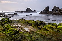
 Tanjung Lesung
beach,
Pandegelang Regency
Tanjung Lesung
beach,
Pandegelang Regency
 Mangrove forest in
Ujung Kulon National Park
Mangrove forest in
Ujung Kulon National Park
Banten lies between 5°7'50" and 7°1'11" south latitude and 105°1'11" and 106°7'12" east longitude.
[34]
The province has a land area of 9,352.77 km
2
(3,611.12 sq mi).
[35]
It is near the
Sunda Strait
's sea lanes, which link
Australia
and
New Zealand
with
Southeast Asia
. Banten also links
Java
and Sumatra. The region has a number of industries; its seaports handle overflow cargo from the seaport in
Jakarta
,
[36]
and are intended to be an alternative to the
Port of Singapore
.
[37]
Its location on the western tip of Java makes Banten the gateway to Java,
Sumatra
and the adjacent areas of Jakarta, Indonesia's capital. Bordering the
Java Sea
on the north, the
Sunda Strait
on the west and the
Indian Ocean
on the south, the province has abundant marine resources.
[38]
The land area includes some 81 offshore islands (large enough to have names) of which 50 are in Pandeglang Regency, 4 in Lebak Regency, 9 in Serang Regency, 5 in Cilegon City and 11 in Tangerang Regency.
Topography
[
edit
]
 Sawarna Banten Green View, Lebak Regency
 Rawa Danau, Serang Regency
The province ranges in altitude from sea level to 2,000 m (6,600 ft). Banten is primarily lowland (below 50 metres above sea level) in
Cilegon
,
Tangerang
,
Pandeglang Regency
, and most of
Serang Regency
. The central
Lebak
and Pandeglang Regencies range from 201 to 2,000 m (659 to 6,562 ft), and the eastern Lebak Regency ranges in altitude from 501 to 2,000 m (1,644 to 6,562 ft) at the summit of
Mount Halimun
.
Banten's
geomorphology
generally consists of lowlands and sloping and steep hills.
[39]
The lowlands are generally in the north and south.
The sloping hills have a minimum height of 50 m (160 ft) above sea level. Mount Gede, north of Cilegon, has an altitude of 553 m (1,814 ft) above sea level; there are also hills in the southern Serang Regency, in the Mancak and Waringin Kurung Districts. The southern Pandeglang Regency is also hilly. In eastern Lebak Regency, bordering
Bogor Regency
and
Sukabumi Regency
in
West Java
, most of the region consists of steep hills of old
sedimentary rock
interspersed with igneous rocks such as
granite
,
granodiorite
,
diorite
and
andesite
. It also contains valuable
tin
and
copper
deposits.
[40]
Climate
[
edit
]
 Administrative map of Banten
Banten's climate is influenced by the
South
and
East Asian Monsoons
and the alternating
La Nina
or
El Nino
. During the rainy season, the weather is dominated by a west wind (from
Sumatra
and the
Indian Ocean
south of the
Indian subcontinent
) joined by winds from
Northern Asia
crossing the
South China Sea
. The dry season is dominated by an east wind which gives Banten severe droughts, especially on the northern coast during El Nino. Temperatures on the coast and in the hills range from 22 to 32 °C (72 to 90 °F), and temperatures in the mountains from 400 to 1,350 m (1,310 to 4,430 ft) above sea level range from 18 to 29 °C (64 to 84 °F).
The heaviest rainfall ranges from 2,712 to 3,670 mm (106.8 to 144.5 in) during the rainy season from September to May, covering half of the western
Pandeglang Regency
. Rainfall from 335 to 453 mm (13.2 to 17.8 in) covers half of
Tangerang Regency
, the northern
Serang Regency
, and the cities of
Cilegon
and
Tangerang
. In the dry season (from April to December), the peak rainfall of 615 to 833 mm (24.2 to 32.8 in) covers half of the northern Serang and Tangerang Regencies and the cities of Cilegon and Tangerang. The lowest dry-season rainfall, 360 to 486 mm (14.2 to 19.1 in) from June to September, covers half of the southern Tangerang Regency and 15 percent of southeastern Serang Regency.
Administrative divisions
[
edit
]
The city of
Serang
is the capital and administrative center of the province.
Banten consists of four
regencies
(
kabupaten
) and four autonomous
cities
(
kota
), listed below with their populations in the 2010
[6]
and 2020 censuses
[5]
and in official mid-2023 estimates.
[1]
The cities and regencies are subdivided into 155 districts (
kecamatan
) as at 2023, in turn sub-divided into 314
urban villages
(
kelurahan
) and 1,238 rural villages (
desa
).
Over half (54.48% in mid 2023) of the population lives in the northeast corner of the province on just 14.6% of its land area. This corner, which comprises Tangerang Regency, Tangerang City and South Tangerang City, is part of the Jakarta metropolitan area (
Jabodetabek
).
Kode
Wilayah
|
Name of
City or
regency
|
Capital
|
Area
(km
2
)
|
Pop'n
2010
census
|
Pop'n
2020
census
|
Pop'n
estimate
mid-2023
|
HDI
[41]
2014
estimate
|
| 36.72
|
Cilegon
|
162.51
|
374,559
|
434,896
|
450,507
|
0.715 (high)
|
| 36.73
|
Serang
|
266.18
|
577,785
|
692,101
|
723,794
|
0.702 (high)
|
| 36.02
|
Lebak Regency
|
Rangkasbitung
|
3,312.18
|
1,204,095
|
1,386,793
|
1,433,698
|
0.616 (medium)
|
| 36.01
|
Pandeglang Regency
|
Pandeglang
|
2,746.81
|
1,149,610
|
1,272,687
|
1,312,766
|
0.620 (medium)
|
| 36.04
|
Serang Regency
|
Ciruas
|
1,467.35
|
1,402,818
|
1,622,630
|
1,682,133
|
0.639 (medium)
|
|
|
Western Banten totals
|
7,955.03
|
4,708,867
|
5,409,107
|
5,602,898
|
|
| 36.74
|
South Tangerang
|
164.85
|
1,290,322
|
1,354,350
|
1,391,649
|
0.791 (high)
|
| 36.71
|
Tangerang
|
164.55
|
1,798,601
|
1,895,486
|
1,950,580
|
0.758 (high)
|
| 36.03
|
Tangerang Regency
|
Tigaraksa
|
1,034.54
|
2,834,376
|
3,245,619
|
3,362,605
|
0.695 (medium)
|
|
|
Eastern Banten totals
(Greater Tangerang)
|
1,363.94
|
5,923,299
|
6,495,455
|
6,704,834
|
|
|
|
Banten totals
|
9,318.97
|
10,632,166
|
11,904,562
|
12,307,732
|
0.698 (medium)
|
Regency capitals
[
edit
]
Under the Law No. 2 of 1993, Tangerang was incorporated as a city on 27 February 1993 from the Tangerang Regency, of which it had been the administrative capital. It was replaced by Cipasera.
Under the Law No. 15 of 1999, Cilegon was incorporated as a city on 20 April 1999 from the Serang Regency, of which it had been the administrative capital. It was replaced by Serang.
Under the Law No. 32 of 2007, Serang was incorporated as a city on 14 August 2007 from the Serang Regency, of which it had been the administrative capital. It was replaced by Ciruas.
Under the Law No. 51 of 2008, South Tangerang (formerly Cipasera) was incorporated as a city on 26 November 2008 from the Tangerang Regency, of which it had been the administrative capital. It was replaced by Tigaraksa.
Demographics
[
edit
]
 Baduy people
in
Serang
during the Seba Baduy event
Baduy people
in
Serang
during the Seba Baduy event
The 2006 population of Banten was 9,351,470, with 3,370,182 children (36.04 percent), 240,742 elderly people (2.57 percent), and the remaining 5,740,546 people aged between 15 and 64. It was Indonesia's fifth-most-populous province, after
West Java
,
East Java
,
Central Java
and
North Sumatra
. By mid-2022, the estimated total had risen to 12,251,985.
[42]
Ethnic groups
[
edit
]
 Mass
Benteng
wedding ceremony
Mass
Benteng
wedding ceremony
The
Bantenese people
are the largest group in the province, forming 47% of the total population. They mostly inhabit the central and southern part of the province. The origins of the Bantenese people; which are closely related to the
Banten Sultanate
, are different from the
Cirebonese people
whom are not part of the
Sundanese people
nor the
Javanese people
(unless it is from the result of a mixture of two major cultures, namely Sundanese and Javanese). The Bantenese people along with the
Baduy people
(Kanekes) are essentially a subdivision of the
Sundanese people
which occupies the former region of the
Banten Sultanate
(region of Bantam Residency after the abolishment and annexation by the
Dutch East Indies
). Only after the formation of the
Banten Province
did people began to regard the Bantenese as a group of people with a culture and language of their own.
[43]
Most of the north Banten population is
Javanese
. Most of the Javanese are migrants from central and eastern Java. The
Betawi people
live in
greater Jakarta
, including
Tangerang
.
Chinese Indonesians
may also be found in urban areas, also primarily in the greater Jakarta area. The
Benteng Chinese
(a subgroup of Chinese Indonesians) lives in Tangerang and the surrounding area, and are distinct from other Chinese Indonesians.
[44]
[45]
[46]
Languages
[
edit
]
 Linguistic map of Banten
The province's dominant language is
Sundanese
.
[47]
[48]
Its indigenous people speak a dialect derived from archaic Sundanese, classified as informal in modern Sundanese.
[49]
[50]
The
Mataram Sultanate
tried to control West Java, including Banten; the Sultanate of Banten defended its territory except for Banten. In the mountains and most of present-day Banten, the "loma" version of the Sundanese language is dominant; this version is considered "harsh" by people from Parahyangan.
Bantenese
is commonly spoken, especially in the southern
Pandeglang
and
Lebak Regencies
.
[51]
Near Serang and Cilegon, the
Javanese
Banyumasan dialect
is spoken by about 500,000 people.
[52]
In northern Tangerang,
Betawi
is spoken by Betawi immigrants.
Indonesian
is also widely spoken, especially by urban migrants from other parts of Indonesia. The
Baduy people
speak the
Baduy language
, also an archaic form of Sundanese.
[53]
Religion
[
edit
]
 A
rampak bedug
performance at a Serang culinary festival
A
rampak bedug
performance at a Serang culinary festival
Most residents are Muslims (94.85% of population),
[54]
and the Banten Sultanate was one of the largest Islamic kingdoms on the island of
Java
. The province also has other ethnicities and religions, including the Benteng Chinese community in
Tangerang
and the
Baduy people
who practice
Sunda Wiwitan
in Kanekes, Leuwidamar,
Lebak Regency
.
Based on archaeological data, early Banten society was influenced by the
Hindu
-
Buddhist
Tarumanagara
,
Sriwijaya
and
Sunda Kingdoms
. According to the
Babad Banten
,
Sunan Gunung Jati
and Maulana Hasanuddin spread Islam extensively in the region.
Maulana Yusuf
reportedly engaged in
da'wah
in the interior, and conquered
Pakuan Pajajaran
.
The sultan of Banten's genealogy reportedly traced back to
Muhammad
, and the
ulamas
were influential.
Tariqa
Sufism
developed in the region.
Culture
[
edit
]
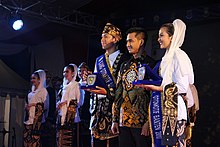 Selection of Kang Nong Banten in 2017. The finalists wear traditional Bantenese dress.
Banten's culture is based on Hinduism, Buddhism and Islam. It includes the
pencak silat
martial arts, the
Saman dance
, and
Palingtung
[
id
]
. Religious sites include the
Great Mosque of Banten
and the Keramat Panjang Tomb.
The
Baduy people
live in central and southern Banten. The Inner Baduy tribes are native Sundanese who are
opposed to modernization
in dress and lifestyle, and the Outer Baduy tribes are more open to modernization. The Baduy-Rawayan tribe lives in the Kendeng Cultural Heritage Mountains, an area of 5,101.85 ha (19.70 sq mi) spanning the Kanekes area, Leuwidamar District,
Lebak Regency
. Baduy villages are generally located on the Ciujung River in the Kendeng Mountains.
[55]
Weapons
[
edit
]
The
golok
, similar to a
machete
, is Banten's traditional weapon. Formerly a self-defence weapon, it is now a martial-arts tool. The Baduy people use goloks for farming and forest hunting. Other traditional weapons include the
kujang
,
kris
, spear, sledgehammer, machete, sword and bow and arrow.
Traditional housing
[
edit
]
Traditional housing in Banten has
thatched
roofing, with floors made of split and pounded
bamboo
. This type of traditional house is still widely found in areas inhabited by the Kanekes and Baduy peoples.
Clothing
[
edit
]
Bantenese men traditionally wear closed-neck shirts and trousers belted with
batik
, perhaps with a golok tucked into the belt. Bantenese women traditionally wear a
kebaya
, decorated with a hand-crafted brooch at the waist. Hair is tied into a bun, and decorated with a flower.
Islamic architecture
[
edit
]
Three-level mosque architecture is symbolic of
tariqa
ihsan
(beauty) and
sharia
(law).
[55]
Pencak silat
[
edit
]
Pencak silat
is a group of martial arts, rooted in
Indonesian culture
, which reportedly existed throughout the archipelago since the seventh century. It began to be recorded when it was influenced by the
ulamas
during the spread of Islam in the 15th century. At that time, martial arts were taught with religious studies in
pesantren
(Islamic boarding schools). Religion and pencak silat became intertwined.
Silat
evolved from folk dancing, becoming part of the region's defense against invaders.
Banten is known for its warriors, who are proficient in the martial arts.
[55]
Debus
(from
Arabic
:
???????
,
romanized
:
dabb?s
) is a Bantenese martial art which was developed during the 16th century.
[56]
Transport
[
edit
]
Banten is in western
Java
. In 2006, 249.246 km (155 mi) of its national roads were in good condition; 214.314 km (133 mi) were in fair condition, and 26.840 km (16.7 mi) were in poor condition. At the end of that year, 203.67 km (127 mi) of Banten's 889.01 km (552 mi) provincial road network were in good condition; 380.02 km (236 mi) were in fair condition, and 305.320 km (190 mi) were in poor condition. The province's national roads are congested; provincial roads have less traffic, and congestion is generally localized.
Rail transport is declining; 48 percent of Banten's 305.9 km (190.1 mi) rail network was operational in 2005, with an average of 22 passenger trains and 16 freight trains per day. Most lines were
single-track
, and the main line was the 141.6 km (88.0 mi)
Merak
-
Tanah Abang
, Tangerang-Duri, Cilegon-Cigading line, and
Soekarno?Hatta Airport Rail Link
serving
Manggarai
-
Soetta Airport
along with the
Skytrain
. Then
Jakarta MRT
Phase 3 with Balaraja to Cikarang, will be construction in 2024.
[57]
[58]
Soekarno?Hatta International Airport
is Indonesia's main national airport. Other airports include the general-aviation
Pondok Cabe Airport
in South Tangerang,
Budiarto Airport
in Tangerang (for training), and
Gorda Airport
in
Serang
(used by the
Indonesian Air Force
).
Economy
[
edit
]
Banten GDP share by sector (2022)
[59]
Agriculture (5.09%)
Manufacturing (30.47%)
Other Industrial (14.58%)
Service (49.86%)
 Bantenese
men during a
debus
performance
Bantenese
men during a
debus
performance
Banten's 2006 population totaled 9,351,470, with 36.04 percent children, 2.57 percent elderly, and the remainder 15 to 64 years old. The province's 2005 Gross Regional Domestic Product (GDP) was primarily from the manufacturing industry sector (49.75 percent), followed by the trade, hotel and restaurant sector (17.13 percent), transportation and communication (8.58 percent), and agriculture (8.53 percent). Industry had 23.11 percent of jobs, followed by agriculture (21.14 percent), trade (20.84 percent) and transportation and communication (9.5 percent). The northern part of the province is more economically developed than the southern part.
It is strategically located between
Java
and
Sumatra
. Most investment is in
Tangerang
,
South Tangerang
and the rest of the north because of their infrastructure and proximity to
Jakarta
. Infrastructure in southern Banten lags behind that of the north, and Banten's development policies have prioritised growth over equality in
Pandeglang
and
Lebak
regencies; investors choose areas with existing infrastructure to ensure competitiveness.
Tourism
[
edit
]
 The Great Mosque of Banten
 Ujung Kulon National Park
in 2014
Ujung Kulon National Park
in 2014
Ujung Kulon National Park
is a national park and nature preserve which includes the island of
Panaitan
. Its highest point is Mount Honje. Species protected in the park include the Javan rhino, deer, antelope, buffalo, several primate species, wild boar, jungle cat, sloth, and several species of birds. It can be reached via Labuan in Pandeglang Regency or by boat. The park has telecommunications networks, electricity, clean water, accommodations, information centers, travel guides, and transportation facilities. In 1991, it became a UNESCO
World Heritage Site
.
[60]
Pulau Dua, covering about 30 ha (74 acres) near Serang, is known for its ocean coral, fish and of birds. Between April and August each year, it is visited by about 40,000 birds from 60 species from Australia, Asia and Africa. Originally an island, sedimentation has joined it to mainland Java.
Tanjung Lesung Beach, in the Panimbang district of western Pandeglang Regency, covers about 150 ha (370 acres). A proposed
special economic zone
in 2012, the Tanjung Lesung SEZ became operational on 23 February 2015.
Cuisine
[
edit
]
 Jojorong,
a food originating in Pandeglang. Made with rice flour, brown sugar, coconut milk and
pandan
leaves, it is served in a bowl made of banana leaves.
Jojorong,
a food originating in Pandeglang. Made with rice flour, brown sugar, coconut milk and
pandan
leaves, it is served in a bowl made of banana leaves.
Rabeg
[
id
]
is a Bantenese food similar to goat or curried
rawon
. Found in
Serang Regency
, it is believed to have originated in the
Arabian Peninsula
and was brought by Arab traders during the
spread of Islam in Indonesia
.
[61]
Other Bantenese foods include
nasi sumsum
(from Serang Regency, made of white rice and buffalo-bone marrow), mahbub,
shark fin soup
,
milkfish
and duck
satays
, duck soup,
laksa
Tangerang,
rice vermicelli
, beef jerky and
emping
.
Sports
[
edit
]
There are multiple football clubs based in Banten. Each of them usually represent each one of Banten's regencies and cities. Two clubs are currently playing in
Liga 1
,
Persita Tangerang
and
Dewa United
, both play at
Indomilk Arena
in
Tangerang regency
. The rest are playing in the lower division of Indonesian football, namely
Persikota Tangerang
which represented the
city of Tangerang
with its home base at the
Benteng Stadium
and
Persic Cilegon
based at
Krakatau Steel Stadium
in
Cilegon
playing in
Liga 3
while
Perserang Serang
(with its home ground at
Maulana Yusuf Stadium
) playing in
Liga 2
.
Motorsports
[
edit
]
In 2009, the
Lippo Village International Formula Circuit
was built in a bid to host the
A1 Grand Prix
. The series was removed from the schedule, and the track was used for local motorsports before it was dismantled for the
Lippo Village
expansion; the paddock area was reclaimed by
Pelita Harapan University
. A replacement street circuit, BSD City Grand Prix, was built in
BSD City
for local motorsports.
References
[
edit
]
- ^
a
b
c
Badan Pusat Statistik, Jakarta, 28 February 2024,
Provinsi Banten Dalam Angka 2024
(Katalog-BPS 1102001.36)
- ^
"Laporan Penduduk Berdasarkan Agama Provinsi Banten Semester I Tahun 2014"
. Biro Pemerintahan Provinsi Banten. Archived from
the original
on 31 March 2022
. Retrieved
18 October
2018
.
- ^
Badan Pusat Statistik
(2023).
"Produk Domestik Regional Bruto (Milyar Rupiah), 2020?2022"
(in Indonesian). Jakarta: Badan Pusat Statistik.
- ^
Badan Pembangunan Nasional
(2023).
"Capaian Indikator Utama Pembangunan"
(in Indonesian). Jakarta: Badan Pembangunan Nasional.
- ^
a
b
Badan Pusat Statistik, Jakarta, 2021.
- ^
a
b
Biro Pusat Statistik, Jakarta, 2011.
- ^
Ekspedisi Anjer-Panaroekan, Laporan Jurnalistik Kompas
. Penerbit Buku Kompas, PT Kompas Media Nusantara, Jakarta Indonesia. November 2008. pp. 1?2.
ISBN
978-979-709-391-4
.
- ^
a
b
Gorlinski, Virginia.
"Banten"
.
Encyclopædia Britannica
.
- ^
a
b
c
d
Banten, BPCB (28 February 2017).
"Banten, arti kata dan toponimi"
.
Balai Pelestarian Cagar Budaya Banten
. Retrieved
16 March
2019
.
- ^
Guillot, Claude, Lukman Nurhakim, Sonny Wibisono, "La principaute de Banten Girang",
Archipel
, 1995, Volume 50, No. 50, pp. 13-24.
- ^
OV (Oudheidkundige Verslag) 1949; 1950:20
- ^
Soekmono, Raden (1973).
Pengantar Sejarah Kebudayaan Indonesia
(5th reprint ed.). Yogyakarta: Kanisius. p. 36.
ISBN
9794131741
.
OCLC
884261720
.
- ^
Soekmono, Raden (1973).
Pengantar Sejarah Kebudayaan Indonesia
(5th reprint ed.). Yogyakarta: Kanisius. p. 60.
ISBN
9794131741
.
OCLC
884261720
.
- ^
Heuken, A. (1999).
Sumber-sumber asli sejarah Jakarta, Jilid I: Dokumen-dokumen sejarah Jakarta sampai dengan akhir abad ke-16
. Cipta Loka Caraka. p. 34.
- ^
Untoro, Heriyanti Ongkodharma (2007).
Kapitalisme pribumi awal Kesultanan Banten, 1522-1684 : kajian arkeologi ekonomi
(in Indonesian) (1st ed.). Depok: Fakultas Ilmu Pengetahuan Budaya UI.
ISBN
978-979-8184-85-7
.
OCLC
271724805
.
- ^
Ishii, Yoneo (1998).
The junk trade from Southeast Asia : translations from the Tosen fusetsu-gaki, 1674-1723
. Singapore: Institute of Southeast Asian Studies.
ISBN
981-230-022-8
.
OCLC
40418802
.
- ^
Nana Supriatna,
Sejarah
, PT Grafindo Media Pratama,
ISBN
979-758-601-4
.
- ^
a
b
Guillot, C. (1990).
The Sultanate of Banten
. Hasan Muarif Ambary, Jacques Dumarcay. Jakarta, Indonesia: Gramedia Book Pub. Division.
ISBN
979-403-922-5
.
OCLC
23812664
.
- ^
a
b
Ota, Atsushi (25 June 2003).
"Banten Rebellion, 1750-1752: Factors behind the Mass Participation"
.
Modern Asian Studies
.
37
(3): 613?651.
doi
:
10.1017/S0026749X03003044
.
ISSN
0026-749X
.
- ^
Pudjiastuti, Titik (2007).
Perang, dagang, persahabatan : surat-surat Sultan Banten
(1st ed.). Jakarta: Yayasan Obor Indonesia.
ISBN
978-979-461-650-5
.
OCLC
228631545
.
- ^
Azra, Azyumardi (2004).
The origins of Islamic reformism in Southeast Asia : networks of Malay-Indonesian and Middle Eastern 'Ulama' in the seventeenth and eighteenth centuries
. Crows Nest, New South Wales: Asian Studies Association of Australia in association with Allen & Unwin.
ISBN
1-74114-261-X
.
OCLC
54998728
.
- ^
Kumar, Ann (1976).
Surapati : man and legend : a study of three Babad traditions
. Leiden: E.J. Brill.
ISBN
90-04-04364-0
.
OCLC
3554749
.
- ^
Amir Hendarsah,
Cerita Kerajaan Nusantara
, Great! Publisher,
ISBN
602-8696-14-5
.
- ^
Poesponegoro, Marwati Djoened (2008).
Sejarah nasional Indonesia
(Updated ed.). Jakarta: Balai Pustaka.
ISBN
979-407-407-1
.
OCLC
435629543
.
- ^
Ota, Atsushi (2006).
Changes of regime and social dynamics in West Java : society, state, and the outer world of Banten, 1750-1830
. Leiden: Brill.
ISBN
90-04-15091-9
.
OCLC
62755670
.
- ^
Pramono, Sidik (2008).
Ekspedisi Anjer-Panaroekan : laporan jurnalistik Kompas : 200 tahun Anjer-Panaroekan, jalan untuk perubahan. = Expeditie Anjer-Panaroekan : journalistiek verslag van Kompas
. Penerbit Buku Kompas. Jakarta: Penerbit Buku Kompas. pp. 1?2.
ISBN
978-979-709-391-4
.
OCLC
298706775
.
- ^
Kartodirdjo, Sartono
(1966).
The peasants' revolt of Banten in 1888 : its conditions, course and sequel : a case study of social movements in Indonesia
. Martinus Nijhoff Publishers.
ISBN
978-94-017-6357-8
.
JSTOR
10.1163/j.ctt1w76vfh
.
OCLC
652424455
.
- ^
Cribb, Robert; Kahin, Audrey (2004).
Historical dictionary of Indonesia
(2nd ed.). Lanham, Maryland.: Scarecrow Press.
ISBN
0-8108-4935-6
.
OCLC
53793487
.
- ^
a
b
Poeze, Harry A.
"The Road to Hell: Construction of a Railway Line in West Java during the Japanese Occupation"
. In Kratoska, Paul H. (ed.).
Asian Labor in the Wartime Japanese Empires
. Armonk, New York: M.E.Sharpe. pp. 152?178.
ISBN
978-0-7656-3335-4
.
- ^
Shigeru Sato (1994).
"The Bayah-Saketi Railway Construction"
.
War, Nationalism and Peasants: Java Under the Japanese Occupation, 1942?1945
. M.E. Sharpe. pp. 179?186.
ISBN
978-0-7656-3907-3
.
OCLC
1307467455
.
- ^
Bruin, Jan de; de Jager, Henk (2003).
Het Indische spoor in oorlogstijd : de spoor- en tramwegmaatschappijen in Nederlands-Indie in de vuurlinie, 1873-1949
(in Dutch) (1st ed.). 's-Hertogenbosch: Uquilair. pp. 119?122.
ISBN
90-71513-46-7
.
OCLC
66720099
.
- ^
"United States of Indonesia"
.
- ^
Gorlinski, Virginia.
"Banten"
.
Encyclopædia Britannica
.
- ^
According to the Law of the Republic of Indonesia No. 23 (2000).
- ^
Biro Pusat Statistik, Jakarta, 2014.
- ^
Deslatama, Yandhi.
"Pemprov Banten Ajukan Enam Pelabuhan 'Pembantu' Tanjung Priok"
.
ekonomi
(in Indonesian).
Jakarta
:
CNN Indonesia
. Retrieved
16 March
2019
.
- ^
"Banten dan Lampung Bakal Jadi Pelabuhan Penting Internasional"
.
Redaksi Indonesia | Jernih ? Tajam ? Mencerahkan
. 18 October 2015
. Retrieved
16 March
2019
.
- ^
"Perikanan Jadi Komoditi Andalan Provinsi Banten"
.
SINDOnews.com
(in Indonesian)
. Retrieved
16 March
2019
.
- ^
Dokumen Rencana Pembangunan Daerah.
"Geografi ? Profil Provinsi"
.
Website Resmi Pemerintah Provinsi Banten
. Retrieved
16 March
2019
.
- ^
"Dinas Energi dan Sumber Daya Mineral Provinsi Banten | Potensi Pertambangan"
.
desdm.bantenprov.go.id
. Retrieved
16 March
2019
.
- ^
"Indeks-Pembangunan-Manusia-2014"
. Archived from
the original
on 10 November 2016
. Retrieved
14 February
2017
.
- ^
Badan Pusat Statistik, Jakarta, 2023,
Provinsi Banten Dalam Angka 2023
(Katalog-BPS 1102001.36)
- ^
"Suku Banten"
. Kebudayaan Indonesia. 26 August 2013. Archived from
the original
on 22 March 2017
. Retrieved
22 March
2017
.
- ^
Lohanda, Mona (1996).
The Kapitan Cina of Batavia, 1837?1942: A History of Chinese Establishment in Colonial Society
. Jakarta: Djambatan.
ISBN
9789794282571
. Retrieved
20 September
2017
.
- ^
"Sejarah Cina Benteng di Indonesia !"
. Archived from
the original
on 7 January 2012
. Retrieved
29 August
2017
.
- ^
Knorr, Jacqueline (2014).
Creole Identity in Postcolonial Indonesia
. Berghahn Books.
ISBN
978-1-78238-269-0
. Retrieved
20 September
2017
.
- ^
Language maps of Indonesia (Java and Bali)
- ^
"ECAI ? Pacific Language Mapping"
. Archived from
the original
on 22 February 2009
. Retrieved
16 March
2019
.
- ^
"Bahasa Sunda Banten"
. Perpustakaan Digital Budaya Indonesia. 2014
. Retrieved
12 September
2017
.
- ^
Purwo, Bambang K. (1993).
Factors influencing comparison of Sundanese, Javanese, Madurese, and Balinese
.
- ^
Parisi, Batur (16 March 2017).
"Bahasa dan Sastra Sunda Banten Terancam Punah"
. Metro TV News. Archived from
the original
on 1 June 2018
. Retrieved
12 September
2017
.
- ^
Ethnologue
. Retrieved
1 February
2009
.
- ^
"Kewarganegaraan, Suku Bangsa, Agama, Dan Bahasa Sehari-Hari Penduduk Indonesia"
. Badan Pusat Statistik. 2010. Archived from
the original
on 10 July 2017
. Retrieved
18 July
2017
.
- ^
"Jumlah Penduduk Menurut Agama"
(in Indonesian).
Ministry of Religious Affairs
. 31 August 2022
. Retrieved
29 October
2023
.
- ^
a
b
c
Banten, Website Resmi Pemerintah Provinsi.
"Kebudayaan ? Profil Provinsi"
.
Website Resmi Pemerintah Provinsi Banten
. Retrieved
16 March
2019
.
- ^
"Debus"
.
www.indonesia.travel
. Retrieved
16 March
2019
.
- ^
Kamalina, Annasa Rizki (23 January 2023).
"Jepang Alirkan Rp160 Triliun untuk Proyek MRT Cikarang-Balaraja, Konstruksi 2024"
.
Bisnis com
.
- ^
Al Hikam, Herdi Alif (18 February 2023).
"Cek! Rincian 48 Wilayah Bakal Dilewati MRT Fase 3 Cikarang-Balaraja"
.
finance.detik.com
.
- ^
"Provinsi Banten Dalam Angka 2023"
. Statistics Indonesia
. Retrieved
22 September
2023
.
- ^
"Ujung Kulon National Park"
.
UNESCO World Heritage Convention
. Retrieved
16 September
2022
.
- ^
"Banten Introduces Distinctive Dish at Culinary Festival"
.
en.tempo.co
. Archived from
the original
on 15 April 2016
. Retrieved
2 April
2016
.
Further reading
[
edit
]
External links
[
edit
]
Wikivoyage has a travel guide for
Banten
.
Places adjacent to Banten
|
|---|
|