Mountain ranges stretching the length of Italy
The
Apennines
[2]
or
Apennine Mountains
(
;
Greek
:
?π?ννινα ?ρη
or ?π?ννινον ?ρο?;
[3]
Latin
:
Appenninus
or
Apenninus Mons
? a singular with plural meaning;
[note 1]
Italian
:
Appennini
[appen?niːni]
)
[4]
are a
mountain range
consisting of parallel smaller chains extending
c.
1,200 km (750 mi)
along the length of
peninsular
Italy
. In the northwest they join with the
Ligurian Alps
at
Altare
. In the southwest they end at
Reggio di Calabria
, the coastal city at the tip of the peninsula. Since 2000 the Environment Ministry of Italy, following the recommendations of the Apennines Park of Europe Project, has been defining the Apennines System to include the mountains of north
Sicily
, for a total distance of
1,500 kilometres (930 mi)
.
[5]
The system forms an arc enclosing the east side of the
Ligurian
and
Tyrrhenian
seas.
The Apennines conserve some intact ecosystems that have survived human intervention. In these are some of the best preserved forests and
montane grasslands
in Europe, now protected by
national parks
and, within them, a high diversity of flora and fauna. These mountains are one of the last refuges of the big European predators such as the
Italian wolf
and the
Marsican brown bear
, now extinct in the rest of
Central Europe
.
The mountains lend their name to the
Apennine peninsula
that forms the major part of Italy.
They are mostly verdant, although one side of the highest peak,
Corno Grande
, is partially covered by
Calderone glacier
, the only
glacier
in the Apennines.
[7]
The eastern slopes down to the
Adriatic Sea
are steep, while the western slopes form foothills on which most of peninsular Italy's cities are located. The mountains tend to be named from the province or provinces in which they are located; for example, the Ligurian Apennines are in
Liguria
.
Etymology
[
edit
]
The etymology most frequently repeated, because of its semantic appropriateness, is that it derives from the
Celtic
penn
, 'mountain', 'summit':
[4]
A-penn-inus
,
which could have been assigned during the Celtic domination of north Italy in the 4th century BC or before. The name originally applied to the north Apennines. However, historical linguists have never found a derivation with which they all agree.
Wilhelm Deecke said:
"[…] its etymology
is doubtful but some derive it from the Ligurian-Celtish
Pen
or
Ben
, which means mountain peak."
[8]
A large number of place names seem to reflect
pen
: Penarrig, Penbrynn, Pencoid, Penmon, Pentir, etc. or
ben
: Beanach, Benmore, Benabuird, Benan, Bencruachan, etc.
[9]
In one derivation
Pen/Ben
is cognate with
Old Irish
cenn
, 'head', but an original
*kwen-
would be required, which is typologically not found in languages that feature
labio-velars
.
Windisch
and
Brugmann
reconstructed
Indo-European
*kwi-
, deriving also the Greek
Pindus Mountains
from the same root, but
*kwen-
<
*kwi-
is not explained by any rule.
[10]
By some, English
pin
,
[11]
as well as
pen
and Latin
pinna
or
penna
, 'feather' (in the sense of the horn of the quill),
[12]
have been connected to the name. This view has the word originating in
Latium
inconsistently with the theory of the northern origin. None of these derivations are unquestionably accepted.
History
[
edit
]
 Western Europe during the
Middle Bronze Age
: the
Apennine culture
is in blue.
Western Europe during the
Middle Bronze Age
: the
Apennine culture
is in blue.
The
Apennine culture
is a
technology complex
in central and southern
Italy
from the Italian
Middle Bronze Age
(15th?14th centuries BC).
[13]
In the mid-20th century the Apennine was divided into Proto-, Early, Middle and Late
sub- phases
[13]
, but now archaeologists prefer to consider as "Apennine" only the ornamental pottery style of the later phase of Middle Bronze Age (BM3).
This phase is preceded by the Grotta Nuova facies (central Italy) and by the Protoapennine B facies (southern Italy) and succeeded by the Subapennine facies of 13th-century ("Bronzo Recente"). Apennine pottery is a burnished ware incised with spirals, meanders and geometrical zones, filled with dots or transverse dashes. It has been found on
Ischia
island in association with
LHII
and
LHIII
pottery and on
Lipari
in association with LHIIIA pottery, which associations date it to the Late Bronze Age as it is defined in Greece and the Aegean.
[14]
The people of the Apennine culture were alpine cattle herdsmen grazing their animals over the meadows and groves of mountainous central Italy. They lived in small hamlets located in defensible places. On the move between summer pastures they built temporary camps or lived in caves and rock shelters.
[14]
Their range was not necessarily confined to the hills; their pottery has been found on the
Capitoline Hill
in Rome as well as on the islands mentioned above.
Geography
[
edit
]
 Orographic and hydrographic map of the Apennines
The Apennines are divided into three sectors: northern (
Appennino settentrionale
), central (
Appennino centrale
), and
southern (
Appennino meridionale
).
[15]
A number of long hiking trails wind through the Apennines. Of note is
European walking route E1
coming from northern Europe and traversing the lengths of the northern and central Apennines. The
Grand Italian Trail
begins in
Trieste
and after winding through the Alpine arc traverses the entire Apennine system, Sicily and Sardinia.
Northern Apennines
[
edit
]
The northern Apennines consist of three
subchains
: the Ligurian (
Appennino ligure
), Tuscan-Emilian (
Appennino tosco-emiliano
), and Umbrian Apennines (
Appennino umbro
).
[16]
Ligurian Apennines
[
edit
]
 La Cisa pass
The Ligurian Apennines border the
Ligurian Sea
in the
Gulf of Genoa
, from about
Savona
below the upper
Bormida
River valley to about
La Spezia
(
La Cisa pass
) below the upper
Magra
River valley. The range follows the
Gulf of Genoa
separating it from the upper
Po Valley
. The northwestern border follows the line of the Bormida River to
Acqui Terme
. There the river continues northeast to
Alessandria
in the
Po Valley
, but the mountains bend away to the southeast.
The upper Bormida can be reached by a number of roads proceeding inland at a right angle to the coast southwest of
Savona
, the chief one being the Autostrada Torino-Savona. They ascend to the Bocchetta di
Altare
, sometimes called
Colle di Cadibona
, 436 m (1,430 ft), the border between the
Ligurian Alps
along the coast to the west and the Ligurian Apennines. A bronze plaque fixed to a stone marks the top of the pass. In the vicinity are fragments of the old road and three ruins of former fortifications.
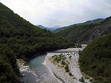 Trebbia
river
Trebbia
river
At
Carcare
, the main roads connect with the upper Bormida valley (Bormida di Mallare) before turning west. The
Scrivia
, the
Trebbia
and the
Taro
, tributaries of the
Po River
, drain the northeast slopes. The range contains dozens of peaks. Toward the southern end the
Aveto Natural Regional Park
includes
Monte Penna
. Nearby is the highest point of Ligurian Apennines,
Monte Maggiorasca
at 1,800 m (5,900 ft).
[16]
The main and only feasible overland route connecting the coastal plain of Liguria to the north Italian plain runs through Bocchetta di Altare. It has always been of strategic importance. Defenders of north Italy have had to control it since ancient times, as the various fortifications placed there testify.
Trenitalia
, the state railway system, highly developed on the coastal plain, now traverses the mountains routinely through a number of railway tunnels, such as the one at
Giovi Pass
.
The southeastern border of the Ligurian Apennines is the Fiume
Magra
, which projects into the Tyrrhenian Sea south of
La Spezia
, and the Fiume
Taro
, which runs in the opposite direction to join the Po. The divide between the two upper river valleys is the
Cisa Pass
. Under it (in two tunnels) runs the
Autostrada della Cisa
between Spezia and
Parma
.
Tuscan?Emilian Apennines
[
edit
]
 Monte Cimone
(2,165 m or 7,103 ft), in
Emilia Romagna
, is the highest mountain of the northern Apennines.
Monte Cimone
(2,165 m or 7,103 ft), in
Emilia Romagna
, is the highest mountain of the northern Apennines.
 Apuan Alps
Starting at
Cisa Pass
, the mountain chain turns further to the southeast, to cross the peninsula along the border between the
Emilia-Romagna
and
Tuscany
regions. They are named the Tuscan?Emilian Apennines west of the
Futa Pass
and the Tuscan?Romagnol Apennines east of it, or just the Tuscan Apennines.
[16]
They extend to the upper
Tiber River
. The highest point is
Monte Cimone
at 2,165 m (7,103 ft).
A separate branch, the
Apuan Alps
, goes southwest, bordering the coast south of
La Spezia
. Whether they are to be considered part of the Apennines is a matter of opinion; certainly, they are part of the Apennine System. Topographically only the valley of the River
Serchio
, which running parallel to the coast turns and exits into the Tyrrhenian Sea north of
Pisa
, separates the Apuan Alps from the Apennines; geologically the rock is of a slightly different composition,
marble
. The Roman marble industry was centered at
Luna
, and is now active in
Carrara
.
As the Tuscan Apennines divide the peninsula between the
Po Valley
and the plains and hills of
Tuscany
and
Lazio
, transportation over them has been used to achieve political and economic unity. Historically the Romans used the
Via Flaminia
between
Rome
and
Rimini
. The montane distance between
Florence
in
Tuscany
and
Bologna
in
Emilia-Romagna
is shorter, but exploitation of it required the conquest of more rugged terrain, which was not feasible for the ancients. Railway lines were constructed over the mountains in the early 19th century but they were of low capacity and unimprovable.
Since 1856, a series of tunnels have been constructed to conduct "the Bologna-Florence rail line", which is neither a single line nor a single tunnel. The Porrettana Line went into service in 1864, the Direttissima in 1934 and the High Speed in 1996.
[17]
A few dozen tunnels support the three of them, the longest on the High-Speed Line being the Voglia Tunnel at 16.757 km (10.412 mi).
[18]
The longest is on the Direttissima, the Great Apennine Tunnel, which at 18.5 kilometres (11.5 miles) is the longest entirely within Italy, although the
Simplon Tunnel
, which connects Italy and Switzerland, is longer.
[note 2]
Automobile traffic is carried by the Autostrada del Sole, Route A1, which goes through numerous shorter tunnels, bypassing an old road, originally Roman, through Futa Pass. In December 2015, a new Route A1 called
Variante di Valico
was opened after many years of construction consisting of major tunnels (the longest being the new 8.6-kilometre (5.3-mile) 'Tunel Base') and new overpasses, shortening the traveling time between Florence and Bologna by road. The
Foreste Casentinesi, Monte Falterona, Campigna National Park
is in the southern part of the Tuscan?Romagnol Apennines. The southern limit of the Tuscan?Romagnol Apennines is the
Bocca Serriola Pass
in northern
Umbria
, which links
Fano
and
Citta di Castello
.
 Source of the
Tiber
river at
Mount Fumaiolo
, marked by a column with an eagle and wolves, part of the Apennine fauna and symbols of
Rome
. The inscription reads: "Here the river sacred to the destinies of Rome is born."
Source of the
Tiber
river at
Mount Fumaiolo
, marked by a column with an eagle and wolves, part of the Apennine fauna and symbols of
Rome
. The inscription reads: "Here the river sacred to the destinies of Rome is born."
The
Tiber River
at
Rome
flows from
Monte Fumaiolo
in the Tuscan-Romagnol Apennine from northeast to southwest, projecting into the Tyrrhenian Sea at right angles to the shore. The upper Tiber, however, flows from northwest to southeast, gradually turning through one right angle clockwise. The northern
Tiber Valley
is deep and separates the Apennines on the left bank from a lesser range, the Tuscan
Anti-Apennines
(Sub-Apennines) on its right.
Central Apennines
[
edit
]
The Apennine System forms an irregular arc with centers of curvature located in the Tyrrhenian Sea. The northern and southern segments comprise parallel chains that can be viewed as single overall mountain ridges, such as the Ligurian Mountains. The center, being thicker and more complex, is geologically divided into an inner and an outer arc with regard to the centers of curvature. The geologic definition, however, is not the same as the geographic.
Based on rock type and orogenic incidents, the northern segment of the arc is divided into the Outer Northern Apennines (ONA) and the Inner Northern Apennines (INA).
[19]
The Central Apennines are divided into the Umbrian?Marchean (
Appennino umbro-marchigiano
) or Roman Apennines in the north and the Abruzzi Apennines (
Appennino abruzzese
) in the south. It extends from Bocca Serriola pass in the north to Forli pass in the south.
[16]
Umbria-Marche Apennines
[
edit
]
 Sibillini Mountains
The west border of the Umbria-Marche Apennines (or
Appennino umbro-marchigiano
)) runs through
Cagli
. They extend south to the
Tronto
River, the south border of the ONA.
The highest peak,
Monte Vettore
, at 2,478 m (8,130 ft), is part of the
Monti Sibillini
, incorporated into
Parco Nazionale dei Monti Sibillini
. Further north is the
parco naturale regionale della Gola della Rossa e di Frasassi
[
it
]
, in which are the Gola della Rossa ("Red Gorge") and
Frasassi Caves
. Still further north is Parco Sasso Simone e Simoncello.
[20]
The Italian Park Service calls it the "green heart" of Italy. The region is heavily
forested
, such as the Riserva Naturale Statale Gola del Furlo, where
Furlo Pass
on the
Via Flaminia
is located. Both the
Etruscans
and the Romans constructed tunnels here.
Abruzzi Apennines
[
edit
]
 Gran Sasso
mountain and
Campo Imperatore
plateau
Gran Sasso
mountain and
Campo Imperatore
plateau
The Abruzzi Apennines, located in
Abruzzo
,
Molise
and southeastern
Lazio
, contain the highest peaks and most rugged terrain of the Apennines. They are known in history as the territory of the Italic peoples first defeated by the city of
Rome
. Coincidentally they exist in three parallel folds or chains surviving from the
orogeny
.
[16]
These extend in a northwest?southeast direction from the
River Tronto
to the River
Sangro
, which drain into the
Adriatic
. The coastal hills of the east extend between
San Benedetto del Tronto
in the north and
Torino di Sangro
in the south.
The eastern chain consists mainly of the southern part of the
Monti Sibillini
, the
Monti della Laga
, the
Gran Sasso d'Italia
Massif and the
Majella
Massif. Among them are two national parks:
Gran Sasso e Monti della Laga National Park
and
Majella National Park
; and the Regional Park of the Monti Simbruini. Gran Sasso contains
Corno Grande
, the highest peak of the Apennines (2912 m).
 Majella
massif
Majella
massif
Other features between the western and central ranges are the plain of
Rieti
, the valley of the Salto, and the
Lago Fucino
; while between the central and eastern ranges are the valleys of
Aquila
and
Sulmona
. The chief rivers on the west are the
Nera
, with its
tributaries
the Velino and Salto, and the
Aniene
, both of which fall into the Tiber. On the east there is at first a succession of small rivers which flow into the
Adriatic
, from which the highest points of the chain are some 20
km distant, such as the
Tronto
, Tordino, Vomano and others. The
Pescara
, which receives the
Aterno
from the north-west and the Gizio from the south-east, is more important; and so is the
Sangro
.
The central Apennines are crossed by the railway from
Rome
to
Pescara
via
Avezzano
and Sulmona: the railway from
Orte
to
Terni
(and thence to
Foligno
) follows the Nera valley; while from Terni a line ascends to the plain of Rieti, and thence crosses the central chain to Aquila, whence it follows the valley of the Aterno to Sulmona. In ancient times the
Via Salaria
,
Via Caecilia
and
Via Tiburtina
all ran from
Rome
to the
Adriatic coast
. The volcanic mountains of the province of Rome are separated from the Apennines by the
Tiber
valley, and the
Monti Lepini
, part of the Volscian chain, by the valleys of the
Sacco
and
Liri
.
Southern Apennines
[
edit
]
Samnite and Campanian Apennines
[
edit
]
 The
Monti Picentini
, in the
Campanian
Apennines
The
Monti Picentini
, in the
Campanian
Apennines
In the southern Apennines, to the south of the
Sangro
valley, the three parallel chains are broken up into smaller groups; among them may be named the
Matese
, the highest point of which is the Monte Miletto 2,050 metres (6,725 ft). The chief rivers on the south-west are the
Liri
or
Garigliano
with its tributary the Sacco, the
Volturno
, Sebeto, Sarno, on the north the Trigno, Biferno and
Fortore
.
Daunian mountains
, in
Apulia
, are connected with the Apennine range, and so are
Cilento
hills on the west. On the converse the promontory of
Mount Gargano
, on the east, is completely isolated, and so are the
Campanian
volcanic arc
near
Naples
. The district is traversed from north-west to south-east by the railway from
Sulmona
to
Benevento
and on to
Avellino
, and from south-west to northeast by the railways from Caianello via Isernia to
Campobasso
and Termoli, from Caserta to Benevento and Foggia, and from
Nocera Inferiore
and Avellino to Rocchetta Sant'Antonio, the junction for Foggia, Spinazzola (for Barletta, Bari, and
Taranto
) and Potenza. Roman roads followed the same lines as the railways: the
Via Appia
ran from
Capua
to Benevento, whence the older road went to Venosa and Taranto and so to
Brindisi
, while the
Via Traiana
ran nearly to
Troia
(near Foggia) and thence to Bari.
Lucan Apennines
[
edit
]
 Pollino
massif
Pollino
massif
The valley of the
Ofanto
, which runs into the Adriatic close to
Barletta
, marks the northern termination of the first range of the Lucanian Apennines (now
Basilicata
), which runs from east to west, while south of the valleys of the Sele (on the west) and
Basento
(on the east)?which form the line followed by the railway from Battipaglia via
Potenza
to
Metaponto
?the second range begins to run due north and south as far as the plain of
Sibari
. The highest point is the Monte
Pollino
2,233 metres (7,325 ft). The chief rivers are the Sele?joined by the Negro and Calore?on the west, and the
Bradano
,
Basento
, Agri, Sinni on the east, which flow into the gulf of Taranto; to the south of the last-named river there are only unimportant streams flowing into the sea east and west, inasmuch as here the width of the peninsula diminishes to some 64 kilometres (40 mi).
Calabrian and Sicilian Apennines
[
edit
]
 Aspromonte
The railway running south from Sicignano to Lagonegro, ascending the valley of the Negro, is planned to extend to Cosenza, along the line followed by the ancient Via Popilia, which beyond Cosenza reached the west coast at Terina and thence followed it to Reggio. The
Via Herculia
[
it
]
, a branch of the
Via Traiana
, ran from
Aequum Tuticum
to the ancient
Nerulum
. At the narrowest point the plain of Sibari, through which the rivers Coscile and Crati flow to the sea, occurs on the east coast, extending halfway across the peninsula. Here the limestone Apennines proper cease and the granite mountains of
Calabria
begin.
The first group extends as far as the
isthmus
formed by the gulfs of South Eufemia and Squillace; it is known as the Sila, and the highest point reached is 1,930 metres (6,330 ft) (the
Botte Donato
). The forests which covered it in ancient times supplied the Greeks and Sicilians with timber for shipbuilding. The railway from South Eufemia to
Catanzaro
and Catanzaro Marina crosses the isthmus, and an ancient road may have run from Squillace to Monteleone. The second group extends to the south end of the
Italian Peninsula
, culminating in the
Aspromonte
(1,960 metres (6,420 ft)) to the east of
Reggio di Calabria
. In both groups the rivers are quite unimportant.
Finally, the Calabrian southern Apennine Mountains extend along the northern coast of Sicily (the Sicilian Apennines, Italian
Appennino siculo
)?
Pizzo Carbonara
(6,493 feet (1,979 m)) being the highest peak.
Environment
[
edit
]
Vegetative zones
[
edit
]
Ecoregions
[
edit
]
 Apennine deciduous montane forests
at
Mount Cimone
Apennine deciduous montane forests
at
Mount Cimone
The number of
vascular plant
species in the Apennines has been estimated at 5,599. Of these, 728 (23.6%) are in the treeline
ecotone
.
Hemicryptophytes
predominate in the entire Apennine chain.
[22]
Alpine zone
[
edit
]
The
tree line
ecotone
is mainly
grasslands
of the
Montane grasslands and shrublands
biome; with Temperate broadleaf and mixed forests, and Mediterranean forests, woodlands, and scrub below it. The tree line in the Apennines can be found in the range 1,600 m (5,200 ft) to 2,000 m (6,600 ft).
[23]
About 5% of the map area covered by the Apennines is at or above the tree line?or in the treeline ecotone. The
snow line
is at about 3,200 m (10,500 ft), leaving the Apennines below it, except for the one remaining glacier. Snow may fall from October to May. Rainfall increases with latitude.
[7]
The range's climates, depending on elevation and latitude, are the
Oceanic climate
and
Mediterranean climate
.
Fauna
[
edit
]
 Marsican brown bear
 Italian wolf
pack
Italian wolf
pack
 Apennine yellow-bellied toad
 European perch
The mammal fauna
[24]
is mainly composed of
Italian wolves
(endemic),
Corsican hare
,
badgers
,
weasels
,
foxes
,
marmots
,
Etruscan shrew
,
Crested porcupine
,
European snow vole
and
Apennine shrews
(endemic),
Marsican brown bears
(endemic), the
European fallow deer
, the
European mouflon
and the
Pyrenean chamois
.
There are also numerous birds
[25]
such as the
golden eagle
, the
Bonelli's eagle
, the
Eurasian goshawk
, the
hoopoe
, the
hawk
, the
European roller
, the
White-backed woodpecker
, the
European green woodpecker
, the
Alpine chough
, the
Egyptian vulture
, the
European nightjar
, the
Italian sparrow
(endemic) and the
Eurasian eagle-owl
There are also numerous amphibians
[26]
such as the
Apennine yellow-bellied toad
(endemic), the
Italian cave salamander
(endemic), the
Italian newt
(endemic), the
Italian stream frog
(endemic) and the
Spectacled salamander
(endemic), the
Italian tree frog
(endemic), the
Agile frog
, the
Italian edible frog
(endemic), the
Common toad
, the
Balearic green toad
, the
Northern spectacled salamander
(endemic), the
Fire salamander
, the
Smooth newt
, the
Alpine newt
, and the
Italian crested newt
.
The reptile
[27]
fauna is mainly composed of suc as the
Italian Aesculapian snake
(endemic), the
Dice snake
, the
Green whip snake
, the
Aesculapian snake
, the
Smooth snake
, the
Vipera ursinii
, the
Vipera aspis
, the
Italian wall lizard
(endemic), the
Podarcis muralis
, the
European green lizard
.
Notable Apennine freshwater fishes are the
Brook lamprey
(endemic),
Lombardy lamprey
,
Italian bleak
(endemic),
Horse barbel
(endemic),
Eurasian carp
,
Scardola scardafa
(endemic),
European perch
,
Chubius Chub
,
Tench
and
Northern pike
.
The
Italian wolf
is the
national animal
of Italy,
[28]
[29]
while the
national bird
of the country is the
Italian sparrow
.
[30]
The reasons for this choice are related to the fact that the Italian wolf, which inhabits the Apennine Mountains and the
Western Alps
, features prominently in Latin and Italian cultures, such as in the legend of the
founding of Rome
.
[31]
Transhumance
[
edit
]
 Sheep-track near to
Ariano Irpino
, Campanian Apennine
Sheep-track near to
Ariano Irpino
, Campanian Apennine
In Italy the
transhumance
took place mainly starting from the Abruzzi Apennines, moving both towards the Tuscan and Lazio
Maremma
and above all towards the
Tavoliere delle Puglie
.
[32]
The Apennines are to some extent covered with forests, though these were probably more extensive in classical times (
Pliny
mentions especially
pine
,
oak
and
beech
woods,
Hist. Nat
. xvi. 177); they have indeed been greatly reduced in comparatively modern times by indiscriminate timber-felling, and though serious attempts at
reforestation
have been made by the government, much remains to be done.
They also furnish considerable summer pastures, especially in the
Abruzzi
: Pliny (
Hist. Nat
. xi. 240) praises the cheese of the Apennines. In the forests
Italian wolves
were frequent, and still are found, the flocks being protected against them by large sheep-dogs;
Marsican brown bears
, however, which were known in Roman times, have almost entirely disappeared. Nor are the wild goats called
rotae
, spoken of by
Marcus Terentius Varro
(
Rerum rusticarum
II. i. 5), which may have been either
Pyrenean chamois
or
steinbock
, to be found.
Brigandage appears to have been prevalent in Roman times in the more remote parts of the Apennines, as it was until recently. An inscription found near the Furlo pass was set up in AD 246 by an
evocatus Augusti
(a member of a picked corps) on special police duty with a detachment of twenty men from the Ravenna fleet.
Snow lies on the highest peaks of the Apennines for almost the whole year. The range produces no minerals, but there are a considerable number of good
mineral springs
, some of which are thermal (such as
Bagni di Lucca
,
Montecatini
,
Monsummano
, Porretta, Telese), while others are cool (such as Nocera,
Sangemini
, Cinciano), the water of which is both drunk on the spot and sold as table water elsewhere.
National parks
[
edit
]
 Abruzzo, Lazio and Molise National Park
, the oldest
Italian national park
in the Apennine Mountains and the second oldest in Italy
Abruzzo, Lazio and Molise National Park
, the oldest
Italian national park
in the Apennine Mountains and the second oldest in Italy
The Apennines are home to twelve
Italian national parks
: the
Appennino Tosco-Emiliano National Park
, the
Foreste Casentinesi, Monte Falterona, Campigna National Park
, the
Monti Sibillini National Park
, the
Gran Sasso e Monti della Laga National Park
, the
Abruzzo, Lazio and Molise National Park
, the
Maiella National Park
, the
Pollino National Park
, the
Vesuvius National Park
, the
Cilento, Vallo di Diano and Alburni National Park
, the
Appennino Lucano - Val d'Agri - Lagonegrese National Park
, the
Sila National Park
, the
Aspromonte National Park
.
Hydrography
[
edit
]
Important rivers originate from the Apennines are the
Panaro
, the
Secchia
, the
Reno
, the
Marecchia
, the
Rubicon
, the
Metauro
, the
Arno
, the
Tiber
, the
Savio
, the
Nera
, the
Velino
, the
Tronto
, the
Aterno-Pescara
, the
Aniene
, the
Liri
, the
Sangro
and the
Volturno
. Among the lakes of glacial origin of the Alpine type is
Lago di Pilato
.
Geology
[
edit
]
 Liri
river
Liri
river
The Apennines were created in the Apennine
orogeny
beginning in the early
Neogene
(about 20
mya
, the middle
Miocene
) and continuing today.
[33]
Geographically they are partially (or appear to be) continuous with the
Alpine system
. Prior to the explosion of data on the topic from about the year 2000, many authors took the approach that the Apennines had the same origin as the Alps. Even today, some authors use the term Alpine-Apennine system. They are not, however, the same system and did not have the same origin. The Alps were millions of years old before the Apennines rose from the sea.
The northward movement of the African Plate and its collision with the European Plate then caused the
Alpine Orogeny
, beginning in the late Mesozoic. The band of mountains created extends from Spain to Turkey in a roughly east?west direction and includes the Alps. The Apennines are much younger, extend from northwest to southeast, and are not a displacement of the Alpine chain.
The key evidence of the difference is the geologic behavior of the
Po Valley
in northern Italy. Compressional forces have been acting from north to south in the Alps and from south to north in the Apennines, but instead of being squeezed into mountains the valley has been subsiding at 1 to 4 mm (0.16 in) per year since about 25
mya
, before the Apennines
existed.
[34]
It is now known to be not an erosional feature, but is a filled portion of the Adriatic Trench, called the Adriatic
foredeep
after its function as a subduction zone was discovered.
Apennine orogeny
[
edit
]
 A
pillow lava
from an
ophiolite
sequence, Northern Apennines
A
pillow lava
from an
ophiolite
sequence, Northern Apennines
The Apennine orogeny is a type of mountain-building in which two simpler types are combined in an apparently paradoxical configuration. Sometimes this is referred to as "syn-orogenic extension", but the term implies that the two processes occur simultaneously during time.
Some scientists imagine that this is relatively rare but not unique in mountain building, whereas others imagine that this is fairly common in all mountain belts.
The RETREAT Project
[note 3]
have this specific feature as one of their focus points
[35]
In essence the east side of Italy features a
fold and thrust belt
raised by compressional forces acting under the
Adriatic
Sea. This side has been called the "Apennine-Adriatic Compressional Zone" or the "Apennines Convergence Zone." On the west side of Italy
fault-block mountains
prevail, created by a spreading or extension of the crust under the
Tyrrhenian Sea
. This side is called the "Tyrrhenian Extensional Zone." The mountains of Italy are of paradoxical provenience, having to derive from both compression and extension:
"The paradox of how contraction and extension can occur simultaneously in convergent mountain belts remains a fundamental and largely unresolved problem in continental dynamics."
Both the folded and the fault-block systems include parallel mountain chains. In the folded system
anticlines
erode into the highest and longest massifs of the Apennines.
According to the older theories (originating from the 1930s to 1970s) of Dutch geologists, including Van Bemmelen, compression and extension can and should occur simultaneously at different depths in a mountain belt. In these theories, these different levels are called
Stockwerke
. More recent work in geotectonics and geodynamics of the same school of geoscientists (Utrecht and Amsterdam University) by Vlaar, Wortel, and Cloetingh, and their disciples, extended these concepts even further into a temporal realm. They demonstrated that internal and external forces acting upon the mountain belt (e.g.,
slab pull
and intra-plate stress field modulations due to large scale reorganisations of the
tectonic plates
) result in both longer episodes and shorter phases of general extension and compression acting both upon and inside mountain belts and tectonic arches (See e.g. for extensive reviews, bibliography and discussions on the literature:
Van Dijk (1992),
[36]
Van Dijk and Okkes (1991),
[37]
Van Dijk & Scheepers (1995),
[38]
and Van Dijk et al. (2000a)
[39]
).
Compressional zone
[
edit
]
 Boundaries of the
Adriatic Plate
Boundaries of the
Adriatic Plate
The gradual subsidence of the
Po Valley
(including that of
Venice
) and the folding of the mountains of eastern Italy have been investigated using
seismic wave
analysis of the "Apennine
Subduction
System."
[35]
Along the Adriatic side of Italy the floor of the
Adriatic Sea
, referred to as the "Adriatic lithosphere" or the "Adriatic plate," terms whose precise meaning is the subject of ongoing research, is dipping under the slab on which the Apennines have been folded by compressional forces.
Subduction occurs along a
fault
, along which a
hanging wall
, or overriding slab is thrust over an overridden slab, also called the subducting slab. In north Italy the dip of this interface is 30° to 40° at a depth of 80?90
km.
[40]
The
strike
of the Apennine subduction zone forms a long, irregular arc with centers of curvature in the Tyrrhenian Sea following the hanging wall over which the mountains have been raised; i.e., the eastern wall of the mountains. It runs from near the base of the Ligurian Apennines in the Po Valley along the margin of the mountains to the Adriatic, along the coastal deeps of the Adriatic shore, strikes inland at
Monte Gargano
cutting off
Apulia
, out to sea again through the
Gulf of Taranto
, widely around the rest of Italy and
Sicily
and across inland north Africa.
[40]
The
upper mantle
above 250 km (160 mi) deep is broken into the "Northern Apennines Arc" and the "Calabrian Arc", with compressional forces acting in different directions radially toward the arcs' centers of curvature.
Extensional zone
[
edit
]
The west side of Italy is given to a
fault-block
system, where the crust ? extended by the lengthening mantle below ? thinned, broke along roughly parallel
fault
lines, and the blocks alternatively sank into
grabens
or were raised by
isostasy
into
horsts
. This system prevails from
Corsica
eastward to the valley of the
Tiber River
, the last rift valley in that direction. It runs approximately across the direction of extension. In the fault-block system, the ridges are lower and are more steep-sided, since the walls are formed by faults. Geographically they are not considered part of the Apennines proper but are termed
Sub-Apennines
(
Subappennini
) or
Anti-Apennines
(
Antiappennini
) or
Pre-Apennines
(
Preappennini
). These mountains are found mainly in
Tuscany
,
Lazio
and
Campania
.
Stability of terrain
[
edit
]
 The
Pietra di Bismantova
, Emilian Apennines,
Emilia-Romagna
The
Pietra di Bismantova
, Emilian Apennines,
Emilia-Romagna
The terrain of the Apennines (as well as that of the Alps) is to a large degree unstable due to various types of
landslides
, including falls and slides of rocks and debris, flows of earth and mud, and sink holes. The Institute for Environmental Protection and Research (
Istituto Superiore per la Protezione e la Ricerca Ambientale
), a government agency founded in 2008 by combining three older agencies, published in that year a special report,
Landslides in Italy
, summarizing the results of the IFFI Project (
Il Progetto IFFI
), the Italian Landslide Inventory (
Inventario dei Fenomeni Franosi in Italia
), an extensive survey of historical landslides in Italy undertaken by the government starting in 1997. On December 31, 2007, it had studied and mapped 482,272 landslides over 20,500 km
2
(7,900 sq mi). Its major statistics are the Landslide Index (LI here), the ratio of the landslide area to the total area of a region, the Landslide Index in Mountainous-Hilly Areas (here LIMH) and the Density of Landslides, which is the number per 100 km
2
(39 sq mi).
Italy as a whole has a LI of 6.8, a LIMH of 9.1 and a density of 160.
Lombardia
(LI of 13.9),
Emilia-Romagna
(11.4),
Marches
(19.4),
Molise
(14.0),
Valle d'Aosta
(16.0) and
Piemonte
(9.1) are significantly higher.
[41]
The most unstable terrain in the Apennines when the landslide sites are plotted on the map are in order from most unstable the eastern flanks of the Tuscan-Emilian Apennines, the Central Apennines and the eastern flank of the southern Apennines. Instability there is comparable to the Alps bordering the
Po Valley
. The most stable terrain is on the western side:
Liguria
,
Tuscany
,
Umbria
and
Lazio
. The Apennines are slumping away to the northeast into the Po Valley and the Adriatic
foredeep
; that is, the zone where the Adriatic floor is being subducted under Italy. Slides with large translational or rotational surface movements are most common; e.g., a whole slope slumps into its valley, placing the population there at risk.
Glacial ice
[
edit
]
Glaciers no longer exist in the Apennines outside the
Gran Sasso d'Italia
massif. However, post-Pliocene
moraines
have been observed in Basilicata.
Major peaks
[
edit
]
The Apennines include about 21 peaks over 1,900 m (6,200 ft), the approximate
tree line
(counting only the top peak in each massif). Most of these peaks are located in the Central Apennines.
[23]
 Corno Grande
 Monte Velino
 Monte Vettore
 Monte Meta
| Name
|
Height
|
Corno Grande
(
Gran Sasso massif
)
|
2,912 m (9,554 ft)
|
Monte Amaro
(
Majella massif
)
|
2,793 m (9,163 ft)
|
| Monte Velino
|
2,486 m (8,156 ft)
|
| Monte Vettore
|
2,476 m (8,123 ft)
|
| Pizzo di Sevo
|
2,419 m (7,936 ft)
|
Serra Dolcedorme
(
Pollino massif
)
|
2,267 m (7,438 ft)
|
| Monte Meta
|
2,241 m (7,352 ft)
|
| Monte Terminillo
|
2,217 m (7,274 ft)
|
| Monte Sibilla
|
2,173 m (7,129 ft)
|
| Monte Cimone
|
2,165 m (7,103 ft)
|
| Monte Viglio
|
2,156 m (7,073 ft)
|
| Monte Cusna
|
2,121 m (6,959 ft)
|
| Montagne del Morrone
|
2,061 m (6,762 ft)
|
| Monte Prado
|
2,053 m (6,736 ft)
|
Monte Miletto
(
Matese massif
)
|
2,050 m (6,730 ft)
|
| Alpe di Succiso
|
2,017 m (6,617 ft)
|
Monte Cotento
(
Simbruini range
)
|
2,015 m (6,611 ft)
|
| Monte
Sirino
|
2,005 m (6,578 ft)
|
Montalto
(
Aspromonte massif
)
|
1,955 m (6,414 ft)
|
| Monte Pisanino
|
1,946 m (6,385 ft)
|
Monte Botte Donato
(
Sila plateau
)
|
1,928 m (6,325 ft)
|
| Corno alle Scale
|
1,915 m (6,283 ft)
|
| Monte Alto
|
1,904 m (6,247 ft)
|
| Monte Alpi
|
1,900 m (6,200 ft)
|
| Monte
Cervati
|
1,898 m (6,227 ft)
|
| La Nuda
|
1,894 m (6,214 ft)
|
| Monte Maggio
|
1,853 m (6,079 ft)
|
| Monte Maggiorasca
|
1,799 m (5,902 ft)
|
| Monte Giovarello
|
1,760 m (5,770 ft)
|
| Monte Catria
|
1,701 m (5,581 ft)
|
| Monte Gottero
|
1,640 m (5,380 ft)
|
| Monte Pennino
|
1,560 m (5,120 ft)
|
| Monte Nerone
|
1,525 m (5,003 ft)
|
| Monte San Vicino
|
1,480
m (4,856
ft)
|
| Monte Fumaiolo
|
1,407 m (4,616 ft)
|
See also
[
edit
]
Notes
[
edit
]
- ^
Apenninus
(Greek
?π?ννινο?
or
?π?ννινα
) has the form of an adjective, which would be segmented
Apenn-inus
, often used with nouns such as
mons
("mountain") or Greek
?ρο?
(
oros
), but
Apenninus
is just as often used alone as a noun. The ancient Greeks and Romans typically but not always used "mountain" in the singular to mean one or a range; thus, "the Apennine mountain" refers to the entire chain and is translated "the Apennine mountains". The ending can vary also by gender depending on the noun modified. The Italian singular refers to one of the constituent chains rather than to a single mountain, and the Italian plural refers to multiple chains rather than to multiple mountains.
- ^
Claims of being the longest or second-longest in the world have been soon outdated. See
List of longest tunnels
.
- ^
The Retreating-trench, extension and accretion (RETREAT) Project is a study conducted by a consortium of scientific organizations in different countries including in the US the
National Science Foundation
.
References
[
edit
]
- ^
"Topographic map of Corno Grande"
.
opentopomap.org
. Retrieved
2023-06-11
.
- ^
Entry
Apennines
, in
Merriam-Webster Dictionary
, on-line on
www.merriam-webster.com
.
- ^
Strabo
,
Geography
,
book 5
.
- ^
a
b
c
Lewis, Charlton T.; Short, Charles (1879).
"Apenninus"
.
A Latin Dictionary
. Oxford; Medford: Clarendon Press; Perseus Digital Library.
- ^
a
b
Gambino, Roberto; Romano, Bernardino (2000?2001).
Territorial strategies and environmental continuity in mountain systems: The case of the Apennines (Italy)
(PDF)
. World Commission on Protected Areas.
- ^
a
b
Pedrotti & Gafta 2003
, p. 75
- ^
Deecke 1904
, p. 23
- ^
Blackie & Blackie 1887
, pp. 21, 154
- ^
"ceann"
.
MacBain's Dictionary
.
- ^
"pin".
Webster's Third New International Dictionary
.
- ^
"*pet-".
The American Heritage Dictionary of the English Language, Indo-European Roots
.
- ^
a
b
Coles, John M.; Harding, A. F. (1979).
The bronze age in Europe: an introduction to the prehistory of Europe, c. 2000?700 BC
(illustrated ed.). London: Taylor & Francis. p. 165.
ISBN
978-0-416-70650-5
.
- ^
a
b
Bury, J. B.; I E S Edwards; C. J. Gadd; John Boardman; N. G. L. Hammond (1975). P. Mack Crew (ed.).
The Cambridge Ancient History: c. 1800?1380 B.C
. Vol. II, part 2: c. 1380?1000 B.C. (3, revised ed.). Cambridge University Press. p. 720.
ISBN
978-0-521-08691-2
.
- ^
Martini & Vai 2001
, p. 3.
- ^
a
b
c
d
e
Merriam-Webster 2001
, p. 59.
- ^
Lunardi 2008
, pp. 413?414.
- ^
Lunardi 2008
, pp. 425?437.
- ^
Barchi et al. 2001
, p. 216.
- ^
"Parks, Reserves and other Protected Areas in the Marches"
. Parks.it. 1995?2010
. Retrieved
15 March
2010
.
- ^
Pedrotti & Gafta 2003
, p. 79.
- ^
a
b
Pedrotti & Gafta 2003
, p. 73.
- ^
"Mammiferi d'Italia - Ministero della Transizione Ecologica"
(PDF)
(in Italian). p. 7
. Retrieved
11 March
2022
.
- ^
"Appennini - Uccelli"
(in Italian)
. Retrieved
11 March
2022
.
- ^
"Quali sono gli anfibi autoctoni?"
(in Italian)
. Retrieved
11 March
2022
.
- ^
Peter Uetz; Jakob Hallermann; Jiri Hosek.
"Distribution: italy"
.
The Reptile Database
. Retrieved
22 June
2021
.
- ^
Sheri Foster (January 2021).
"What is Italy national animal?"
.
Yourtrip.com
.
- ^
James Hansen (June 2018).
"Il lupo grigio degli appennini e l animale dell Italia"
.
- ^
"Italian House Sparrow"
. EBN Italia. 1 May 2015
. Retrieved
10 May
2015
.
- ^
Livy (1797).
The history of Rome
. George Baker (trans.). Printed for A. Strahan.
- ^
"Tratturi"
(in Italian)
. Retrieved
13 October
2023
.
- ^
a
b
James, Kristen (2004),
Determining the source for the magmas of Monte Amiata (Central Italy) using strontium, neodymium, and lead isotopes
, Carleton Geology Department: Geology Comps Papers, pp. 3?4,
S2CID
43061617
,
During the
Neogene
and into the
Quaternary
the region around
Amiata
underwent a general NNE contraction .... This compression also created the Apennine orogeny of east-central Italy .... This area was brought
above sea level
during a doming phase during the Middle
Pliocene
.
- ^
Ollier, Cliff; Pain, Colin (2000).
The origin of mountains
. London: Routledge. p. 77.
Apennine thrusts move in from the south, and Southern Alps thrust in from the north, but instead of collisional compression there is subsidence and horizontal sedimentation.
- ^
a
b
Margheriti 2006
, p. 1120.
- ^
van Dijk, J.P. (1992). "Late Neogene fore-arc basin evolution in the Calabrian Arc (Central Mediterranean). Tectonic sequence stratigraphy and dynamic geohistory. With special reference to the geology of Central Calabria".
Geologica Ultraiectina
.
92
: 288.
- ^
van Dijk, J.P.; Okkes, F.W.M. (1991). "Neogene tectonostratigraphy and kinematics of Calabrian Basins. implications for the geodynamics of the Central Mediterranean".
Tectonophysics
.
196
(1?2): 23?60.
Bibcode
:
1991Tectp.196...23V
.
doi
:
10.1016/0040-1951(91)90288-4
.
- ^
van Dijk, J.P.; Scheepers, P.J.J. (1995). "Neogene rotations in the Calabrian Arc. Implications for a Pliocene-Recent geodynamic scenario for the Central Mediterranean".
Earth-Science Reviews
.
39
(3?4): 207?246.
Bibcode
:
1995ESRv...39..207V
.
doi
:
10.1016/0012-8252(95)00009-7
.
hdl
:
1874/19084
.
S2CID
128811666
.
- ^
a
b
van Dijk, J.P.; Bello, M.; Brancaleoni, G.P.; Cantarella, G.; Costa, V.; Frixa, A.; Golfetto, F.; Merlini, S.; Riva, M.; Toricelli, S.; Toscano, C.; Zerilli, A. (2000). "A new structural model for the northern sector of the Calabrian Arc".
Tectonophysics
.
324
(4): 267?320.
Bibcode
:
2000Tectp.324..267V
.
doi
:
10.1016/S0040-1951(00)00139-6
.
S2CID
130289171
.
- ^
a
b
Margheriti 2006
, p. 1124.
- ^
Trigila, Alessandro; Iadanza, Carla (2008).
"Landslides in Italy: Special Report 2008"
(PDF)
. Rome: Istituto Superiore per la Protezione e la Ricerca Ambientale (ISPRA). pp. 15?16. Archived from
the original
(PDF)
on 2011-07-17.
Bibliography
[
edit
]
- "Apennines".
Merriam-Webster's Geographical Dictionary
(3rd ed.). Merriam-Webster, Incorporated. 2001.
- Blackie, Christina; Blackie, John Stuart (1887).
Geographical etymology, a dictionary of place-names giving their derivations
. London: Murray.
- Deecke, W (1904).
Italy; a popular account of the country, its people, and its institutions (including Malta and Sardinia)
. Translated by Nesbitt, H A. London; New York: Macmillan Co.; S. Sonnenschein & Co.
- Lunardi, Pietro (2008).
Design and construction of tunnels: analysis of controlled deformation in rocks and soils (ADECO-RS)
. Berlin: Springer.
- Margheriti, Lucia; et al. (August?October 2006).
"The subduction structure of the Northern Apennines: results for the RETREAT seismic deployment"
(PDF)
.
Annals of Geophysics
.
49
(4/5). Archived from
the original
(PDF)
on 2010-06-19.
- Martini, I. Peter; Vai, Gian Battista (2001). "Geomorphologic Setting". In Martini, I. Peter; Vai, Gian Battista (eds.).
Anatomy of an orogen: the Apennines and adjacent Mediterranean basins
. Dordrecht [u.a.]: Kluwer Academic Publishers. pp. 1?4.
.
- Barchi, Massimiliano; Landuzzi, Alberto; Minelli, Giorgio; Pialli, Giampaolo (2001). "Inner Northern Apennines". In Martini, I. Peter; Vai, Gian Battista (eds.).
Anatomy of an orogen: the Apennines and adjacent Mediterranean basins
. Dordrecht [u.a.]: Kluwer Academic Publishers. pp. 215?254.
.
- Pedrotti, F.; Gafta, D. (2003). "The High Mountain Flora and Vegetation of the Apennines and the Italian Alps". In Nagy, Laszlo; Grabherr, G.; Korner, Ch.; Thompson, D.B.A. (eds.).
Alpine biodiversity in Europe
. Ecological studies, 167. Berlin, Heidelberg [u.a.]: Springer-Verlag. pp. 73?84.
.
- Attribution
External links
[
edit
]
Look up
Apennines
in Wiktionary, the free dictionary.
|
|---|
| International
| |
|---|
| National
| |
|---|
| Geographic
| |
|---|
| Other
| |
|---|