From Wikipedia, the free encyclopedia
District and municipality in Manisa, Turkey
?ehzadeler
is a municipality and
district
of
Manisa Province
,
Turkey
.
[2]
Its area is 515 km
2
,
[3]
and its population is 167,227 (2022).
[1]
It covers the eastern part of the agglomeration of
Manisa
and the adjacent countryside.
The district ?ehzadeler was created at the
2013 reorganisation
from part of the former central district of Manisa Province, along with the new district
Yunusemre
.
[4]
[5]
Its name means "princes", referring to those princes who served as
sanjak
rulers in Manisa during the
Ottoman Empire
period.
Composition
[
edit
]
There are 67
neighbourhoods
in ?ehzadeler District:
[6]
- 1.Anafartalar
- 2.Anafartalar
- Adakale
- Adnan Menderes
- Ahmet Bedevi
- Akıncılar
- Akpınar
- Alaybey
- Arda
- A?a?ıcobanisa
- Ayvacık
- Bayındırlık
- Belenyenice
- Camkoy
- Car?ı
- Cavu?o?lu
- Cerkezmahmudiye
- Cınarlıkuyu
- Dere
- Dil?eker
- Dincer
- Ege
- Gediz
- Gokbel
- Gokta?lı
- Guzelkoy
- Hacıhaliller
- Halitli
- Hamzabeyli
- ?brahimcelebi
- ?shakcelebi
- Ka?an
- Kalekoy
- Kalemli
- Karaa?aclı
- Karao?lanlı
- Karayenice
- Kazımkarabekir
- Kıranciftli?i
- Kocatepe
- Ku?lubahce
- Mimarsinan
- Ni?ancıpa?a
- Nurlupınar
- Peker
- Sakarya
- Sancaklıbozkoy
- Sancaklıce?meba?ı
- Sancaklıi?decik
- Sancaklıkayadibi
- Sancaklıuzuncınar
- Sarıalan
- Saruhan
- ?ehitler
- Selim?ahlar
- Tekeliler
- Tepecik
- Tilkisuleymaniye
- Tunca
- Turgut Ozal
- Utku
- Veziro?lu
- Yarhasanlar
- Yeniharmandalı
- Yenikoy
- Ye?ilkoy
- Yukarıcobanisa
References
[
edit
]
|
|---|
| Districts
| |  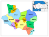 Districts of Manisa Districts of Manisa
|
|---|
|
|
