Archipelago in the Salish Sea in Washington, US
 San Juan Islands (in white) and surrounding region
 Location of the San Juan Islands
The
San Juan Islands
is an archipelago in the Pacific Northwest of the United States between the U.S. state of Washington and Vancouver Island, British Columbia, Canada. The San Juan Islands are part of Washington state, and form the core of
San Juan County
.
In the archipelago, four islands are accessible to vehicular and foot traffic via the Washington State Ferries system.
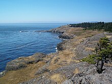 Lopez Island, one of the San Juan Islands, Washington
History
[
edit
]
 Straits Steamship Company
house flag
, shipping firm that operated steamships on
Puget Sound
and the
Strait of Juan de Fuca
Straits Steamship Company
house flag
, shipping firm that operated steamships on
Puget Sound
and the
Strait of Juan de Fuca
The Gulf of Georgia Culture Area encompasses the San Juan and
Gulf Islands
, which share many archaeological similarities.
[1]
These islands were home to various
Coast Salish
peoples, including the
Nooksack
and
Northern Straits
groups (consisting of the
Lummi
,
Klallam
,
Saanich
,
Samish
, and
Songhees
dialects). European exploration in the area introduced
smallpox
in the 1770s.
The Spanish explorer
Francisco de Eliza
named the San Juan Islands
Isla y Archipielago de San Juan
in 1791
[2]
while sailing under the authority of
Juan Vicente de Guemes Padilla Horcasitas y Aguayo, 2nd Count of Revillagigedo
, the Viceroy of Mexico.
[3]
Eliza named several places for the Viceroy, including
Orcas Island
(short for "Horcasitas") and
Guemes Island
. San Juan Island's first European discoverer was
Gonzalo Lopez de Haro
, one of Eliza's officers, for whom
Haro Strait
is named. The Spanish had previously encountered the islands during
Manuel Quimper
's exploring voyage on the
Princesa Real
in 1790, but they were not recognized as islands until Eliza's expedition.
Jose Maria Narvaez
, one of Eliza's pilots, also helped explore the San Juans in 1791 and became the first European to explore the
Strait of Georgia
.
The
Vancouver Expedition
, led by
George Vancouver
, explored the area in 1792 while a Spanish expedition led by
Dionisio Alcala Galiano
and
Cayetano Valdes y Flores
was also exploring. The British and Spanish ships met and cooperated in exploring the north. Vancouver encountered other Spanish ships and traded information, so he was aware of the names given by the Spanish expedition and kept them, although he renamed some features, such as the
Strait of Georgia
.
The
United States Exploring Expedition
, led by
Charles Wilkes
, explored the region in 1841. Wilkes named many coastal features after American heroes of the
War of 1812
or members of his crew, possibly unaware of the already existing Spanish names and charts.
Henry Kellett
led a project in 1847 to reorganize the official charts of the region for the British Admiralty. The project only applied to British territory, which at the time included the San Juan Islands but not
Puget Sound
. Kellett removed most of the names given by Wilkes and kept British and Spanish names, sometimes moving Spanish names to replace those given by Wilkes. As a result, Wilkes' names are common in Puget Sound and Spanish names are rare, while the opposite is true for the San Juan and Gulf Islands. Wilkes had named the San Juan Islands the
Navy Archipelago
and individual islands after U.S. naval officers, such as
Rodgers Island
for San Juan Island, "
Chauncey
" for Lopez Island, and
Hull Island
for Orcas Island. Some of Wilkes' names, such as Shaw, Decatur, Jones, Blakely, and Sinclair, named after American naval officers, survived Kellett's editing.
[4]
Border dispute
[
edit
]
 July 4, 1867, celebrated on San Juan Island. U.S. Army soldiers and Royal Marines mingle in the American Camp.
In 1843, the
Hudson's Bay Company
established
Fort Victoria
on
Vancouver Island
. The 1846
Oregon Treaty
established the
49th parallel
as the border between Canada and the US, with Vancouver Island remaining British. The treaty did not specify which channel the border should follow between the Strait of Georgia and the Strait of Juan de Fuca, leading to a boundary dispute. In 1852, the
Territory of Oregon
created
Island County
, including the San Juan Islands. In 1853, Island County became part of the
Washington Territory
,
[5]
which created
Whatcom County
out of parts of Island County in 1854. The San Juan Islands were finally split off into present-day San Juan County in 1873.
In 1855, Washington Territory levied a property tax on properties of the Hudson's Bay Company on San Juan Island, which the HBC refused to pay. This led to a dispute with the
Colony of Vancouver Island
over the ownership of the San Juan Islands, with the US claiming Haro Strait as the border and Britain claiming Rosario Strait.
[6]
The resulting
Pig War
and San Juan Dispute were a diplomatic stalemate until the boundary issue was placed in the hands of Emperor
Wilhelm I of Germany
for arbitration in 1871. The border through Haro Strait was established in 1872.
Post-border dispute
[
edit
]
The surrounding bodies of water, including Puget Sound and the Straits of Georgia and Juan de Fuca, were recognized collectively as the
Salish Sea
, by the United States in 2009 and by Canada in 2010.
[7]
On the 7th of June 2024, a T-34 plane driven by former astronaut and air force pilot,
Bill Anders
, crashed on the San Juan Islands. Anders did not survive the crash.
[8]
Ecology
[
edit
]
The islands were heavily logged in the nineteenth century, but now have an extensive second-growth
coast Douglas fir
(
Pseudotsuga menziesii var. menziesii
),
Pacific madrone
(
Arbutus menziesii
),
red alder
(
Alnus rubra
) and
bigleaf maple
(
Acer macrophyllum
) forest. There are small stands of old-growth Douglas fir and
western redcedar
(
Thuja plicata
), mostly within long standing privately held property. In the highlands one also finds
grand fir
(
Abies grandis
),
western hemlock
(
Tsuga heterophylla
) and other subalpine trees.
The San Juan Islands host the greatest concentration of
bald eagles
(
Haliaeetus leucocephalus
) in the contiguous United States.
[9]
Great blue herons
(
Ardea herodias
),
black oystercatchers
(
Haematopus bachman
), and numerous shorebirds are found along the shore and in winter, the islands are home to
trumpeter swans
(
Cygnus buccinator
),
Canada geese
(
Branta canadensis
) and other waterfowl.
Peregrine falcons
(
Falco peregrinus
),
northern harriers
(
Circus cyaneus
),
barred owls
(
Strix varia
) and other birds of prey are found. In addition diving birds such as
rhinoceros auklets
(
Cerorhinca monocerata
),
pigeon guillemots
(
Cepphus columba
) and endangered
marbled murrelets
(
Brachyramphus marmoratus
) frequent the surrounding seas.
[10]
Western bluebirds
(
Sialia mexicana
), which were eliminated from the islands 50 years ago because of competition for nesting sites by non-native
European starlings
(
Sturnus vulgaris
), were recently restored to San Juan Island thanks to the efforts of volunteers and conservation organizations.
[11]
The islands are famous for their resident pods of
orcas
(
Orcinus orca
). There are three resident pods that eat salmon, but also some transient orcas that come to take
harbor seals
(
Phoca vitulina
). Other marine mammals include
river otters
(
Lontra canadensis
),
Steller sea lions
(
Eumetopias jubatus
),
common minke whales
(
Balaenoptera acutorostrata
),
Dall's porpoises
(
Phocoenoides dalli
) and other
cetaceans
.
Columbia black-tailed deer
(
Odocoileus hemionus columbianus
) are the largest mammals on the San Juan Islands, which are unusual in their historic absence of large carnivores, except for
wolves
(
Canis lupus
) which were
extirpated
in the 1860s.
[12]
Dr. Caleb B. R. Kennerly, surgeon and naturalist, collected a wolf specimen on Lopez Island, which is now in the
National Museum of Natural History
, probably during the
Northwest Boundary Survey
from 1857 to 1861.
[13]
Also, there is a specimen of
elk
in the
Slater Museum of Natural History
at the
University of Puget Sound
that was collected on Orcas Island, and old-timers report finding elk antlers on both Lopez and Orcas Islands.
Before 1850, most of the freshwater on the islands was held in
beaver
(
Castor canadensis
) ponds, although the aquatic mammal was extirpated by
Hudson's Bay Company
fur stations at
Fort Langley
and San Juan Island. Remnants of beaver dams number in the hundreds across the archipelago. Gnawed stumps and beaver sign are now seen on Orcas and other islands, and recolonization by this
keystone species
is likely to lead to increased abundance and diversity of birds, amphibians, reptiles and plants.
[14]
In spring 2011 a pair of beaver appeared at Killebrew Lake on Orcas Island, but were killed to avoid flooding a phone company switch box buried under Dolphin Bay Road. These beaver likely swam from the mainland and could have recolonized the islands.
Northern sea otter
(
Enhydra lutis kenyoni
) remains are documented on
Sucia Island
in the San Juan Islands archipelago. In 1790, Spanish explorer
Manuel Quimper
traded copper sheets for sea otter pelts at
Discovery Bay
, for live sea otters captured north of the bay in the "interior" of the Strait of Juan de Fuca.
[15]
Although historical records of sea otter in the San Juan Islands are sparse, there is a sea otter specimen collected in 1897 in the "Strait of Fuca" in the
National Museum of Natural History
.
[16]
When the sea otter finally received federal protection in 1911, Washington's sea otter had been hunted to extinction, and although a small remnant population still existed in British Columbia, it soon died out. Fifty-nine sea otters were re-introduced to the Washington coast from
Amchitka Island
, Alaska, in the summers of 1969 and 1970, and these have expanded by 8% per year, mainly along the outer west and northwest coast of the
Olympic Peninsula
.
[17]
Professional marine mammal biologists verified a single sea otter observed near Cattle Point, San Juan Island, in October 1996.
[15]
Although the historical numbers of sea otter in the San Juan Islands is not known, the habitat for them may have once been ideal.
[18]
In the 1890s non-native
European rabbits
, an
exotic
invasive species
, began to infest the islands as the result of the release of domestic rabbits on
Smith Island
. Rabbits from the San Juan Islands were used later for several introductions of European rabbits into other, usually Midwestern, states. The rabbits are pursued by Eurasian
red fox
(
Vulpes vulpes
), another non-native species introduced intermittently through the twentieth century.
[19]
On the islands is the
San Juan Islands National Monument
with 75 sections.
[20]
Geography
[
edit
]
 Unidentified San Juan island at night
The
United States Geological Survey
(USGS) defines the San Juan Islands as the archipelago north of the
Strait of Juan de Fuca
, west of
Rosario Strait
, east of
Haro Strait
, and south of
Boundary Pass
.
[21]
To the north lie the open waters of the
Strait of Georgia
. All these waters are within the
Salish Sea
. The USGS definition of the San Juan archipelago coincides with
San Juan County
. Islands not in San Juan County are not part of the San Juan Islands, according to the USGS.
NOAA
notes that, while geopolitically divided, the San Juan Islands and Canadian
Gulf Islands
geologically form part of a larger Gulf Archipelago.
[22]
At mean high tide, the San Juan Islands comprise over 400 islands and rocks, 128 of which are named, and over 478 miles (769 km) of shoreline.
[23]
The majority of the San Juan Islands are quite hilly, with some flat areas and valleys in between, often quite fertile. The tallest peak is
Mount Constitution
, on Orcas Island, at an elevation of 2,407 feet (734 m).
[24]
The coastlines are a mix of sandy and rocky beaches, shallow inlets and deep harbors, placid coves and reef-studded bays. Gnarled, ochre-colored madrona trees
[25]
(
Arbutus
) grace much of the shorelines, while evergreen fir and pine forests cover large inland areas.
[26]
[27]
The San Juan Islands get substantially less rainfall than
Seattle
, about 65 miles (105 km) to the south, due to their location in the
rain shadow
of the
Olympic Mountains
to the southwest.
[28]
Summertime high temperatures are around 70 °F (21 °C), while average wintertime lows are in the high 30s and low 40s Fahrenheit (around 5 degrees Celsius). Snow is infrequent in winter, except for the higher elevations, but the islands are subject to high winds at times; those from the northeast sometimes bring brief periods of freezing.
[29]
[30]
Panoramic view of the San Juan Islands from the ferry
Present
[
edit
]
In the present, the San Juan Islands are an important tourist destination, with
sea kayaking
and
orca
whale-watching (by boat or air tours) being two of the primary attractions. San Juan Island's
Lime Kiln Point State Park
is a prime whale-watching site, with knowledgeable interpreters often on site.
[31]
[32]
[33]
[34]
Politically, the San Juan Islands comprise by definition,
San Juan County, Washington
.
[35]
[36]
[37]
Media based in and/or concerning the islands includes the
Journal of the San Juan Islands
and the
Islands' Sounder
.
Generally speaking, the resident population of San Juan County is well educated. In the period 2016 to 2020, 51.7 percent of the resident population aged 25 and up have earned a bachelor’s degree or attained a higher level of formal education. Statewide, 36.7 percent of the adult population have a bachelor’s degree or higher.
[38]
Transportation
[
edit
]
There are no bridges to the San Juan Islands; therefore, all travel from the mainland is either by water or by air.
[39]
Water
[
edit
]
 Aerial view of the San Juan Islands from the southeast
Four ferry systems serve some of the San Juan Islands.
- Washington State Ferries
serves
Lopez Island
,
Shaw Island
,
Orcas Island
, and
San Juan Island
from terminals in
Anacortes, Washington
, and
Sidney, British Columbia
.
[40]
- Puget Sound Express
provides passenger-only service from
Port Townsend
, on the northeast corner of the Olympic Peninsula, to
Friday Harbor
on San Juan Island.
- M/V San Juan Clipper
of
Clipper Navigation
, Inc. provides high-speed water-jet?powered catamaran ferry service between
San Juan Island
and
Seattle, Washington
.
[41]
Passenger-only ferries serve more islands. Passenger-only ferry service is usually seasonal and offered by private business.
Air service to the San Juan Islands is provided by the following:
- Kenmore Air
(to and from Roche Harbor, Orcas Island, Seattle/Boeing Field, Seattle/Lake Union)
- San Juan Airlines
(to and from Anacortes, Bellingham, Eastsound (Orcas Island), Lopez Island, Blakely, Decatur). They merged with Northwest Sky Ferry,
[42]
an inter-island carrier serving Bellingham, Anacortes, Friday and Roche Harbors (San Juan Island), Eastsound (Orcas Island) and Lopez, Waldron, Shaw, Stuart, Blakely, Center, Crane, Decatur and Eliza Islands, as well as Seattle.
- Friday Harbor Seaplanes (to and from Renton Municipal Airport/Lake Washington, Friday Harbor and Roche Harbor)
Shipping
[
edit
]
The San Juan Islands are surrounded by major shipping channels. Haro Strait, along with Boundary Pass, is the westernmost and most heavily used channel connecting the Strait of Juan de Fuca and the Strait of Georgia. It is the main route connecting the
Port of Vancouver
and other ports around the Strait of Georgia with the Pacific Ocean. Haro Strait joins Boundary Pass at Turn Point on Stuart Island, where a major navigation beacon,
Turn Point Light
, is located. Strong, dangerous
rip tides
occur near Turn Point, as well as near the northern end of Boundary Pass, between
Patos Island Light
on
Patos Island
and East Point on
Saturna Island
.
[43]
Rosario Strait is also a major shipping channel. More than 500
oil tankers
pass through the strait each year, to and from the
Cherry Point Refinery
and refineries near Anacortes.
[44]
The strait is in constant use by vessels bound for Cherry Point,
Bellingham
, Anacortes, and the San Juan Islands. Vessels bound for British Columbia or Alaska also frequently use it in preference to the passages farther west, when greater advantage can be taken of the tidal currents.
[43]
List of islands
[
edit
]
This list includes only those islands that are part of San Juan County as defined by the USGS, bounded by the
Strait of Juan de Fuca
,
Haro Strait
,
Rosario Strait
,
Boundary Pass
, and the
Strait of Georgia
.
[21]
2016 populations estimates for inhabited islands are in parentheses, though some have major seasonal changes.
[45]
Islands protected as
state parks
are marked with an asterisk. Additional small rocks are listed at
San Juan Islands National Monument
.
See also
[
edit
]
References
[
edit
]
- ^
Stein, Julie K. (2000).
Exploring Coast Salish prehistory: the archaeology of San Juan Island
. University of Washington Press. pp. 4?5.
ISBN
978-0-295-97957-1
. Retrieved
July 30,
2011
.
- ^
"Lime Kiln and Cattle Point Lighthouses (San Juan Island)"
,
HistoryLink
, Seattle: History Ink
- ^
Phillips, James W. (1971).
Washington State Place Names
. University of Washington Press.
ISBN
0-295-95158-3
.
- ^
Phillips, James W. (1971).
Washington State Place Names
. University of Washington Press.
ISBN
0-295-95158-3
.
- ^
Scholefield, Ethelbert Olaf Stuart;
Howay, Frederic William
(1914).
British Columbia from the earliest times to the present. Vol. 2
. The S.J. Clarke publishing company. p. 301.
OCLC
697901687
. Archived from
the original
on May 27, 2011
. Retrieved
June 22,
2011
.
- ^
The northwest boundary: discussion of the water boundary question : geographical memoir of the islands in dispute and history of the military occupation of San Juan Island, accompanied by map and cross-sections of channels ...
, pp. 3?5, United States Dept. of State, Northwest Boundary Commission, 1868
- ^
"Salish Sea"
.
Geographic Names Information System
.
United States Geological Survey
,
United States Department of the Interior
.
- ^
https://vancouver.citynews.ca/2024/06/07/plane-crash-san-juan-islands/
- ^
Rebecca Smith (March 30, 2015).
"Bald Eagles"
.
San Juan Island National Historical Park Washington
. National Park Service.
- ^
Gardner, Mark B. (2008).
Images of the San Juan Islands
. Rainshadow Arts.
ISBN
978-0-9753068-1-9
.
- ^
Mapes, Lynda V. (March 14, 2007).
"Volunteers returning bluebirds to old nesting grounds"
.
Seattle Times
. Retrieved
July 3,
2011
.
- ^
"Biodiversity and the Salish Sea"
. Archived from
the original
on February 23, 2010
. Retrieved
July 3,
2011
.
- ^
"Canis lupus, Specimen #A3438"
. Smithsonian National Museum of Natural History
. Retrieved
July 10,
2011
.
- ^
Barsh, Russel; Murphy, Madrona (2008).
"Wetland engineers"
(PDF)
.
Islands Weekly
.
Archived
(PDF)
from the original on October 9, 2022
. Retrieved
July 3,
2011
.
[
permanent dead link
]
- ^
a
b
Kenyon, Karl W. (1969).
"The Sea Otter in the Eastern Pacific Ocean"
.
North American Fauna
.
68
: 1?352.
doi
:
10.3996/nafa.68.0001
.
- ^
"Enhydra lutis Specimen #188633"
. Smithsonian National Museum of Natural History
. Retrieved
July 9,
2011
.
[
permanent dead link
]
- ^
Scott Richardson; Harriet Allen (2000).
Washington State Recovery Plan for the Sea Otter
(PDF)
(Report). Olympia, Washington: Washington Department of Fish and Wildlife. Archived from
the original
(PDF)
on March 23, 2012
. Retrieved
July 3,
2011
.
- ^
Daniel Pauly; Tony J. Pitcher; David Preikshot (1998).
"Back to the Future: Reconstructing the Strait of Georgia Ecosystem"
(PDF)
.
Fisheries Centre Research Reports
.
Archived
(PDF)
from the original on October 9, 2022
. Retrieved
July 3,
2011
.
[
permanent dead link
]
- ^
"Nonnative Species"
. Kwiaht Center for the Historical Ecology of the Salish Sea
. Retrieved
July 3,
2011
.
- ^
Presidential Proclamation ? San Juan Islands National Monument
- ^
a
b
"San Juan Islands"
.
Geographic Names Information System
.
United States Geological Survey
,
United States Department of the Interior
. Retrieved
January 31,
2011
.
- ^
NOAA.
"What is an archipelago?"
.
National Ocean Service
. Retrieved
May 10,
2023
.
- ^
Scherer, Migael (2004).
A Cruising Guide to Puget Sound and the San Juan Islands: Olympia to Port Angeles
. McGraw-Hill Professional. p. 201.
ISBN
978-0-07-142039-6
. Retrieved
June 23,
2011
.
- ^
"Mt. Constitution ? Moran State Park"
.
- ^
"Obstruction Pass Park ? Moran State Park"
.
- ^
"Environmental Factors - San Juan Island National Historical Park (U.S. National Park Service)"
.
- ^
"San Juan Islands Habitat Oregon/Washington BLM"
. Archived from
the original
on April 8, 2019
. Retrieved
April 8,
2019
.
- ^
"Olympic Rain Shadow Map and Location"
.
- ^
"Average Weather at Orcas Island Airport, Washington, United States, Year Round - Weather Spark"
.
- ^
"Weather - San Juan Island National Historical Park (U.S. National Park Service)"
.
- ^
"Home"
.
visitsanjuans.com
.
- ^
"Home"
. Archived from
the original
on November 28, 2020
. Retrieved
January 25,
2021
.
- ^
"What to See in Washington's San Juan Islands"
.
- ^
Lime Kiln Point State Park
- ^
"GNIS Detail - San Juan Islands"
. Archived from
the original
on April 27, 2020
. Retrieved
April 8,
2019
.
- ^
"Home"
.
sanjuanco.com
.
- ^
"Maps | San Juan County, WA"
.
- ^
"ESDWAGOV - San Juan County profile"
.
esd.wa.gov
. Retrieved
March 21,
2023
.
- ^
"10 Most Frequently Asked Questions about San Juan Island"
.
- ^
San Juan Islands Route Map
Archived
October 11, 2012, at the
Wayback Machine
, Washington State Ferries
- ^
"San Juan Islands Vacation"
.
- ^
"San Juan Airlines"
.
San Juan Islands
.
- ^
a
b
Strait of Juan De Fuca and Georgia, Washington; Chapter 12 - Coast Pilot 7 - Edition 43, 2011
Archived
November 27, 2020, at the
Wayback Machine
,
NOAA
- ^
Scherer, Migael (2004).
A Cruising Guide to Puget Sound and the San Juan Islands: Olympia to Port Angeles
. McGraw-Hill Professional. p. 202.
ISBN
978-0-07-142039-6
. Retrieved
June 23,
2011
.
- ^
"San Juan County Population Forecast"
.
San Juan County
. April 11, 2017. Archived from
the original
on August 6, 2020
. Retrieved
February 12,
2020
.
External links
[
edit
]
|
|---|
| International
| |
|---|
| National
| |
|---|
| Other
| |
|---|
48°31′55″N
123°01′45″W
/
48.532066°N 123.029251°W
/
48.532066; -123.029251