The introductions of the country, dependency and region entries are in the native languages and in English. The other introductions are in English.
|
Saint Martin
|
|
|
|
|
|
Saint-Martin
|
|
|
|
| Francais
|
Saint-Martin
- Collectivite de Saint-Martin (collectivite unique depuis 2007, auparavant une commune de la Region Guadeloupe)
Saint-Martin
, dont les habitants sont appeles les Saint-Martinois, est une collectivite francaise situee dans la partie nord de l'ile de Saint-Martin (tandis que la moitie sud est connue sous le nom de Sint-Maarten l'une des cinq regions des Antilles neerlandaises).
|
| English
|
Saint Martin
- Collectivity of Saint Martin
The
Collectivity of Saint Martin
is in the northern part of Saint Martin, a tropical island in the northeast Caribbean, approximately 240 km (150 miles) east of Puerto Rico. The 38-square-mile (98 km²) island is divided roughly in half between France and the Netherlands. It is one of the smallest inhabited landmasses in the world that is divided between two nations. The northern French half is an overseas collectivity and a constituent part of the French Republic. The southern Dutch half is called
Sint Maarten
and is a constituent country of the
Kingdom of the Netherlands
. Collectively the two territories are known as "Saint-Martin / Sint Maarten", "Saint Martins", or simply "SXM." (SXM is the IATA identifier for Princess Juliana International Airport, the island's main airport). The island lies near Anguilla, Saint Barthelemy, and the British Virgin Islands.
|
|
| Short name
|
Saint Martin
|
| Official name
|
Collectivity of Saint Martin
|
| Status
|
Overseas collectivity and constituent part of the French Republic (French since 1648)
|
| Location
|
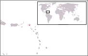
Caribbean
|
| Capital
|
Marigot
|
| Population
|
35,334 inhabitants
|
| Area
|
52 km²
|
| Major language(s)
|
French
|
| Major religion(s)
|
Roman Catholicism
|
| More information
|
Saint Martin
,
Geography of Saint Martin
,
History of Saint Martin
and
Politics of Saint Martin
|
| More images
|
Saint Martin
-
Saint-Martin (France) (Category)
.
|
|
General maps

|
English:
CIA World Factbook map of Saint-Martin
French:
Carte de Saint-Martin
|

|
Dutch:
Ligging van Sint Maarten binnen Guadeloupe
English:
Location of Saint-Martin relative to Saint Barthelemy and islands of the French overseas region of Guadeloupe
French:
Localisation de Saint-Martin par rapport aux autres iles francaises: Saint-Barthelemy et les iles de la Guadeloupe
|

|
Dutch:
Sint Maarten en omgeving
English:
The island of Saint Martin and surrounding islands
French:
L'ile de Saint-Martin et les iles environnantes
|
|
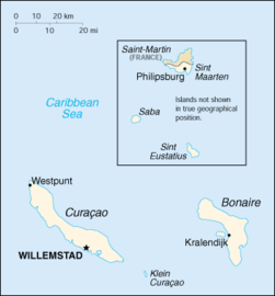
Dutch:
Ligging van Sint Maarten binnen de Nederlandse Antillen
English:
Location of Saint Martin (French part) relative to Sint Maarten, Saba, and Sint Eustatius
French:
Localisation de Saint-Martin (partie francaise) par rapport a Sint Maarten, Saba, et Sint Eustatius
|

|
Dutch:
Kaart van Sint Maarten
English:
Map of Saint Martin
French:
Carte de Saint-Martin
|

|
Dutch:
Kaart van Sint Maarten
English:
Topographic map of Saint Martin
French:
Carte topographique de Saint-Martin
|

|
Dutch:
Kaart van Sint Maarten
English:
Map of Saint Martin
French:
Carte de Saint-Martin
|
Satellite maps

|
Dutch:
Satellietfoto
English:
Satellite photo
French:
Photo satellite
|
Notes and references
General remarks:
- The WIKIMEDIA COMMONS Atlas of the World is an organized and commented collection of geographical, political and historical maps available at Wikimedia Commons. The main page is therefore the portal to
maps
and
cartography
on Wikimedia. That page contains links to entries by country, continent and by topic as well as general
notes and references
.
- Every entry has an introduction section in English. If other languages are native and/or official in an entity, introductions in other languages are added in separate sections. The text of the introduction(s) is based on the content of the Wikipedia encyclopedia. For sources of the introduction see therefore the Wikipedia entries linked to. The same goes for the texts in the history sections.
- Historical maps are included in the continent, country and dependency entries.
- The status of various entities is disputed. See the content for the entities concerned.
- The maps of former countries that are more or less continued by a present-day country or had a territory included in only one or two countries are included in the atlas of the present-day country. For example the Ottoman Empire can be found in the
Atlas of Turkey
.
|
Entries available in the atlas
- General pages
- World
- Continents and oceans
- Themes
- Historical eras
- States with wide recognition
- States with limited recognition
- Dependencies and other overseas territories
- Country subdivisions
- Belgium
- India
- Pakistan
- United Kingdom
- Other
- Disputed subnational territories
- Other regions
- Former sovereign states
- Former dependencies and overseas territories
- Former disputed territories
|
