Gikan sa Wikipedia, ang gawasnong ensiklopedya
Tibuok resolusyon
(SVG nga payl, nominally 2,029 × 1,326 pixels, size sa payl: 473 KB)
Kining maong payl gikan sa Wikimedia Commons ug mahimong gigamit sa ubang proyekto.
Ang
deskripsyon
niini didto gipakita sa ubos.
Yolot hdz
Mubong sugid:

W3C-validity not checked.
Pagtugot
I, the copyright holder of this work, hereby publish it under the following licenses:

|
Copyleft: This work of art is free; you can redistribute it and/or modify it according to terms of the
Free Art License
. You will find a specimen of this license on the
Copyleft Attitude site
as well as
on other sites
.
http://artlibre.org/licence/lal/en
FAL
Free Art License
false
true
|
- Libre ka:
- sa pagsabwag
? sa pagkopya, pag-apod-apod ug pagsabwag sa hinimo
- sa pag-remix
? sa pag-adap sa binuhat
- Ubos sa mosunod nga mga kondisyon:
- atribusyon
? Kinahanglan nimo nga hatagan ang angay nga kredito, maghatag usa ka link sa lisensya, ug ipakita kung adunay mga pagbag-o. Mahimo nimo kini buhaton sa bisan unsang makatarunganon nga paagi, apan dili sa bisan unsang paagi nga nagsugyot nga gi-endorso ka sa licensor o ang imong paggamit.
- share parehas
? Kung imong gi-remix, gibag-o, o gibase sa materyal, kinahanglan nimo nga iapod-apod ang imong mga kontribusyon sa ilawom sa
parehas o katugma nga lisensya
sama sa orihinal.
https://creativecommons.org/licenses/by-sa/4.0
CC BY-SA 4.0
Creative Commons Attribution-Share Alike 4.0
true
true
You may select the license of your choice.
Add a one-line explanation of what this file represents
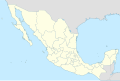
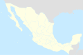
Map of Mexico, with states borders.
Carte du Mexique, avec les limites des Etats.
Mapa de Mexico, con los limites de los estados.
Kaagi sa payl
I-klik ang petsa/oras aron makit-an ang hulagway sa payl niadtong panahona.
| Petsa/Takna
| Thumbnail
| Mga dimensyon
| Tiggamit
| Komento
|
|---|
| kasamtangan
| 15:41, 13 Agosto 2010
|  | 2,029 × 1,326
(473 KB)
| Kmusser
| Try that again
|
| 15:41, 13 Agosto 2010
|  | 975 × 654
(361 KB)
| Kmusser
| change projection to match that used at File:Mexico location map.svg so should be more accurate for pushpins, also reverted Yucatan boundary change to match Mexican government maps.
|
| 11:58, 25 Mayo 2009
|  | 975 × 654
(361 KB)
| Semhur
| Modify border south between Quintana Roo and Campeche
|
| 08:31, 24 Mayo 2009
|  | 975 × 654
(361 KB)
| Semhur
| Adding Yucatan states
|
| 12:57, 24 Septiyembre 2008
|  | 975 × 654
(330 KB)
| Semhur
| new try
|
| 12:40, 24 Septiyembre 2008
|  | 975 × 654
(328 KB)
| Semhur
| Thiner strokes
|
| 12:37, 24 Septiyembre 2008
|  | 975 × 654
(328 KB)
| Semhur
| {{Information |Description= {{en|Map of Mexico, with states borders.}} {{es|Mapa de Mexico, con los limites de los estados.}} {{fr|Carte du Mexique, avec les limites des etats.}} |Source=Travail personnel / Own work. Source : * [[:Image:Mexico blank.sv
|
Mga paggamit sa payl
More than 100 pages use this file.
The following list shows the first 100 pages that use this file only.
A
full list
is available.
View
more links
to this file.
Global nga paggamit sa payl
Kining ubang wiki naggamit ning maong payl:
- Paggamit sa af.wikipedia.org
- Paggamit sa am.wikipedia.org
- Paggamit sa ar.wikipedia.org
- Paggamit sa ast.wikipedia.org
- Paggamit sa azb.wikipedia.org
- Paggamit sa ban.wikipedia.org
- Paggamit sa bcl.wikipedia.org
- Paggamit sa bn.wikipedia.org
- Paggamit sa bs.wikipedia.org
- Paggamit sa ca.wikipedia.org
View
more global usage
of this file.
Ang kining payl adunay dugang nga impormasyon, mahimong nadugang gikan sa digital camera o scanner nga gigamit sa paghimo o pag-digitize niini.
Kon ang payl namodipikar gikan sa orihinal nga estado, ang ubang detalye mamahimong dili moreplek sa namodipikar nga payl.
