Capital city of American Samoa
Place in American Samoa, United States
Pago Pago
(
PAHNG
-gaw-
PAHNG
-gaw
;
Samoan
:
Samoan pronunciation:
[?paŋo
?paŋo]
)
[3]
is the capital of
American Samoa
. It is in
Maoputasi County
on
Tutuila
, which is American Samoa's main island.
Pago Pago is home to one of the deepest natural deepwater harbors in the
South Pacific Ocean
, sheltered from wind and rough seas, and strategically located.
[4]
[5]
: 52
[6]
: 12
The harbor is also one of the best protected in the South Pacific,
[7]
: 11
which gives American Samoa a natural advantage because it makes landing fish for processing easier.
[7]
: 61
Tourism
, entertainment, food, and
tuna
canning are its main industries. As of 1993, Pago Pago was the world's fourth-largest tuna processor.
[8]
: 353
The total value of fish landed in Pago Pago ? about $200,000,000 annually ? is higher than in any other port in any U.S. state or territory.
[9]
Pago Pago is the only modern urban center in American Samoa,
[6]
: 29
[10]
and the main port of American Samoa.
[11]
[12]
[13]
It is also home to the territorial government, all the industry, and most of the commerce in American Samoa.
[14]
: 166
The Greater Pago Pago Metropolitan Area encompasses several villages strung together along
Pago Pago Harbor
.
[15]
[16]
One of the villages is itself named Pago Pago, and in 2010 that village had a population of 3,656. The constituent villages are:
Utulei
,
Fagatogo
,
Malaloa
, Pago Pago,
Satala
and
Atu'u
. Fagatogo is the downtown area, referred to as "town", and is home to the legislature, while the executive seat is in Utulei. Also in Fagatogo are the
Fono
, police department, the Port of Pago Pago, and many shops and hotels. In 2000, the Greater Pago Pago area was home to 8,000 residents;
[17]
by 2010 the population had increased to 15,000.
[18]
Rainmaker Mountain
(Mount Pioa), which is located in Pago Pago, contributes to a weather pattern that results in the city having the highest annual rainfall of any harbor in the world.
[19]
[20]
[21]
It stands protectively over the eastern side of Pago Pago, making the harbor one of the most sheltered deepwater anchorages in the Pacific Ocean.
[22]
: 3
Historically, the strategic location of Pago Pago Bay played a direct role in the political separation of
Western
and Eastern Samoa. The initial reason that the U.S. was interested in Tutuila was its desire to use Pago Pago Harbor as a coaling station.
[23]
: 30?31
The town has the distinction of being the southernmost U.S. capital, and the only one located in the
Southern Hemisphere
.
Pronunciation
[
edit
]
The letter "g" in
Samoan
sounds like "ng"; thus Pago Pago is pronounced "Pango Pango."
[24]
[25]
[26]
[27]
[28]
[29]
An early name for Pago Pago was
Long Bay
(Samoan: O le Fagaloa), which was a name used by the first permanent inhabitants to settle in the Pago Pago area.
[23]
: 26
[30]
[31]
: 123
It was also called O le Maputasi ("The Single Chief's House") in compliment to the Mauga, who lived at
Gagamoe
in Pago Pago and was the senior to all the other chiefs in the area.
[31]
: 123
History
[
edit
]
Pago Pago was first settled 4,000 years ago.
[32]
There is archeological evidence of people living in the Pago Pago Valley at least 1500-1300 years ago.
[33]
The ancient people of Tutuila produced clay pottery known as Samoan Plainware. The majority of these open bowls had plain designs and featured rounded bases. Such pottery has been retrieved from sites in Pago Pago, including at Vaipito. The production of such pottery ceased approximately 1500 years ago.
[34]
[35]
A site in the Vaipito Valley has also revealed more substantial elements, such as constructions made from rocks, like house foundations and terraces (lau mafola).
[36]
[37]
Ceramic findings have been retrieved at Vaipito, an inland area within Pago Pago village. A deposit here is thought to be an old hill-slope below a living area where people threw away their waste. Numerous large ceramic pieces have been retrieved here. The layer with the ceramics dates back to the time between 350 BCE and 10 CE. Another site, Fo’isia, is located approximately 100 meters from Vaipito, at the same elevation inland in Pago Pago. During sewer line construction, the
American Samoa Power Authority
noticed many broken pieces of clay pottery. Five dates associated with the ceramics indicate a time range between 370 BCE and 130 CE.
[38]
The island of Tutuila was part of the
Tu?i Tonga Empire
from the invasion around 950 CE to when Tongans were expelled in
1250
. According to Samoan folklore, a warrior from Pago Pago, Fua’au, is associated with driving the Tongans out of Tutuila. According to the legend, Fua’au’s fiance, Tauoloasi’i, was kidnapped and taken to Tonga while sleeping on an exquisite mat known as Moeilefuefue. Filled with anger at the loss of his fiance and the renowned mat, Fua’au rallied the Tutuilans, encouraging them to revolt against the Tongan rule imposed by
Lautivunia
.
[39]
[40]
When Westerners first visited Tutuila, the Mauga was the leading matai (chief) of Pago Pago.
[41]
19th century
[
edit
]
 An 1896 illustration of Pago Pago.
 From 1878 to 1951, it was a
coaling
and repair station for the
U.S. Navy
, known as
US Naval Station Tutuila
.
From 1878 to 1951, it was a
coaling
and repair station for the
U.S. Navy
, known as
US Naval Station Tutuila
.
 Boatmen in Pago Pago, 1907
 Pago Pago as seen in the early 1900s
Two missionaries were assigned to Tutuila Island in the 1830s: Reverend Murray and his wife to Pago Pago and Reverend Barnden to
Leone
. They landed at
Fagasa Bay
and hiked over the hill to the High Chief Mauga in Pago Pago. Mauga welcomed the missionaries and gave them support. RMS
Dunottar Castle
later moved to Pago Pago, becoming the second ship to enter
Pago Pago Harbor
. The missionaries later chose to establish their headquarters at Leone.
[22]
: 79?80
On May 9, 1838, the
London Missionary Society
established a church in Pago Pago.
[42]
As early as 1839, American interest was generated for the Pago Pago area when Commander
Charles Wilkes
, head of the
United States Exploring Expedition
, surveyed Pago Pago Harbor and the island. Rumors of possible annexation by Britain or Germany were taken seriously by the U.S., and the U.S. Secretary of State
Hamilton Fish
sent Colonel
Albert Steinberger
to negotiate with Samoan chiefs on behalf of American interests.
[43]
American interest in Pago Pago was also a result of Tutuila's central position in one of the world's richest whaling grounds.
In 1871, the local
steamer
business of W. H. Webb required coal and he sent Captain E. Wakeman to Samoa in order to evaluate the suitability of Pago Pago as a coaling station. Wakeman approved the harbor and alerted the
U.S. Navy
about
Germany
's intent to take over the area. The U.S. Navy responded a few months later by dispatching Commander
Richard Meade
from
Honolulu
, Hawaii to assess Pago Pago's suitability as a naval station. Meade arrived in Pago Pago on
USS
Narragansett
and made a treaty with the Mauga for the exclusive use of the harbor and a set of commercial regulations to govern the trading and shipping in Pago Pago. He also purchased land for a new naval station.
[22]
: 137?138
The chief of Pago Pago signed a treaty with the U.S. in 1872, giving the American government considerable influence on the island.
[44]
It was acquired by the United States through a treaty in 1877.
[45]
One year after the naval base was built at
Pearl Harbor
in 1887, the U.S. government established a naval station in Pago Pago.
[46]
It was primarily used as a fueling station for both naval- and commercial ships.
[47]
The U.S. Navy first established a coaling station in 1878, right outside
Fagatogo
. The United States Navy later bought land east of Fagatogo and on Goat Island, an adjacent peninsula. Sufficient land was obtained in 1898 and the construction of
United States Naval Station Tutuila
was completed in 1902. The station commander doubled as
American Samoa's Governor
from 1899 to 1905, when the station commandant was designated Naval Governor of American Samoa.
The Fono
(legislature) served as an advisory council to the governor.
[48]
: 84?85
Despite being a part of the United States, the
United Kingdom
and Germany maintained a strong naval presence in the Samoan Islands. Twice between 1880 and 1900, the U.S. Navy came close to taking part in a shooting war while its only true interest was the establishment of a coaling station in Pago Pago. The U.S. quietly purchased land around the harbor for the construction of the naval station. It rented land on Fagatogo Beach for $10/month in order to store the coal. Admiral Kimberly was ordered to Pago Pago while in
Apia
waiting for transportation home after the hurricane of 1889. In Pago Pago, he selected a site for the new coaling station and naval base. In June 1890, the
U.S. Congress
passed an appropriation of $100,000 for the purpose of permanently establishing a station for the naval and commercial marine. With the appropriation, the
State Department
sent Consul Sewall from Apia to Pago Pago to buy six tracts of land for the project. Some parts were previously owned by the Polynesian Land Company, while other tracts were still owned by Samoan families. For the defense of the harbor in event of a naval war, the U.S. Navy wanted to purchase headlands and mountainsides above the Lepua Catholic Church which directly faced the harbor's entrance.
[22]
: 138?139
In 1889,
Robert Louis Stevenson
paid a visit to Pago Pago.
[49]
A
California
-based construction and engineering firm was contracted to build the coal depot in 1898. The naval engineer in charge was W. I. Chambers. On April 30, 1899, Commander
Benjamin Franklin Tilley
sailed from
Norfolk, Virginia
on
USS
Abarenda
with a cargo of coal and steel for the project. The U.S. Navy was the only American agency present in the area, and it was made responsible for administering the new territory.
[22]
: 139?140
The first
American flag
was raised on April 17, 1900, at Sogelau Hill above the site of the new wharf and coaling facilities in Fagatogo. For the ceremony, a group of invitees from
Apia
arrived with German Governor Heinrich Solf onboard
SMS
Cormoran
. USS
Abarenda
, home of B. F. Tilley and his new government, was in the harbor. American consul Luther W. Osborn arrived from Apia, and many spectators arrived from American Samoa villages and other countries. Tilley was the master of ceremonies and began the program by reading the Proclamation of the President of the United States, which asserted American sovereignty over the islands. Next was the reading of the Order of the Secretary of the Navy, followed by chiefs who read the
Deed of Cession
, which they had written and signed. Before raising the flag, reverend E. V. Cooper of the
London Missionary Society
(LMS) and reverend Father Meinaidier of the Roman Catholic Mission offered prayers. Students from the LMS school in
Fagalele
sang the national anthem. The two ships,
Comoran
and
Abarenda
, fired the national salutes.
[22]
: 145?146
[23]
: 111
The
Deed of Cession of Tutuila
and
Aunu'u
Islands was signed on
Gagamoe
, and formalized the relationship between the U.S. and American Samoa. Gagamoe is an area in Pago Pago which is the Mauga family's communal and sacred land.
[50]
[51]
Pago Pago became the
administrative capital
of American Samoa in 1899.
[52]
[53]
20th century
[
edit
]
 English author
W. Somerset Maugham
stayed at
Sadie Thompson Inn
during his 6-week visit to Pago Pago in 1916.
English author
W. Somerset Maugham
stayed at
Sadie Thompson Inn
during his 6-week visit to Pago Pago in 1916.
 Guns were emplaced at
Blunts
and
Breakers Points
in 1940?42, covering Pago Pago Harbor.
Guns were emplaced at
Blunts
and
Breakers Points
in 1940?42, covering Pago Pago Harbor.
 Remains of a World War II encampment above
Utulei
.
Remains of a World War II encampment above
Utulei
.
 The historic tramway on the World War II Heritage Trail
At the beginning of the 20th century, Pago Pago became American Samoa's
port of entry
.
[31]
: 179
On April 11, 1904, the first public school in American Samoa, called
Fagatogo
, was established in the
naval station
area. The school had two teachers and forty students at the time of its opening.
[54]
First and Second World Wars
[
edit
]
English author
W. Somerset Maugham
and his secretary Gerald Haxton visited Pago Pago from December 16, 1916, to January 30, 1917 on their way from Hawaii to
Tahiti
. Also on board the ship was a passenger named Miss Sadie Thompson, who had been evicted from Hawaii for prostitution. She was later the main character in the popular short story,
Rain
(1921), a story of a prostitute arriving in Pago Pago.
[55]
Delayed because of a quarantine inspection, they checked into what is now known as
Sadie Thompson Inn
. Maugham also met an American sailor here, who later appeared as the title character in another short story,
Red
(1921).
[52]
[56]
The Sadie Thompson Inn was added to the
U.S. National Register of Historic Places
in 2003.
When the U.S. joined
World War I
in May 1917, two German ships anchoring in Pago Pago were seized. The 10,000-ton
Elsass
was towed to Honolulu and turned over to the U.S. Navy, while its smaller
gunboat
,
Solf
, was refitted in Pago Pago and given the name
USS
Samoa
. Wireless messaging between Pago Pago and Hawaii was routed through
Fiji
. As the British censored all messages through Fiji, the Navy quickly upgraded the facilities to go directly between Pago Pago and Honolulu.
[22]
: 188
Pago Pago was a vital naval base for the U.S. during
World War II
.
[57]
Limited improvements at the naval station took place in the summer of 1940, which included a
Marine Corps
airfield at
Tafuna
. The new airfield was partly operational by April 1942, and fully operational by June. On March 15, 1941, the Marine Corps' 7th Defense Battalion arrived in Pago Pago and was the first Fleet Marine Force unit to serve in the
South Pacific Ocean
. It was also the first such unit to be deployed in defense of an American island. Guns were emplaced at
Blunts
and
Breakers Points
, covering Pago Pago Harbor. It trained the only
Marine reserve
unit to serve on active duty during World War II, namely the 1st Samoan Battalion, U.S. Marine Corps Reserve. The battalion mobilized after the attack on Pearl Harbor and remained active until January 1944.
[48]
: 85?86
In January 1942 Pago Pago Harbor was shelled by a
Japanese
submarine
, but this was the only battle action on the islands during World War II.
[58]
On January 20, 1942, the 2nd Marine Brigade arrived in Pago Pago with about 5,000 men and various supplies of weaponry, including cannons and tanks.
[59]
Pago Pago and the
U.S. Naval Station
was visited by First Lady
Eleanor Roosevelt
on August 24, 1943.
[60]
[61]
1960s
[
edit
]
Pago Pago was an important location for
NASA
's
Apollo program
from 1961 to 1972.
Apollo 10
,
Apollo 11
,
Apollo 12
,
Apollo 13
,
Apollo 14
and
Apollo 17
landed by Tutuila Island, and the crew flew from Pago Pago to Honolulu on their way back to the mainland.
[62]
[63]
At
Jean P. Haydon Museum
are displays of an
American Samoa-flag
brought to the Moon in 1969 by Apollo 11, as well as moonstones, all given as a gift to American Samoa by President
Richard Nixon
following the return of the Apollo Moon missions.
[64]
The museum was officially opened in October 1971 with an opening featuring
Margaret Mead
as a guest speaker. The
National Endowment for the Arts
provided a start-up grant. The most valuable asset was an exquisite mat reputed to be the
Fala o Futa
, the first important fine mat of Samoa, donated by Senate President HC Salanoa S.P. Aumoeualogo. The other major contribution was a cannon which came off
Kamiloa
, a 171-ton steamer and the only warship in the fleet of
King Kalakaua
of Hawai'i. The Hawaiian king sent the ship to the Samoan Islands in an effort at creating a Polynesian kingdom.
[22]
: 313
In 1965, the Tramway at
Mount ?Alava
was constructed as access to the TV transmission equipment on the mountain. It ran from atop Solo Hill at the end of the Togotogo Ridge above
Utulei
. It ascended 1.1 miles (1.8 kilometers) across
Pago Pago Harbor
and landed at the 1,598 ft (487 m) Mount ?Alava. It was one of the world's longest single-span cablecar routes.
[14]
: 167
[65]
: 475
[66]
President
Lyndon B. Johnson
and First Lady
Lady Bird Johnson
visited Pago Pago on October 18, 1966. Johnson remains the only U.S. President to have visited American Samoa.
Lyndon B. Johnson Tropical Medical Center
was named in honor of the president.
[67]
Landing ahead of the
Air Force One
was the press plane that carried seventy news reporters. The two-hour visit was televised throughout the country and the world. Governor H. Rex Lee and traditional leaders crammed ceremonies, entertainment, a brief tour, and a school dedication: the Manulele Tausala, Lady Bird Johnson School. The President gave a speech where he laid out the American policy for its lone South Pacific territory. The President and First Lady returned to American Samoa in December 1966, on their way to Prime Minister's
Harold Holt
's funeral in Australia. Governor
Owen Aspinall
offered a quiet welcome as the
White House
asked for there to be no ceremonies during the visit. Around 3,000 spectators went to the
Pago Pago International Airport
to see the President.
[22]
: 292
In May 1967, Governor
H. Rex Lee
signed a law making Pago Pago a
duty-free
port. Excise taxes, however, were imposed on automobiles, firearms, luxury goods, and auto parts. The excise tax was heaviest on secondhand motor vehicles and machinery. It was nicknamed the "Junk Bill" as it intended to keep out old used merchandise.
[22]
: 285
1970s and later
[
edit
]
In November 1970,
Pope Paul VI
visited Pago Pago on his way to Australia.
[68]
[22]
: 292
Shortly after Christmas in 1970, a village fire destroyed the legislative chambers and adjacent facilities. It was decided that the new Legislature would be placed permanently in the center of the township of Fagatogo, the traditional Malae o le Talu, at a cost of $500,000. A triple celebration in October 1973 marked the dedication of the new Fono compound, its 25th anniversary, and the holding in Pago Pago of the Pacific Conference of Legislators. First Lady Lillian "Lily" Lee unveiled the official
seal of American Samoa
carved on
ifelele
by master wood-carver
Sven Ortquist
, which was mounted in front of the new Fono. The Arts Council Choir sang the territorial anthem, "Amerika Samoa", as composer HC Tuiteleleapaga Napoleone conducted. The territorial bird, lupe, and flower, mosooi, were officially announced during the same ceremony.
[22]
: 302
 Pago Pago International Airport
 2007 Annual Pago Pago Championship Busfest
Shipping in and out of Pago Pago experienced an economic boom from 1970 to 1974. Flights into Pago Pago International Airport continued to increase in the early 1970s, with the Office of Tourism reporting 40,000 visitors and calling for the construction of additional hotels. Service to American Samoa by air was offered by
Pan American
(four weekly flights),
Air New Zealand
(four weekly flights), and
UTA
(four weekly flights). From 1974 to 1975, records show that 78,000 passengers moved by air between the two Samoas and that
Polynesian Airlines
collected $1.8 million from the route.
[22]
: 311
Pago Pago Harbor became a popular stop for yachts in the early 1970s.
[22]
: 312
In 1972, Army Sp. 4 Fiatele Taulago Te?o was killed in
Vietnam
and his body was flown home to Pago Pago where his many awards were presented to his parents. The first Army Reserve Center was named after him.
[22]
: 316
Two additional American Samoans were killed in the Vietnam War, Cpl. Lane Fatutoa Levi and LCpl. Fagatoele Lokeni in 1970 and 1968, respectively.
[69]
In 1972, seven historical buildings in American Samoa were entered in the
National Register of Historic Places
of the United States, including
Navy Building 38
,
Jean P. Haydon Museum
, and the
Government House
.
[22]
: 313
In 1985, the decision was made to privatize
Ronald Reagan Shipyard
.
Southwest Marine
, a company from
San Diego, California
, was selected to operate the shipyard under lease from the American Samoa Government.
[70]
In 1986, the First Invitational Canoe Race was held in Pago Pago.
[22]
: 339
On September 25, 1991, downtown Fagatogo received a new landmark: the
Samoa News
Building. The
Executive Office Building
in
Utulei
was dedicated on October 11, 1991.
[22]
: 357
21st century
[
edit
]
 Pago Pago Yacht Club
Since 2000,
American Samoa Department of Education
through its school athletic program is the host of the East & West High School All-Star Football Game. It has been held at the field in
Gagamoe
in Pago Pago.
[71]
Pago Pago hosted the 10th annual
Festival of Pacific Arts
from July 20 through August 2, 2008.
In 2010,
Tri Marine Group
, the world's largest supplier of fish, purchased the plant assets of
Samoa Packing
and committed $34 million for a state-of-the-art tuna packing facility.
[70]
Mike Pence
was the third sitting U.S. vice president to visit American Samoa
[72]
when he made a stopover in Pago Pago in April 2017.
[73]
He addressed 200 soldiers here during his refueling stop.
[74]
U.S. Secretary of State
Rex Tillerson
visited town on June 3, 2017.
[75]
In August 2017, the
Fono
building in
Fagatogo
was demolished.
[76]
[77]
In 2018, four months of repair took place at the ASG-owned
Ronald Reagan Shipyard
in
Satala
.
[78]
A North Korean cargo ship seized by the United States arrived in Pago Pago for inspections in 2019.
[79]
2009 tsunami
[
edit
]
Security camera footage of the
2009 tsunami
surging through a parking lot
On September 29, 2009, an
earthquake
struck in the
South Pacific
, near
Samoa
and
American Samoa
, sending a
tsunami
into Pago Pago and surrounding areas. The tsunami caused moderate to severe damage to villages, buildings and vehicles and caused 34 deaths and hundreds of injuries.
[80]
[81]
It was an 8.3 magnitude earthquake which caused 5-foot (1.5 m) waves to hit the city. It caused major flooding and damaged numerous buildings. A local power plant was disabled, 241 homes were destroyed, and 308 homes had major damage. Shortly after the earthquake, President
Barack Obama
issued a federal disaster declaration, which authorized funds for individual assistance (IA), such as temporary housing.
[82]
The largest wave hit Pago Pago at 6:13 pm local time, with an amplitude of 6.5 feet (2.0 m).
[83]
Geography
[
edit
]
 NPS
map of Pago Pago
NPS
map of Pago Pago
 Pago Pago Harbor
 Bird's-eye view of the coast of Pago Pago
Pago Pago is in the
Eastern District
of American Samoa, in
Ma'oputasi County
.
[84]
It is approximately 2,600 miles (4,200 km) southwest of Hawaii, 1,600 miles (2,600 km) northeast of New Zealand, and 4,500 miles (7,200 km) southwest of California.
[85]
It is located at
14°16′46″S
170°42′02″W
/
14.27944°S 170.70056°W
/
-14.27944; -170.70056
. Pago Pago is located 18 degrees south of the
equator
.
[86]
The city of Pago Pago encompasses several surrounding villages,
[87]
including Fagatogo, the legislative and judicial capital, and
Utulei
, the executive capital and home of the Governor.
[52]
The town is located between steep mountainsides and the harbor. It is surrounded by mountains such as
Mount Matafao
(2,142 ft),
Rainmaker Mountain
(1,716 ft),
Mount ?Alava
(1,611 ft),
Mount Siona
(892 ft),
Mount Tepatasi
(666 ft), and
Mount Matai
(850 ft), all mountains protecting Pago Pago Harbor.
[88]
The main downtown area is Fagatogo on the south shore of Pago Pago Harbor, the location of the
Fono (territorial legislature)
, the port, the bus station and the market. The banks are in Utulei and Fagotogo, as are the
Sadie Thompson Inn
and other hotels. The
tuna
canneries, which provide employment for a third of the population of Tutuila, are in Atu'u on the north shore of the harbor. The village of Pago Pago is at the western head of the harbor.
[89]
Pago Pago Harbor nearly bisects
Tutuila Island
. It is facing south and situated almost midpoint on the island. Its bay is 0.6 miles (0.97 km) wide and 2.5 miles (4.0 km) long. A 1,630-foot (500 m) high mountain, Mount Pioa (Rainmaker Mountain), is located at the east side of the bay. Half of American Samoa's inhabitants live along Pago Pago's foothills and coastal areas. The downtown area is known as Fagatogo and is home to government offices, port facilities, Samoan High School and the
Rainmaker Hotel
. Two tuna factories are located in the northern part of town. The town is centered around the mouth of the
Vaopito Stream
.
[17]
Pago Pago Harbor
collects water from numerous streams, including the 1.7-mile (2.7 km) Vaipito Stream, which as the area's largest watershed. Not far from where
Route One
crosses Vaipito Stream is Laolao Stream, which discharges into the head of Pago Pago Harbor. It merges with Vaipito Stream in Pago Pago Park, a few yards from the harbor.
In the village of Pago Pago, from
Malaloa
to
Satala
, there are a total of eleven rivers or streams. These include Vaipito, Gagamoe, Laolao, Pago, Leau, Vaima, Utumoa, and Aga.
Tidal mud flats
associated with the mouth of the Vaopito Stream were filled in order to create
Pago Pago Park
at the head of
Pago Pago Harbor
.
[90]
: 24?6
Five species of
Gobie fish
,
Mountain bass
,
Freshwater eel
,
Mullet
and four
shrimp
species have been recorded along the lower reach of the Vaipito Stream.
[90]
: 24?7, 24?13
One of the Goby species,
Stiphodon hydoreibatus
, is
endemic
to the Samoan Islands and found nowhere else on Earth.
[91]
North of town is the
National Park of American Samoa
.
[92]
A climb to the summit of
Mount ?Alava
in the National Park of American Samoa provides a bird's-eye view of the harbor and town.
[93]
Agriculture
[
edit
]
Agriculture and fishing still provide sustenance for local families.
[22]
: 8?9
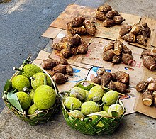 Breadfruit and taro from Pago Pago
City features
[
edit
]
 The Fono
(legislature) is located in
Fagatogo
, which is the center of town.
The Fono
(legislature) is located in
Fagatogo
, which is the center of town.
The Greater Pago Pago Area stretches into neighboring villages:
[24]
- Fagatogo
is home to the
Pago Pago Post Office
, museum, movie theater, bars, and taxi services. It is locally known as Downtown Pago Pago.
[5]
: 51
- Utulei
and
Maleimi
are home to some Pago Pago-based hotels.
- Satala
and
Atu'u
are home to Pago Pago's tuna industry.
- Tafuna
is the location of the Pago Pago International Airport, seven miles (11 km) south of Pago Pago.
Some houses are Western-style; others are more traditional Samoan housing units. All houses have running water and plumbing.
[94]
It has been described as a "thoroughly
Americanized
" city.
[95]
Fagatogo is Pago Pago's chief governmental and commercial center.
[96]
Pago Pago Park
is a public park by the harbor in Pago Pago. It lies by the Laolao Stream at the very end of Pago Pago Harbor. It is a 20-acre (8.1 ha) recreational complex and culture center. There are a ball field, sports court and boat ramp in the park. The park houses businesses such as the American Samoa Development Bank.
[97]
[98]
There are basketball and tennis courts, a football field, a gymnasium, a bowling alley and several Korean food kiosks in the park. The Korean House was built as a social center for the Korean fishermen in town.
[14]
: 170
National Park
[
edit
]
 National Park of American Samoa is accessed through
Pago Pago International Airport
.
[99]
National Park of American Samoa is accessed through
Pago Pago International Airport
.
[99]
Pago Pago is the primary entry point for visits to National Park of American Samoa, and the city is situated immediately south of the park.
[3]
[100]
Its park visitor center is located at the head of Pago Pago Harbor: Pago Plaza Visitor Center (Pago Plaza, Suite 114, Pago Pago, AS 96799).
[101]
[102]
This center also contains a collection of Samoan artifacts, corals, and seashells.
[65]
: 479
The center expanded with 700 sq. ft. in July 2019, adding new demonstrations and exhibits. An item at the new exhibit is the skull of a sperm whale which washed up on
Ofu
Island in 2015. Several video screens and panels inform visitors about Samoan dolphins and whales. The exhibit also contains a 6-foot (1.8 m) by 6-foot (1.8 m)
siapo
which was made by college students as well as an ?enu basket woven with traditional materials.
[103]
The nearest hotels to the national park are also located in Pago Pago.
[104]
Other parts of the park, on the islands of
Ta??
and
Ofu
, can be visited via commercial inter-island air carrier from Pago Pago International Airport.
The national park is home to tropical rainforest, tall mountains, beaches, and some of the tallest sea cliffs in the world (3,000 ft; 910 m).
[105]
It was authorized by the U.S. Congress in 1988 to preserve the
paleotropical
rain forest, Indo-Pacific
coral reefs
, and Samoan culture. It officially opened in 1993 when a 50-year lease was signed between the U.S. federal government, the
government of American Samoa
, and local village chiefs (Matai). It is the only U.S. National Park where the U.S. federal government leases the land from local governments instead of being the land owner. It is a 8,257-acre (3,341 ha) park which provides habitat for a variety of tropical wildlife, including coral reef fish, seabirds, flying
fruit bats
, and numerous other species of animals. Approximately 2,600 acres (1,100 ha) are on Tutuila, and the remainder is on the other islands and the ocean. The park's offshore coral reefs provide habitat for 1,000 species of
coral reef
and
pelagic fishes
.
[106]
The park is home to over 150 species of coral. Notable terrestrial species are the
Pacific tree boa
and the Flying
Megabat
, which has a three-foot (0.91 m) wingspread.
[107]
Natural hazards
[
edit
]
Pago Pago is vulnerable to natural and man-made disasters. Vulnerabilities include heavy storms, flooding,
tsunamis
, mudslides, and
earthquakes
. American Samoa has experienced several
cyclones
and tropical storms, which also increase risks of rock slides and floodings.
[108]
The capital city is situated at the head of
Pago Pago Harbor
in a sheltered area that has been described as relatively safe during
hurricanes
.
[95]
'
In the past century, Pago Pago has experienced over 50 minor tsunamis. The earliest and most impactful tsunami before the
2009 Samoa earthquake and tsunami
occurred in 1917. This event was triggered by a magnitude 8.3 earthquake at the outer border of the northern end of the
Tonga Trench
, approximately 200 km off the Tutuila coast. The initial wave, reaching a height of about 3 m., resulted in the destruction of numerous houses and two churches. No human casualties were reported. Another notable event was the tsunami associated with the
1960 Valdivia earthquake
. While waves in the head of Pago Pago Bay reached a maximum height of 5 m., they caused minimal damage to several houses, with no reported casualties. The most destructive tsunami in Pago Pago's recorded history took place in 2009. Studies indicate that during this incident, wave amplification occurred in the Pago Pago Bay due to its long and narrow morphology. Waves that measured approximately 1 m. at the mouth of Pago Pago Bay surged to a maximum height of 7 m. at the head of Pago Pago Bay. The resulting inundation caused extensive damage in Pago Pago Harbor, extending up to 500 m. inland, and reaching a maximum run-up of 8 m., leading to 34 casualties across Tutuila Island.
[109]
Climate
[
edit
]
 At 1,716 ft (523 m),
Rainmaker Mountain
gives the city the highest annual rainfall of any harbor in the world.
[20]
At 1,716 ft (523 m),
Rainmaker Mountain
gives the city the highest annual rainfall of any harbor in the world.
[20]
Pago Pago has a
tropical rainforest climate
(
Koppen climate classification
Af
) with hot temperatures and abundant year-round rainfall. All official climate records for American Samoa are kept at Pago Pago. The hottest temperature ever recorded was 99 °F (37 °C) on February 22, 1958. Conversely, the lowest temperature on record was 59 °F (15 °C) on October 10, 1964.
[110]
The average annual temperature recorded at the weather station at
Pago Pago International Airport
is 82 °F (28 °C), with a temperature range of about two degrees Fahrenheit separating the average monthly temperatures of the coolest and hottest months.
Pago Pago has been named one of the wettest places on Earth. Due to its warm winters, the plant hardiness zone is 13b. It receives 128.34 inches (3,260 mm) of rain per year. The rainy season lasts from October through May, but the town experiences warm and humid temperatures year-round. Besides it being wetter and more humid from November?April, this is also the hurricane season. The frequency of hurricanes hitting Pago Pago has increased dramatically in recent years. The windy season lasts from May to October. As warmer easterlies are forced up and over Rainmaker Mountain, clouds form and drop moisture on the city. Consequentially, Pago Pago experiences twice the rainfall of nearby Apia in Western Samoa.
[8]
: 350?351
The average yearly rainfall in Pago Pago Harbor is 197 inches (5,000 mm), whereas in neighboring Western Samoa, it is around 118 inches (3,000 mm) per year.
[111]
Rainmaker Mountain, which is also known as Mount Pioa, is a designated
National Natural Landmark
.
[3]
It is notable for its ability to extract rain in tremendous quantities. Rising 1,716 feet (523 m) out of the ocean, the Pioa
monolith
blocks the path of the low clouds heavy with fresh water as they are pushed along by the southeast tradewinds. The southeast ridge of Rainmaker Mountain reaches up into the clouds creating downfalls of enormous proportions.
[23]
: 30
| Climate data for Pago Pago, American Samoa (
Pago Pago International Airport
), 1991?2020 normals, extremes 1957?present
|
| Month
|
Jan
|
Feb
|
Mar
|
Apr
|
May
|
Jun
|
Jul
|
Aug
|
Sep
|
Oct
|
Nov
|
Dec
|
Year
|
| Record high °F (°C)
|
95
(35)
|
99
(37)
|
95
(35)
|
95
(35)
|
93
(34)
|
95
(35)
|
91
(33)
|
92
(33)
|
92
(33)
|
94
(34)
|
95
(35)
|
94
(34)
|
99
(37)
|
| Mean maximum °F (°C)
|
91.0
(32.8)
|
91.3
(32.9)
|
91.3
(32.9)
|
90.7
(32.6)
|
89.6
(32.0)
|
88.0
(31.1)
|
87.7
(30.9)
|
88.0
(31.1)
|
88.9
(31.6)
|
89.6
(32.0)
|
90.4
(32.4)
|
90.7
(32.6)
|
92.4
(33.6)
|
| Mean daily maximum °F (°C)
|
87.8
(31.0)
|
88.1
(31.2)
|
88.4
(31.3)
|
87.8
(31.0)
|
86.5
(30.3)
|
85.3
(29.6)
|
84.6
(29.2)
|
84.8
(29.3)
|
85.7
(29.8)
|
86.4
(30.2)
|
87.0
(30.6)
|
87.6
(30.9)
|
86.7
(30.4)
|
| Daily mean °F (°C)
|
83.0
(28.3)
|
83.2
(28.4)
|
83.3
(28.5)
|
83.0
(28.3)
|
82.2
(27.9)
|
81.5
(27.5)
|
80.9
(27.2)
|
80.9
(27.2)
|
81.6
(27.6)
|
82.1
(27.8)
|
82.5
(28.1)
|
82.9
(28.3)
|
82.3
(27.9)
|
| Mean daily minimum °F (°C)
|
78.2
(25.7)
|
78.3
(25.7)
|
78.2
(25.7)
|
78.1
(25.6)
|
77.9
(25.5)
|
77.8
(25.4)
|
77.2
(25.1)
|
77.0
(25.0)
|
77.5
(25.3)
|
77.7
(25.4)
|
78.0
(25.6)
|
78.2
(25.7)
|
77.8
(25.4)
|
| Mean minimum °F (°C)
|
75.1
(23.9)
|
75.2
(24.0)
|
75.0
(23.9)
|
74.7
(23.7)
|
73.6
(23.1)
|
73.4
(23.0)
|
72.4
(22.4)
|
72.6
(22.6)
|
73.3
(22.9)
|
73.7
(23.2)
|
73.9
(23.3)
|
74.7
(23.7)
|
70.7
(21.5)
|
| Record low °F (°C)
|
67
(19)
|
65
(18)
|
63
(17)
|
68
(20)
|
65
(18)
|
61
(16)
|
62
(17)
|
60
(16)
|
62
(17)
|
59
(15)
|
60
(16)
|
65
(18)
|
59
(15)
|
| Average
precipitation
inches (mm)
|
15.25
(387)
|
13.70
(348)
|
10.95
(278)
|
11.27
(286)
|
11.73
(298)
|
6.37
(162)
|
7.51
(191)
|
6.93
(176)
|
7.99
(203)
|
10.24
(260)
|
12.05
(306)
|
14.35
(364)
|
128.34
(3,260)
|
| Average precipitation days
(≥ 0.01 in)
|
24.3
|
22.0
|
23.8
|
22.2
|
20.8
|
18.8
|
20.0
|
19.0
|
18.4
|
21.1
|
21.3
|
23.8
|
255.5
|
| Average
relative humidity
(%)
|
82.8
|
83.3
|
83.2
|
84.0
|
83.6
|
82.0
|
80.4
|
79.8
|
80.2
|
81.5
|
82.3
|
82.1
|
82.1
|
| Average
dew point
°F (°C)
|
74.8
(23.8)
|
74.8
(23.8)
|
74.8
(23.8)
|
74.8
(23.8)
|
74.3
(23.5)
|
73.6
(23.1)
|
72.1
(22.3)
|
71.6
(22.0)
|
72.5
(22.5)
|
73.6
(23.1)
|
74.1
(23.4)
|
74.5
(23.6)
|
73.8
(23.2)
|
| Mean monthly
sunshine hours
|
165.3
|
150.3
|
179.2
|
132.2
|
123.3
|
113.7
|
148.0
|
168.0
|
196.0
|
159.6
|
156.7
|
156.8
|
1,849.1
|
| Percent
possible sunshine
|
41
|
43
|
48
|
37
|
35
|
34
|
42
|
47
|
54
|
41
|
41
|
39
|
42
|
| Source: NOAA (relative humidity and sun 1961?1990)
[112]
[113]
[114]
|
See or edit
raw graph data
.
Demographics
[
edit
]
Historical population
| Census
| Pop.
| Note
| %±
|
|---|
| 1920
| 508
| | ?
|
|---|
| 1930
| 708
| | 39.4%
|
|---|
| 1940
| 934
| | 31.9%
|
|---|
| 1950
| 1,586
| | 69.8%
|
|---|
| 1960
| 1,251
| | ?21.1%
|
|---|
| 1970
| 2,451
| | 95.9%
|
|---|
| 1980
| 2,491
| | 1.6%
|
|---|
| 1990
| 3,518
| | 41.2%
|
|---|
| 2000
| 4,278
| | 21.6%
|
|---|
| 2010
| 3,656
| | ?14.5%
|
|---|
| 2020
| 3,000
| | ?17.9%
|
|---|
 Pago Pago Post Office (Luman'ai Building) in Fagatogo
The village of Pago Pago proper had a 2010 population of 3,656. However, Pago Pago also encompasses neighboring villages. The Greater Pago Pago Area was home to 11,500 residents in 2011.
[115]
Around 90 percent of American Samoa's population lives around Pago Pago.
[116]
[117]
American Samoa's population grew by 22 percent in the 1990s; nearly all of this growth took place in Pago Pago.
[118]
As of the
2000 U.S. Census
, 74.5% of Pago Pago's population are of "
Native Hawaiian or Other Pacific Island
" race. 16.6% were
Asian
, while 4.9% were
white
.
[119]
In Pago Pago proper, residential communities are mostly found in the
Vaipito Valley
.
[90]
: 24?23
The proportion of Pago Pago residents born outside of American Samoa was 26 percent in the early 1980s, and 39 percent in the late 1980s. The percentage of residents born abroad reached 44 percent in 1990. Many of the residents are American Samoans who were born abroad, and the village also has had an increasing number of new residents from
Far East
countries such as
South Korea
.
[90]
: 24?22
The village of Pago Pago, the Greater Pago Pago Area and
Ma?op?tasi County
observed a notable reduction in population during the period from 2010 to 2020. Specifically, the county registered a 16.8 percent decline in population, while Pago Pago proper recorded an 18 percent decrease. This decline surpassed the overall population decrease for American Samoa, which stood at 10.5 percent during the same timeframe. Among the villages in the county, only
Anua
experienced a positive growth in population, contrasting with declines in villages such as
Fagatogo
(-16.8%),
Satala
(-26.6%), and
Utulei
(-30%).
[120]
Government
[
edit
]
 High Court of American Samoa
Pago Pago is the seat of the judiciary (
Fagatogo
), legislature and Governor's Office (
Utulei
).
[24]
Education
[
edit
]
The
Feleti Barstow Public Library
is located in Pago Pago.
[121]
In 1991, severe tropical
Cyclone Val
hit Pago Pago, destroying the library that existed there. The current Barstow library, constructed in 1998, opened on April 17, 2000.
[122]
The
American Samoa Community College
(ASCC) was founded in July 1970 by the
American Samoa Department of Education
. The college's first courses were taught in 1971 at the Lands and Survey Building in
Fagatogo
. At the time, the college had a total enrollment of 131 students. In 1972, the college moved to the former
Fialloa High School
in
Utulei
, before ultimately moving to its current location in
Mapusaga
in 1974.
[123]
Economy
[
edit
]
 A statue of
StarKist
Tuna mascot Charlie the Tuna at the company cannery in
Atu'u
A statue of
StarKist
Tuna mascot Charlie the Tuna at the company cannery in
Atu'u
 Tuna boats in the Port of Pago Pago
Pago Pago is the center of commerce in American Samoa.
[124]
[125]
[126]
It is home to all the industry and most of the commerce in American Samoa.
[14]
: 166
It is the number one port in the United States in terms of value of fish landed - about $200,000,000 per year.
[9]
In 2007, tuna exports accounted for 93% of all exports, amounting to $446 million.
[127]
Tuna canning is the main economic activity in town. Exports are almost exclusively tuna canneries such as
Chicken of the Sea
and
StarKist
, which are both located in Pago Pago. These also occupy 14 percent of American Samoa's total workforce as of 2014.
[128]
The most industrialized area in the territory can be found between Pago Pago Harbor and the
Tafuna
-
Leone
Plain, which also are the two most densely populated places in the islands.
[129]
American Samoa was the world's fourth-largest tuna processor in 1993. The primary industry is tuna processing by the Samoa Packing Co. (
Chicken of the Sea
) and
StarKist Samoa
, a subsidiary of
H.J. Heinz
. The first cannery was opened in 1954. Canned fish, canned pet food, and fish meal from skin and bones account for 93 percent of American Samoa's industrial output.
[8]
: 353
Dining establishments, amusement facilities, professional services, and bars can be found throughout Pago Pago. Pago Pago proper was home to 225 registered commercial enterprises as of year 2000. Within the Pago Pago watershed, farmland (faatoaga) are located in two areas in the southern half of the Vaipito Valley as well as in Happy Valley and on the west side of Pago Pago village. Farmland is also found by
Fagatogo
,
Atu'u
, Punaoa Valley,
Lepua
,
Aua
, and
Leloaloa
.
[90]
: 24?24, 24?25
Centers for shopping are Pago Plaza, which consists of smaller stores selling handcrafts and souvenirs, and Fagatogo Square Shopping Center, which is home to larger shops.
[87]
This shopping mall is next-door to
Fagatogo Market
in
Fagatogo
, which is considered the main center of Pago Pago. It is home to several restaurants, shops, bars, and often live entertainment and music. Souvenirs are often sold at the market when cruise ships are visiting town. Locals also sell handmade crafts at the dock and on main street.
Mount ?Alava
, the canneries in
Atu'u
,
Rainmaker Mountain
(Mount Pioa), and
Pago Pago Harbor
are all visible from the market. The main bus station is located immediately behind the market.
[130]
[131]
Pago Pago is a
duty-free
port and prices on imported goods are lower than in other parts of the
South Pacific Ocean
.
[14]
: 166
Governor
H. Rex Lee
signed a law making Pago Pago a duty-free port in May 1967.
[22]
: 285
It is a wealthier city than nearby
Apia
, capital of
Samoa
.
[132]
[133]
[134]
Tourism
[
edit
]
 Rainmaker Hotel
Tourism in
American Samoa
is centered around Pago Pago. It receives 34,000 visitors per year, which is one-fourth of neighboring country of
Samoa
. 69.3 percent of visitors are from the
United States
as of 2014.
[135]
Until 1980, one could experience the view of Mt. Avala by taking an
aerial tramway
over the harbor, but on April 17 of that year a
U.S. Navy
plane, flying overhead as part of the
Flag Day
celebrations, struck the cable; the plane crashed into a wing of the
Rainmaker Hotel
.
[136]
The tramway was repaired, but closed not long after. The tram remains unusable, although according to
Lonely Planet
,
plans have been put forth to reopen it, but in January 2011 the cable was damaged by Tropical
Cyclone Wilma
, fell into the harbor and has not been repaired. Governor
Lolo Matalasi Moliga
announced in 2014 that he would look into restoring the cable car.
[137]
The
Sadie Thompson Inn
, on the outskirts of Pago Pago, is a hotel and restaurant that is listed on the U.S.
National Register of Historic Places
.
The Greater Pago Pago Area is home to more than 10 hotels:
[65]
: 483?485
Transportation
[
edit
]
 Pago Pago Harbor is capable of accommodating the largest ships in the world.
[138]
[139]
[140]
Pago Pago Harbor is capable of accommodating the largest ships in the world.
[138]
[139]
[140]
 Pago Pago International Airport
Pago Pago Harbor is the
port of entry
for vessels arriving in American Samoa.
[141]
Many cruise boats and ships land at Pago Pago Harbor for reprovision reasons, such as to restock on goods and to utilize American-trained medical personnel.
[142]
Pago Pago Harbor is one of the world's largest natural harbors.
[115]
It has been named one of the best deepwater harbors in the South Pacific Ocean,
[4]
[143]
or one of the best in the world as a whole.
[144]
Pago Pago is a port of call for South Pacific
cruise ships
, including
Norwegian Cruise Line
[145]
and
Princess Cruises
.
[146]
However, cruise ships do not take on passengers in Pago Pago, but typically arrive in the morning and depart in the afternoon. Thirteen cruise ships were scheduled to visit Pago Pago in 2017, bringing 31,000 visitors.
[147]
Pago Pago Harbor can accommodate two cruise ships at the same time, and has done so on several occasions.
[148]
Pago Pago International Airport
(PPG) is located at
Tafuna
, eight miles (13 km) southwest of Pago Pago. There are international flights to Samoa 4?7 times daily by
Polynesian Airlines
:
[86]
Pago Pago is a 35-minute flight from Apia in Samoa. Most flights are to and from
Fagali'i
.
[65]
: 512
[149]
There is only one flight destination from the territory to the United States:
Honolulu International Airport
, a five-hour flight from Pago Pago by
Hawaiian Airlines
. Of the 88,650 international arrivals in 2001, only 10 percent were tourists. The rest came to visit relatives, for employment reasons, or in transit. Most international visitors are from the independent country of Samoa.
[65]
: 468?469
Scheduled intra-territorial flights are available to the islands of Ta?? and Ofu, which take 30 minutes by air from Pago Pago.
A ferry called
MV
Lady Naomi
runs between Pago Pago and
Apia, Samoa
, once a week.
[150]
Bus and taxi services are based in Fagatogo.
[151]
Historical sites
[
edit
]
Sixteen remaining structures from the
U.S. Naval Station Tutuila Historic District
are listed on the
U.S. National Register of Historic Places
. These include the
Government House
,
Courthouse of American Samoa
,
Jean P. Haydon Museum
,
Navy Building 38
, and other buildings.
World War II fortifications
[
edit
]
Near Pila F. Palu Co. Inc. Store, a road runs up the hill into
Happy Valley
, and on the side of this road, six World War II ammunition bunkers can be seen on the left before reaching a dirt road. The dirt road, also located on the left side, leads to a big concrete bunker which was used as naval communications headquarters during World War II.
[152]
: 411?412
Over fifty
pillbox fortifications
can be found along the coastline on Tutuila Island. The largest of these is the
Marine Corps
communication bunker in Pago Pago.
[153]
It is located in the
Autapini
area, which is between
Malaloa
and Happy Valley.
[152]
: 416?417
During World War II, guns were emplaced at
Blunt's
and
Breaker's Points
, covering
Pago Pago Harbor
.
[48]
: 85?86
Landmarks
[
edit
]
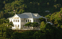 Government House
, on the Togotogo Ridge, appears on the
National Register of Historic Places
.
Government House
, on the Togotogo Ridge, appears on the
National Register of Historic Places
.
 Fale
outside Jean P. Haydon Museum
Fale
outside Jean P. Haydon Museum
Landmarks include:
[5]
: 54
[14]
: 167?169
- National Park of American Samoa
, immediately north of town
- U.S. Naval Station Tutuila Historic District
, sixteen buildings are listed on the
U.S. National Register of Historic Places
- Government House
is a colonial mansion atop Mauga o Ali'i (the chief's hill), which was erected in 1903
- The Fono
is the territorial legislature
- The Courthouse
is a two-story colonial-style house listed on the
U.S. National Register of Historic Places
- Jean P. Haydon Museum
was constructed in 1917 and houses historical artifacts such as canoes. It is named for its founder, the wife of Governor
John Morse Haydon
- Blunts Point Battery
, erected as a part of the fortification following the attack on
Pearl Harbor
[154]
- Breakers Point Naval Guns
, World War II-era defensive fortification
- Rainmaker Mountain
(Pioa Mountain), designated
National Natural Landmark
[3]
- Utulei Beach, beach in
Utulei
- Navy Building 38
, historic radio station in
Fagatogo
- Tauese PF Sunia Ocean Center
, visitor center for
National Marine Sanctuary of American Samoa
- Air Disaster Memorial, in Utulei. Monument for the eight deceased during a 1980 airplane crash
In popular culture
[
edit
]
 The film
Sadie Thompson
(1928) is based on the story of a prostitute who arrives in Pago Pago.
[155]
The film
Sadie Thompson
(1928) is based on the story of a prostitute who arrives in Pago Pago.
[155]
- Rain
(1921) by
W. Somerset Maugham
is set in Pago Pago.
[65]
: 463
[156]
Movie adaptions include
Sadie Thompson
(1928),
Rain
(1932), and
Miss Sadie Thompson
(1953).
- The Blonde Captive
(1931) was filmed in Pago Pago.
[157]
- The Hurricane
(1937) and its sequel,
Hurricane (1979)
, were set in Pago Pago. The 1937 film was filmed in Pago Pago.
[157]
- The storyline in the film
South of Pago Pago
(1940) is set here. This movie was partly shot in Pago Pago, although most filming took place in
Hawai'i
and
Long Beach, CA
.
[158]
- A jungle village resembling Pago Pago was created for motion picture in
Two Harbors
,
Catalina Island, CA
.
[159]
Several
Sadie Thompson
films were shot here.
- Lost and Found on a South Sea Island
(1923) is set in Pago Pago.
- Next Goal Wins
(2014), British documentary filmed in Pago Pago.
- Samoa, California
was named in honor of American Samoa. It was assumed that the harbor in Pago Pago looked similar to that of the town, and it consequentially got the name Samoa, CA in the 1890s.
[160]
- In the Sweet Pie and Pie
(1941),
The Three Stooges
short. Pago Pago is mentioned as being one of the locations for the fictional Heedam Neckties stores.
- In
Better Call Saul
(2015), Saul Goodman graduated from the fictional American Samoa Law School.
Notable people
[
edit
]
 Peter T. Coleman
was the first Governor of Samoan descent.
Peter T. Coleman
was the first Governor of Samoan descent.
- Peter Tali Coleman
, 43rd, 51st, and 53rd
Governor of American Samoa
- Al Harrington
, actor most known for his role in
Hawaii Five-O
[161]
- Gary Scott Thompson
, director and television producer
[162]
- John Kneubuhl
, screenwriter
- Shalom Luani
, NFL player for the
Los Angeles Chargers
- Junior Siavii
, Former NFL player for the
Kansas City Chiefs
,
Dallas Cowboys
, and the
Seattle Seahawks
- Jonathan Fanene
, Former NFL player for the
Cincinnati Bengals
- Mosi Tatupu
, Former NFL player for the
New England Patriots
, and the
Los Angeles Rams
- Shaun Nua
, Former NFL player for the
Pittsburgh Steelers
- Isaac Sopoaga
, Former NFL player for the
San Francisco 49ers
,
Philadelphia Eagles
,
New England Patriots
, and the
Arizona Cardinals
- Daniel Te?o-Nesheim
, Former NFL player for the
Philadelphia Eagles
, and the
Tampa Bay Buccaneers
- Frank Solomon
, rugby player
- Faauuga Muagututia
, US Navy Seal
- Amata Coleman Radewagen
,
Delegate
in the
U.S. House of Representatives
- Fofo Iosefa Fiti Sunia
, first non-voting Delegate from American Samoa to the U.S. House of Representatives
- Palauni Ma Sun
, American football offensive lineman
- Joey Iosefa
, football player
- Bob Apisa
, football player
- Domata Peko
, football player
- Isaako Aaitui
, football player
- Kennedy Polamalu
, football coach and former player
- Gabe Reid
, former football tight end for the NFL's Chicago Bears
- Nicky Salapu
, soccer player
- Trevor Misipeka
, football player
- Cocoa Samoa
, wrestler
- Mighty Mo
, kickboxer
See also
[
edit
]
References
[
edit
]
- ^
United States Postal Service (2012).
"USPS - Look Up a ZIP Code"
.
Archived
from the original on February 14, 2012
. Retrieved
February 15,
2012
.
- ^
"Geographic Names Information System"
.
United States Geological Survey
.
Archived
from the original on July 14, 2012
. Retrieved
January 31,
2008
.
- ^
a
b
c
d
Harris, Ann G. and Esther Tuttle (2004).
Geology of National Parks
. Kendall Hunt. Page 604.
ISBN
9780787299705
.
- ^
a
b
United States Central Intelligence Agency (2016).
The World Factbook 2016?17
. Government Printing Office. Page 19.
ISBN
9780160933271
.
- ^
a
b
c
Grabowski, John F. (1992).
U.S. Territories and Possessions (State Report Series)
. Chelsea House Pub.
ISBN
9780791010532
.
- ^
a
b
Kristen, Katherine (1999).
Pacific Islands (Portrait of America)
. San Val.
ISBN
9780613032421
.
- ^
a
b
Leonard, Barry (2009).
Minimum Wage in American Samoa 2007: Economic Report
. Diane Publishing.
ISBN
9781437914252
.
- ^
a
b
c
Stanley, David (1993).
South Pacific Handbook
. David Stanley.
ISBN
9780918373991
.
- ^
a
b
"NATURAL HISTORY GUIDE TO AMERICAN SAMOA"
(PDF)
. National Park Service. 2009. p. 48. Archived from
the original
(PDF)
on 2017-02-24
. Retrieved
3 September
2022
.
- ^
United States. Army. Corps of Engineers. Pacific Ocean Division (1975).
Water Resources Development by the U.S. Army Corps of Engineers in American Samoa, 1975
. Division Engineer, U.S. Army Engineer Division, Pacific Ocean, Corps of Engineers. Page 36.
- ^
Carter, John (1984).
Pacific Islands Yearbook 1981
. Pacific Publications Pty, Limited. Page 49.
ISBN
9780858070493
.
- ^
Encyclopædia Britannica (2003).
The New Encyclopædia Britannica: Volume 25
. Encyclopaedia Britannica, Inc. Page 288.
ISBN
9780852299616
.
- ^
C. Balme (2006).
Pacific Performances: Theatrically and Cross-Cultural Encounter in the South Seas
. Springer. Page 156.
ISBN
9780230599536
.
- ^
a
b
c
d
e
f
Swaney, Deanna (1994).
Samoa: Western & American Samoa: a Lonely Planet Travel Survival Kit
. Lonely Planet Publications.
ISBN
9780864422255
.
- ^
"Raiders draft Shalom Luani"
. 30 April 2017.
- ^
Mack, Doug (2017).
The Not-Quite States of America: Dispatches From the Territories and Other Far-Flung Outposts of the USA
. W.W. Norton & Company. Page 62.
ISBN
9780393247602
.
- ^
a
b
Lal, Brij V. and Kate Fortune (2000).
The Pacific Islands: An Encyclopedia, Volume 1
. University of Hawaii Press. Page 101.
ISBN
9780824822651
.
- ^
Sparks, Karen Jacobs (2010).
Britannica Book of the Year 2010
. Encyclopaedia Britannica, Inc. Page 509.
ISBN
9781615353668
.
- ^
Atkinson, Brett and Charles Rawlings-Way (2016).
Lonely Planet Rarotonga, Samoa & Tonga (Travel Guide)
. Lonely Planet. Page 147.
ISBN
9781786572172
.
- ^
a
b
"Rainmaker Mountain in Tutuila"
.
Lonely Planet
. Archived from
the original
on October 19, 2017
. Retrieved
November 28,
2017
.
- ^
"American Samoa Is The Empty Slice Of Bliss You've Been Craving"
.
huffingtonpost.com
. 5 September 2014.
Archived
from the original on September 10, 2017
. Retrieved
November 28,
2017
.
- ^
a
b
c
d
e
f
g
h
i
j
k
l
m
n
o
p
q
r
s
t
Sunia, Fofo I.F. (2009).
A History of American Samoa
. Amerika Samoa Humanities Council.
ISBN
9781573062992
.
- ^
a
b
c
d
Shaffer, Robert J. (2000).
American Samoa: 100 Years Under the United States Flag
. Island Heritage.
ISBN
9780896103399
.
- ^
a
b
c
Cruise Travel Vol. 2, No. 1
(July 1980). Lakeside Publishing Co. Page 60.
ISSN
0199-5111
.
- ^
"Uber, schmuber. Behold the buses of Pago Pago ..."
LA Times
. 10 November 2015.
Archived
from the original on October 21, 2017
. Retrieved
November 28,
2017
.
- ^
"Language in Samoa | Frommer's"
.
Archived
from the original on 2019-08-14
. Retrieved
2019-08-14
.
- ^
Craig, Robert D. (2004).
Handbook of Polynesian Mythology
. ABC-CLIO. Page 17.
ISBN
9781576078945
.
- ^
Fraser, Peter (2010).
More Curious Than Cautious
. Dog Ear Publishing. Page 122.
ISBN
9781598587708
.
- ^
Leib, Amos Patten (1972).
The Many Islands of Polynesia
. Schuster Merchandise. Page 60.
ISBN
9780684130101
.
- ^
Gray, John Alexander Clinton (1960).
Amerika Samoa: a history of American Samoa and its United States Naval Administration
. United States Naval Institute. Page 123.
- ^
a
b
c
Gray, John Alexander Clinton (1980).
Amerika Samoa
. Arno Press.
ISBN
9780405130380
.
- ^
Stahl, Dean A. and Karen Landen (2001).
Abbreviations Dictionary
. CRC Press. Page 1451.
ISBN
9781420036640
.
- ^
Sand, Christophe and David J. Addison (2008).
Recent Advances in the Archaeology of the Fiji/West-Polynesia Region
. Department of Anthropology, Gender and Sociology.
University of Otago
. Dunedin: New Zealand. Page 93. ISBN 9780473145866.
- ^
Craig, Peter (2009).
Natural history guide to American Samoa
.
National Park of American Samoa
. Page 19. Retrieved on January 20, 2024, from
https://www.nps.gov/npsa/learn/education/upload/NatHistGuideAS09.pdf
.
- ^
Sand, Christophe and David J. Addison (2008).
Recent Advances in the Archaeology of the Fiji/West-Polynesia Region
. Department of Anthropology, Gender and Sociology.
University of Otago
. Dunedin: New Zealand. Page 110. ISBN 9780473145866.
- ^
Rieth, Tim (2008). How Dark Are They? The Samoan Dark Ages, ~1500-1000 BP. Retrieved on January 20, 2024, from
https://www.academia.edu/1758604/How_Dark_Are_They_The_Samoan_Dark_Ages_1500-1000_BP
.
- ^
Sand, Christophe and David J. Addison (2008).
Recent Advances in the Archaeology of the Fiji/West-Polynesia Region
. Department of Anthropology, Gender and Sociology.
University of Otago
. Dunedin: New Zealand. Page 91. ISBN 9780473145866.
- ^
Sand, Christophe and David J. Addison (2008).
Recent Advances in the Archaeology of the Fiji/West-Polynesia Region
. Department of Anthropology, Gender and Sociology.
University of Otago
. Dunedin: New Zealand. Page 103. ISBN 9780473145866.
- ^
Pearl, F. B. (2004). The Chronology of Mountain Settlements on Tutuila, American Samoa.
The Journal of the Polynesian Society
, 113(4), 331?348. Page 334. Retrieved on January 21, 2024, from
http://www.jstor.org/stable/20707242
.
- ^
"TS Tongan War in Tutuila : Samoan Mythology"
.
- ^
Lutali, A.P. and William J. Stewart. The Chieftal System in Twentieth Century America: Legal Aspects of the Matai System in the Territory of American Samoa. 4 Ga. J. Int’l & Compar. L. 387 (1974). Page 390. Retrieved on January 20, 2024, from
https://digitalcommons.law.uga.edu/gjicl/vol4/iss2/8/
.
- ^
Sorensen, Stan and Theroux, Joseph. The Samoan Historical Calendar, 1606-1997. Government of American Samoa. Page 113.
- ^
Freeman, Donald B. (2010).
The Pacific
. Routledge. Page 167.
ISBN
9780415775724
.
- ^
Levi, Werner (1947).
American-Australian Relations
. University of Minnesota Press. Page 73.
ISBN
9780816658152
.
- ^
Dixon, Joe C. (1980).
The American Military and the Far East
. Diane Publishing. Page 139.
ISBN
9781428993679
.
- ^
Stanley, George Edwards (2005).
The Era of Reconstruction and Expansion (1865?1900)
. Gareth Stevens. Page 36.
ISBN
9780836858273
.
- ^
Pafford, John (2013).
The Forgotten Conservative: Rediscovering Grover Cleveland
. Regnery Publishing. Page 61.
ISBN
9781621570554
.
- ^
a
b
c
Rottman, Gordon L. (2002).
World War II Pacific Island Guide: A Geo-military Study
. Greenwood Publishing Group.
ISBN
9780313313950
.
- ^
"Robert Louis Stevenson".
Encyclopedia Britannica
. 5 February 2019.
- ^
"American Samoa Bar Association"
. Archived from
the original
on 2020-01-10
. Retrieved
2019-09-08
.
- ^
Stoler, Ann Laura and Willy Brandt (2006).
Haunted by Empire: Geographies of Intimacy in North American History
. Duke University Press. Page 88.
ISBN
9780822337249
.
- ^
a
b
c
"Pago Pago | American Samoa"
.
Britannica.com
.
Archived
from the original on October 19, 2017
. Retrieved
November 28,
2017
.
- ^
Carpenter, Allan (1993).
Facts about the Cities
. Wilson. Page 11.
ISBN
9780924208003
.
- ^
"American Samoa Community College (ASCC) Trades & Technology Program (TT&P): "Assessment & Strategic Vision Report"
"
(PDF)
. American Samoa Community College. 17 April 2005. p. 7
. Retrieved
28 November
2022
.
- ^
"NFS Form 10-900-a OMB Approval No. 1024-0018 | Thompson, Sadie, Building, Eastern AS"
(PDF)
. National Register of Historic Places. February 2, 2009.
Archived
(PDF)
from the original on February 28, 2017
. Retrieved
November 28,
2017
.
- ^
Rogal, Samuel J. (1997).
A William Somerset Maugham Encyclopedia. Greenwood Publishing Group
. Page 244.
ISBN
9780313299162
.
- ^
Labor, Earle (2013).
Jack London: An American Life
. Farrar, Straus and Giroux. Page 272.
ISBN
9781466863163
.
- ^
Rill, James C. (2003).
A Narrative History of the 1st Battalion, 11th Marines During the Early History and Deployment of the 1st Marine Division, 1940?43
. Merriam Press. Page 32.
ISBN
9781576383179
.
- ^
Kennedy, Joseph (2009).
The Tropical Frontier: America's South Sea Colony
. University of Hawaii Press. Page 207.
ISBN
9780980033151
.
- ^
"David Huebner - US Ambassador to New Zealand"
. Archived from
the original
on February 27, 2013
. Retrieved
November 28,
2017
.
- ^
"Dedication of VA Clinic centerpiece of VP Pence visit to AmSam"
.
samoanews.com
. 19 April 2017.
Archived
from the original on October 26, 2017
. Retrieved
November 28,
2017
.
- ^
"Apollo At American Samoa Summary"
.
members.tripod.com
. Retrieved
November 28,
2017
.
- ^
"Kevin Steen"
.
history.nasa.gov
.
Archived
from the original on December 26, 2017
. Retrieved
November 28,
2017
.
- ^
"Jean P. Haydon Museum Review | Fodor's Travel"
.
fodors.com
.
Archived
from the original on October 23, 2017
. Retrieved
November 28,
2017
.
- ^
a
b
c
d
e
f
Stanley, David (2004).
Moon Handbooks South Pacific
. David Stanley.
ISBN
9781566914116
.
- ^
Dalton, Bill and David Stanley (1979).
South Pacific Handbook
. David Stanley. Page 73.
ISBN
9780804813136
.
- ^
"Lyndon B. Johnson: Remarks Upon Arrival at Tafuna International Airport, Pago Pago, American Samoa"
.
presidency.ucsb.edu
.
Archived
from the original on May 25, 2017
. Retrieved
November 28,
2017
.
- ^
Cassidy, Edward Idris (2009).
My Years in Vatican Service
. Paulist Press. Page 52.
ISBN
9780809145935
.
- ^
"THE WALL OF FACES"
.
Vietnam Veterans Memorial Fund
. Retrieved
2020-10-22
.
- ^
a
b
"HISTORY OF THE AMERICAN SAMOA SHIPYARD"
.
Ronald Reagan Shipyard
.
Archived
from the original on 2019-07-23
. Retrieved
2019-07-23
.
- ^
"Samoa Bowl IX: Live the experience through the Samoa Bowl!"
. 19 December 2011.
- ^
"US Vice-President to dedicate American Samoa clinic to 'Eni'
"
. RNZ. 19 April 2017
. Retrieved
3 September
2022
.
- ^
"Pence cutting Pacific trip short"
.
POLITICO
. 24 April 2017.
Archived
from the original on October 20, 2017
. Retrieved
November 28,
2017
.
- ^
"Mike Pence cuts short his stop in Hawaii to deal with domestic issues"
.
CBS News
. 24 April 2017.
Archived
from the original on October 20, 2017
. Retrieved
November 28,
2017
.
- ^
"american samoa"
.
americansamoa.gov
.
Archived
from the original on October 20, 2017
. Retrieved
November 28,
2017
.
- ^
"Fono coming down"
. 28 August 2017.
Archived
from the original on 2019-07-24
. Retrieved
2019-07-24
.
- ^
"JUST ASKING… when will there be a new Fono building? | American Samoa | Samoa News"
.
Archived
from the original on 2018-12-20
. Retrieved
2019-07-24
.
- ^
"Four-month repair work underway at the Satala Shipyard"
.
Samoa News
. 7 December 2018.
Archived
from the original on 2019-07-23
. Retrieved
2019-07-23
.
- ^
"North Korean cargo ship seized by US arrives in American Samoa for inspection by American authorities"
.
USA Today
.
Archived
from the original on 2019-07-17
. Retrieved
2019-07-17
.
- ^
Article
Archived
2009-10-03 at the
Wayback Machine
on
Google News
- ^
"
Disaster aid flows to tsunami-hit Samoas
Archived
2009-09-29 at the
Wayback Machine
".
MSNBC
.
- ^
Jadacki, Matt (2011).
American Samoa 2009 Earthquake and Tsunami: After-Action Report
. DIANE Publishing. Page 2.
ISBN
9781437942835
.
- ^
Dunbar, Paula K. (2015).
Pacific Tsunami Warning System: A Half Century of Protecting the Pacific, 1965?2015
. Government Printing Office. Page 56.
ISBN
9780996257909
.
- ^
"CPH-T-8. Population, Housing Units, Land Area, and Density for U.S. Island Areas: 2010"
(PDF)
. U.S. Census Bureau. p. 2. Archived from
the original
(PDF)
on 2019-02-07.
- ^
Ruffner, James A. and Frank E. Bair (1987).
Weather of U.S. Cities: City Reports
. Gale Research Company. Page 840.
ISBN
9780810321021
.
- ^
a
b
"Pago Pago International Airport (PPG) - American Samoa | Department of Port Administration"
.
americansamoaport.as.gov
.
Archived
from the original on December 15, 2017
. Retrieved
November 28,
2017
.
- ^
a
b
"Pago Pago, American Samoa: The Capital City on the Harbor"
.
visittheusa.com
.
Archived
from the original on October 19, 2017
. Retrieved
November 28,
2017
.
- ^
"Port of Pago Pago - American Samoa | Department of Port Administration"
.
americansamoaport.as.gov
.
Archived
from the original on December 10, 2017
. Retrieved
November 28,
2017
.
- ^
"
Pago Pago (American Samoa)
".
Britannica Online Encyclopedia
.
- ^
a
b
c
d
e
"AMERICAN SAMOA WATERSHED PROTECTION PLAN"
(PDF)
. American Samoa Environmental Protection Agency. Archived from
the original
(PDF)
on 2019-08-19.
- ^
"Samoa Guide, 26. Life in a Samoan stream"
.
Archived
from the original on 2019-08-19
. Retrieved
2019-08-19
.
- ^
"Pago Pago, capital city of American Samoa"
.
visitcapitalcity.com
.
Archived
from the original on July 5, 2017
. Retrieved
November 28,
2017
.
- ^
Farrell, Jack,
"American Samoa American Samoa: A Tropical Delight Hosting the Only U.S. National Park South of the Equator"
Archived
2014-05-12 at
archive.today
,
Frederick News-Post
, Sunday, March 16, 2014
- ^
McDonald, George (1994).
Frommer's Guide to the South Pacific, 1994?1995
. Prentice Hall Travel. Page 262.
ISBN
9780671866600
.
- ^
a
b
Rauzon, Mark J. (2016).
Isles of Amnesia: The History, Geography, and Restoration of America's Forgotten Pacific Islands
. University of Hawai'i Press, Latitude 20. Page 7.
ISBN
9780824846794
.
- ^
Holmes, Lowell D. (1974).
Samoan Village
. Holt McDougal. Page 98.
ISBN
9780030779251
- ^
Goodwin, George McDonald (1994).
Frommer's Guide to the South Pacific, 1994?1995
. Prentice Hall Travel. Page 258.
ISBN
9780671866600
.
- ^
Lonely Planet Publications (1990).
Samoa, Western & American Samoa
. Lonely Planet Publications. Page 141.
ISBN
9780864420787
.
- ^
National Geographic (2016).
National Geographic Guide to National Parks of the United States
. National Geographic. Page 319.
ISBN
9781426216510
.
- ^
Hughes, Holly (2010).
Frommer's 500 Extraordinary Islands (500 Places)
. Frommer's. Page 86.
ISBN
9780470500705
- ^
National Geographic Society (2012).
National Geographic Guide to National Parks of the United States
. National Geographic Books. Page 233.
ISBN
9781426208690
.
- ^
Smith, Darren L. and Penny J. Hoffman (2001).
Parks Directory of the United States
. Omnigraphics. Page 70.
ISBN
9780780804401
.
- ^
"Check out exhibits at NPS Visitor Center"
.
Archived
from the original on 2019-07-04
. Retrieved
2019-08-09
.
- ^
Moker, Molly (2008).
America's National Parks: Complete Coverage of All 391 National Parks, Including Scenic Trails, Battlefields, and Other Historic Sites
. Fodor's Travel Pub. Page 429.
ISBN
9781400016280
.
- ^
Harris, Ann G. and Esther Tuttle (2004).
Geology of National Parks
. Kendall Hunt. Page 603.
ISBN
9780787299705
.
- ^
Goldin, Meryl Rose (2002).
Field Guide to the Samoan Archipelago: Fish, Wildlife, and Protected Areas
. Bess Press. Pages 273-274.
ISBN
9781573061117
.
- ^
Butcher, Russell D. and Lynn P. Whitaker (1999).
National Parks and Conservation Association Guide to National Parks: Pacific Region
. Globe Pequot Press. Page 82.
ISBN
9780762705733
.
- ^
Corlew, Kati (2015).
Sauniuniga mo Puapuaga ma Suiga o le Tau i Amerika S?moa
(in
Samoan language
). East-West Center. Pages 3-5.
ISBN
9780866382601
.
- ^
Brieuc Riou, Eric Chaumillon, Jean-Luc Schneider, Thierry Correge, Catherine Chague. “The sediment-fill of Pago Pago Bay (Tutuila Island, American Samoa): New insights on the sediment record of past tsunamis.” Sedimentology, Blackwell Publishing, In press, 10.1111/sed.12574. hal-02422133. Retrieved on January 19, 2024, from
https://onlinelibrary.wiley.com/doi/10.1111/sed.12574
- ^
"NOWData - NOAA Online Weather Data"
. National Oceanic and Atmospheric Administration
. Retrieved
November 22,
2012
.
- ^
Stanley, David (1982).
South Pacific Handbook
. David Stanley. Page 154.
ISBN
9780960332236
.
- ^
"NOWData - NOAA Online Weather Data"
.
National Oceanic and Atmospheric Administration
. Retrieved
September 11,
2021
.
- ^
"Summary of Monthly Normals 1991-2020"
.
National Oceanic and Atmospheric Administration
. Archived from
the original
on 2023-06-24
. Retrieved
September 11,
2021
.
- ^
"WMO Climate Normals for Tafuna/American Samoa, PI 1961?1990"
.
National Oceanic and Atmospheric Administration
. Archived from
the original
on September 11, 2021
. Retrieved
September 11,
2021
.
- ^
a
b
"Archived copy"
(PDF)
. Archived from
the original
(PDF)
on 2017-01-30
. Retrieved
2017-10-21
.
{{
cite web
}}
: CS1 maint: archived copy as title (
link
)
- ^
McColl, R.W. (2014).
Encyclopedia of World Geography, Volume 1
. Infobase Publishing. Page 29.
ISBN
9780816072293
.
- ^
"library/publications/the-world-factbook/geos/print_aq"
.
cia.gov
. Retrieved
November 28,
2017
.
- ^
Hans Folke and Merete Borch: "Amerikansk Samoa" in
Den Store Danske
,
Gyldendal
. Retrieved October 31, 2019, from
http://denstoredanske.dk/index.php?sideId=36933
- ^
Census of population and housing (2000): American Samoa Summary Social, Economic, and Housing Characteristics
(2000). DIANE Publishing. Page 147.
ISBN
9781428985490
.
- ^
"Tables 1 and 2. 2020 Census"
(PDF)
. Census Bureau.
Archived
(PDF)
from the original on 2022-12-07
. Retrieved
2022-07-01
.
- ^
"
Contact Us
Archived
2010-05-16 at the
Wayback Machine
".
Feleti Barstow Public Library
. Retrieved May 19, 2010.
- ^
"
History
Archived
2010-12-18 at the
Wayback Machine
."
Feleti Barstow Public Library
. Retrieved May 19, 2010.
- ^
Crocombe, R.G. and Malama Meleisea (1988).
Pacific Universities: Achievements, Problems, Prospects
.
The University of the South Pacific
. Page 218.
ISBN
9789820200395
.
- ^
Crocombe, R.G. and Malama Meleisea (1988).
Pacific Universities: Achievements, Problems, Prospects
.
The University of the South Pacific
. Page 218.
ISBN
9789820200395
.
- ^
"In this 'weird, lost corner of America,' the beach of your dreams awaits in the most remote national park"
.
Los Angeles Times
. 26 December 2016.
Archived
from the original on 2019-07-23
. Retrieved
2019-07-23
.
- ^
Blackford, Mansel G. (2007).
Pathways to the Present: U.S. Development and Its Consequences in the Pacific
. University of Hawaii Press. Page 196.
ISBN
9780824830731
.
- ^
Craig, Robert D. (2011).
Historical Dictionary of Polynesia
. Rowman & Littlefield. Page 26.
ISBN
9780810867727
.
- ^
"AMERICAN SAMOA: Alternatives for Raising Minimum Wages to Keep Pace with the Cost of Living and Reach the Federal Level"
(PDF)
. GAO. 2016. p. 1. Archived from
the original
(PDF)
on 2017-06-02
. Retrieved
3 September
2022
.
- ^
"Outreach and Enforcement Reduce Instream E. coli Levels and Disease Risk"
(PDF)
. EPA. May 2006
. Retrieved
28 November
2022
.
- ^
"Fagatogo Market in Tutuila"
.
Lonely Planet
.
Archived
from the original on October 21, 2017
. Retrieved
November 28,
2017
.
- ^
Stanley, David (1999).
Moon Handbooks Tonga-Samoa
. David Stanley. Page 168.
ISBN
9781566911740
.
- ^
Brillat, Michael (1999).
South Pacific Islands
. Hunter Publishing, Inc. Page 136.
ISBN
9783886181049
.
- ^
Clausing, Jeri (21 January 2001).
"AGING WELL IN AMERICAN SAMOA"
.
The New York Times
.
Archived
from the original on October 19, 2017
. Retrieved
November 28,
2017
.
- ^
Goodwin, George McDonald (1994).
Frommer's Guide to the South Pacific, 1994?1995
. Prentice Hall Travel. Page 205.
ISBN
9780671866600
.
- ^
Harssel, Jan van and Richard H. Jackson (2014).
National Geographic Learning's Visual Geography of Travel and Tourism
. Cengage Learning. Page 526.
ISBN
9781305176478
.
- ^
Moos, Grant. 1980 [1997]. "April 17, 1980: Fiery crash halts Flag Day".
Samoa News
, April 18, 1980 (reprinted in the
Samoa News
, January 22, 1997: 4). Cited in Sorensen, Stan, and Joseph Theroux.
The Samoan Historical Calendar, 1606?2007
Archived
2009-02-27 at the
Wayback Machine
. p. 93.
- ^
"American Samoa plans cable car revival"
.
Radio New Zealand News
. 16 October 2014.
Archived
from the original on November 7, 2017
. Retrieved
November 28,
2017
.
- ^
"Pago Pago Harbor, American Samoa"
.
American Samoa Tourism
.
Archived
from the original on October 21, 2017
. Retrieved
November 28,
2017
.
- ^
"American Samoa Targets Expedition Market - Cruise Industry News | Cruise News"
.
cruiseindustrynews.com
. 20 June 2017.
Archived
from the original on June 20, 2017
. Retrieved
November 28,
2017
.
- ^
"American Samoa Cruises"
.
USA Today
.
Archived
from the original on October 21, 2017
. Retrieved
November 28,
2017
.
- ^
Stanley, David (1999).
South Pacific Handbook
. Moon Handbooks. Page 438.
ISBN
9781566911726
.
- ^
Pocock, Michael (2013).
The Pacific Crossing Guide: RCC Pilotage Foundation with Ocean Cruising Club
. Bloomsbury Publishing. Page 71.
ISBN
9781472905260
.
- ^
McColl, R.W. (2014).
Encyclopedia of World Geography, Volume 1
. Infobase Publishing. Page 28.
ISBN
9780816072293
.
- ^
Creason, Pam (1993).
Geography
. Page 588.
ISBN
9780890843772
.
- ^
"Welcome"
.
ncl.com
.
Archived
from the original on October 26, 2017
. Retrieved
November 28,
2017
.
- ^
"Princess Cruises : Pago Pago, American Samoa"
.
princess.com
.
Archived
from the original on October 26, 2017
. Retrieved
November 28,
2017
.
- ^
"Thirteen cruise ships to visit American Samoa"
.
Radio New Zealand News
. 17 January 2017.
Archived
from the original on October 26, 2017
. Retrieved
November 28,
2017
.
- ^
"American Samoa Targets Expedition Market - Cruise Industry News | Cruise News"
.
cruiseindustrynews.com
. 20 June 2017.
Archived
from the original on June 20, 2017
. Retrieved
November 28,
2017
.
- ^
"Port Information - American Samoa | Department of Port Administration"
.
americansamoaport.as.gov
.
Archived
from the original on December 8, 2017
. Retrieved
November 28,
2017
.
- ^
Atkinson, Brett (2016).
Lonely Planet Rarotonga, Samoa & Tonga
. Lonely Planet Publications. Page 163.
ISBN
9781786572172
.
- ^
"Planning a Trip in American Samoa | Frommer's"
.
frommers.com
.
Archived
from the original on October 30, 2017
. Retrieved
November 28,
2017
.
- ^
a
b
Stanley, David (1996).
South Pacific Handbook
. David Stanley.
ISBN
9781566910408
.
- ^
"Gallery Item Display"
.
Archived
from the original on 2019-08-24
. Retrieved
2019-08-24
.
- ^
"american samoa"
.
americansamoa.gov
.
Archived
from the original on October 20, 2017
. Retrieved
November 28,
2017
.
- ^
Moss, Marilyn (2011).
Raoul Walsh: The True Adventures of Hollywood's Legendary Director
. University Press of Kentucky. Page 101.
ISBN
9780813133942
.
- ^
Cruise Travel Vol. 2, No. 1
(July 1980). Lakeside Publishing Co. Page 61.
ISSN
0199-5111
.
- ^
a
b
American Film Institute (1993).
The American Film Institute Catalog of Motion Pictures Produced in the United States, Volume 1
. University of California Press. Page 1111.
ISBN
9780520079083
.
- ^
Reyes, Luis and Ed Rampell (1995).
Made in paradise: Hollywood's films of Hawai'i and the South Seas
. Mutual Pub. Page 1940.
ISBN
9781566470896
.
- ^
Fleming, E.J. (2008).
Paul Bern: The Life and Famous Death of the MGM Director and Husband of Harlow
. McFarland. Page 73.
ISBN
9780786452743
.
- ^
Capace, Nancy (1999).
Encyclopedia of California
. North American Book Dist LLC. Page 399.
ISBN
9780403093182
.
- ^
Hunter, James Michael (2013).
Mormons and Popular Culture: The Global Influence of an American Phenomenon
. Literature, art, media, tourism, and sports. Volume 2. ABC-CLIO. Page 237.
ISBN
9780313391675
.
- ^
"About"
.
gstproductions.com
.
Archived
from the original on October 24, 2017
. Retrieved
November 28,
2017
.
External links
[
edit
]
Wikimedia Commons has media related to
Pago Pago
.
Look up
Pago Pago
in Wiktionary, the free dictionary.
|
|---|
|
| Australasia
| |
|---|
| Melanesia
| |
|---|
| Micronesia
| |
|---|
| Polynesia
|
- Adamstown
,
Pitcairn Islands
6
- Alofi
,
Niue
7
- Apia
,
Samoa
- Avarua
,
Cook Islands
7
- Fakaofo
,
Tokelau
8
- Funafuti
,
Tuvalu
- Mata Utu
,
Wallis and Futuna
(de facto)
2
- Nuku?alofa
,
Tonga
- Pago Pago
,
American Samoa
4
- Papeete
,
French Polynesia
2
|
|---|
|
|
|---|
Nation:
States:
Territories:
|
14°16′46″S
170°42′02″W
/
14.27944°S 170.70056°W
/
-14.27944; -170.70056
|
|---|
| International
| |
|---|
| National
| |
|---|
| Other
| |
|---|
